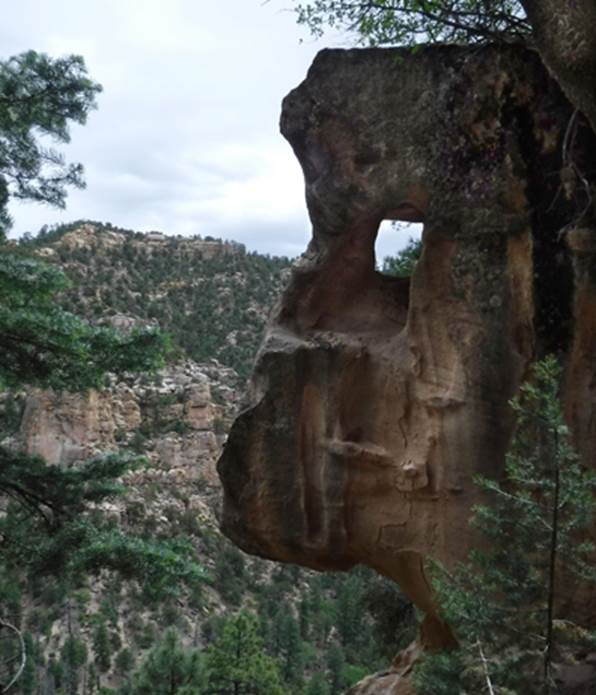
New Mexico Natural Arches & Bridges
There are
many more natural arches and bridges in New Mexico than these...
Here is a list
of the 5 natural arches and/or bridges in New Mexico, having the longest
opening span, that we know of:
1. Snake Bridge – 209’ span - Navajo Nation Lands #19 worldwide see Below
and: https://www.naturalarches.org/big9-9.htm
2. La Ventana Arch – 135’ span – El Malpais
National Monument see below
3. Red Lake Natural Bridge – 100’ span – Navajo Nation Lands –not on our
list below see: http://naturalarches.org/db/arches/nmex52.htm
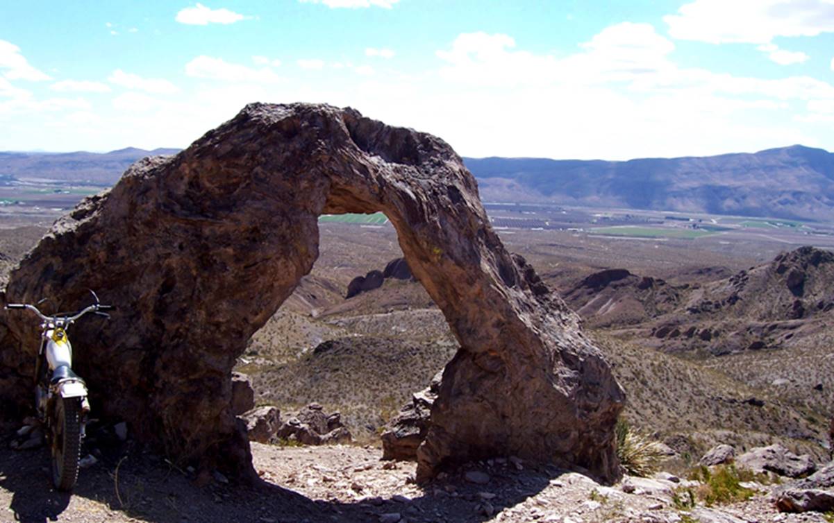
4. Sacaton Arch – 75’ – Gila National Forest see below
5. Tapia Natural Bridge – 65’ span – BLM public lands see below
The list below runs from north to south
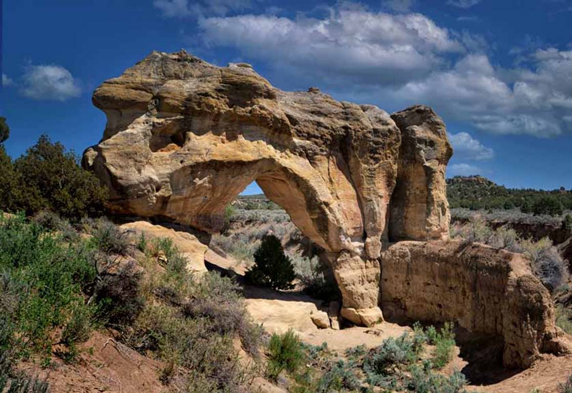
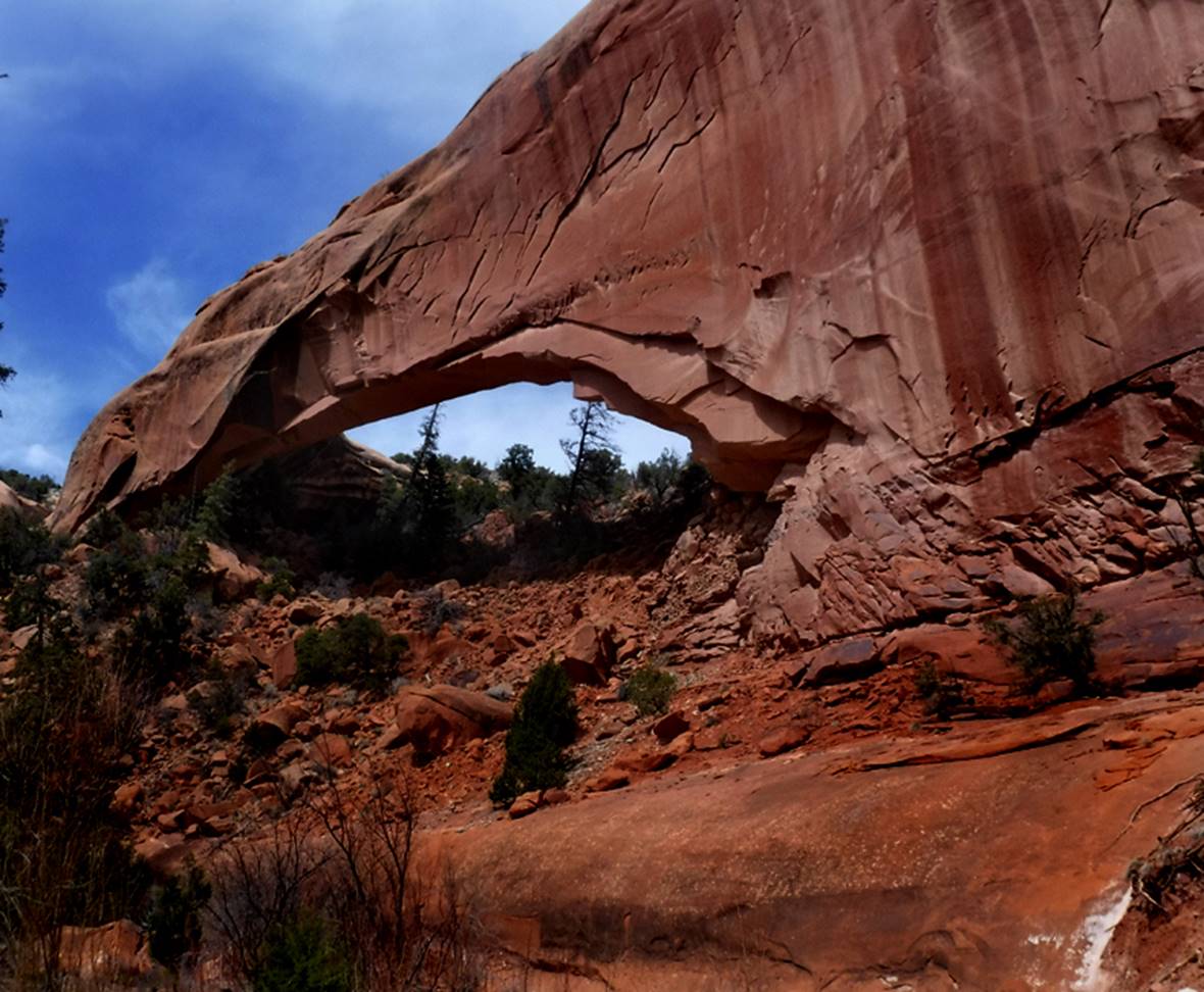
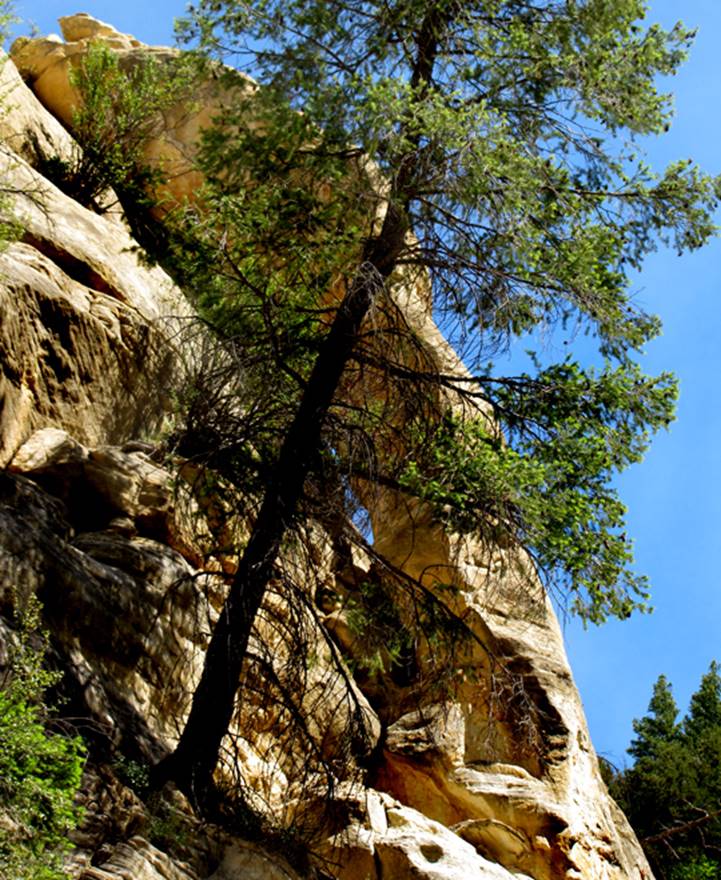
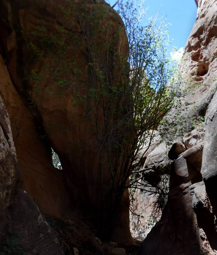
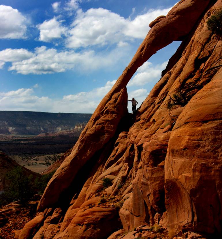
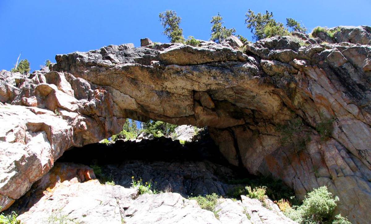
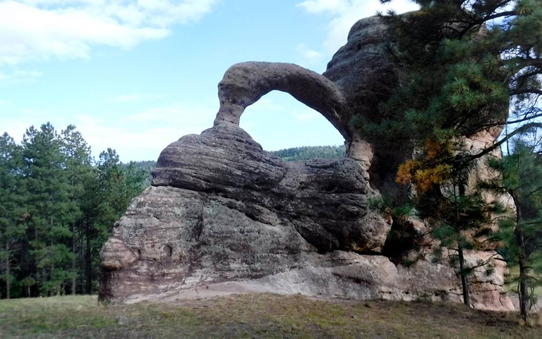
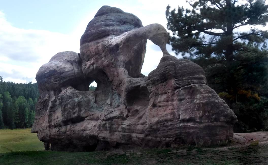
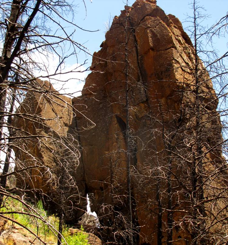
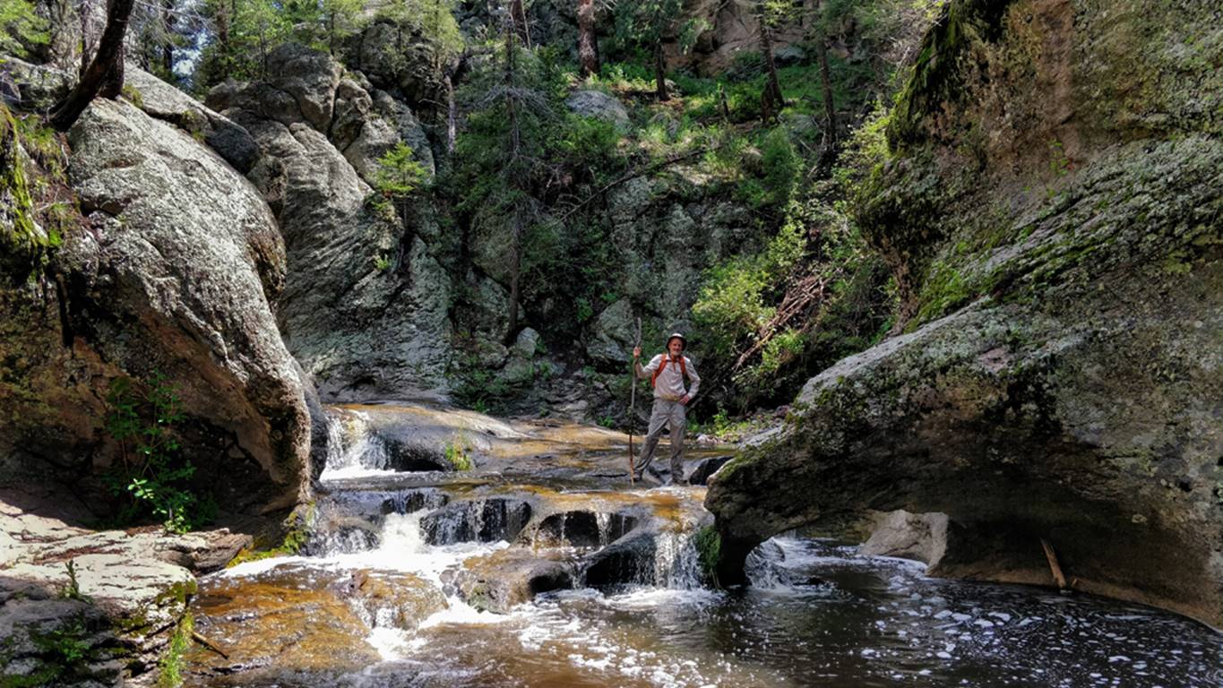
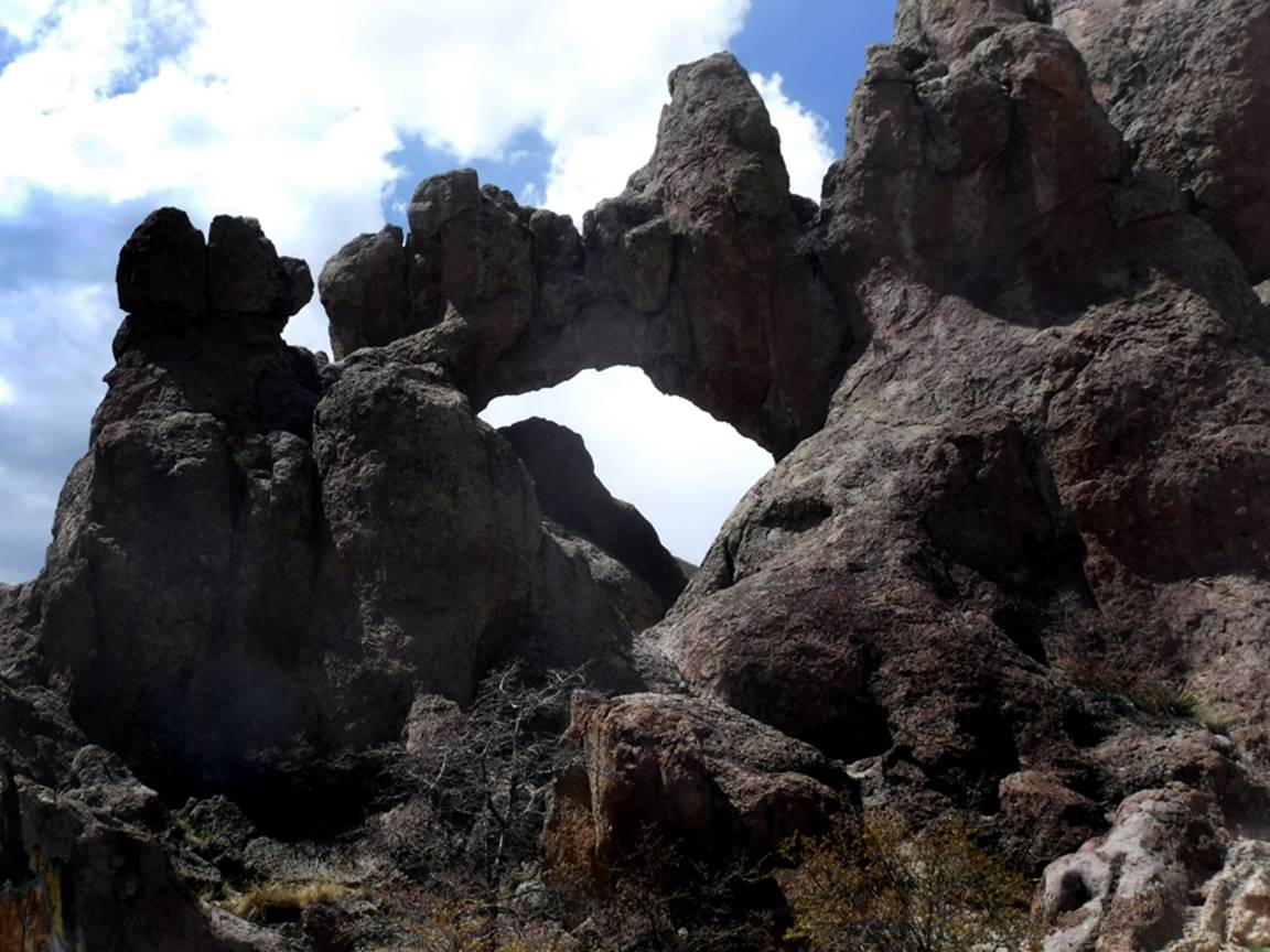
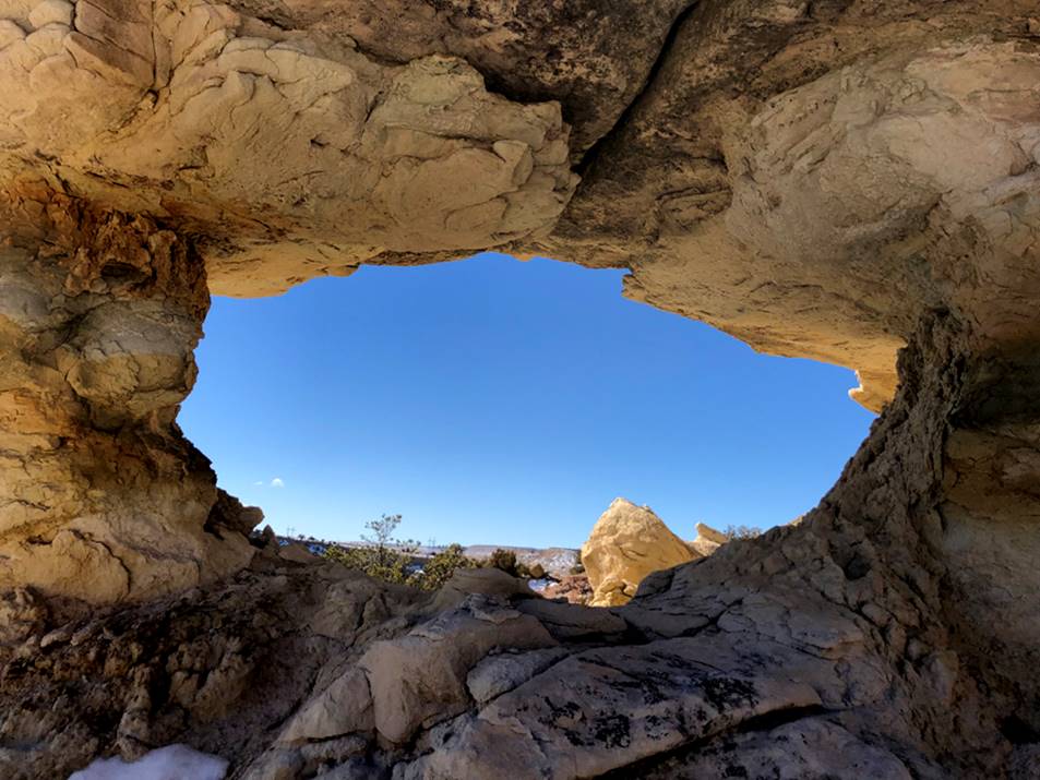
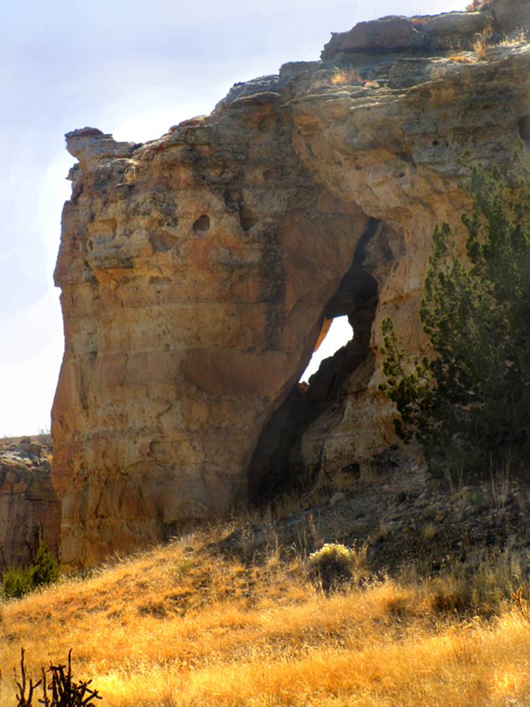
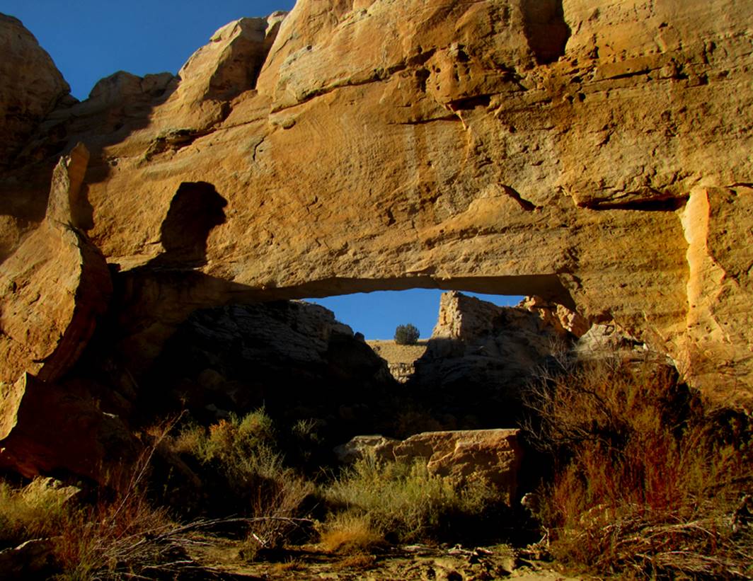
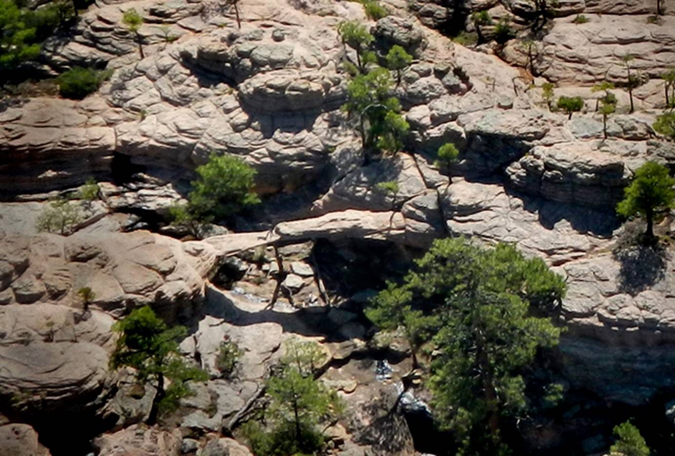
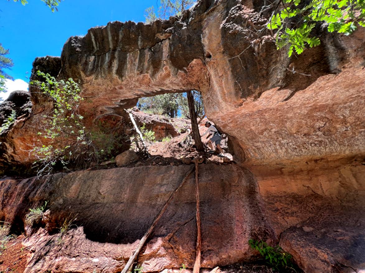
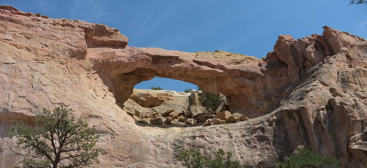
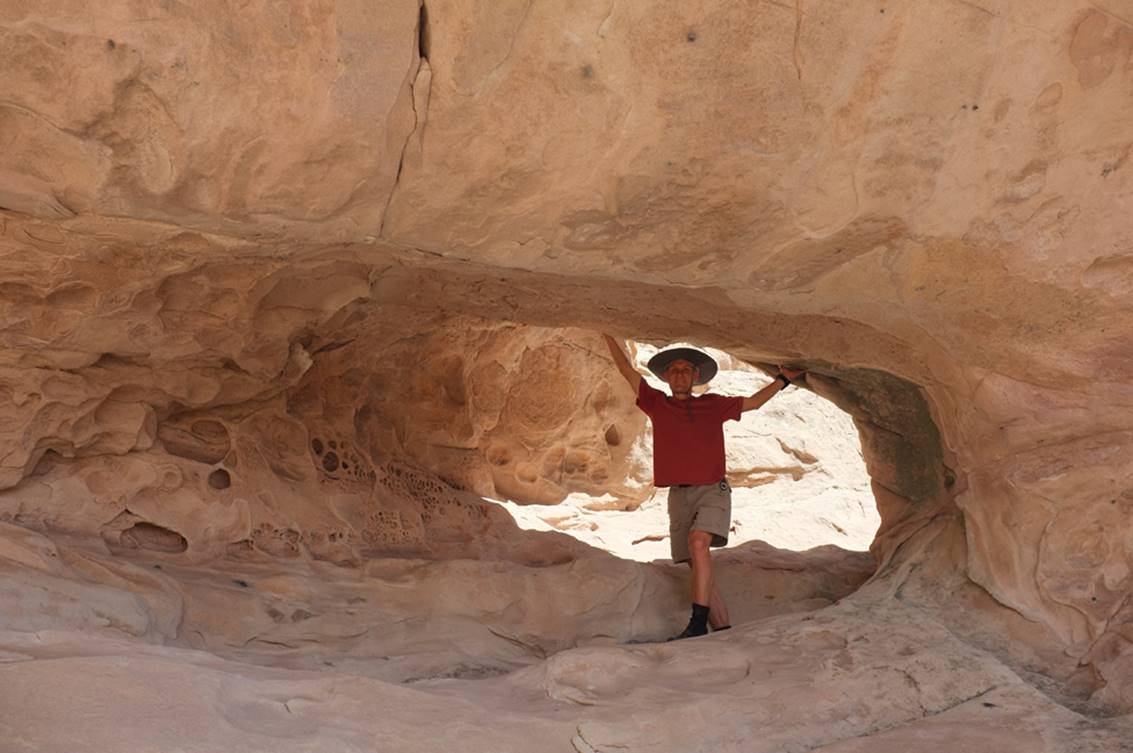
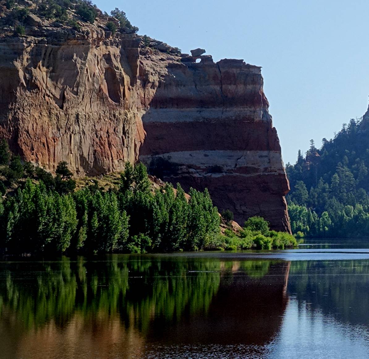
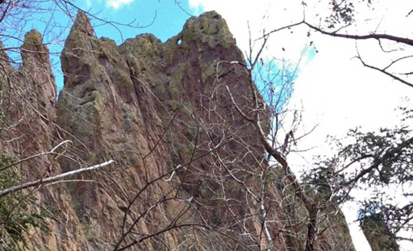
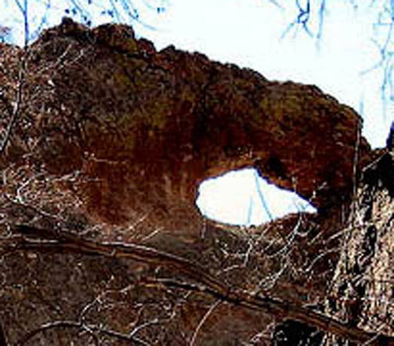
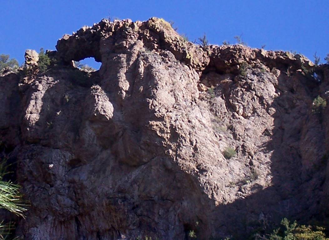
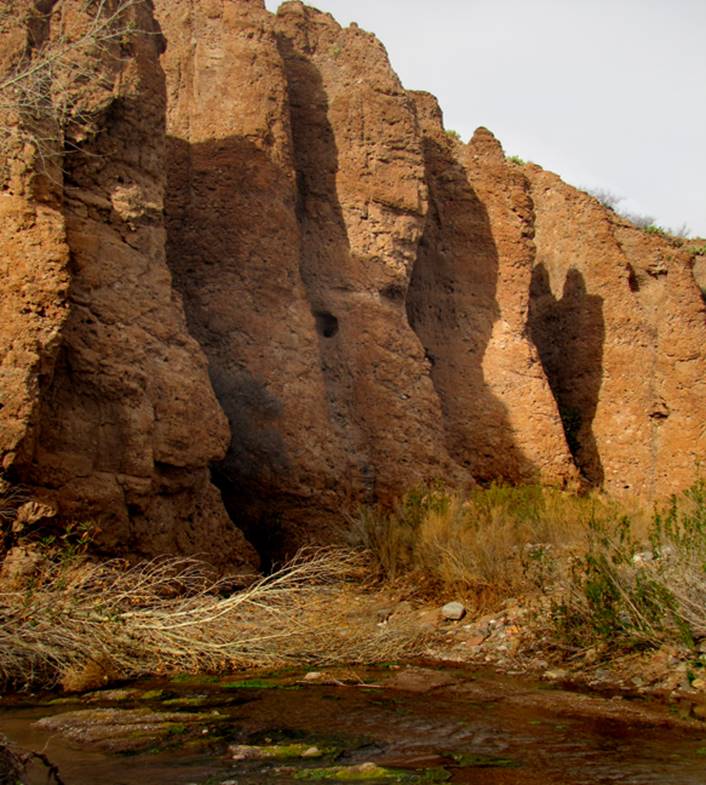
Cox Canyon
Arch
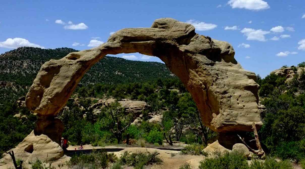
Kathy, Rebekah and
Raina play under Cox Canyon Arch, which is just south of the Colorado border...
north of Aztec, NM. Nate Bartnick
Photo
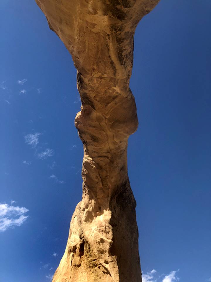
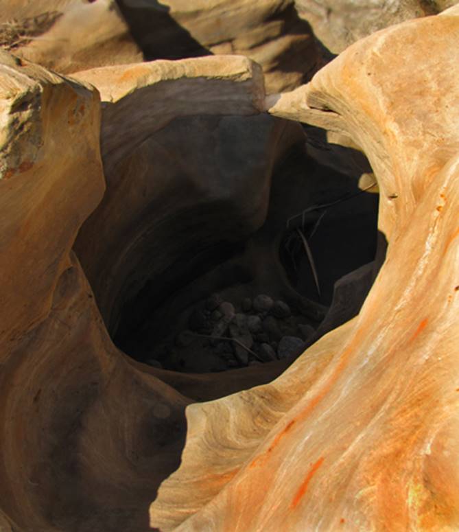
The photo below is
looking straight up from underneath the arch…!!!
beta facts:
name- Cox Canyon Arch
opening size- 43’ high x 35’ span
elevation- 6361’
GPS coordinates- ±36°59.872’N 107°54.554’W
ownership- BLM
access- is from Cedar Hill- west on BLM
Road 2300 & north on 2310
nearest town- Cedar Hill is about 5 miles south of here
fun fact- ...this is a nice one...
____________________________________________________________________________________________________
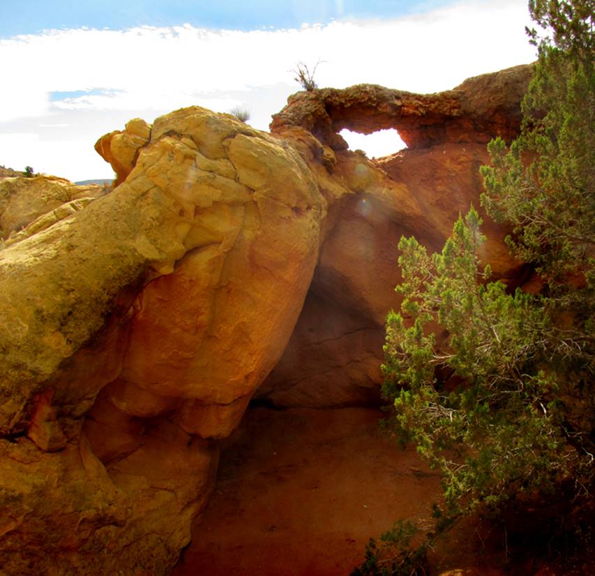
Arrowhead
Arch
AKA- Toltec Arch
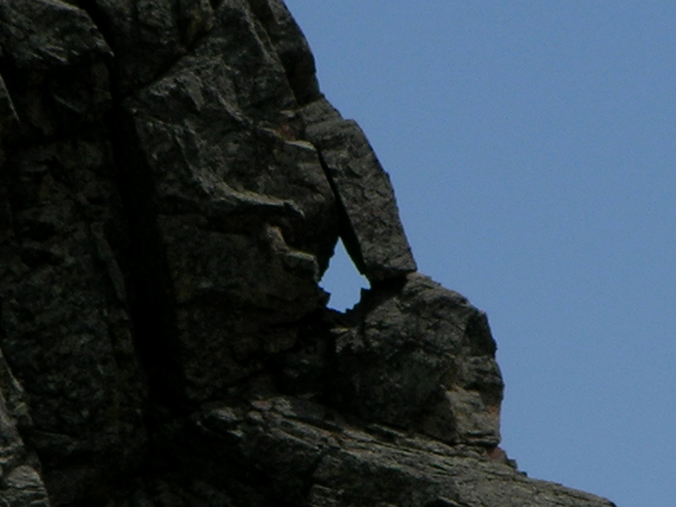
Arrowhead Arch also-known-as Toltec Arch has
an opening shaped like an arrowhead and is about the size of a person
beta facts:
name- Arrowhead Arch
opening size- about 6 feet
elevation- 9600’
GPS coordinates- ±35°59.029’N 106°18.430’W
ownership- Carson National Forest
access- is from Cumbres
& Toltec Railroad
nearest town- Chama is about 20 miles
southwest of here
fun fact- this arch is on the very brink of
the most sublime precipice of the AMAZING, thousand-foot-deep, Toltec Gorge
Arrowhead/Toltec Arch is out on the brink
of the same bedrock ridge as the upper Cumbres &
Toltec Tunnel cuts thru. One must climb
out as far as possible on the first protruding ridge west of the tunnel. This is neither advised nor legal... but it
is extremely exciting and invigorating...!!!
...another fact is that cross-tie-walking is trespassing and thus
illegal... but it happens a lot and “us” cross-tie-walkers excite the
passengers
___________________________________________________________________________________________________________________________
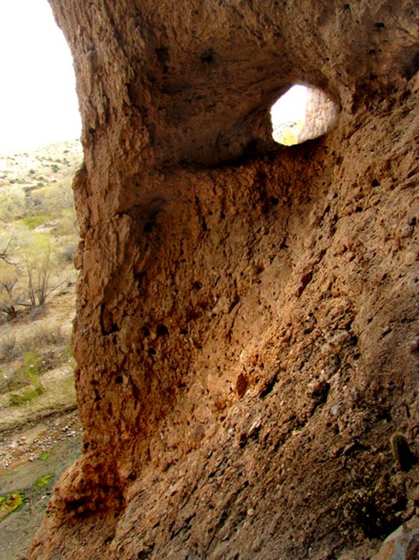
Un-named
arch near Hwy 64
This arch is easy to
see while driving on US Highway 64 west of Blanco, NM …although it’s exact location is not
documented
beta facts:
name- un-known
opening size- 15’ high x 15’ span -approx.…
elevation- unknown
GPS coordinates- un-known
ownership- un-known
access- is easily viewed north of US Hwy 64
nearest town- Blanco, NM
fun fact- for as easy as it is to view this
arch… there’s not much known about it
____________________________________________________________________________________________________
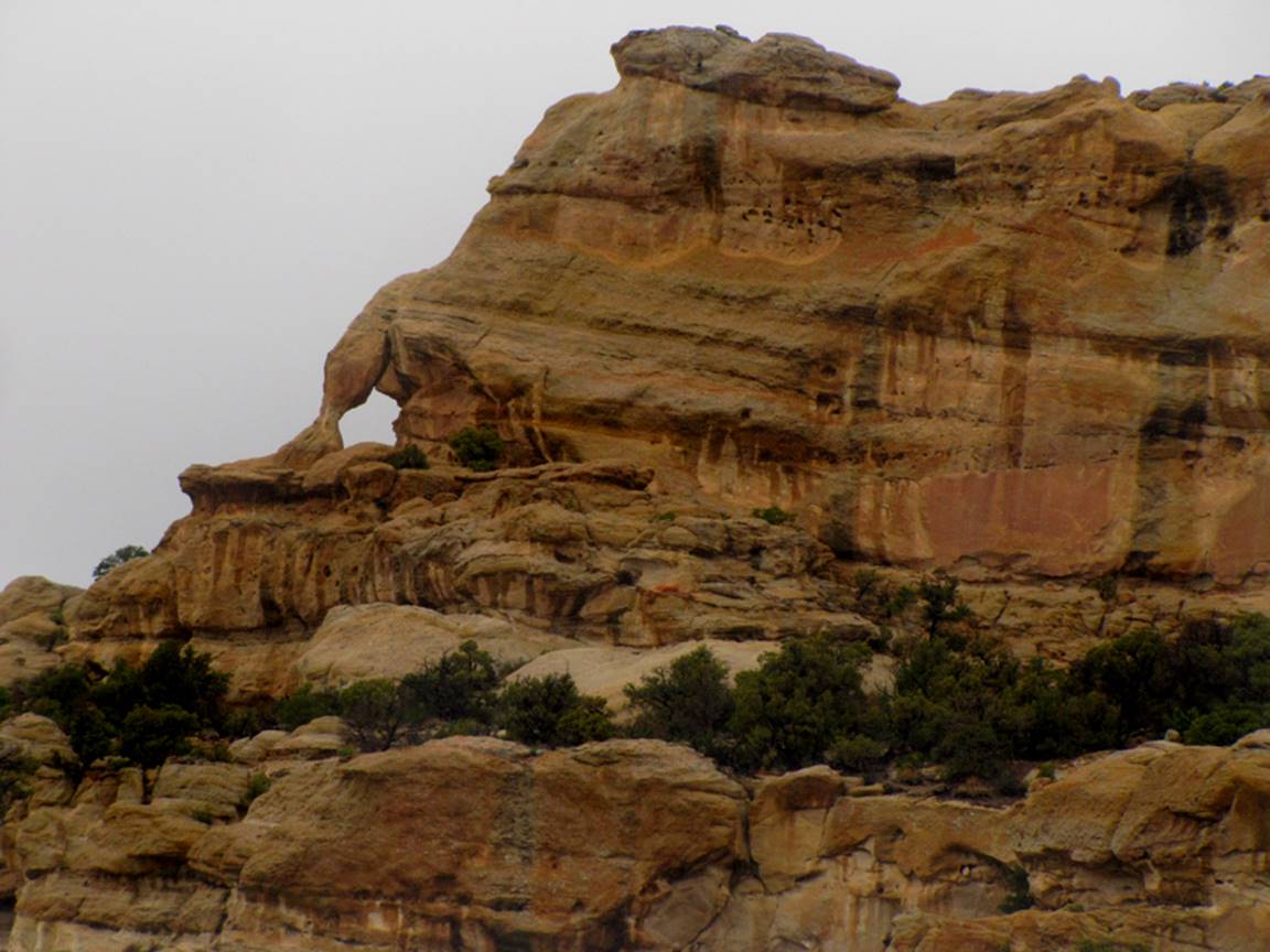
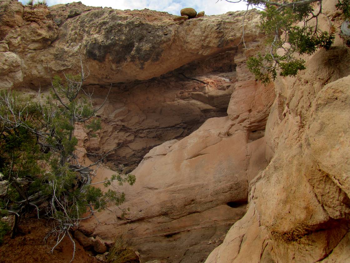
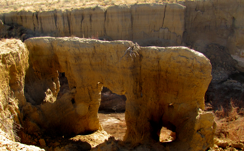
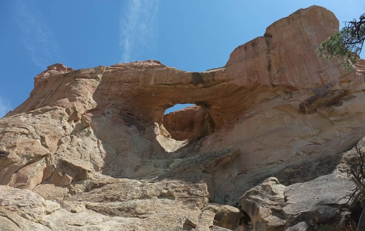
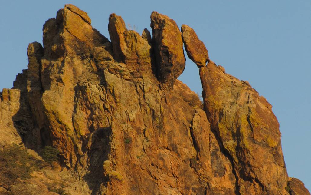
Arch Rock
Arch Rock is found up
Arch Rock Canyon 9 miles northeast of Aztec, NM Ken MacAdams
Photo
beta facts:
name- Arch Rock
opening size- 30’ high x 30’ span
elevation- 6350’
GPS coordinates- ±36.891000 -107.849180
ownership- BLM public lands
access- via a mase of drilling roads
nearest town- Cedar Hill, NM is about 4 miles north, northwest of here
fun fact- Arch Rock is quite substantial…
and… is actually
a natural bridge spanning a legit intermittent streambed
____________________________________________________________________________________________________
Corrumpa
Arch
I walked thru the 6+
foot round-hole of this arch, without bumping my head
beta facts:
name- Corrumpa Arch
opening size- 6 feet
elevation- 5000’
GPS coordinates- ±36°42.813’N 103°08.950’W
ownership- Private
nearest town- Clayton
fun fact- This was an over-night stop on
the Santa Fe Trail
for more info see: http://www.dougscottart.com/hobbies/waterfalls/CorrumpaWaterfall.htm
____________________________________________________________________________________________________
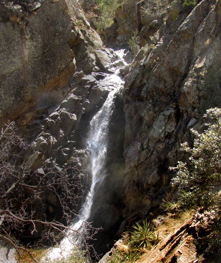
El Salto
Arch
This small, 5 foot
natural arch is found among the beautiful El Salto waterfalls a mile or more
northeast of the small town of Arroyo Seco, NM
Pictured below is the
splendid, El Salto Falls #5
beta facts:
name- un-known
opening size- 5’ span
elevation- un-known
GPS coordinates- un-known
ownership- private land- a Spanish Land
Grant
access- is northeast of Arroyo Seco, NM
nearest town- Arroyo Seco is about 2 miles southwest of here
fun fact- extreme beauty here…
for more details see El Salto Falls: http://www.dougscottart.com/hobbies/waterfalls/elsalto.htm
____________________________________________________________________________________________________
Snake
Bridge
Longest
natural span in New Mexico and nineteenth longest span known on earth
AMAZING…! ! !
beta facts:
name- Snake Bridge
opening size- 90’ high x 209’ span
Snake Bridge is on sacred Navajo Nation lands. It can only be visited while accompanied by a
Native Navajo Guide. My guide wishes to
remain anonymous and is not for hire.
____________________________________________________________________________________________________
Nogales Cliff House Arch
Nogales Cliff House Ruins is watched from
above by this and other small natural arches...
Nogales Cliff
House Ruins
Rorke Murphy
Photo
beta facts:
opening size- 4 or 5 feet
elevation- 7700’
GPS coordinates- - ±36°24.528’N 106°52.778’W
ownership- Carson National Forest
nearest town- from Llaves, NM
fun fact- wonderful place of ancient magic
_________________________________________________________________________________________________
Golondrina Arch
or in English = Cliff Swallow Arch
Golondrina Arch overlooks the
Chama River for several miles both upstream and downstream at the monastery.
beta facts:
name- Golondrina
Arch
opening size-6’ high x 3’ span
elevation- 7750’
GPS coordinates- ±36.38491° -106.70537°
ownership-Santa Fe National Forest
access- is from the south end of Forest
Road #6 out on the point of Mesa Golondrina
nearest town- Llaves, NM is about 8.5 miles west of here
fun fact- the archeological trail down this
ridge misses seeing Golondrina Arch
____________________________________________________________________________________________________
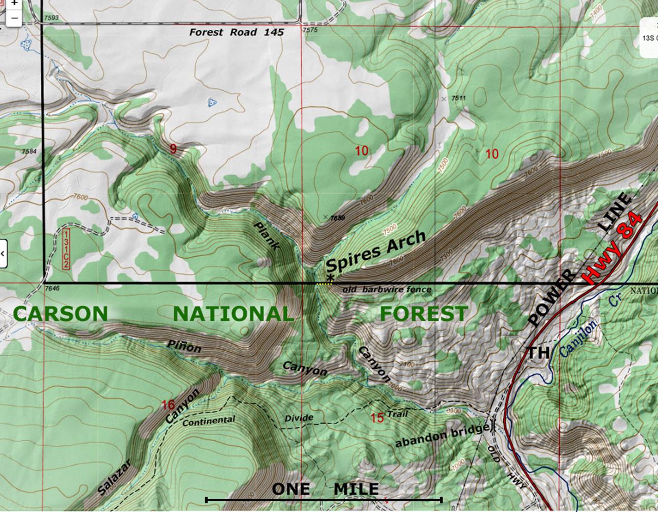
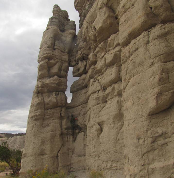
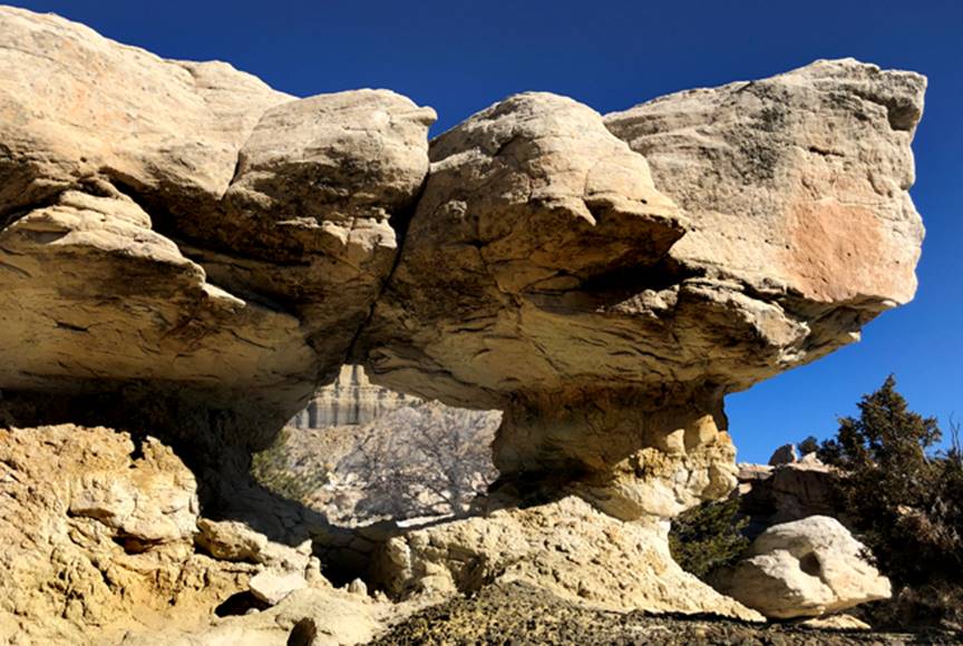
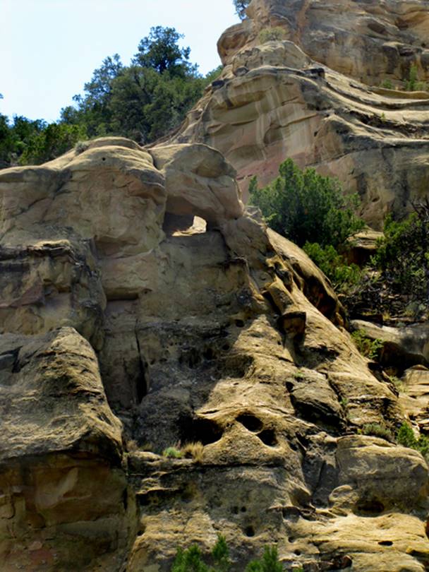
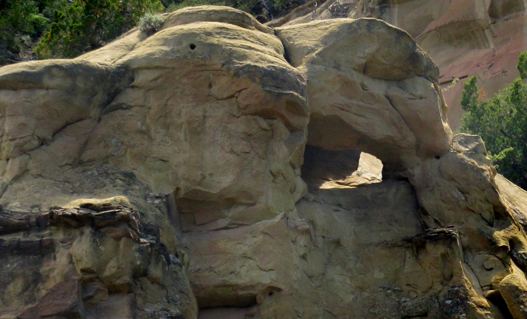
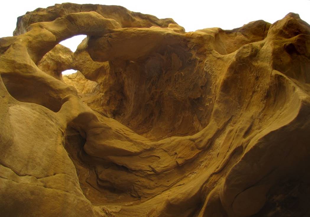
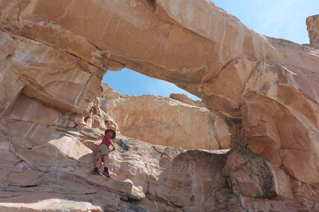
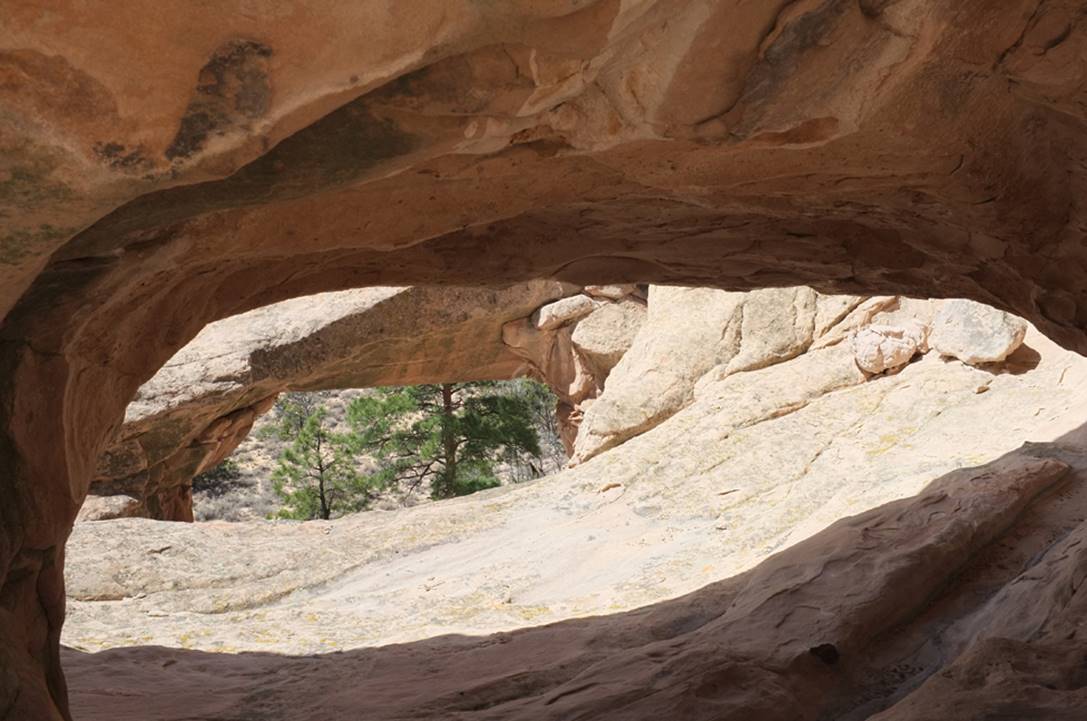
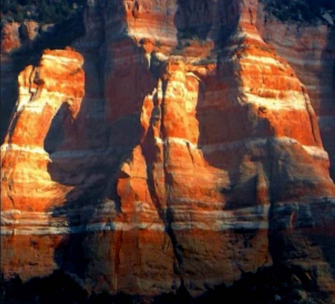
Spires Arch
…named for the natural sandstone spire that forms the arch as well
as several other spires clustered nearby on this same outcropping…
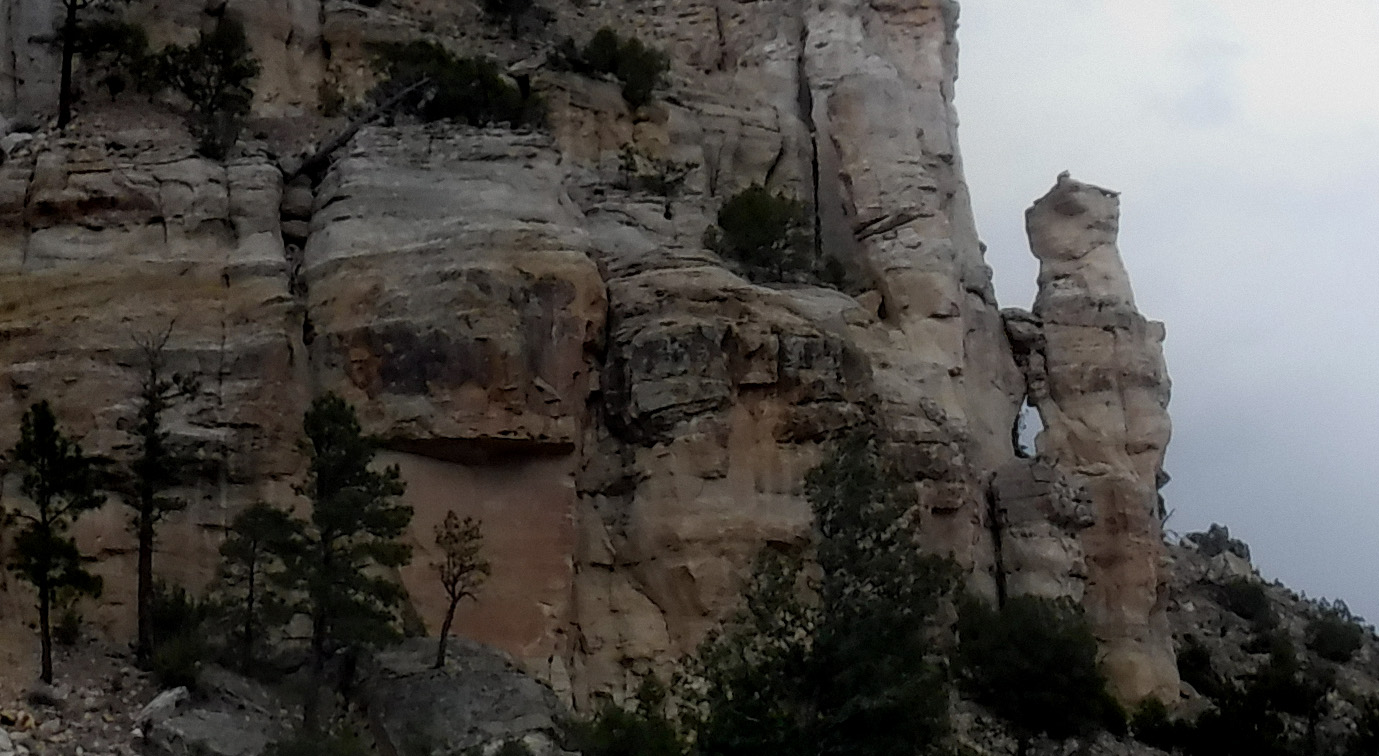
I climbed up a steep game trail along an old
damaged barbed-wire fence, to stand inside the arch opening
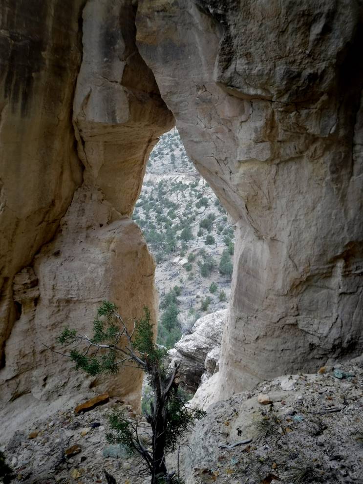
Spires Arch, found
overlooking Plank Canyon in Carson National Forest, is not quite 5 feet wide by
about 15 feet high. This arch is within Morrison Formation Sandstone. Please feel welcome to right-click-save-as on
our map below, to print a hand-held copy for your hike. I hiked up the Continental Divide Trail from
Hwy 84 to where the CDT leaves Plank Canyon.
Then continued up Plank Canyon to the old damaged barbed-wire fence…
turning right, to follow the fence up to Spires Arch.
beta facts:
name- Spires Arch
opening size-15’ high x 5’ span
elevation- approx. 7400’ elev.
GPS coordinates- ±36°24.435’N 106°30.433’W
route ownership- Carson National Forest… Spires Arch appears to be on
(section 10) “un-usable” private land by a few feet
access- is from The Continental Divide
Trailhead on Hwy 84. This is ruffly, a 2
mile hike one-way
nearest known location- Spires Arch is 2 or 3 miles north of Echo Amphitheater
fun fact- The ruins of the Plank Family Homestead lye silent in the upper reaches of this
beautiful canyon named in their memory
Enhanced USGS topo
north is up
____________________________________________________________________________________________________
Cheerio
Arch
Cheerio Arch is within
the depths of one of New Mexico’s finest slot canyons: Big Canyon in the Chama
Canyon Wilderness
See: http://www.dougscottart.com/hobbies/SlotCanyons/BigCanyon.htm
beta facts:
name- Cheerio Arch
opening size- maybe two feet
elevation- 6800’
GPS coordinates- ±36°23.227’N 106°44.925’W
ownership- Santa Fe National Forest
access- is from Forest Road 8 see: http://www.dougscottart.com/hobbies/SlotCanyons/BigCanyon.htm
nearest town- Gallina is about 12 miles south of here
fun fact- I normally would NEVER post an
arch this small... but Cheerio Arch is just too special…!!!
Read the webpage link: http://www.dougscottart.com/hobbies/SlotCanyons/BigCanyon.htm ...and enjoy...!!!
_______________________________________________________________________________________________________
Randy’s
Arch
Sorry that this big
pine tree is in the way... Randy’s Arch is within the depths of one of New
Mexico’s finest slot canyons: Big Canyon in the Chama Canyon Wilderness
See: http://www.dougscottart.com/hobbies/SlotCanyons/BigCanyon.htm
beta facts:
name- Randy’s Arch
opening size- maybe 12’ high and 2’ wide
elevation- 7000’
GPS coordinates- ±36°23.083’N 106°45.117’W
ownership- Santa Fe National Forest
access- is from Forest Road 8 see: http://www.dougscottart.com/hobbies/SlotCanyons/BigCanyon.htm
nearest town- Gallina is about 12 miles south of here
fun fact- my friend Randy found this arch
Read the webpage link: http://www.dougscottart.com/hobbies/SlotCanyons/BigCanyon.htm ...and enjoy...!!!
_______________________________________________________________________________________________________
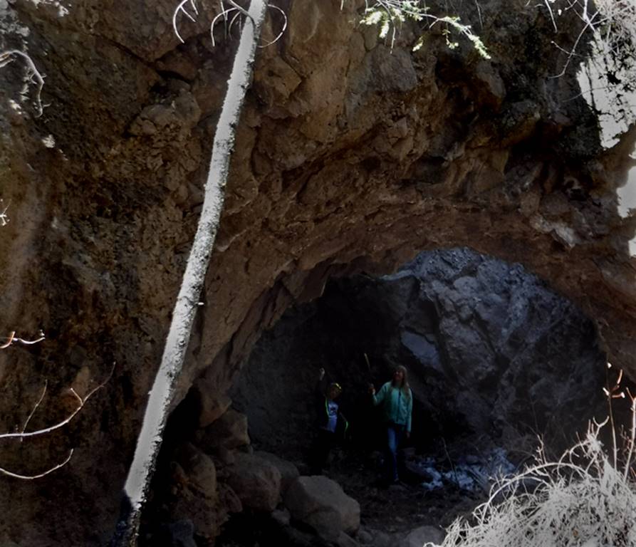
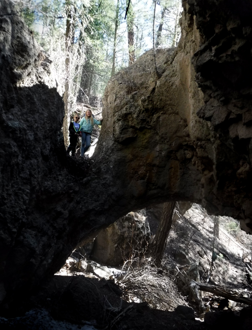
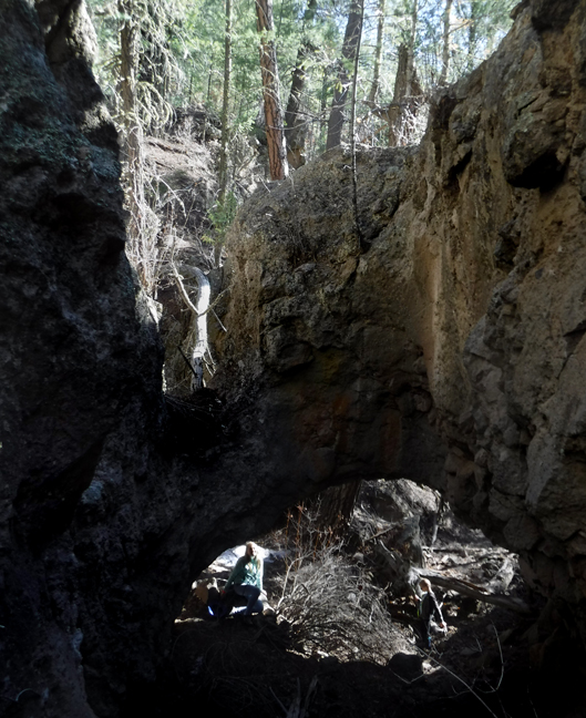
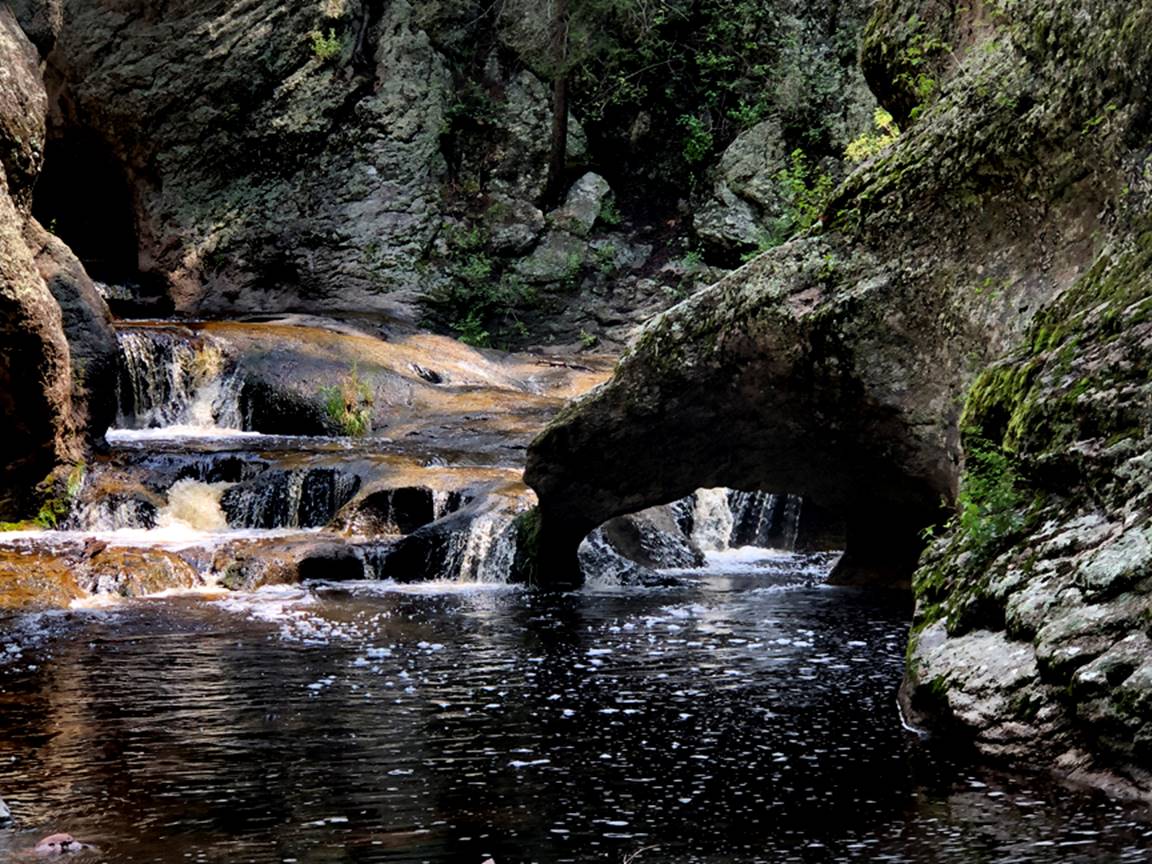
Big Canyon
Land Bridge
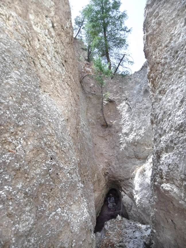
The Big Canyon Land
Bridge is composed of alabaster AKA gypsum and is found in one of New Mexico’s
finest slot canyons: Big Canyon in the Chama Canyon Wilderness
See: http://www.dougscottart.com/hobbies/SlotCanyons/BigCanyon.htm *notice the grown man in the passage
under the arch.
beta facts:
name- Big Canyon Land Bridge
opening size- maybe 8’ high and 8’ wide
elevation- 7000’
GPS coordinates- ±36°23.083’N 106°45.117’W
ownership- Santa Fe National Forest
access- is from Forest Road 8 see: http://www.dougscottart.com/hobbies/SlotCanyons/BigCanyon.htm
nearest town- Gallina is about 11 miles south of here
fun fact- a large pine tree & other plant life thrives
on top of this bridge... but also...
extremely large bear tracks
were evidence that a huge bear walked thru this tunnel a short while before we
did…
Read the webpage link: http://www.dougscottart.com/hobbies/SlotCanyons/BigCanyon.htm ...and enjoy...!!!
_______________________________________________________________________________________________________
Alabaster
Arch
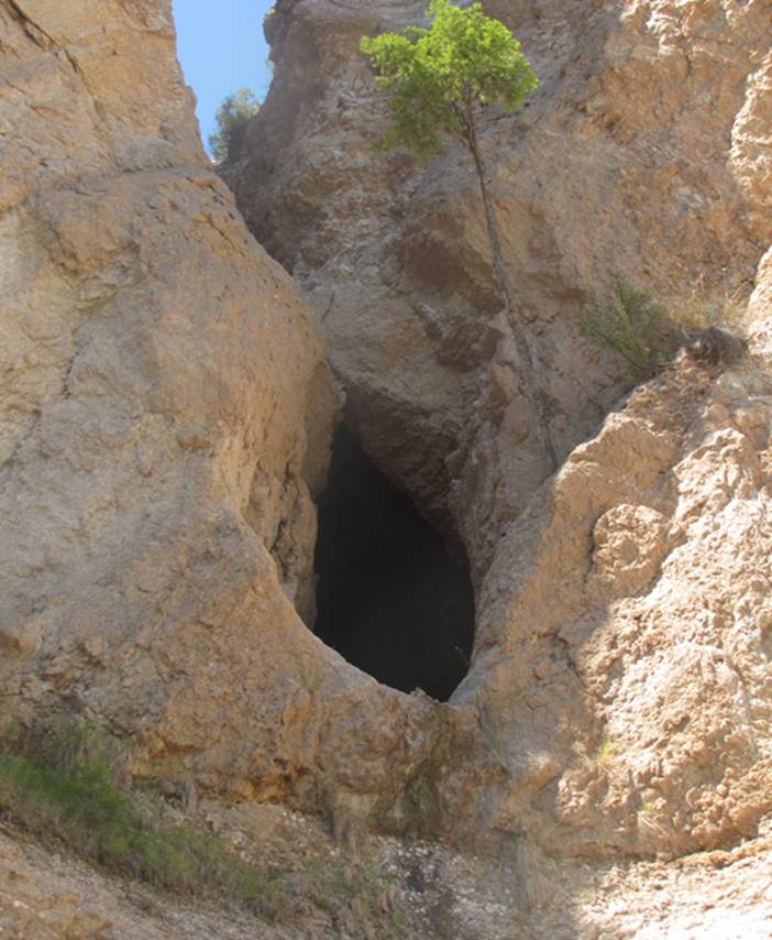
Alabaster Arch is actually a natural bridge
instead of a natural arch because a substantial intermittent watercourse flows
thru it.
See: http://www.dougscottart.com/hobbies/SlotCanyons/Alabaster.htm
beta facts:
name- Alabaster Arch
opening size- about 25’ high x 15’ wide
elevation- 7100’
GPS coordinates- ±36°23.242’N 106°46.778’W
ownership- Santa Fe National Forest
access- from Llaves,
NM is State Hwy 112 north 4.3 miles, then east 1.1 mile to 4WD Chupadero Road and south 3 miles to the Rio Gallina
nearest town- Gallina, NM is about 12 miles
south of here
fun fact-
when traversing Alabaster Slot Canyon, the 80 foot high exit rappel
passes thru the opening of Alabaster Arch
Alabaster Arch is beginning to weaken on
its upstream west side. Major cracks are
appearing here and hopefully... it will not crumble and collapses very
soon.
_______________________________________________________________________________________________________
Little
Gallegos Arch
Man peeks thru window at Little Gallegos Arch found within Little
Gallegos Slot Canyon
Little Gallegos Arch is
hidden away between technical rappels within Little Gallegos Slot Canyon
beta facts:
name- Little Gallegos Arch
opening size-3’ high x 2’ span
elevation- 7000’
GPS coordinates- ±36°21.523’N 106°42.583’W
ownership- Santa Fe National Forest
access- is from within Little Gallegos Slot
Canyon see: http://www.dougscottart.com/hobbies/SlotCanyons/littlegallegos.htm
nearest town- Llaves, NM is about 8 miles west of here
fun fact- technical canyoneering rope
rappels are mandatory to visit this natural arch, so ONLY canyoneers visit her…
____________________________________________________________________________________________________
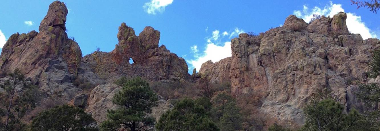
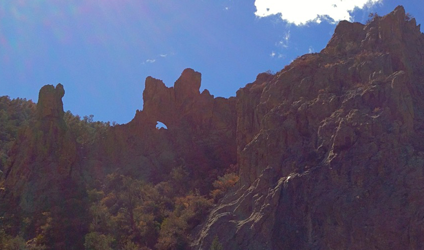
Bull Canyon Arch
Bull Canyon Arch is
about 300' overhead
beta facts:
name- Bull Canyon Arch
opening size- unknown
....because it involves ropes and technical rock climbing gear to visit it…
elevation- 7900’
GPS coordinates ±36°22.008’N 106°22.862’W
ownership- Carson National Forest
access-
is from Forest Road #137
nearest town- Abiquiu is about 12 miles south of here
fun fact- this arch is high
above a slot canyon
see also, for more details and a map: http://www.dougscottart.com/hobbies/SlotCanyons/Bull.htm
____________________________________________________________________________________________________
Ventana del
Cielo
English= Window of the
Sky
This butte is about
three to four hundred feet high & likely the crumbly rock is
unclimbable. Therefore, I estimate the
opening spans about a 35 foot span width
Locals call it “La Ventana del Cielo”
“Sky Window”
beta facts:
name-Ventana del Cielo
opening size- 18’ high x 35’ span-
“approximant estimation”
elevation- 6500’
GPS coordinates- ±36.290160 -106.094670
ownership- BLM public domain
access- is 5 miles south of 36.344672
-106.099390 - the intersection of paved Hwy 554 on a 4WD road… see detailed
access description below
nearest town- Ojo Caliente is about 2.5 miles east-north-east of here
fun fact- This area is quite beautiful and
rarely visited…!!!
detailed access description
drive southwest on an unmarked 4WD dirt
road from Hwy 554 at: 36.344672 -106.099390
continue straight at: 36.339393
-106.110749 -a left here connects back
to this same road, but has deep, soft sand
take a right at: 36.337787 -106.116299
continue straight at: 36.309087
-106.101521 -the deep, soft sand road
joins back in here…
continue straight at: 36.300230
-106.098670 -a right turn here goes over
to Canada Ancha
I park my wheels here at: 36.292129
-106.088408
We also park here while visiting “slot
canyon” Piedra Blanca at: 36.285345 -106.089660
See: Ventana del Cielo slot canyon-
https://www.dougscottart.com/hobbies/SlotCanyons/canonVentanaCielo.htm
____________________________________________________________________________________________________
Talus Arch
AKA- Cat’s Eye Arch
My son Talus stands
inside the arch that we found in 1974
beta facts:
name- Talus Arch ...more recently some call
it Cat’s Eye Arch
opening size- 30’ high x 15’wide
elevation- 6500’
GPS coordinates- ±36°18.614’N 106°27.329’W
ownership- Carson National Forest
access- is from US Hwy 84 see: http://www.dougscottart.com/hobbies/SlotCanyons/TalusCan.htm
nearest town- Abiquiu
is about 12 miles southeast of here
fun fact- a fine red sandstone natural
arch... right near Hwy 84
Read the webpage link: http://www.dougscottart.com/hobbies/SlotCanyons/TalusCan.htm ...and enjoy...!!!
______________________________________________________________________________________________________________________________
Red Wash
Arch
Red Wash Arch is within
Red Wash Canyon
See: http://www.dougscottart.com/hobbies/SlotCanyons/RedWash.htm
beta facts:
name- Red Wash Arch
opening size- about 5 feet wide
elevation- 6200’
GPS coordinates- ±36°14.398’N 106°22.459’W
ownership- Carson National Forest
access- is from US Hwy 84 see: http://www.dougscottart.com/hobbies/SlotCanyons/RedWash.htm
nearest town- from HWY 84 about 3.6 miles west of Abiquiu…
fun fact- this is a fine area, also having
a natural bridge described immediately below here
Read the webpage link: http://www.dougscottart.com/hobbies/SlotCanyons/RedWash.htm
...and
enjoy...!!!
______________________________________________________________________________________________________________________________
Red Wash
Natural Bridge
Red Wash Natural Bridge
is within Red Wash Canyon
See: http://www.dougscottart.com/hobbies/SlotCanyons/RedWash.htm
beta facts:
name- Red Wash Natural Bridge
opening size- 12’ wide x 6’ high
elevation- 6400’
GPS coordinates- ±36°14.515’N 106°22.525’W
ownership- Carson National Forest
access- is from US Hwy 84 see: http://www.dougscottart.com/hobbies/SlotCanyons/RedWash.htm
nearest town- from HWY 84 about 3.6 miles west of Abiquiu…
fun fact- this is a fine area, also having
a natural arch described immediately above here
it is a steep climb (west) up out of Red
Wash to visit this natural Bridge
Read the webpage link: http://www.dougscottart.com/hobbies/SlotCanyons/RedWash.htm
...and
enjoy...!!!
________________________________________________________________________________________________________
Plaza
Blanca Arch
Plaza Blanca is Georgia
O’Keeffe’s famous “White Place”
Plaza Blanca Arch is
one of several natural arches found within this wonderful “White Place”
For more info and map see: http://www.dougscottart.com/hobbies/SlotCanyons/PlazaBCan.htm
beta facts:
name- Plaza Blanca Arch
opening size- about 10 feet high
elevation- 6100’
GPS coordinates- ±36°14.099’N 106°18.242’W
ownership- unknown
access- is from Dar La Islam Road 2 miles
north of Abiquiu, NM
fun fact-everything is white
County Road 155 runs east and west on the
other side of the Rio Chama north of Abiquiu, NM. Drive underneath the Dar Islam sign/gate
posts and on for almost a mile. There is
a parking area with signs, at the end of the road... park, hike and enjoy...! !
!
____________________________________________________________________________________________________
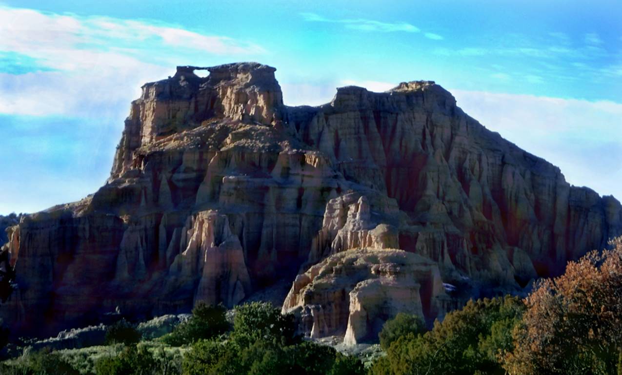
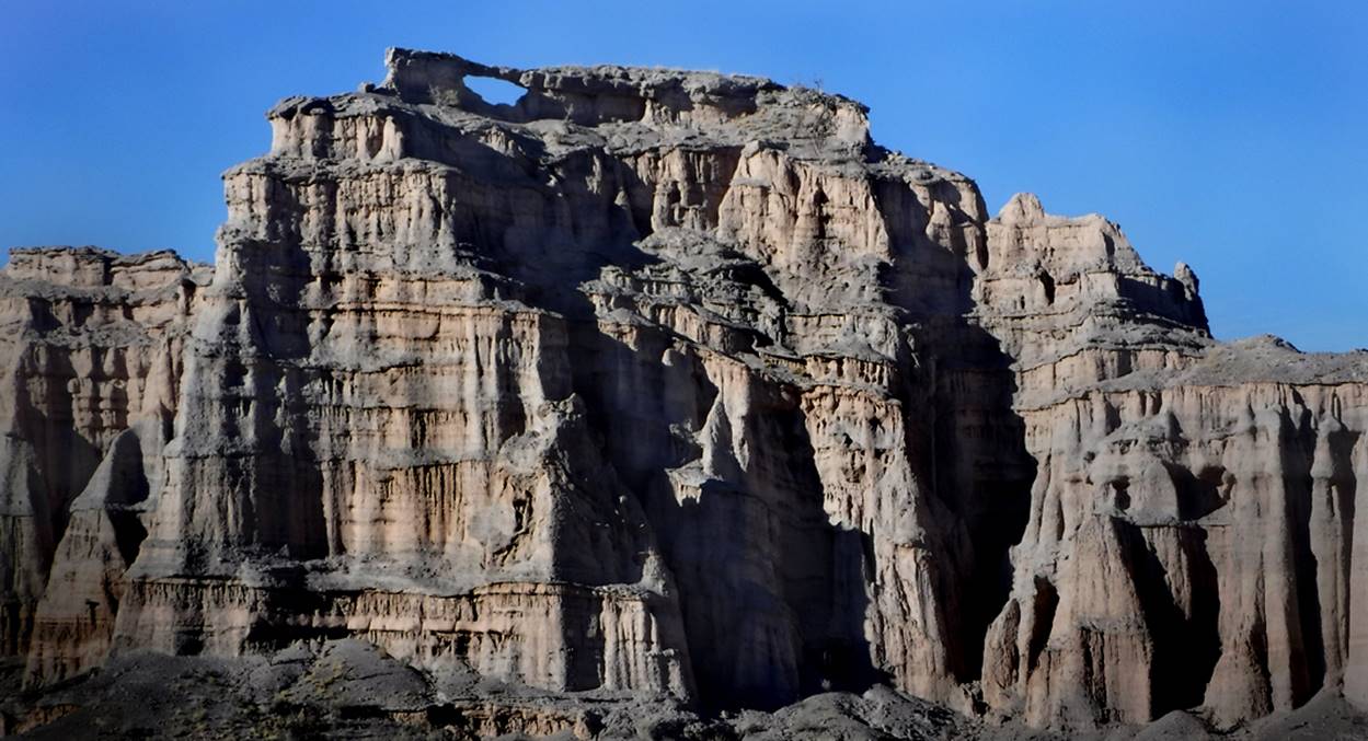
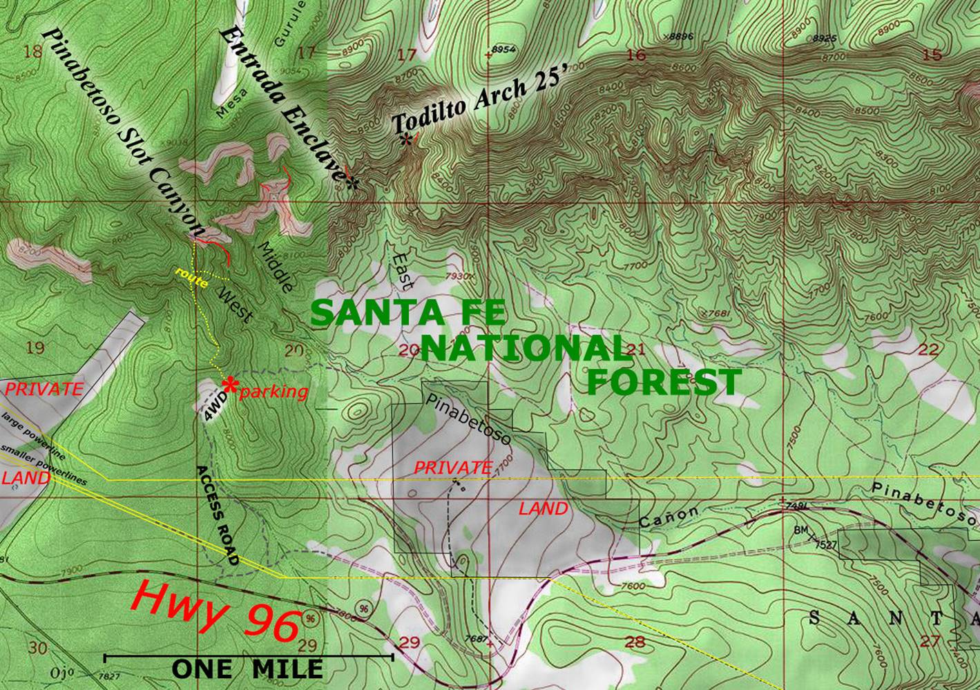
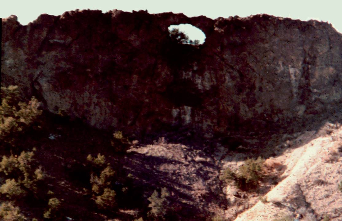
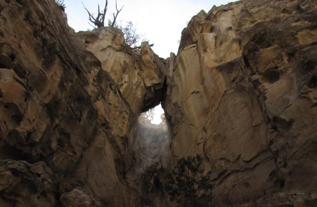
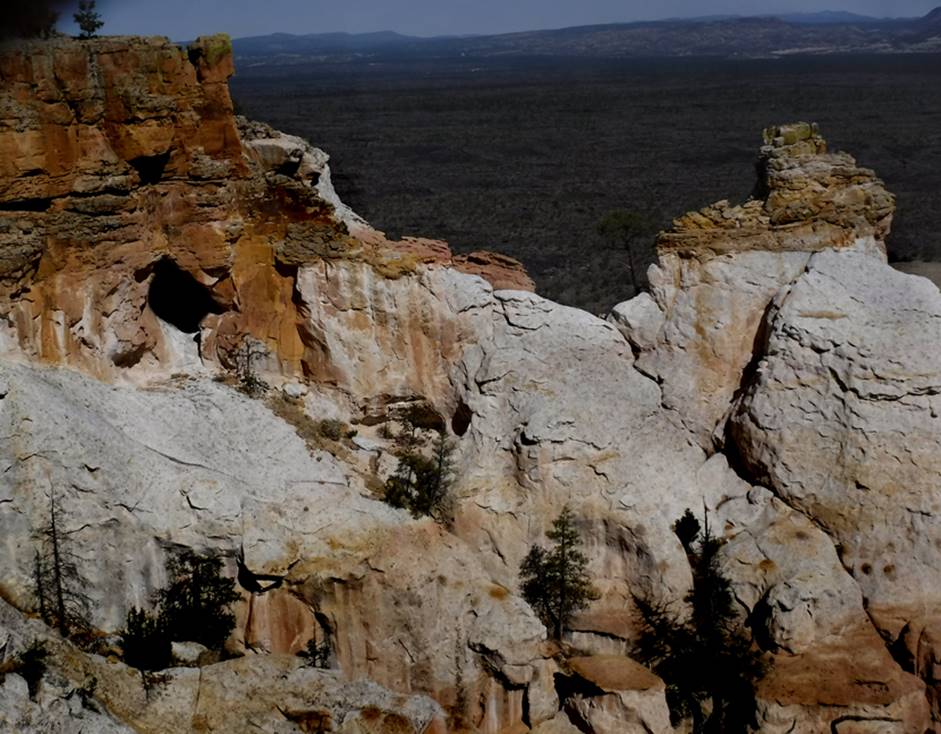
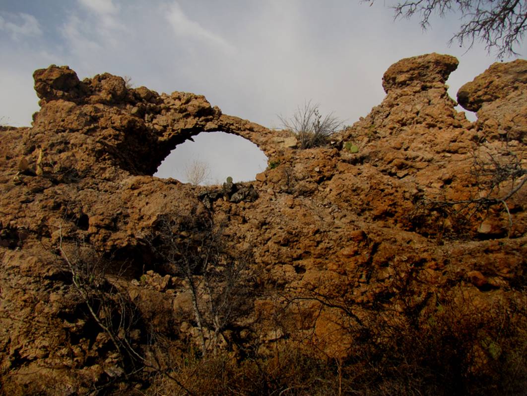
Todilto Arch
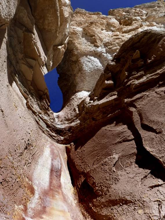
Todilto Arch is found within
the Todilto Formation, which is gypsum
beta facts:
name- Todilto
Arch
opening size- 25’ high x 12’ span
elevation- +8200’
GPS coordinates- ±36°13.278’N 106°44.744’W
ownership- Santa Fe National Forest
access- is from Hwy 96 four miles east of
Gallina, NM -see map below-
fun fact- Technical canyoneering equipment
and two or three hundred feet of rappelling rope is required to stand inside
this arch. However, it can be easily
seen from where we shot the photo above, via a couple miles of non-technical
hiking
Text
Exit Hwy 96 near GPS - ±36°12.026’N
106°45.608’W. Sorry this figure is very
approximate… but close. These 4WD roads
are serious, very deeply “rutted” –BAD roads, requiring 4WD with extra
high clearance. Bring a shovel along-
you may need it. In fact if these roads
are muddy from resent rains…??? I
wouldn’t drive them. The mud here can
get extremely deep and sticky. I usually
park just over the top of the pass, about one mile in from Hwy 96. The road gets way worse descending the steep
grade ahead. Only drive in as far as you
feel comfortable with.
As you can see on the map below… there are
several slot canyons (marked with red lines) right nearby. However, it is East Pinabetoso
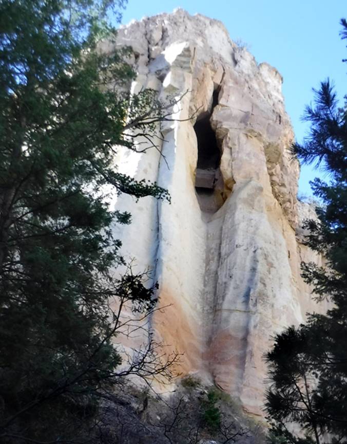
Canyon holding the beautiful Entrada Enclave and Todilto
Natural Arch. See a photo of Entrada
Enclave below our map.
Right-click-save-as
on our map below, to print your own “hand-held” copy for your hike
Enhanced USGS topo map
The Red Lines depict
sections of “slot canyons”
Entrada
Enclave opening is 100 feet high surrounded by a solid Entrada Sandstone cliff
400 feet high
This
almost makes a natural arch…!!!
____________________________________________________________________________________________________
Window Rock
Window Rock is a 30’
wide natural arch in a basalt dike Doug Murphy Photo
1972
beta facts:
name- Window Rock
opening size- 30’ wide x 15’ high
elevation- 6400’
GPS coordinates- ±36°07.578’N 106°13.149’W
ownership- Santa Fe National Forest
nearest town- Española is about 15 miles southeast of Window Rock
fun fact- In 1972 I drove my old hippie van
out to it
In 1972 I drove my old hippie van out there, but now the area is closed to motor vehicles. I used to know how to access Window Rock, but anymore... I do not. However, a friend of mine Corey Norman sent these coords to me for the place to park: N 36° 07.965 W 106°09.946
________________________________________________________________________________________________________
Collins
Arch
Named after Frank Collins
the mayor of Cowles, NM... who found this arch off-trail in 1975
Collins Arch has a span
of 35 feet, in Granitic bedrock, 1/3 of a mile southwest of Lake Johnson. Note an orange daypack in the shade (left) -photos courtesy of Frank
Collins
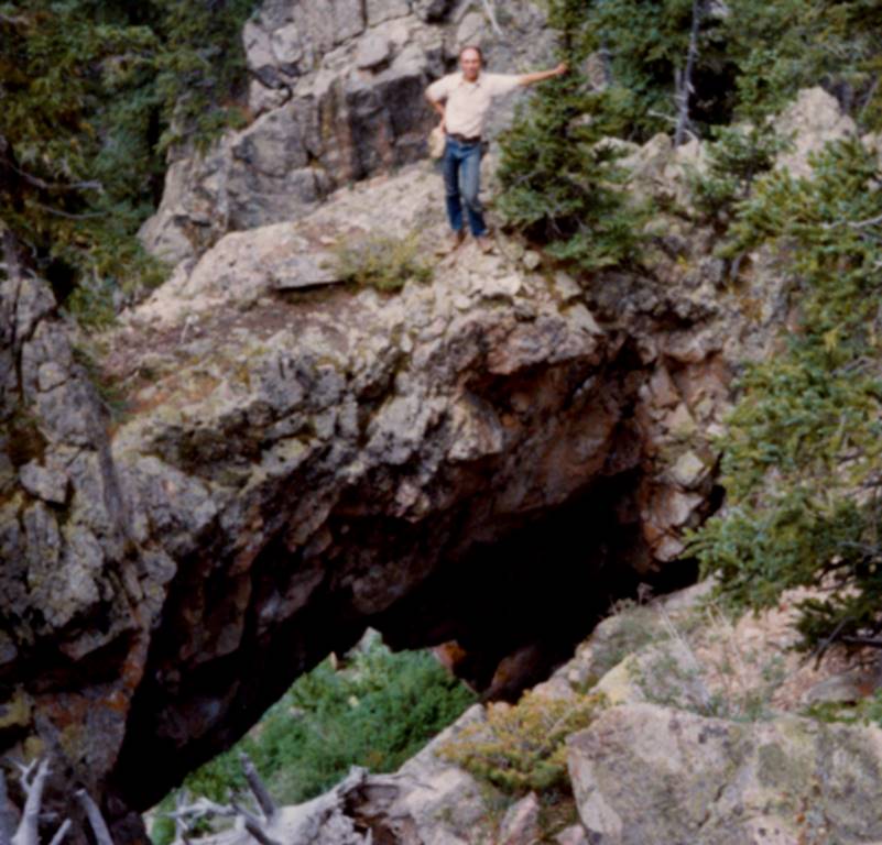
Frank himself poses for
a photo the day he found Collins Arch in 1975
Photo below shows
Collins Arch as viewed from the saddle between Santa Fe Baldy and Redondo Peak
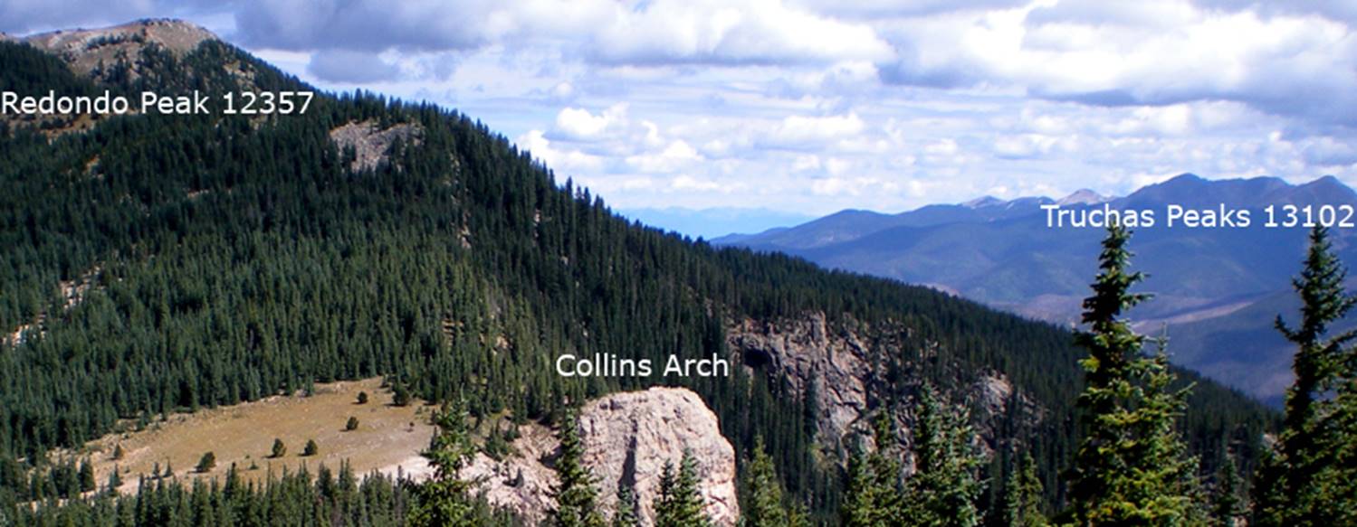
Owen Henderson Photo
beta facts:
name- Collins Arch
opening size- 35’ wide x 15’ high
elevation- 11500’
GPS coordinates- ±35°51.141’N 106°44.563’W
ownership- Pecos Wilderness – Santa Fe
National Forest
access- hike 1/3 mile southwest from Lake
Johnson
nearest town- Cowles, NM is about 6 miles southeast of here
fun fact- Frank Collins nears 90 at his
home up in the woods above Cowles, NM
____________________________________________________________________________________________________
Cicuye Arch
...this is a very poor
photo from on line... if you visit Cicuye Arch,
PLEASE send us a better photo…!!!
beta facts:
name- Cicuye Arch
opening size- unknown
elevation- 7300’
GPS coordinates- ±35°34.324’N 105°36.117’W –very approximate
ownership- private land ...likely
permission required
access- 4 miles east of Pecos in Cañon Ojo
Sarco near County Road B44D
nearest town- Pecos is about 4 miles west of here
fun fact- we don’t know if the
owners/locals love hikers or hate us... we have no idea...
...it seems to be right behind some ones
house...
____________________________________________________________________________________________________
Teakettle
Rock
Teakettle Rock is a
sweet destination
beta facts:
name- Teakettle Rock
opening size- 12’ high x 20’ span
elevation- 8650’
GPS coordinates- ±36°02.672’N 106°41.366’W
ownership- Santa Fe National Forest
access- is from Forest Road 103
nearest town- Coyote is about 11 miles north of here
fun fact-There must be a half a dozen
natural arch “holes” thru this teakettle
____________________________________________________________________________________________________
Un-named
Arch at Water Canyon
This natural arch is
adjacent to Hwy 4 between Whiterock and Bandelier
beta facts:
opening size-6’ wide by 12’ high -approx.
elevation- 6500’
GPS coordinates- ±35°48.615’N 106°14.750’W
ownership- Las Alamos National Lab.
access- is along Hwy 4
nearest town-White Rock is about 2 miles NE of here
fun fact- …don’t have a wreck, looking for
it while you’re driving…!
! !
____________________________________________________________________________________________________
Frijoles
Arch
Frijoles Arch spans
about 12 feet and the opening is about 20 feet high
beta facts:
name- Frijoles Arch
opening size- 20’ high x 12’wide
elevation- 7300’
GPS coordinates- ±35°49.032’N 106°22.154’W
ownership- Bandelier National Monument
access- is from Upper Frijoles Crossing
Trail
nearest town- Los Alamos is about 6 miles northeast of here
fun fact- after the fire burned all the
trees, I could plainly see the arch
Take Upper Frijoles Crossing Trail to
Frijoles Creek and walk upstream a quarter mile or so... then climb up on the
steep north side canyon slopes
This is an amazing, large rock
formation... likely a hundred feet high
____________________________________________________________________________________________________
Banco
Bonito Arch
…is actually a natural bridge, spanning
Upper Battleship Canyon streambed
Banco Bonito Arch is
about 17 feet wide by 10 feet tall
Reann and Linken are
above the arch……..
Reann and Linken are below the arch
beta facts:
name- Banco Bonito Arch
opening size- 10’ high x 17’ span
elevation- 7725’
GPS coordinates- ±35°50.186’N 106°37.619’W
ownership- Santa Fe National Forest
access- is to bushwhack .6 mile west from
NM State Hwy 4
nearest town- the small community of La Cueva is about 3.5 miles north northeast of here
fun fact- This natural bridge is tucked
away in a very secret and unvisited place
This general
area is labeled on Santa Fe National Forest Maps as Banco Bonito. Banco Bonito is a fairly resent lava flow
that created very fertile soil and supports prolific flowers and lush
vegetation. Steve Gaghagen
discovered this natural bridge and is more than happy to share it with all of
us. THANX Steve…!!! - you scored a goodern’ -
____________________________________________________________________________________________________
East Fork
Jemez Arch
This natural
bridge does not span the entire stream… only part of it
 Guess you’ll hafta get your feet wet…
What a beautiful
place….!!!!
beta facts:
name- un-named but referred to as East Fork
Jemez Arch
opening size- 2’ high x 6’ wide
elevation- 8320’
GPS coordinates- ±35°49.439’N 106°33.275’W
ownership- Santa Fe National Forest
access- is via New Mexico State Hwy 4 – Los
Conchos Trailhead
nearest town- La Cueva is about 6 air-miles northwest of here
fun fact- AMAZING BEAUTY
downstream a hundred
feet, high up on the north side canyon wall, is this 4-foot natural arch
____________________________________________________________________________________________________
Los Alamos
Arch
…a nice natural arch
overlooking the town of Los Alamos
beta facts:
name- unknown, but referred to as Los
Alamos Arch
opening size-12’ high x 15’ span
elevation- 8000’
GPS coordinates- ±35°54.722’N 106°20.069’W
ownership- Santa Fe National Forest
access- is from the extreme northwest
corner of Los Alamos town limit
nearest town- Los Alamos is almost a mile southeast of here
fun fact- nice, quick and a fairly easy
hike
____________________________________________________________________________________________________
Stable Mesa
Arch
A two-track remote 4WD
road leads up a steep hill, right to this fine natural arch
beta facts:
name- Stable Mesa Arch
opening size- 10’ high x 20’ span
elevation- 7880’
GPS coordinates- ±35°47.650’N 106°46.500’W
ownership- Santa Fe National Forest
access- is via Forest Road 376
nearest town- Jemez Springs is about 6 miles southeast of here
fun fact-many more smaller natural arches
are abundant nearby- like this one pictured below
____________________________________________________________________________________________________
Orbicularis
Arch
This Arch is
wonderful…!!! Thanx Joe, for this GREAT
find….!!!! Joe Sandusky Photo
beta facts:
name- Orbicularis Arch
opening size- 6’ high x 11’ span
elevation- 5920’
GPS coordinates- 35.519319 -106.953243
ownership- public BLM
access- Ojitos
Wilderness parking area or park along the powerline road near: 35.5155,
-106.9621
nearest town- San Ysidro is about 8 miles northeast of here
fun fact- Orbicularis is the human anatomy
muscle around the mouth…!!!
____________________________________________________________________________________________________
Bernalillito Arch
Bernalillito Arch is about 15’ high
and 10’ wide
Corey Norman Photo
beta facts:
name- Bernalillito
Arch
approximate span of 12 feet
elevation- 6100’
GPS coordinates- ±35°30.296’N 106°56.062’W
ownership- BLM – Ojito Wilderness
nearest town- San Ysidro is about 11 miles east-northeast of here
fun fact- it is a bit cracked and crumbling
some but it shouldn’t collapse for a few years yet...???
access
A couple miles south of San Ysidro on Hwy 550, turn southwest on Cabezon Road. Follow the left fork approximately 9¼ miles to an Ojito Wilderness sign and continue almost 1¾ mile to a developed parking area on the left side of the road. It's a small gravel lot at the trailhead. Hike the Hoodoos Trail past all the large hoodoo formations along the base of Bernalillito Mesa. Informal trails continue around the north side of the mesa. Stay south as the mesa withdraws to the south, stay close to the base of the mesa. Bernalillito Arch is up at the south end of this recessed area of Brenalillito Mesa.
Thanx Corey for this great discovery...! ! !
____________________________________________________________________________________________________
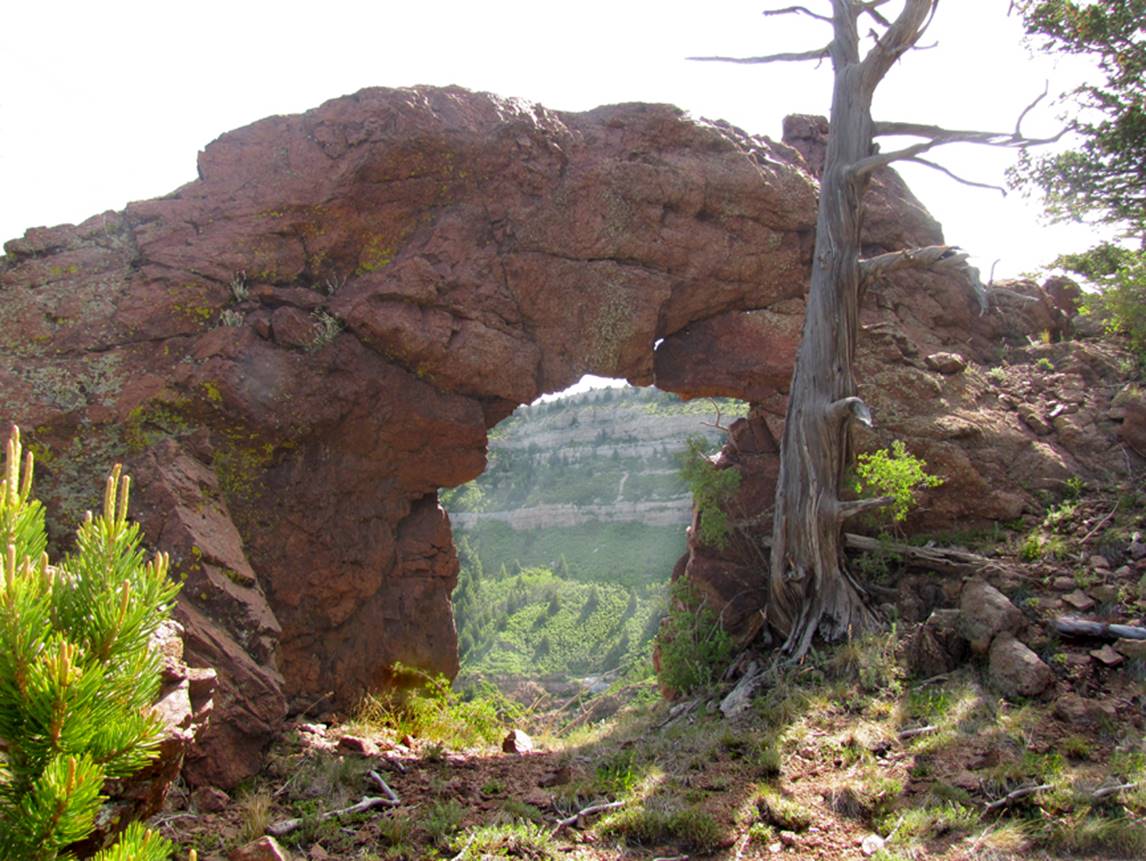
Guadalupe
Arch
Guadalupe Arch appears
in Wingate Sandstone
There are many more natural
arches in this lower Cañon Guadalupe area... but… but… they are actually
DIRT...!!!
see: http://www.dougscottart.com/hobbies/SlotCanyons/Guadalupe.htm
beta facts:
name- Guadalupe Arch
opening size- guessing- 8’wide x 15’high
elevation- 5900’
GPS coordinates- ±35°31.777’N 107°09.352’W
ownership- BLM
access- is from Highway 279
nearest town- Cabezon, NM is about 8 miles northeast of here
fun fact- don’t get in the quicksand... it
is true quicksand that can suck you in at free-fall speed... no joke.
For more info see: http://www.dougscottart.com/hobbies/SlotCanyons/Guadalupe.htm
-and please right-click yourself a copy of our map. When you hike up Cañon Guadalupe from HWY 279
be sure to park and hike before the highway crosses Guadalupe Creek otherwise
sheer and crumbly dirt cliffs 40’ high will block your access... whereas the north side hiking is open and you
can easily cross Rito Guadalupe upstream one mile above the highway, at the ten
foot high waterfall that drops over a “dirt” cliff. Guadalupe Arch is right there.
____________________________________________________________________________________________________
Salado Arch
Salado Arch is in
beautiful Cañon Salado not far from where this photo below was taken
Rito Salado is a
beautiful spring-fed stream flowing thru a forested canyon with sheer sandstone
walls
For more info see: http://www.dougscottart.com/hobbies/SlotCanyons/Salado.htm
beta facts:
name- Salado Arch
opening size- very small... maybe a 5-foot
span
elevation- 6800’
GPS coordinates- ±35°30.311’N 107°14.669’W
ownership- Cibola National Forest
access- is from above off Forest Road 239A
nearest town- Cabezon is about 12 miles northeast of here
fun fact- this place is an unknown
beauty....!!!
...a fairly nice trail takes you off of
Mesa Chivato 1000’ elevation above the Rito
Salado. The trail starts near GPS: ±35°31.380’N 107°15.832’W and runs east off the point
of the mesa. It drops more than 1000’ in
about a mile and a half. It is
beautiful... and the bottom is even more beautiful…!!! Be sure to visit this link to
right-click-save-as your own copy of our map: http://www.dougscottart.com/hobbies/SlotCanyons/Salado.htm
____________________________________________________________________________________________________
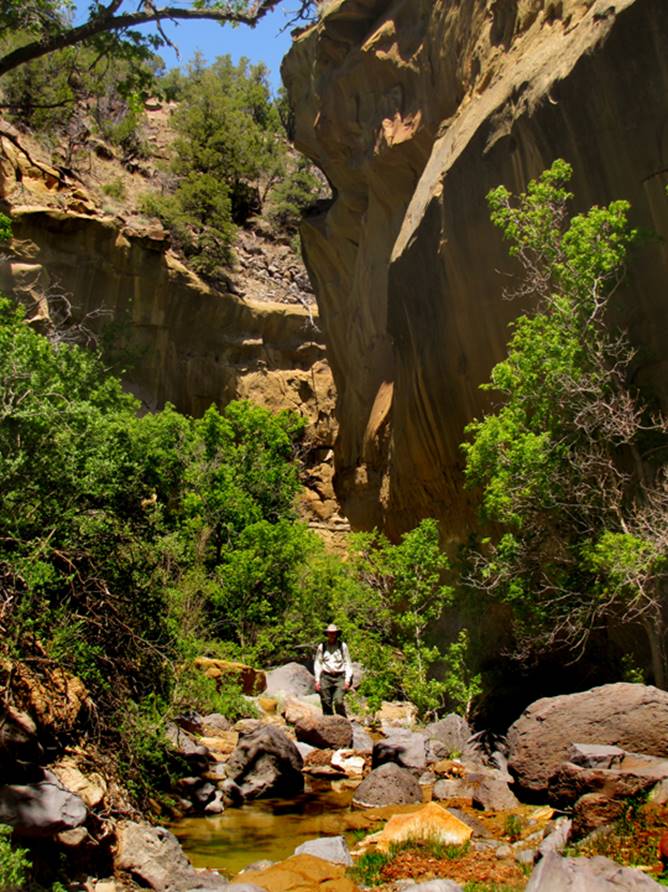
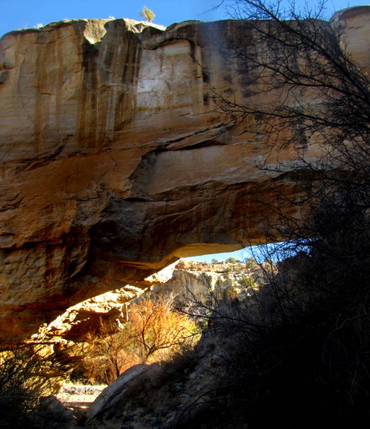
Tapia Arch
Tapia Arch appears in
Wingate Sandstone in Cañon Tapia a mile and a half upstream from the 4WD
parking area
see: http://www.dougscottart.com/hobbies/SlotCanyons/Tapia.htm
beta facts:
name- Tapia Arch
opening size- guessing- 12’wide x 20’high
elevation- 6000’
GPS coordinates- ±35°30.021’N 107°10.366’W –unsure, but close...
ownership- BLM
access- is from Highway 279
nearest town- Cabezon, NM is about 10 miles northeast of here
fun fact- this is an unforgettable
place
For more info see: http://www.dougscottart.com/hobbies/SlotCanyons/Tapia.htm -and please right-click yourself a copy of
our map. When you hike up Cañon Tapia
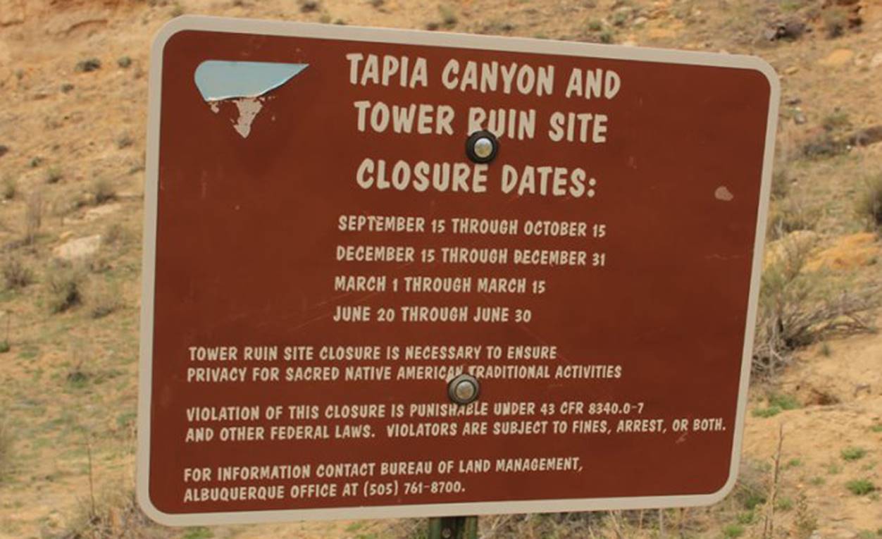
remember this area is closed four times each year for Native American
Festivities. See photo of the sign
below:
____________________________________________________________________________________________________
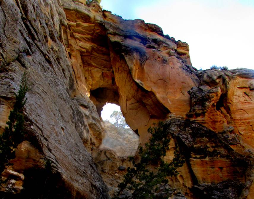
Tapia
Natural Bridge
Fifth longest
span known in New Mexico
The photo above is
looking at the back side of Tapia Natural bridge... from the mouth of the slot
canyon. the photo below is the front
side from Cañon Tapia
Tapia Natural Bridge
appears in Wingate Sandstone in Cañon Tapia a strong two and a half miles
upstream from the 4WD parking area
see: http://www.dougscottart.com/hobbies/SlotCanyons/Tapia.htm
beta facts:
name- Tapia Natural Bridge
opening size- 65’ span x 25’ high opening
elevation- 6100’
GPS coordinates- ±35°29.834’N 107°10.931’W
ownership- BLM
access- is from Highway 279
nearest town- Cabezon, NM is about 11 miles northeast of here
fun fact- this is an unforgettable place
with a slot canyon above the natural bridge
For more info see: http://www.dougscottart.com/hobbies/SlotCanyons/Tapia.htm -and please right-click yourself a copy of
our map. When you hike up Cañon Tapia
remember this area is closed four times each year for Native American
Festivities. See photo of the sign
below:
____________________________________________________________________________________________________
Cañon Canoa
Arches
There are many natural arches within Cañon Canoa Slot
Canyon. None of them have names.
beta facts:
name- None of these many arches have names.
Opening size- up to 5 feet openings
elevation- 7000’at
the top down to 6700’at the bottom
GPS
coordinates- ±35°27.264’N 107°12.897’W
Ownership- BLM
access- is from Tapia Canyon –see above
nearest town- NONE
fun fact- these natural arches are within
an amazing slot canyon
see also- http://www.dougscottart.com/hobbies/SlotCanyons/Canoa.htm
____________________________________________________________________________________________________
Cañada
Ancha Arch
Cañada Ancha means Big
wide canyon in English... and it is a big wide canyon downstream a few miles
from this extremely narrow slot canyon portion
See: http://www.dougscottart.com/hobbies/SlotCanyons/Ancha.htm
beta facts:
name- Ancha Arch
opening size- 20’ high x 10’ wide
elevation- 6450’
GPS coordinates- ±35°27.253’N 107°12.892’W
ownership- is checkerboard – BLM, State,
BIA and private lands
access- is from Cañon Tapia ...it is a long
walk, about 9 miles one way
nearest town- Cabezon is about 15 miles northeast of here
fun fact- nobody visits this place
My friend Steve was hiking up Ancha Slot
Canyon, a few feet ahead of me when he turned to ask, “What makes a natural
arch, a natural bridge?” “A natural
bridge has either a perennial stream or an intermittent water-course flowing
under it.” I replied, “why do you ask?”
...his smile gave him away... I stepped forward and gasp, “What a fine
natural arch...!” Visiting in the Jeep
with him later I boldly stated, “I am going to name this arch Steven’s
Arch.” “There is already a Stevens
Arch.” He declared sharply. ...which I
knew... “Yes, but this Steven’s Arch is spelled differently. It has an apostrophe between the last two
letters.” I knew he would NOT like this,
but I thought I was being quite tricky.... and I really don’t know if this is a
natural arch or a natural bridge.....
____________________________________________________________________________________________________
Sandia Arch
Sandia Arch is upon a
high ridge between the two upper forks of the South Fork of Cañon del
Agua. This natural arch is about 7 feet
wide by 7 feet high.
This photo below shows
both Sandia Arch and Little Sandia Arch... as seen from the north
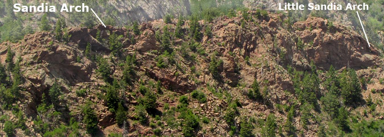
Little Sandia Arch is
best reached with ropes and gear 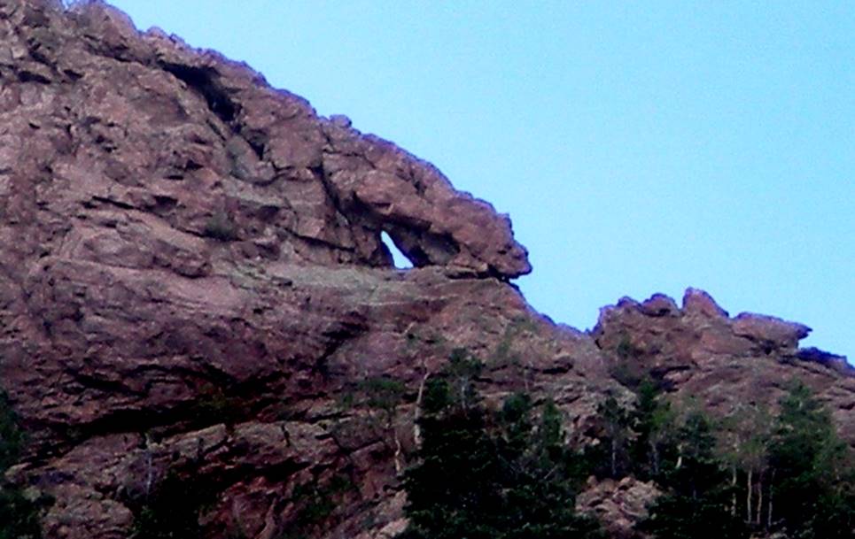
Owen Henderson Photo
2010
...and the hole of this
“third” arch below would be much larger if it were free from several large,
loose rocks and boulders resting inside of its opening...
The photo above is of
the north-facing side of this arch and the photo below is of its south-facing
side... perhaps “Cluttered Arch” is a good name for it.
beta facts:
name- Sandia Arch
opening size- 7’ high x 7’ wide
elevation- 9500’
GPS coordinates- ±35°14.357’N 106°27.416’W
ownership- Cibola National Forest
nearest town- Albuquerque is about 10 miles southwest of here
fun fact- This is a fine natural arch
I first found Sandia Arch from the North
Crest Trail in 1974... This is a very exciting and worthy destination that can
be reached via a 6 mile round-trip excursion with 2000’ vertical. The last half mile from Cañon del Agua
Overlook to Sandia arch is a steep bushwhack descent thru aspens... but very
do-able... There really should be a
trail here......
Below are some important GPS coords for Sandia Arch:
Parking- ±35°14.353’N
106°27.418’W
Cañon del Agua Overlook- ±35°14.272’N 106°26.996’W
Sandia Arch- ±35°14.357’N
106°27.416’W
Little Sandia Arch-
±35°14.393’N 106°27.483’W
Cluttered arch-
±35°14.446’N 106°27.275’W – approximate
____________________________________________________________________________________________________
Pasture
Hollow Natural Bridge
Pasture Hollow Natural
Bridge was submitted by Jeff Trike. He
shot this photo while parasailing above Cibola National Forrest
beta facts:
name- Pasture Hollow Natural Bridge
opening size- unknown
elevation- 7600’ aprox.
GPS coordinates- ± 35.193768, -108.509490°.’W
ownership- Cibola National Forest
access- is via an un-numbered 2 track 4WD
forest road, 3.5 miles north of Ramah Dam.
Then bushwhack a quarter mile NE up a side canyon
nearest town- Ramah is about 4 miles south of here
fun fact- The height and span width of this
arch is yet to be published. Might you
like to supply those numbers?
This Natural Bridge appears quite obvious
on Google Satellite image… although it is not labeled. This area looks like it will be AMAZING….! !
!
Below here is a photo sent to me by Niel
Grady
Niel Grady photo
He
estimates that this arch that he found while hiking, is somewhere near GPS
cords: 35.1990673, -108.4384747 – which is quite near Ramah Falls.
I believe these cords to be incorrect. This arch is more likely to be up near the
top of Hogback Ridge, in the vicinity of Pasture Hollow Natural Bridge…
However, at this time We must consider the
location of this natural arch to be unknown.
The span and height of this arch can be
estimated by the size of the grown man walking within the right-hand side of
this sun-lit opening. Judging by this
man, my guess
is that this arch has a height of about 12
feet and a span of about 18 feet.
____________________________________________________________________________________________________
Ramah Natural Bridge
...a photo online showing about 100 Mormon
settlers on, in and around Ramah Natural Bridge
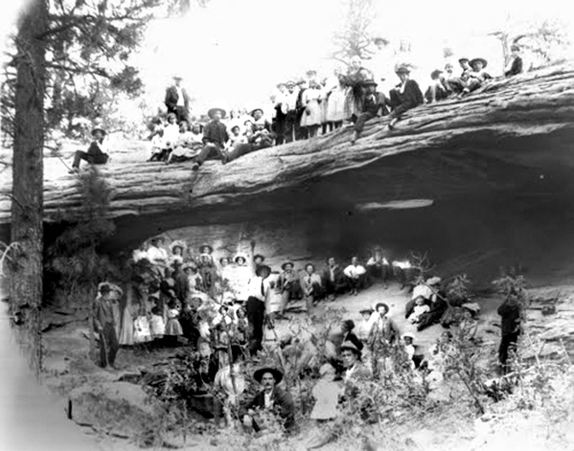
WOW...
beta facts:
name- Ramah Natural Bridge
opening size- unknown
elevation- unknown
GPS coordinates- 35° 15' 2.90
N 108° 30' 29.47W –this is how the GPS coords are
written online
ownership- Cibola National Forest or private
land –it is near the line but unknown which...???
access- Blind Canyon or likely a tributary
thereof...
nearest town- Ramah, NM is about 12 miles south of here
fun fact- WOW... we gotta find
this cool place...!!!
I
wonder if all those Mormon Settlers will still be sit’n
around there when we show up…???
____________________________________________________________________________________________________
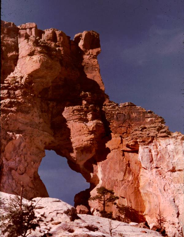
Enchanted
Arch
AKA-
Sandstone
Bluffs 52’ span arch
Sixth longest
span known in New Mexico
...Enchanted Arch, as
seen from above...
...and as seen from
below... this lower shot is a Nate
Bartnick Photo
beta facts:
name- “Enchanted Arch” -AKA-
Sandstone Bluffs 52’ span Arch
elevation- 6750’
GPS coordinates- ±34°58.109’N 107°49.666’W
ownership- ? El Malpais
National Monument
access- is from NM State Hwy 117
nearest town- Grants is about 14 miles north of here
fun fact- El Malpais
National Monument has many, many wonderful natural arches
____________________________________________________________________________________________________
Sandstone
Bluffs 27’ span arch
This 27’ span natural
arch overlooks the Malpais Lava Flows. This is a Nate Bartnick Photo
beta facts:
name- Sandstone Bluffs 27’ span Arch
elevation- 6900’
GPS coordinates- ±34°57.096’N 107°50.052’W
ownership- ? El Malpais
National Monument
access- is from NM State Hwy 117
nearest town- Grants is about 15 miles north of here
fun fact- El Malpais
National Monument has many, many wonderful natural arches
____________________________________________________________________________________________________
Sandstone
Bluffs 18’ span arch
The photo below is of this
arch as seen thru the opening of the 11’ span arch listed below... Photos by
Nate Bartnick
beta facts:
name- Sandstone Bluffs 18’ span Arch
elevation- 6700’
GPS coordinates- ±34°57.826’N 107°49.711’W
ownership- El Malpais
National Monument
access- is from NM State Hwy 117
nearest town- Grants is about 14 miles north of here
fun fact- El Malpais
National Monument has many, many wonderful natural arches
____________________________________________________________________________________________________
Sandstone
Bluffs 11’ span arch
Nate Bartnick Photo
beta facts:
name- Sandstone Bluffs 11’ span Arch
elevation- 6700’
GPS coordinates- ±34°57.826’N 107°49.711’W
ownership- El Malpais
National Monument
access- is from NM State Hwy 117
nearest town- Grants is about 14 miles north of here
fun fact- El Malpais
National Monument has many, many wonderful natural arches
____________________________________________________________________________________________________
Painted
Arch
Documented in 1975 by Doug Murphy while he served on New Mexico,
Governor Jerry Apodaca’s Environmental Advisory Board
Led by a whim... We
climbed WAY steep rocks up to take this photo in 1975... below is a wide-angle
shot in April 2018- notice the massive lava flow beyond
beta facts:
known as - Painted Arch
opening size- 25’ high x 20’ wide
elevation- 7200’
GPS coordinates- very approximate: ±34°52.215’N 107°52.777’W
ownership- El Malpais
National Monument
access- is from State Hwy 117
nearest town- Grants is about 15 miles north of here
fun fact- ...unknown and Amazing…!!! - El Malpais
National Monument has many, many wonderful natural arches
see also this
fine slot canyon in this same Painted Arch Canyon: http://www.dougscottart.com/hobbies/SlotCanyons/PaintedArch.htm
____________________________________________________________________________________________________
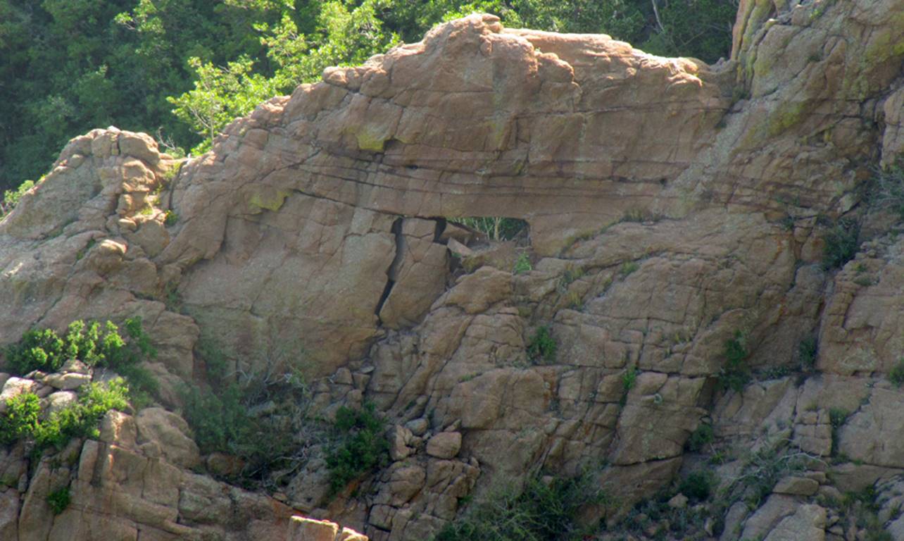
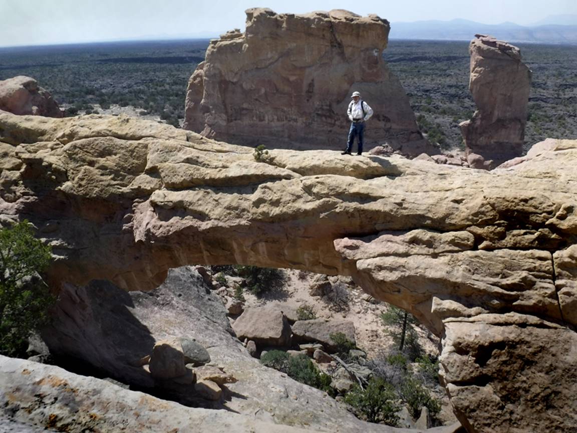
La Ventana
Arch
Second
longest span known in New Mexico
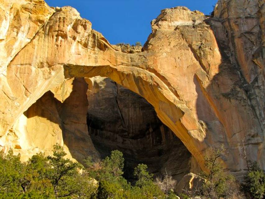
La Ventana Arch has the
second longest span of any known arch in New Mexico – photo below is taken from
above
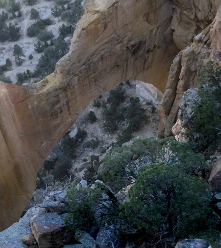
beta facts:
name- La Ventana Arch
opening size- 135’ wide x 80’ high
elevation- 7300’
GPS coordinates- ±34°52.154’N 107°53.335’W
ownership- BLM
access- is from New Mexico State Hwy 117
nearest town- Grants is about 15 miles north of here
fun fact- this is a big, nice arch - El Malpais National Monument has many, many wonderful natural
arches
On USGS topos this
arch is marked seven-tenths of a mile east northeast of its true location...
but MyTopo.com has it correct
____________________________________________________________________________________________________
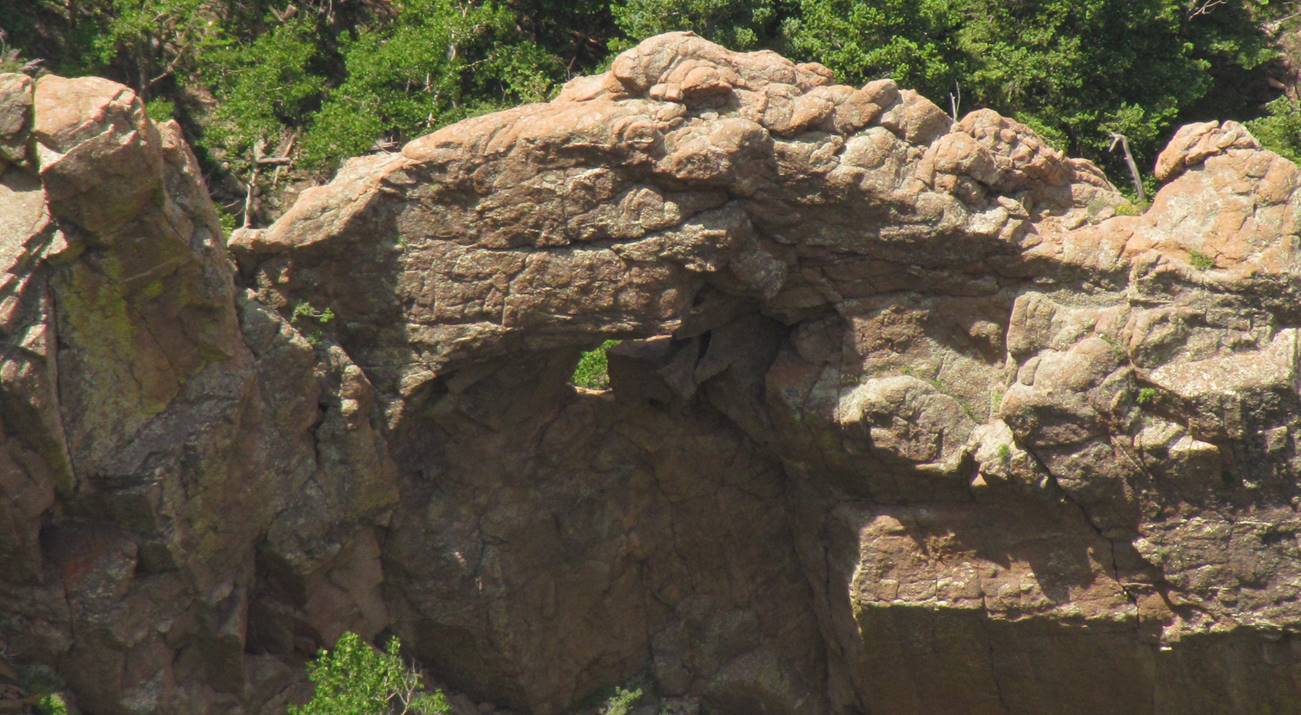
Thin Ben
Arch
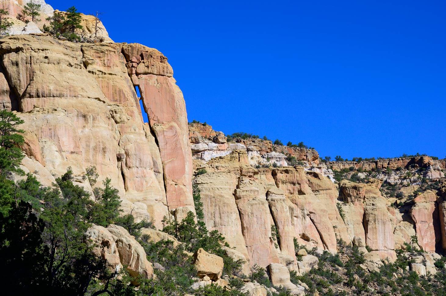 Thin Ben Arch is on the
cliffs behind you as you stand at La Ventana Arch, the arch described on this
same page above this arch. However, you
must walk south a ways to be able to view into the opening of Thin Ben
Arch.
Photo by: Ben Cheesebrough
Thin Ben Arch is on the
cliffs behind you as you stand at La Ventana Arch, the arch described on this
same page above this arch. However, you
must walk south a ways to be able to view into the opening of Thin Ben
Arch.
Photo by: Ben Cheesebrough
beta facts:
name- Thin Ben Arch
opening size- maybe 3 feet wide x 20 or
more feet high
elevation- 7300’
GPS coordinates- ±34.869600° -107.893161°
ownership- BLM
access- is from New Mexico State Hwy 117
nearest town- Grants is about 20 miles north of here
fun fact- I don’t think Ben is that thin,
man…
____________________________________________________________________________________________________
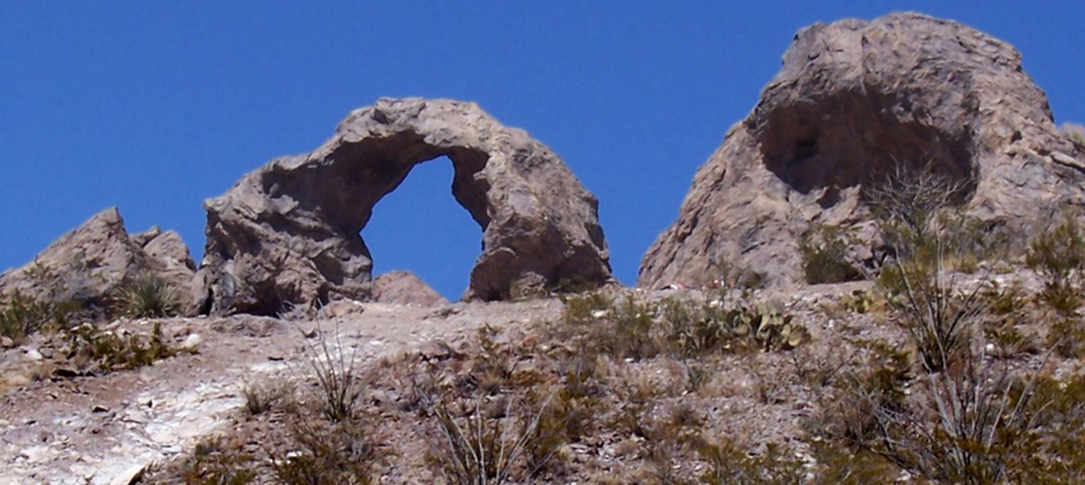
Un-named
Arch
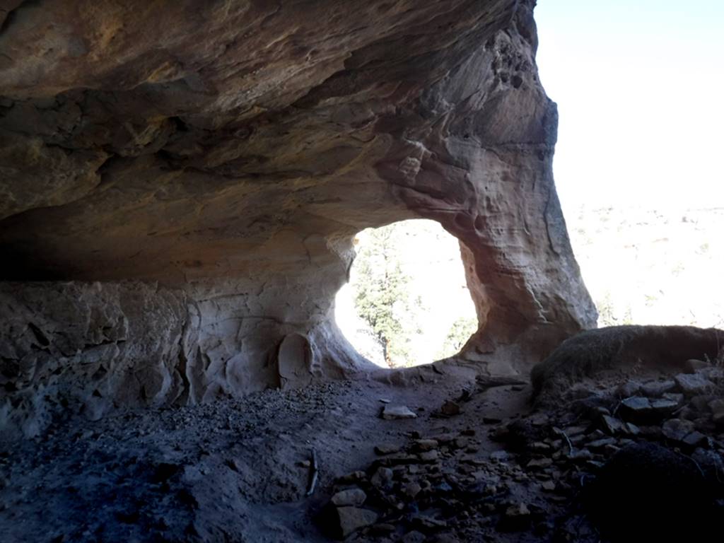
We found this arch in a
shelter cave just below the rim-rock an eighth mile south of La Ventana Arch
beta facts:
name- none
opening size- 5’ wide x 5’ high
elevation- 7300’
GPS coordinates- ±34°52.154’N 107°53.335’W
ownership- El Malpais
National Monument
access- is from New Mexico State Hwy 117
nearest town- Grants is about 16 miles north of here
fun fact- El Malpais
National Monument has many, many wonderful natural arches
____________________________________________________________________________________________________
Un-named
Arch
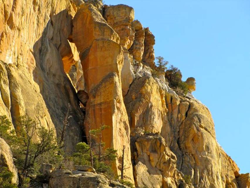
This may not be a true
natural arch if the top portion does not “mate” with the cliff
...but it is
beautiful...!!!
beta facts:
name- none
opening size- about maybe... 50’ high x 20’
wide
elevation- 7200’
GPS coordinates- very approximate: ±34°53.339’N 107°55.070’W
ownership- BLM
access- is from New Mexico State Hwy 117
nearest town- Grants is about 15 miles north of here
fun fact- if the top portion of rock does
not mate with the cliff, then this is not a true arch
El Malpais
National Monument has many, many wonderful natural arches
____________________________________________________________________________________________________
Ramah Lake
Arch
Ramah Lake Arch is
perched, beautifully overlooking Ramah Lake… a Nate Bartnick photo
beta facts:
name- Ramah Lake Arch
opening size- span unknown
elevation- 7300’
GPS coordinates- unknown
access- is from Ramah Dam
nearest town- Ramah is about 1 mile south of here
fun fact- This arch is easy to see but very
difficult to access
Thanx Nate
____________________________________________________________________________________________________
Feather
Rock
Seventh
longest span known in New Mexico
Feather Rock Arch,
shown on the left side of the photo above, displays amazing beauty -a Jeff Ingber photo
We found this photo
online. Thank You Jeff for posting such
a beautiful photo online.
beta facts:
name- Feather Rock Arch
opening size- 40 foot span
elevation- 7100’ elevation
GPS coordinates- unknown
ownership- Zuni Tribal Land
access- is via Hwy 53
nearest town- Zuni, NM is about 9 miles south of here
fun fact- extreme beauty easily viewed from
your car
Feather Rock Arch is located in Zuni Indian Reservation in
McKinley County, New Mexico. The arch is
located 9 miles north of Zuni, NM visible from Hwy 53.
Permission is required to hike to the arch.
____________________________________________________________________________________________________
Dog’s Head
Arch
AKA: Indian Creek Arch
Dog’s
Head Arch also known as Indian Creek Arch appears well above Indian Creek Trail
#48, on the southeastern slopes of the San Mateo Mountains, about 35 miles
north of Truth or Consqences. There are
two separtate Creeks in the San Mateo Mountains by the name of Indian Creek. This Indian Creek is a tributary to Nogal
Canyon flowing east into the Rio Grande.
Forest Road #225 accesses the Trail #48 Trailhead.
The photo below shows a
small arch in this same area... ah... I’d say a bit difficult to access...
Randy Simons Photos
beta facts:
name- Dog’s Head Arch
opening size- estimated opening size is 25
feet
elevation- approx-
7350’
GPS coordinates- ±33°37.131’N 107°22.512’W
ownership- Cibola National Forest
access- is from Forest Road #225 and Trail
#48 -this is a strong 5 mile hike
one-way...!!!
nearest town- Truth or Consequences is about 35 miles south of here
fun fact- There is an un-explored North
Fork Indian Creek, right nearby, that looks to be extremely rocky, steep and
narrow... more so than around Dog’s Head Arch.
The photos
and info on Dog’s Head Arch was submitted by Randy Simons
____________________________________________________________________________________________________
Needles Eye
AKA Cooney Arch
Cooney Arch AKA
Needle’s Eye Arch is in the lower reaches of amazing Mineral Creek Canyon
beta facts:
name- Cooney Arch AKA Needle’s Eye Arch
opening size- unknown
elevation- unknown
GPS coordinates- unknown
ownership- Gila National Forest
access- is from Gila National Forest Road
701
nearest town- Mogollon is about 2 miles south of here
fun fact- Mineral Creek Canyon should be on
every New Mexican’s bucket list
________________________________________________________________________________________________________
Monks Head
Arch submitted by Ben Billings
Monks Head Arch as seen
above the Gila National Forest - Gold Dust Trail near Glenwood, New Mexico -
Ben Billings Photos
The “Monk” of the Monks
Head Rock formation can be seen in this photo below... his “side profile” is
looking straight down upon the natural arch
beta facts:
name- Monks Head Arch
opening size- perhaps 10 to 15 feet
elevation- 5850’
GPS coordinates- ±33°22’47”N 108°49’55”W
ownership- Gila National Forest
access- is a one mile hike up Gold Dust
Trail off of Hwy 159 between Glenwood and Mogollon, NM
nearest town- Mogollon is about 2.5 miles northeast of here
fun fact- A line drawing of Monks Head Arch
appeared on page 3 of the November 1909 issue of “Mogollon Mines” promo
magazine
Monks Head Arch can be seen up on a
prominent ridge, above the Gold Dust Trail
____________________________________________________________________________________________________
Keyhole
Arch
Keyhole Arch has very
interesting hoodoos gathered around it... who seem to be admiring it.
beta facts:
name- Keyhole Arch
opening size- ?’ high x ?’ span
elevation- 6900’
GPS coordinates- ±33°13.726’N 108°39.849’W
ownership- Gila National Forest
access- is from Rain Creek Trailhead up the
old abandon trail going up Rain Creek to it’s upper
reaches...
nearest town- Pleasanton is about 14 miles west of here
fun fact- Thank You Ben Billings for
sending this wonderful arch in to us…!!!
The trail leading up here is the old Rain
Creek Divide Trail... which has been abandon by the Forest Service BUT
maintained by a volunteer citizen.
Keyhole Arch can easily be seen
from this trail.
____________________________________________________________________________________________________
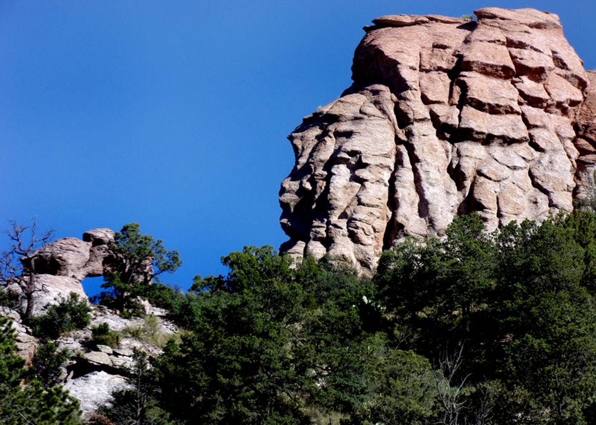
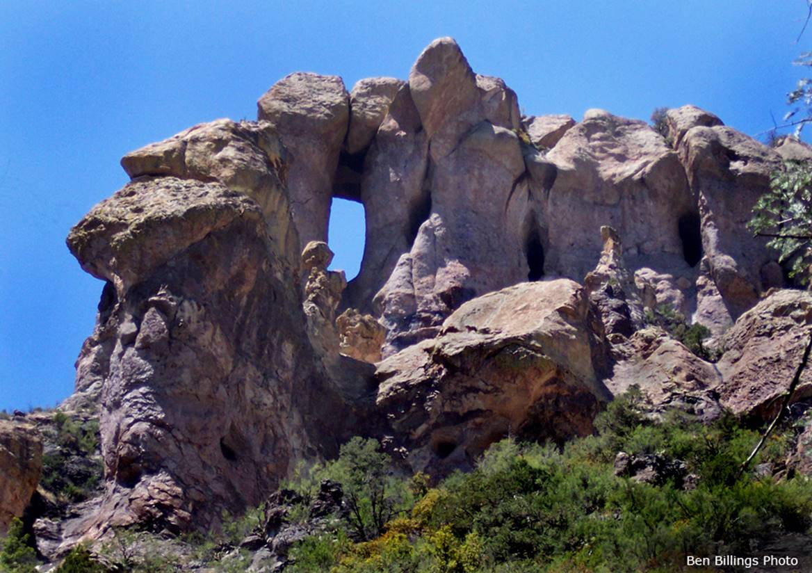
Sacaton
Arch
Found by my friend Jay Hemphill in 2015
Fourth
longest span known in New Mexico
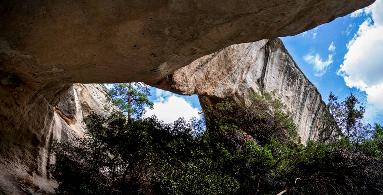
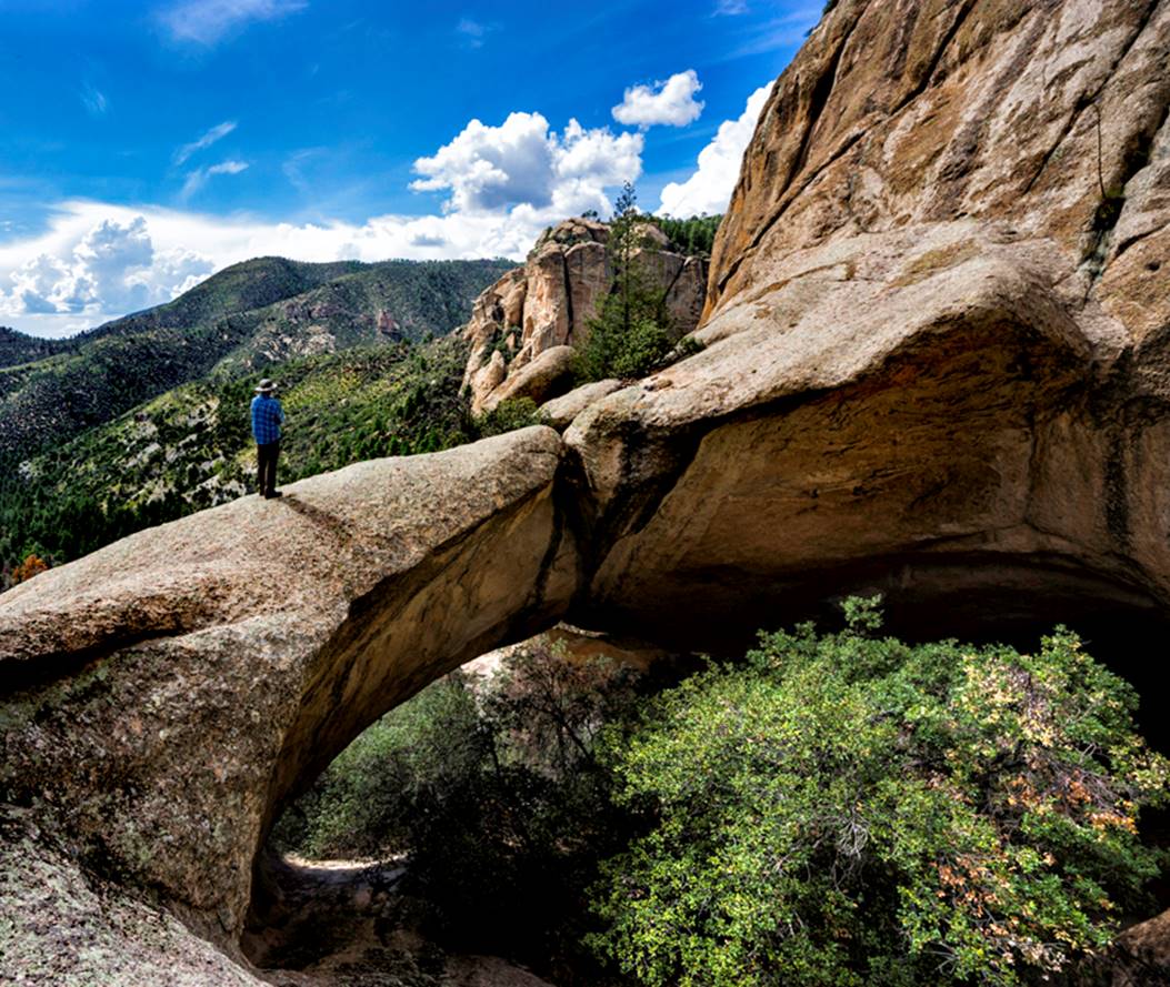
Sacaton Arch is
believed to have a span of 75 feet in Gila Conglomerate bedrock Photos by Jay Hemphill
beta facts:
name- Sacaton Arch
opening size- 75’wide x 35’ high
elevation- 7500’
GPS coordinates- ±33°14.603’N 108°42.081’W
ownership- Gila National Forest
access- is 2.5 miles up Sacaton Trail then
a 200’ climb up the steep north side canyon slopes
nearest town-Glenwood, NM is about 15 miles northwest of here
fun fact- GREAT FIND JAY... ! ! !
essay bro
this is a tuff one to climb up to... and
very likely there are more natural arches in this area
____________________________________________________________________________________________________
Mineral
Creek Arch
Mineral Creek Arch
appears on USGS 7.5 minute topos
Devon Fletcher Photo
This is one of the more wonderful hikes in New
Mexico…!!!
beta facts:
name- Mineral Creek Arch
opening size- approx.- 20 feet wide x 10
feet high
elevation- 6800’
GPS coordinates- ±32°58.480’N 107°43.653’W
ownership- Gila National Forest
access- is from Gila National Forest Road
157 S
nearest town- Kingston is about 5 miles south of here
fun fact- about a mile upstream from here is
beautiful Mineral Creek Falls ...40 feet high...!!!
see: http://www.dougscottart.com/hobbies/waterfalls/mineralcreekkingston.htm
40’ high Mineral Creek Falls
____________________________________________________________________________________________________
Percha Arch
“Perch” in English
Percha Arch is in Percha
Creek Canyon 3.8 miles downstream from the town of Hillsboro, NM
See: http://www.dougscottart.com/hobbies/SlotCanyons/PerchaNarroWicks.htm
beta facts:
name- Percha Arch
opening size- about six feet
elevation- 4950’
GPS coordinates- ±32°54.845’N 107°31.060’W
ownership- BLM
access- is from three different dirt roads
east of Hillsboro
nearest town- Hillsboro is about 3.8 miles west of here
fun fact- easy to get to and a great winter
hike
____________________________________________________________________________________________________
Percha
Cliffs Arch
Percha Cliffs Arch is
about 6 feet in diameter and is less than a mile downstream from Percha Arch
listed above
See: http://www.dougscottart.com/hobbies/SlotCanyons/PerchaNarroWicks.htm
beta facts:
name- Percha Cliffs Arch
opening size- 6 feet
elevation- 4950’
GPS coordinates- ±32°55.196’N 107°30.512’W
ownership- BLM
access- is from three different dirt roads
east of Hillsboro
nearest town- Hillsboro is about 4.5 miles west of here
fun fact- easy to get to and a great winter
hike
____________________________________________________________________________________________________
Percha
Highway Arch
Percha Highway Arch is
above the highway bridge 5 miles west of Hillsboro and it is marked on USGS 7.5
min topos as “nat arch” an
abbreviation of the words natural arch
beta facts:
name- Percha Highway Arch
opening size- estimate: 20 feet high x 10
feet wide
elevation- 5900’
GPS coordinates- ±32°55.059’N 107°38.794’W
ownership- unknown but possibly private
land
access- is from Hwy 152
nearest town- Kingston is about 4 miles west of here
fun fact- it’s pretty
____________________________________________________________________________________________________
Doña Ana
Arch
Devon Fletcher Photos
Doña Ana Arch is in the
Doña Ana Mountains of southern New Mexico
beta facts:
name- Doña Ana Arch
opening size- some bigger than the
motorcycle that is parked next to it in the photo above
elevation- unknown
GPS coordinates- unknown
ownership- unknown
access- unknown
nearest town- somewhere north of Las Cruses
fun fact- maybe we will learn more about
this arch soon
____________________________________________________________________________________________________
next Arch ?
send us your
photo and info... ! ! !
-Photo-
Arch is blah, blah,
blah... your name goes here.
beta facts:
name- Arch
opening size- ?’ high x ?’ span
elevation- 00’
GPS coordinates- ±°.’N °.’W
ownership- ? National Forest
access- is from
nearest town- ? is about ? miles ? of here
fun fact- ?
?
____________________________________________________________________________________________________
Other New Mexico natural arch links:
http://naturalarches.org/db/arches/newmexico.htm
Send questions and comments to dscott@themarblesculptor.com