Cañon
Salado
This is a box canyon but
one of its tributaries up over 6600’ elevation, is a short but sweet little
slot canyon that is a kick-in-the-pants...!!!
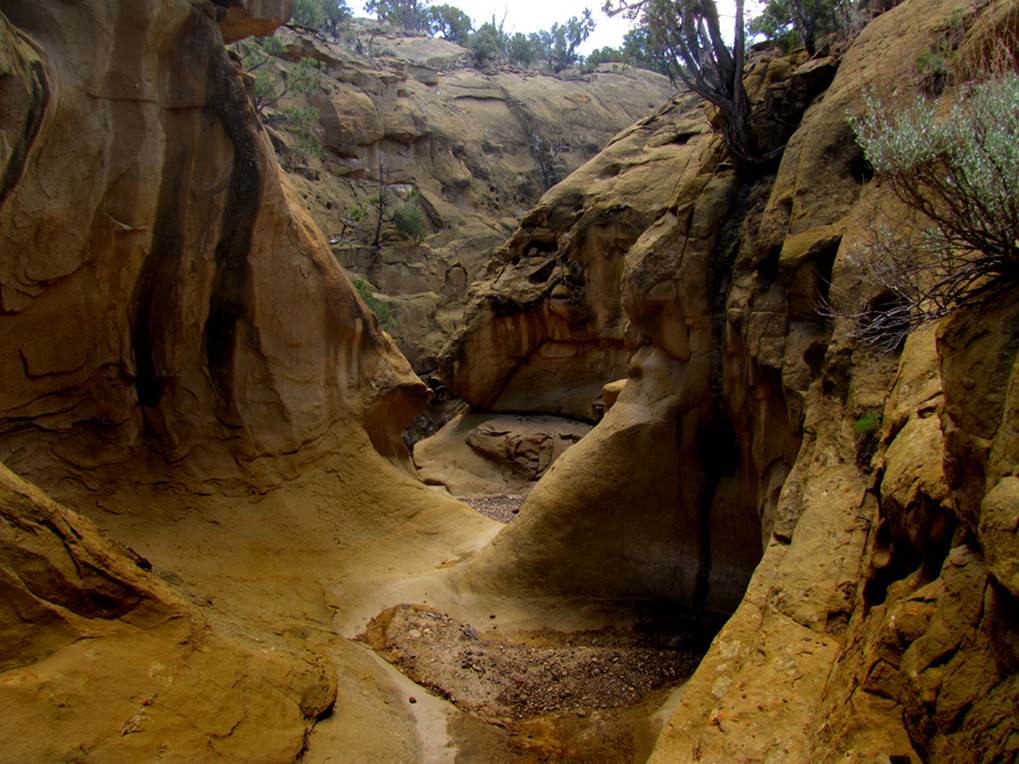
It is shown in the first photo below and it’s
GPS cords are: 35°30.663’N 107°14.262’W
NEVER ENTER ANY
SLOT CANYON WHEN HEAVY RAIN IS IN THE FORCAST…!!!
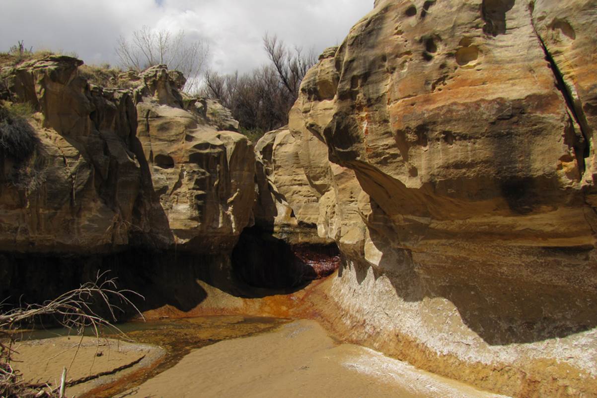
Below is a sweet little slot canyon tributary to upper Salado Canyon. It is less than a quarter-mile long but it
resembles a “fire-escape.” It is
great...!!! It drops–off very steep just
below this photo, but ropes are not needed to ascend or descend this sweet
little canyon.
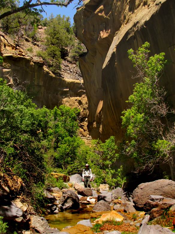
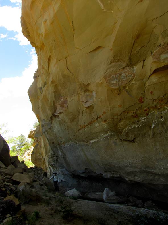
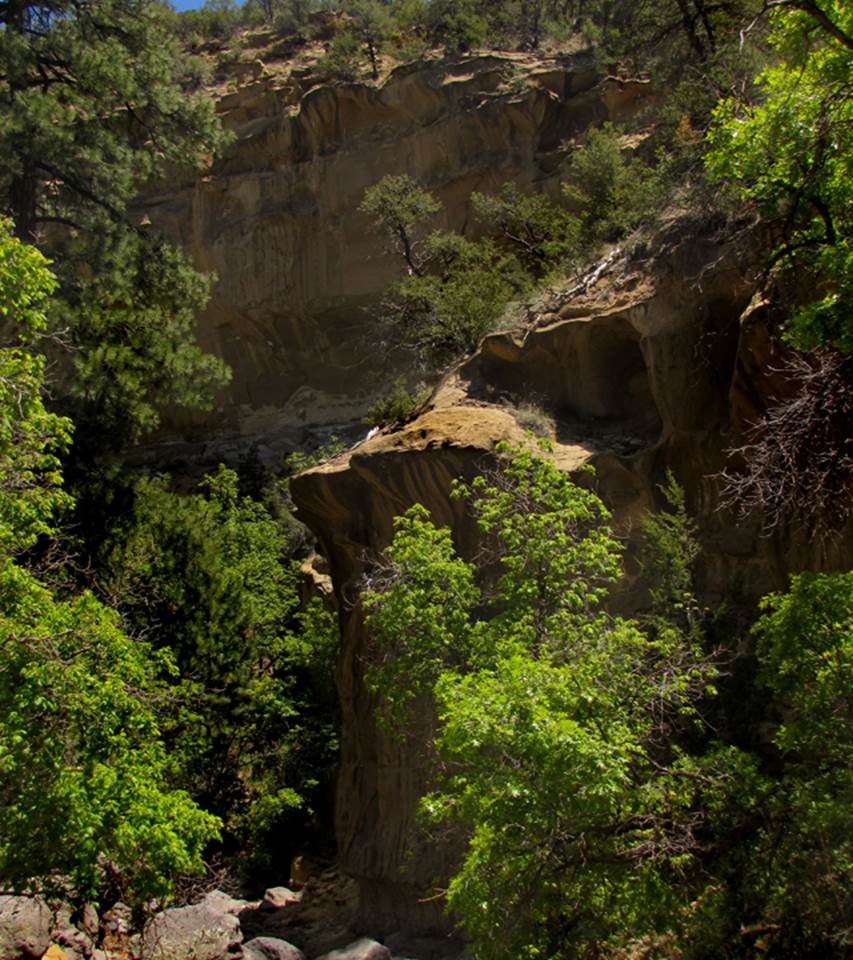
The upper Salado Canyon
within the Cibola National Forest has extreme beauty... AND a nice flowing
stream...
...And... a small natural arch
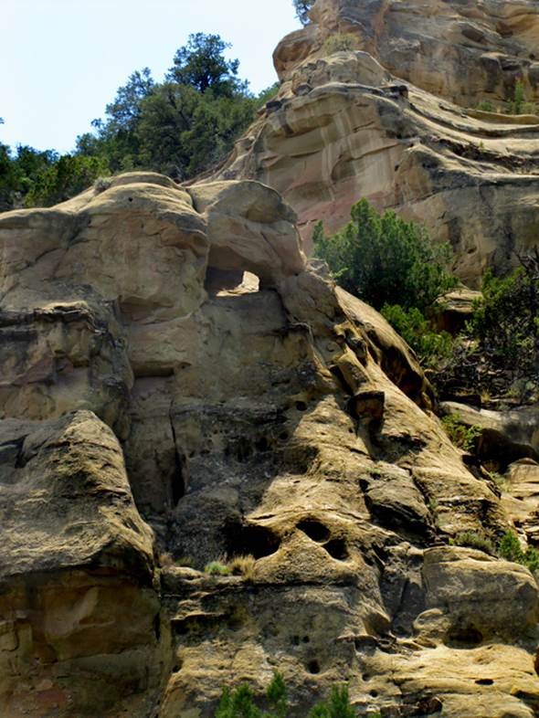
...AND some high,
over-hanging canyon walls...
...And... lush vegetation...
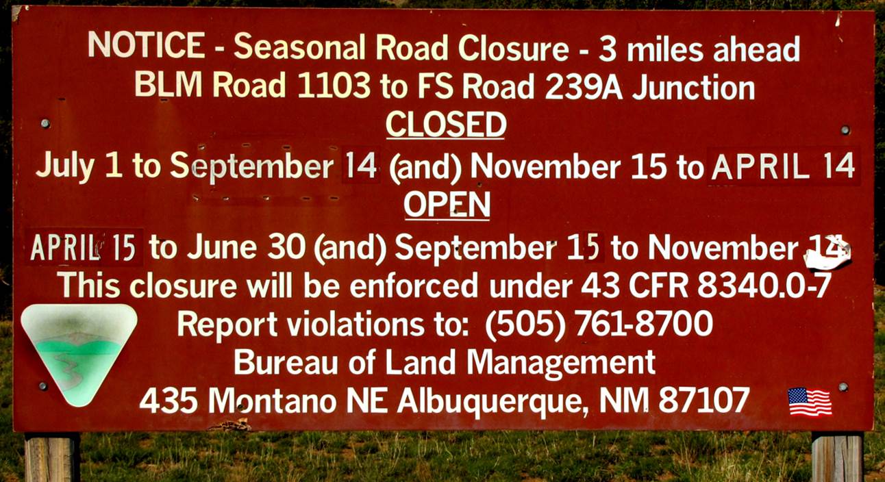
However BLM Road 1103
accessing the Cibola National Forest from above is closed more than it is
open...see the sign below:
A
20’ high clear spring-flow weeping-wall- waterfall in lower Salado Canyon about
2 miles upstream from HWY 279
beta facts:
name- Cañon Salado
elevation- 7000’at the top down to 6000’at the bottom
GPS coordinates- ±35°30.370’N 107°15.679’W at the top and ±35°30.651’N 107°09.683’W at the lower end
season to visit- drier months of the year, like
April, May, June, September, October and November… NEVER ENTER ANY SLOT CANYON WHEN
HEAVY RAIN IS IN THE FORCAST…!!!
accommodations- NONE
ownership- is checkerboard – Cibola National Forest
and BLM being predominate however, private and native lands are present, so
travel carefully…
access- is from below on Hwy 279 … see the map
below
nearest town- none
fun fact- Upper Salado Canyon within the
Cibola National Forest is a “hidden treasure” ...but the road to access it from
above is not open very much of the time.
essay bro
The lower box canyon, a couple miles above
Hwy 279, has two spring fed waterfalls... and the upper box canyons within
Cibola National Forest have timber stands of pine and fir... with one
short-but-sweet section of slot canyon.
The choice of road in is difficult and locked gates are
prohibitive. Upper Salado Canyon is best
accessed from the Cibola National Forest above –via BLM Road 1103.
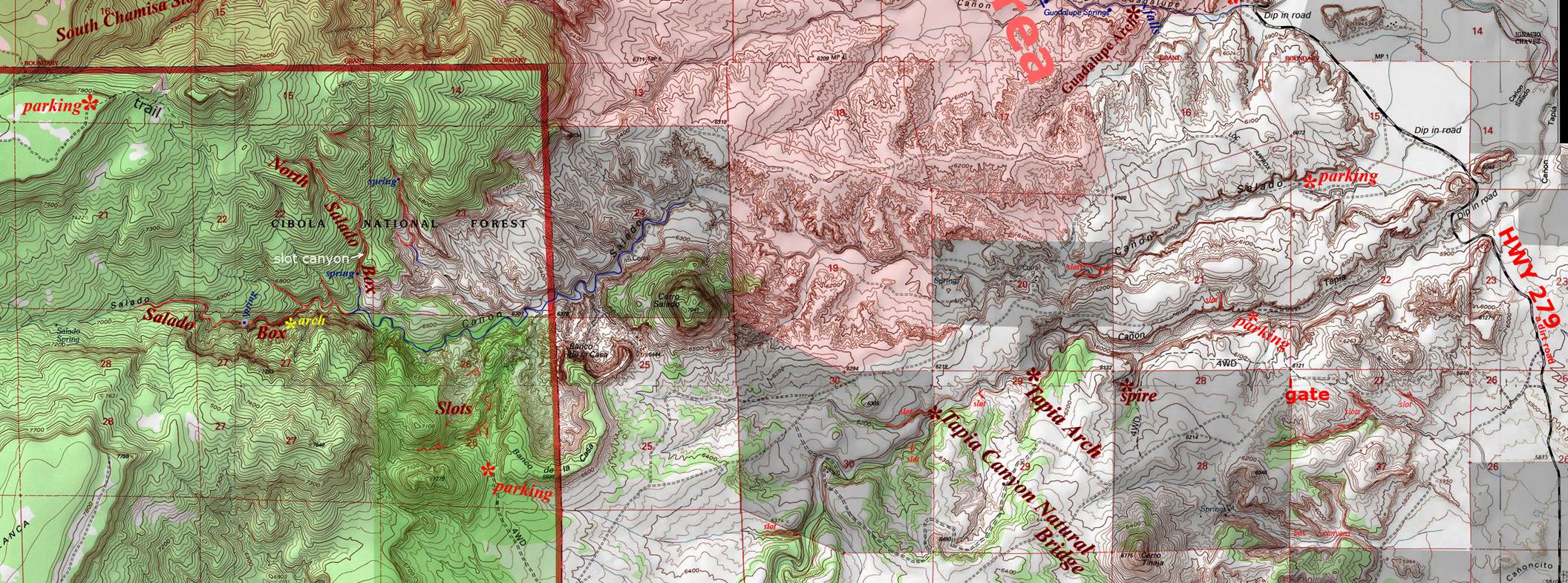
Cañon Salado appears horizontal across the
middle of the map below. Please feel
free to right-click-save-as our map image, to have your own hard copy.
Enhanced USGS topo map
Red Lines depict “slot canyons” and/or
“box canyons” - Shaded green is Cibola National Forest - Shaded grey is private land - The
rest is BLM ...including
the pink “wilderness study area”
Back to New Mexico
Slot Canyons
Send questions and comments to dscott@themarblesculptor.com