Little Gallegos Canyon
ACA Canyon
Rating – 3A II
Experienced Canyoneers
Only
requires a
full range of technical canyoneering equipment as well as multiple ropes…!!!
NEVER ENTER ANY SLOT
CANYON WHEN HEAVY RAIN IS IN THE FORECAST…!!!
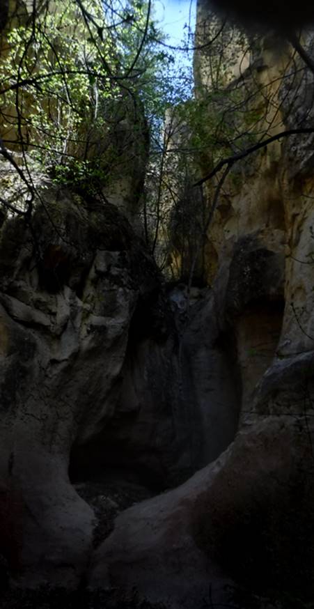
…first rappel – 20’…
Top of the first rappel… plenty of tree anchors thru-out the canyon
…below a monkey style tree climb (down)
worked in leu of a short rappel…
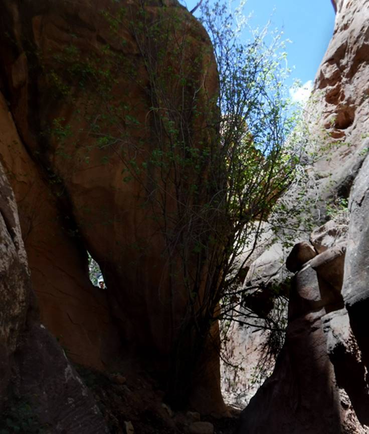
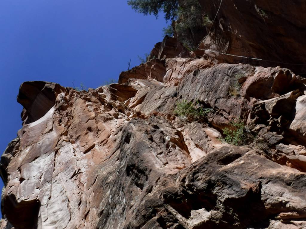
Man peeks thru window at “Little Gallegos
Arch”
the final 120’ rappel, see rope in the
photo upper-right
beta facts:
name- Little Gallegos Canyon Slot
rappel rope
used- 2 - 120’ rappel ropes & used natural
anchors only (small Rocky Mountain Maple) trees.
length of slot canyon- maybe a quarter mile
elevation- 7250’at the top down to about
6750’at the bottom
GPS coordinates- ±36°21.999’N 106°43.564’W
flow- intermittent
season to visit- most anytime except winter
may have ice & NEVER ENTER ANY SLOT CANYON WHEN HEAVY RAIN IS IN THE FORECAST…!!!
accommodations- none
ownership- Santa Fe National Forest
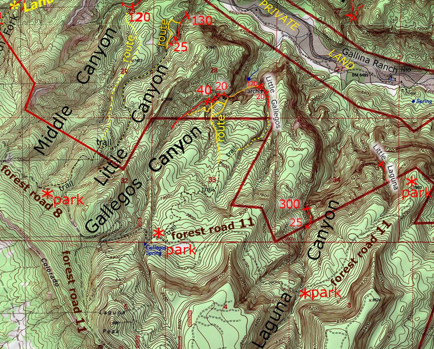
access- is from Santa Fe National Forest Road 11 … see the map
below
nearest town- Gallina
is about 18 miles south of here
fun fact- …another AWESOME Chama Canyon Wilderness
slot canyon…! ! !
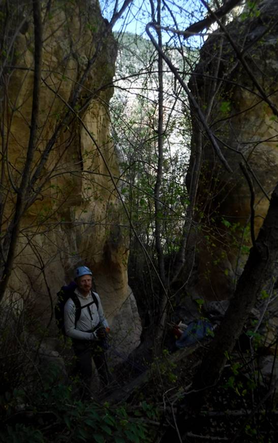
essay bro
We parked on
Forest Road 11 near Gallegos Spring, hiking first the trail then down Little
Gallegos Canyon and descended Little Gallegos Slot Canyon. See map below- Then we traversed southwest to
Gallegos Canyon, keeping our elevation as good as possible. See the yellow line on our map below. We enjoyed the “special feature” and
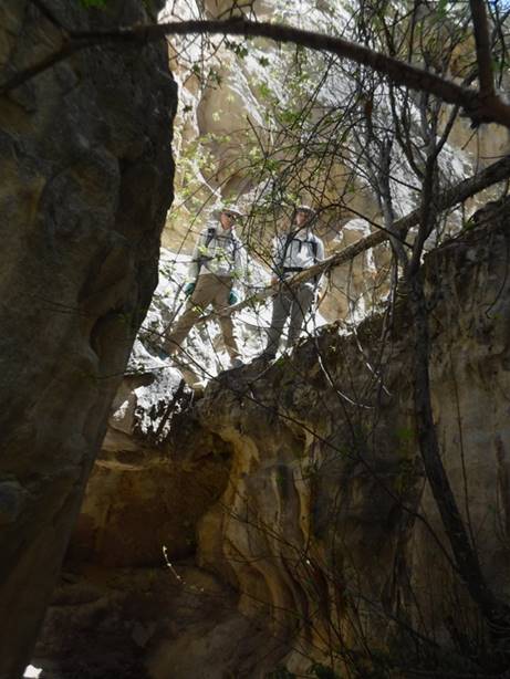
proceeded to do several up-climbs ascending Gallegos Slot Canyon… to the base
of the 40-foot rappel. From there we
exited the slot, scrambling all-fours up that major side-canyon (marked with a
yellow line on our map) …returning back down into the slot above the 40’ rappel
and continuing up thru the upper Gallegos Slot… and back to our wheels. But you do it however you like…!!!!
So we “descended”
Little Gallegos Slot Canyon and “ascended” Gallegos Slot Canyon.
We “ghosted” our
descent of Little Gallegos Canyon. We
used no webbing. We did a simple wrap
around the base of small Rocky Mountain Maple Trees, pulling our rope after
each rappel. This leaves no evidence of
us ever having been there. Those who
follow us may think they are the first to ever be there…!!!
Click this link to see a
larger map of this entire area: http://www.dougscottart.com/hobbies/SlotCanyons/Gallina.htm
Right-click-save-as
on our map below, to print your own “hand-held” copy for your hike
Enhanced USGS topo map
The Red Lines depict
sections of “slot canyons”
Back to New Mexico
Slot Canyons
Send questions and comments to dscott@themarblesculptor.com