Big Canyon
See on youtube: https://www.youtube.com/watch?v=9mbusCgnY2U
ACA Canyon
Rating – 3A III
NEVER ENTER ANY
SLOT CANYON WHEN HEAVY RAIN IS IN THE FORECAST…!!!
Big Canyon in the Chama Canyon Wilderness…
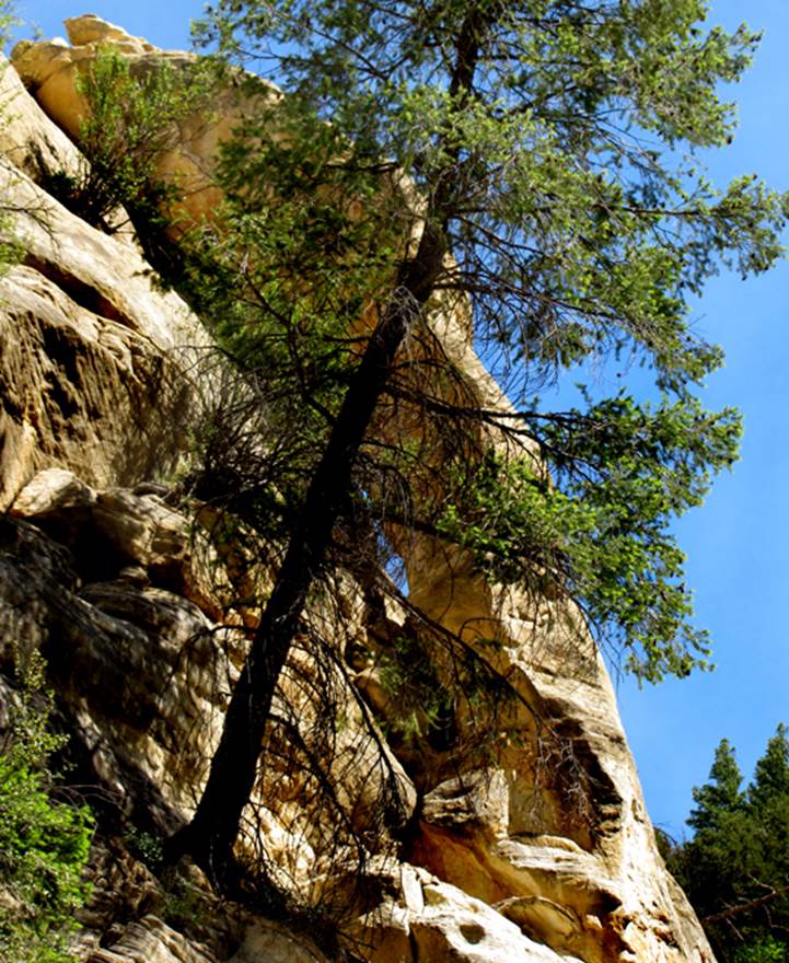
is a wonderful slot canyon whose narrows become 300’ deep
Scroll down for more photos
See also:
https://getoutsideabq.blogspot.com/2018/08/feeling-little-in-big-canyon.html
beta facts:
name- Big Canyon
depth- Big Canyon is 1500 feet deep with slot
portions of 300 feet in depth
elevation- 7800’ down to 6650’
GPS coordinates- ±36°22.673’N 106°46.446’W down to ±36°23.406’N 106°44.700’W
flow- intermittent
season to visit- drier months of the year, like
May, June, September, October and November… NEVER ENTER ANY SLOT CANYON WHEN HEAVY RAIN IS IN
THE FORECAST…!!!
accommodations- NONE ...Chama Canyon Wilderness Area
ownership- Santa Fe National Forest
access- is from above on Forest Road 8
nearest town- Gallina is
about 12 miles south of here
fun fact- at this time Big Canyon’s 3+ miles
of “continuous slot” is among the longest slot canyons we know of in New Mexico
the map below shows a non-technical route that drops you into the
middle of the slot canyon section without ropes. This route is down Bear Trail and under the
Land Bridge... then on down South Fork Big Canyon into Big Canyon itself. From here you can visit the entire 2 mile
center portion of Big Canyon without ropes or climbing gear. Both the upper and the lower portions of Big
Canyon Slot, are a non-technical scramble inward from
either/both ends. However a traverse of
the entire slot canyon is a technical descent for experts only.
essay bro
Big Canyon is a
tributary to the Rio Gallina within the Chama Canyon
Wilderness. Big Canyon, with tributaries
of its own, has over three miles of continuous narrows. The narrow, slot canyon portions of Big
Canyon reaches depths of up to three hundred feet in the lower half
mile…!!! Please right-click-save-as our map below to make yourself a
hard copy of your own.
We drive in about 13 miles to Big Canyon on
Forest Road 8 from Gallina, NM. We turn off onto the tiny, unmarked Big
Canyon access road shown on the map below with a single dotted line, and park a
ways in. We hike north to... and then-
thru a narrow canyon of solid alabaster.
The alabaster layer in this area is one hundred feet thick…!!! The 45’ drop seen on the map below is
sandstone and a very steep down-climb is do-able on the south side of the
fall. One half mile below this is the
confluence of South Fork Big Canyon which hosts a “Land Bridge”. It is quite remarkable... ! ! ! see photos
below. In another quarter mile or so is
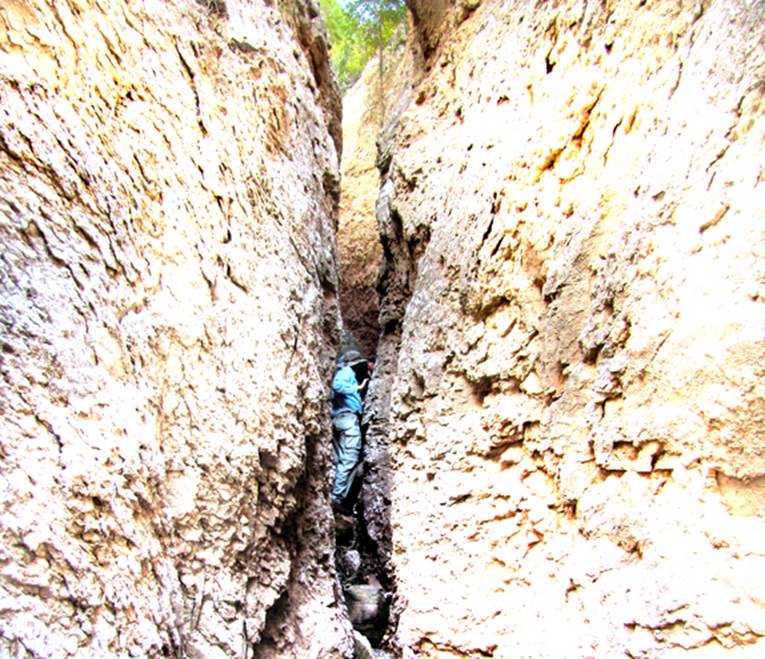
a side canyon we call “Tunnels” which has two forks. Both forks have extremely narrow slots,
requiring even a skinny guy like me to turn sideways...!!! see photos
below. Natural tunnels occur here.
Soon after this, there is a 12’ drop,
requiring a short rope, which we use tying knots for hand and foot holds. Farther
along we encounter an under-cut 30’ drop requiring a free hanging rappel (see
first photo below). There are no rope-less climb-arounds at either of these drops....
and between these two drops is a difficult-to-find ... jug-handle type natural
arch -see photos.
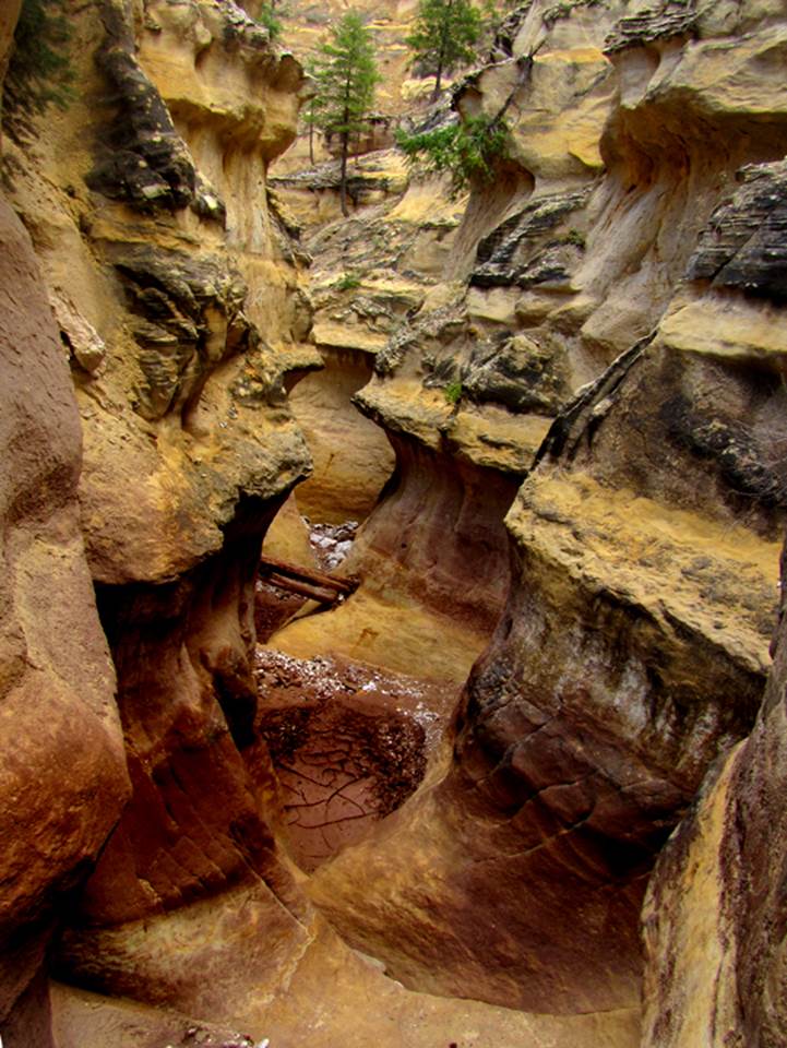
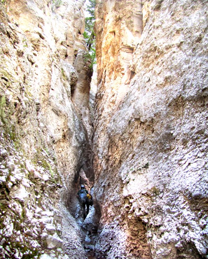
The half-mile of canyon below this 30 foot
rappel, is the crux of Big Canyon…the “sweet” corridor… (see
top photo above). Midway in this section
is a 12’ high drop that can be climbed around without a rope. Downstream a short ways is Cheerio Arch. It is just below eye-level on your
right. Upon reaching the mouth of Big
Canyon, beautiful and grand Gallina Canyon will greet
you. It is a 1500’ deep canyon with a
broad bottom. Notice on our map below,
that there is a route leading back to your vehicle, up on the top of the ridge
just north of Big Canyon. It is marked
with a yellow dotted line. This route is
do-able and has been done, but it is a long grueling trek. We much prefer leaving ropes and/or rope
ladders at the 2 or 3 places they are needed and we re-trace our steps right
back up the bottom of Big Canyon Slot...... all the way back to our wheels.
There is only about a mile and a half of
public forest land to enjoy here on the canyon bottom. 60% of the canyon bottom is private land owned
by Gallina Canyon Ranch…both upstream and downstream.
Gallina Canyon Ranch
…is
Amazing…!!!
Click this
link: http://gallinacanyonranch.com/
Forest Road 474, Abiquiu,
NM 87510
(505) 490-3333
Gallina Canyon Ranch a great way to visit and
enjoy these amazing “slot canyons” of the Chama Canyon Wilderness. Several amazing slot canyons are easy to
visit with normal hiking from here. In
fact, vacationing at Gallina Canyon Ranch will put
you in the heart of slot canyon country...!!! ...AND- you will be in a
great position to visit some of the best parts of some of the best slot canyons
in New Mexico, without technical rock climbing and repelling equipment or even
having much canyoneering experience. Gallina Canyon Ranch is truly
amazing and is the only easy hiking access to this western portion of the Chama
Canyon Wilderness.
Please scroll down to enjoy
the photos below our map:
Click this link to
access a detailed topo map that shows this entire area: http://www.dougscottart.com/hobbies/SlotCanyons/Gallina.htm
Enhanced USGS topo map by Doug Scott
The Red Lines depict
sections of “slot canyons”
The Yellow Lines show easier non-technical routes around the highly technical drops
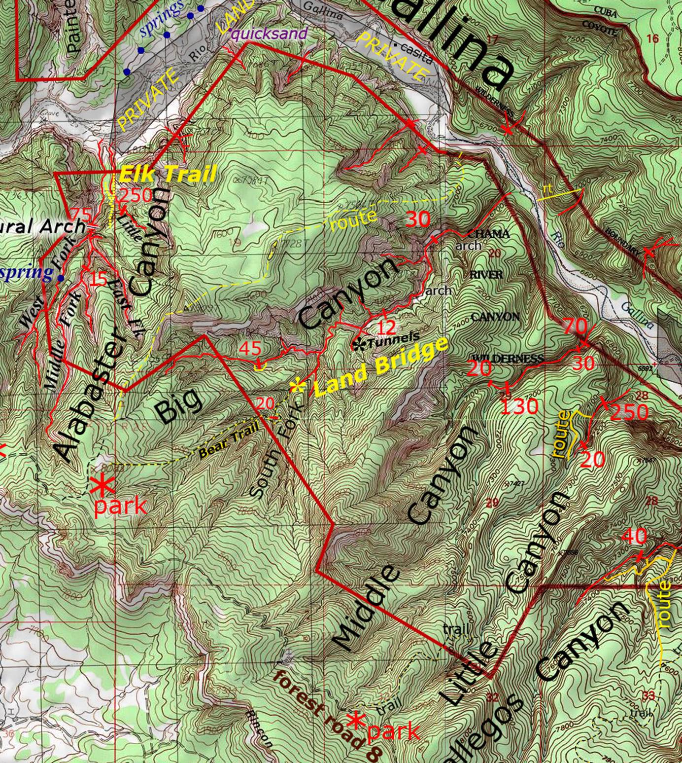
________________one mile____________
Click this link to
access a detailed topo map that shows this entire area: http://www.dougscottart.com/hobbies/SlotCanyons/Gallina.htm
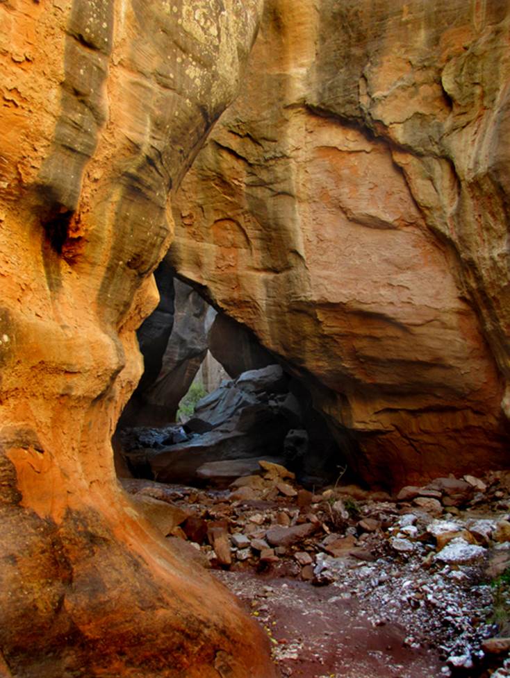
This photo shows a 30’ drop in the lower
portion of Big Canyon. It is here that
Big Canyon turns into an amazingly sculpted, very deep and narrow slot
canyon. This 30’ drop is greatly
undercut requiring a “free-hanging” repel.
There is a strong healthy ponderosa nearby to use as an anchor.
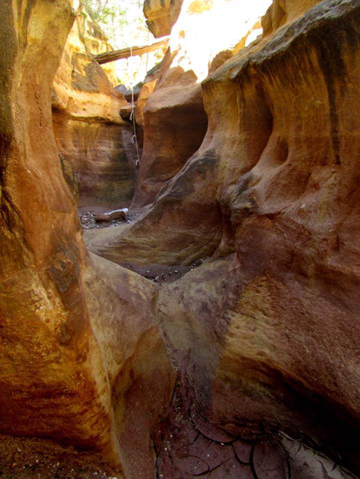
This photo shows the knotted rope we used to
descend a 12’ drop by hand
…a colorful sculpted stretch of Big Canyon
Slot immediately below the 12’ drop
Cheerio Arch is in the lower section of Big
Canyon
The Chalkstone is wedged into place 25’
overhead in the lower reaches of Big Canyon
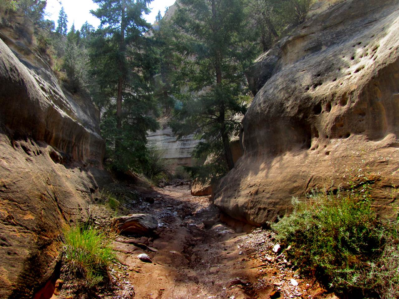
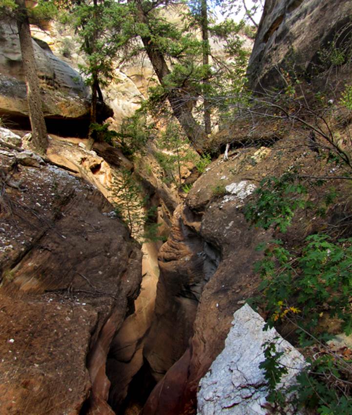
…a more open area… wheeet-wheew… a half mile or more above the 30’ drop.
This small jug-handle arch is between the 10’
and the 30’ drops... Randy found it so I call it Randy’s Arch
A mandatory sideways squeeze allows passage
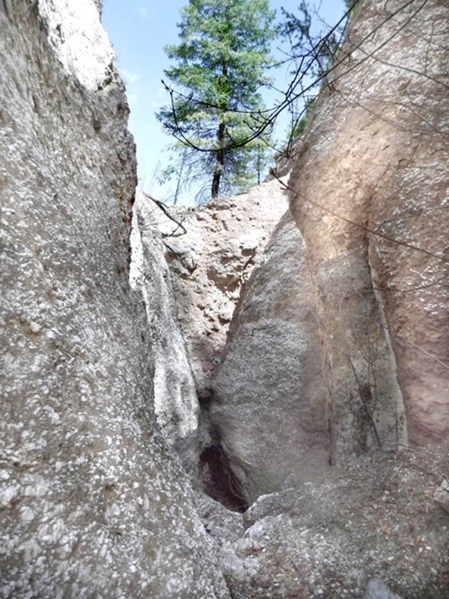
thru a tributary called “Tunnels”...see map above
Both of these narrow slots in the Tunnels
area are solid and amazing alabaster
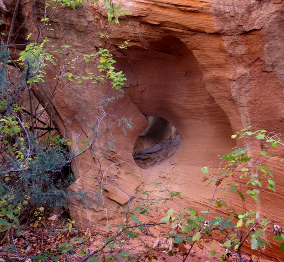
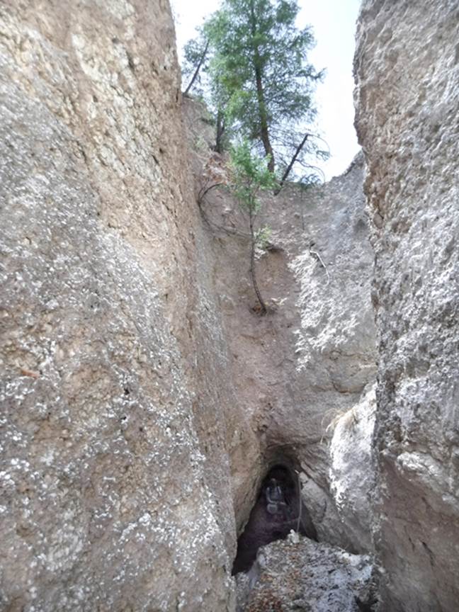
This area is called “Tunnels” because of
natural tunnels created by slumping, massive alabaster blocks. It is a wonder that a passage with head-room
remains open here
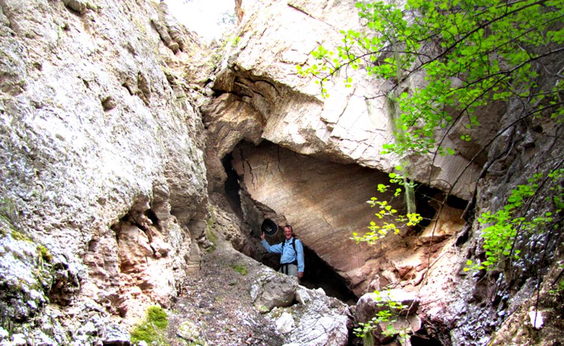
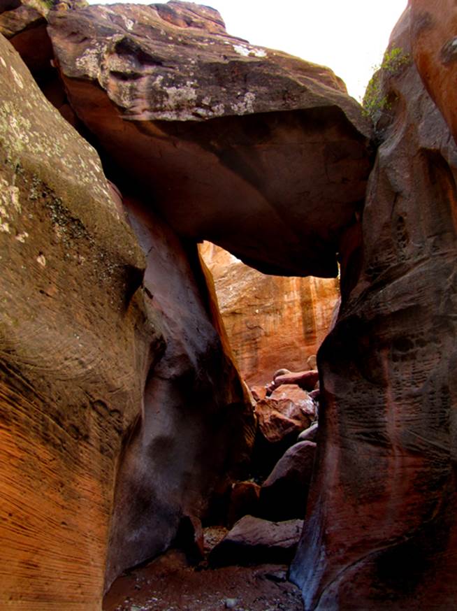
Below
is the Big Canyon “Land Bridge.” -See the map above- It is found up the South Fork of Big
Canyon. I walk thru this archway, up-right
without bumping my head and the ceiling has no cracks in it. There are several other tunnels in this
canyon and others nearby. They are ALL
made by slumping side-walls. This one is
not caused by slumping rock. It is solid
enough to support a full grown Ponderosa Pine and otherplant
life. It is quite stable and it appears
to us that it will be around for longer than any of us likely will...! ! !
My
son can be seen sitting at the other end of the tunnel above
Back to New Mexico
Slot Canyons
Send questions and comments to dscott@themarblesculptor.com