East
Fork Jemez Box Falls
See on youtube: https://www.youtube.com/watch?v=_82URHLAHiw&list=UUCJsfIZ3DXVpmoXu2d487VQ
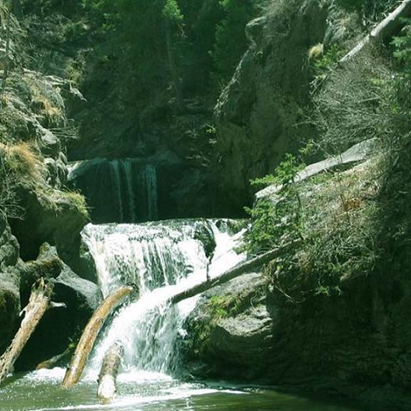
In two drops East
Fork Jemez Box Falls descends about 20 feet
beta facts:
name- East Fork Jemez Box Falls
height- 20’ in two drops
elevation- 8000’
GPS coordinates- ±35°49.555’N 106°34.189’W
flow- strong trout stream
season- spring, summer and fall
accommodations- near by forest campgrounds
ownership- Santa Fe National Forest
access- almost 2 miles of hiking
nearest town- - Jemez Springs is 16 miles
southwest of here
fun fact- There are more falls upstream…
deep into the sheer-wall East Fork Jemez Box Canyon…dangerous swim-hike?
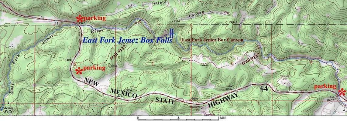
essay bro:
These waterfalls can be accessed from three
directions. Please feel free to make a
copy of my map below and use it.
I prefer to hike the Los
Conchos Trail …from the top, hiking downstream…notice he red parking at the far
right side of the map below. When the
Los Conchos Trail climbs up out of the canyon…just continue on downstream
without any trail, but you will get your feet wet. This is wonderful canyoneering…!!!!
Plan a full day for this
amazing hike.
Also, you might want to
check your Santa Fe National Forest map as well.
Parking on the downstream
end of this hike has changed since this map below was made…you must park a
quarter-mile farther east than the map says.
Park up the hill at the Jemez Falls Sign. There were so many auto
accidents down at the old river parking area, that it has been closed.
(see also Jemez Falls
and Battleship
Falls)
Enhanced USGS 7.5’ topo map
Send questions and
comments to dscott@TheMarbleSculptor.com