Cañada del Agua Falls (spanish
– Big Canyon of Water)
A recent visitor here tells me
that the top portion off this waterfall has crumbled and caved in some... and,
it has lost a lot of it’s
beauty.
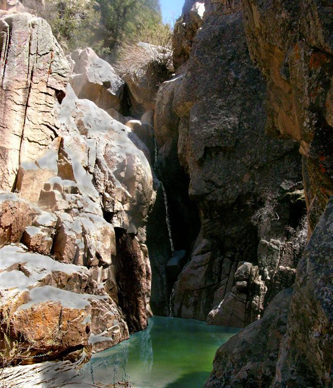
The highest of many
waterfalls in Cañada del Agua….
“Canyon of the water”
beta facts:
name- Cañada del Agua
Falls… in English this means “The Canyon of Water”
height- the highest of the many waterfalls in this
canyon is about 30’ high
elevation- 6850’
GPS coordinates- ±36°10.396’N 105°47.947’W
flow- perennial spring
season- spring, summer and fall
accommodations- none… except a nice little parking lot
that BLM made just for you at Ojo Sarco
Falls.
ownership- public - BLM
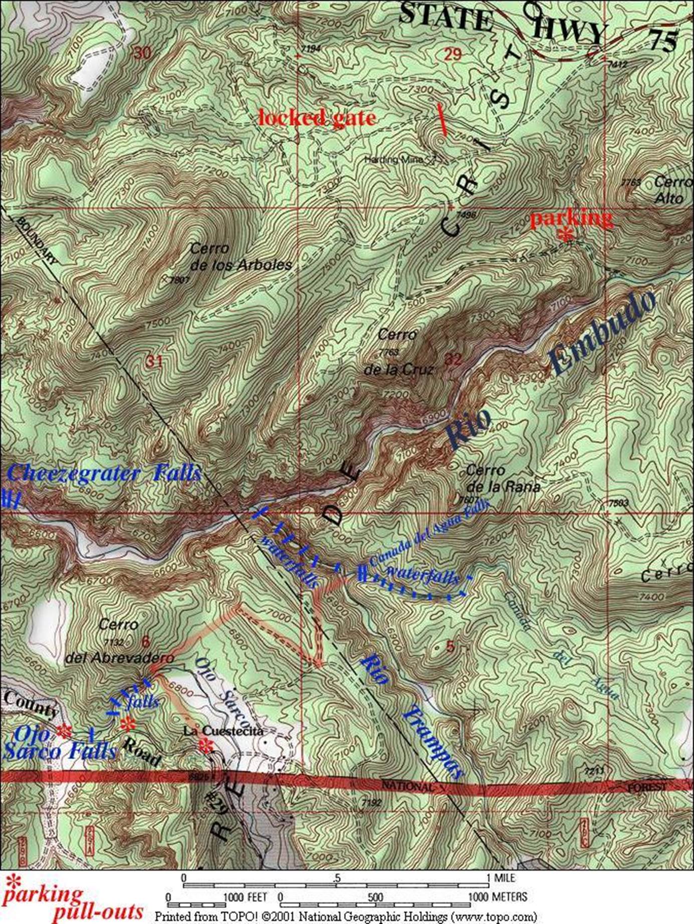
access- 2 miles of difficult hiking with no trail
nearest town- Dixon is 4½ miles west of here
fun fact- this is VERY RUFF backcountry…!!!
essay bro:
It is a must for you to have very good topo
map reading abilities to find your way into this place. I highlighted the route I used in “light red”
on the map below. This is wild country….
You can almost feel a mountain lion nearby.
(See
also Ojo Sarco Falls & Trampas Falls )
Enhanced USGS 7.5’ topo map
Send questions and comments to doug.vivian@yahoo.com