Puerco
Falls
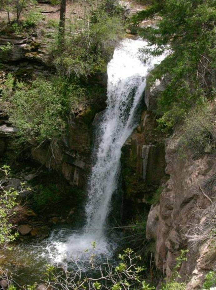
Puerco Falls plunges 50 feet
over a limestone precipice
beta facts:
name- Puerco Falls
height- 50’
elevation- 7500’
GPS coordinates- ±36°06.100’N 106°41.220’W
flow- strong flowing trout stream – 30 to
250 cfs
season- summer and fall
accommodations- forest service campgrounds
are nearby
ownership- public – Santa Fe National
Forest
access- 2½ mile hike without a trail after
9½ miles of gravel road
nearest town- Coyote is 12 miles NE of here
fun fact- puerco means pig or muddy…. But
this water is crystal clear.
essay bro:
The upper Rio Puerco drainage on the east
slopes of San Pedro Peaks has more than it’s fair share of waterfalls. Ten of them are 20 feet high or
more. Three of those are on the
Rio Puerco itself and five are on it’s tributaries. Their descriptions and photos are on this same site. See #18 Echo Falls and #19 Lichen
Falls.
Puerco Falls, just like most of Rio
Puerco’s other waterfalls, has no trail and is very hard to bushwhack in
to. We use Rio Puerco Campgrounds
as a parking place. Puerco Falls
is two and a half miles downstream.
It is best to cross the creek in the first 200 yards, as the hiking is easier
on the north side. The first mile
is an effortless stroll thru storybook land… long open, streamside meadows
sprinkled with wildflowers. The
last mile and a half is ruthless tangles of sticker vine. It helps to stay way above the creek or
just wade down the river.
(see also Echo,
Lichen, Vivian and Resumiderso Falls)
Enhanced
National Geographic 7.5’ topo map
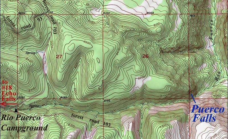
the
thin red section lines above represent one mile
Send questions and comments to doug.vivian@yahoo.com