Cascade
Creek Falls
Is a 260’-high tiered
waterfall that cannot be seen in its entirety from any one single
viewpoint. These following three
photos show some of the tiers of this beautiful high waterfall. There are also other high waterfalls on
Cascade Creek.
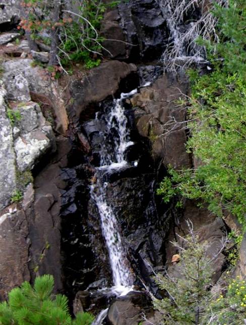
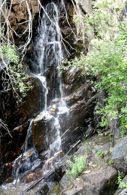
Cascade Creek
Falls upper portion falls about 80’ less steep in multiple tiers about 15 to 20
feet high each...
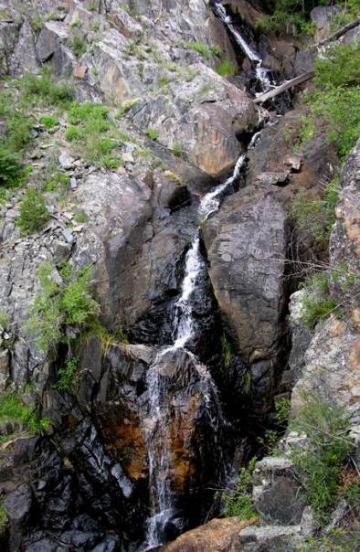
This main portion of Cascade Creek Falls is about 120’ high.
The granite walls here are so steep that this was the best shot I could get of this 60’ high lower portion.
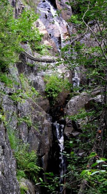
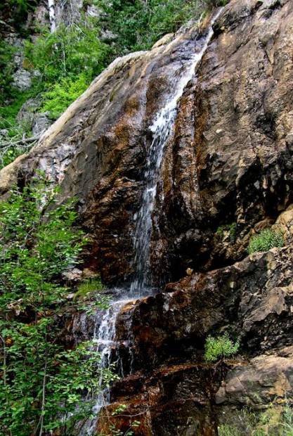
These next two photo could well be called additional tiers to Cascade Creek Falls making it well over 300 feet high.
However I feel that 200 yards of distance between these falls is too much to call it all-one-waterfall.
Therefore I will call these “Middle” and “Upper” Cascade Creek Falls.
Middle Cascade Creek Falls is a beauty... 40 feet high...!!!
20’ high Upper Cascade Creek Falls is another 100 yards or so upstream.
beta facts:
name- Cascade Creek Falls
height- 250’
elevation- 9000’
GPS coordinates- ±35°44.765’N 105°27.846’W
flow- this is a spring fed creek
season- May thru Oct
accommodations- forest service campground
is at the trailhead.
ownership- Santa Fe National Forest – Pecos
Wilderness
access- 4½-mile hike from El Porvenir
Campground… one of New Mexico’s best….!!!!!!
…if you have a way to access the El Cielo
Mountain / Harvey Ranch road, then you can almost drive to this falls.
nearest town- Las Vegas, NM is about 20
miles southeast of here.
fun fact- this is a beautiful, beautiful
place….!!!!!!!
essay bro:
El Porvenir Trail is a wonderful, easy
trail. However once you turn west
up Cascade Creek you will be dealing with steep bushwhacking. Allow most of a day for this trip. We hiked this in mid-May of 2008
and encountered no snow on the trail. There seems to always be a downed tree to
provide a “dry” crossing, near each one of the many “wet” creek crossings that
the trail makes. Our shoes and
pants stayed dry the whole time.
Someone please hike Hermit Creek down into
Porvenir Canyon from Hermit Peak so you can tell me if a nice high waterfall is
there on that creek like I think it is... oh... and... ah... er... while your
at it... hike up Cielo Creek too, between El Cielo Mountain and Porvenir
Creek... I think there are some nice waterfalls there as well... and please
share your photos with me…!!!!
(see also El
Porvenir Falls)
Enhanced
National Geographic 7.5’ topo map
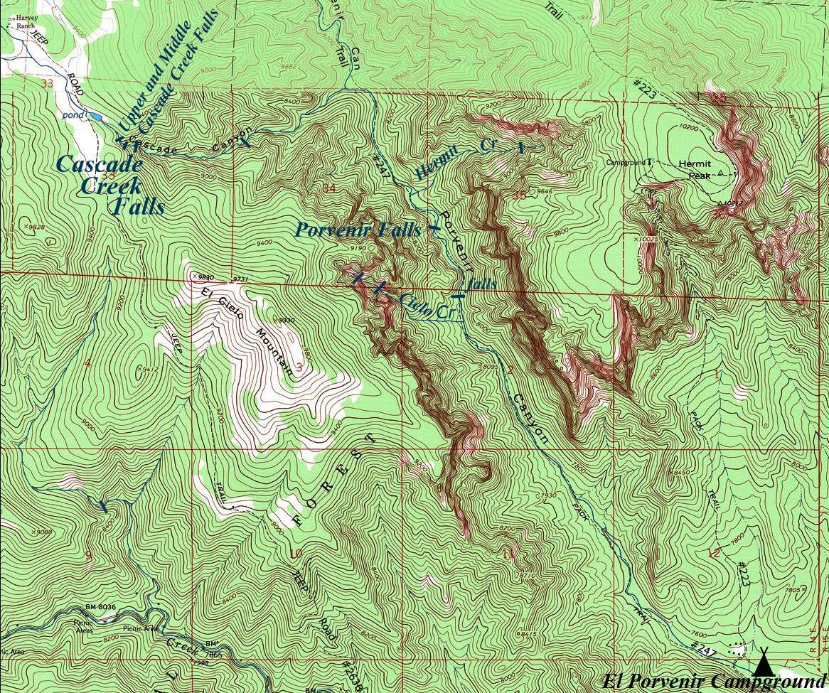
__________ONE_MILE_________
Send questions and comments to doug.vivian@yahoo.com