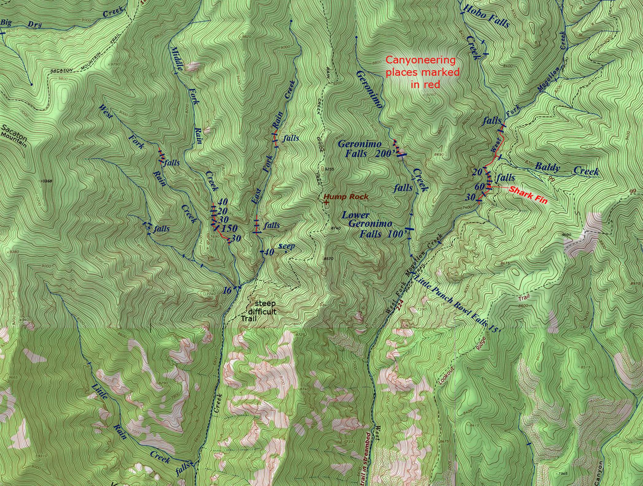
West Fork Rain Creek Falls
Mostly unexplored and undocumented
Rain Creek
is one of New Mexico’s best waterfall streams
Upper Rain Creek
likely has 30 or more waterfalls of 20’ high or more... with several
close to
100’ high ...and a few possibly near 200’ high...!!!
We have only visited and documented 1 of West Fork Rain Creek
waterfalls... the 16’ high beauty found at the mouth of West Fork. It appears in this photo below. (see map)
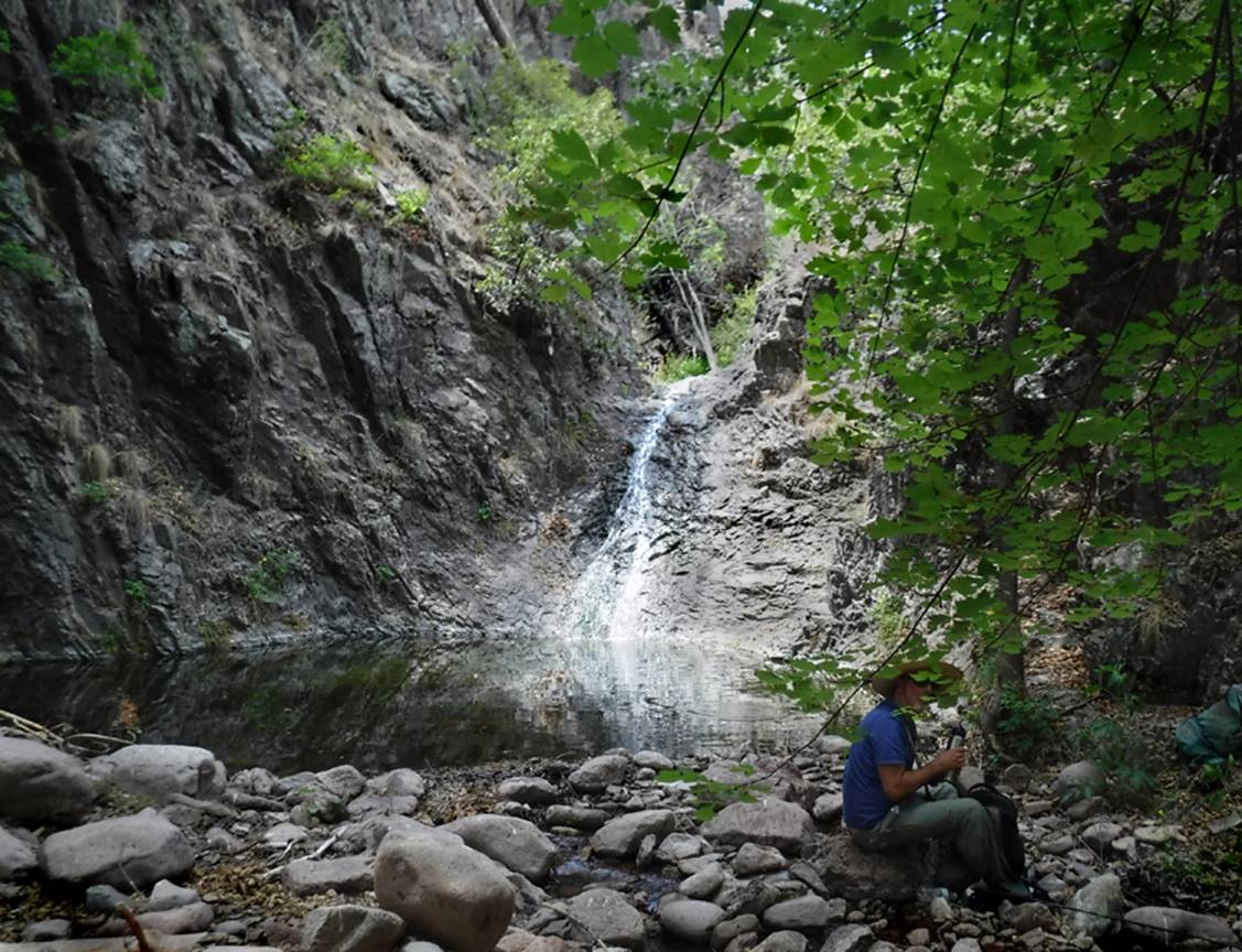
This photo was taken during extreme drought with very minimal
flow... early June of 2018. Some parts
of Rain Creek were bone dry...!
! ! -say Hi to Devon-
It will be difficult
climbing up and around this Lower West fork Rain Creek Falls... and it will be
even more difficult bushwhacking all the way up West Fork to visit the high
beautiful waterfalls there. Rain Creek’s
West Fork is extremely steep and brushy...! ! ! However, if you beat
us get up in here and if you measure, GPS, document and photograph these
wonderful waterfalls... Please be informed and know that you are required by
international WAR CRIMES LAW to share all of your findings, notes and photos
with us... within 5 working days... or else you will not be allowed to use our
website for a LONG TIME…!!!!
The Mogollon Range holds
the Gila Mountain’s highest elevations and gives birth to the largest upper
Gila River tributaries. Rain Creek is a
fine trout stream draining the south slopes of the Mogollon Range. Upper Rain Creek divides into three
forks. We refer to these three forks as
East Fork Rain Creek, Middle Fork Rain Creek and West Fork Rain Creek. Rain Creek is a fine perennial trout
stream. This south-flowing system is
easily accessible via Forest Road 147 at the Rain Creek Trailhead (see map
below). Government maps and our map show
that Rain Creek used to have a trail up it.
This trail was dropped from forest service maintenance years ago. Today it is totally void of any maintained
trails except for one trail-crossing.
Trail 189 descends from the Rain Creek Trailhead only to cross Rain
Creek while continuing on east and immediately climbing up and out of Rain
Creek Canyon.
Some of the old trails no
longer exist. Forest fires and the
massive floods that followed the burns... coupled with discontinued
maintenance, have allowed these old obsolete trails to desist. Faint remnants of these appear for short
stretches... then vanish with no warning.
HOWEVER...
the “Phantom” Gila Wilderness Trail Repairman has saved the trail leading up
from the Rain Creek Trailhead to the Forks of Rain Creek. This trail was originally called: Rain Creek
Divide Trail. He has been faithful. He is a blessing to
humanity…!!!
Click on this
link to learn more and to see his amazing maps: http://www.dougscottart.com/hobbies/waterfalls/WestFkMogo.htm
All of these photos are Google Earth Images
We have yet
to explore this area...!!!
Three parts of this
West Fork Rain Creek Waterfall are labeled A, B and C in the photo below.
GPS coordinates- ±33°15.717’N 108°40.071’W
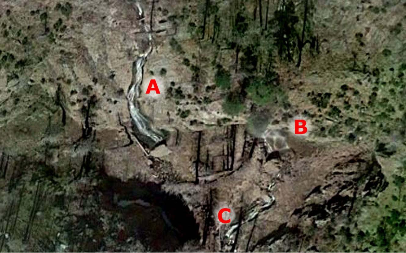
Comparing Google Earth Images with USGS
Topo maps we feel that the waterfalls you see in the photo above occurs at the confluence of
two streams... or two separate branches of the West Fork Rain Creek. This means that this waterfall is extra
special- It is a double waterfall...!!! 2
waterfalls right beside each other and parallel to each other…!!!
A. will likely be about 200 feet high or more
B. barely shows in this photo but that just
means that it is VERY SHEER. But I like
the fuzzy mist seen in the air, in this photo.
This falls should be about as high as A falls is and it will be parallel to A falls AND right beside it…!!!
C. is more of a cascade... maybe 60’ high...
This promises
to be an AMAZING WATERFALL...! ! !
This
waterfall appears over on the left-hand side of the map below. It is marked by only one small word: falls and is found a short distance southeast of Sacaton
Peak.
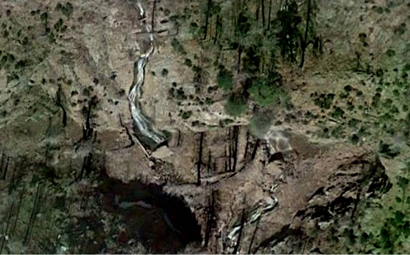
...and we thought
you may like to see this image without the lettering... WOW.....!!!!
This
waterfall is amazing and beautiful…!!!!
We cannot wait to visit it.....!!!
...you know... it is possible that even
Rex Johnson has NOT seen this one...
West
Fork Rain Creek has 3 tributaries. Below
is quite a waterfall filled gorge. This image appears smaller
because it is reduced in scale. The
high falls here may be 100’ high.
Perhaps this will all make more sense once we get there.
GPS coordinates- ±33°16.160’N 108°39.950’W at the downstream end – bottom of this photo

HAPPY EXPLORING...!!!
Right-click-save-as on our map below to
print yourself a hard copy for your hike...
Or click
this link to see a new updated & enlarged map: http://www.dougscottart.com/hobbies/waterfalls/WestFkMogo.htm
To see the Trailhead click on this enlarged map: http://www.dougscottart.com/hobbies/waterfalls/WestFkMogo.htm
Send questions and comments to dscott@themarblesculptor.com