South
Casa Falls or
South Fork Casa Falls
See on Youtube:
https://www.youtube.com/watch?v=6z16K00duGc&list=UUCJsfIZ3DXVpmoXu2d487VQ
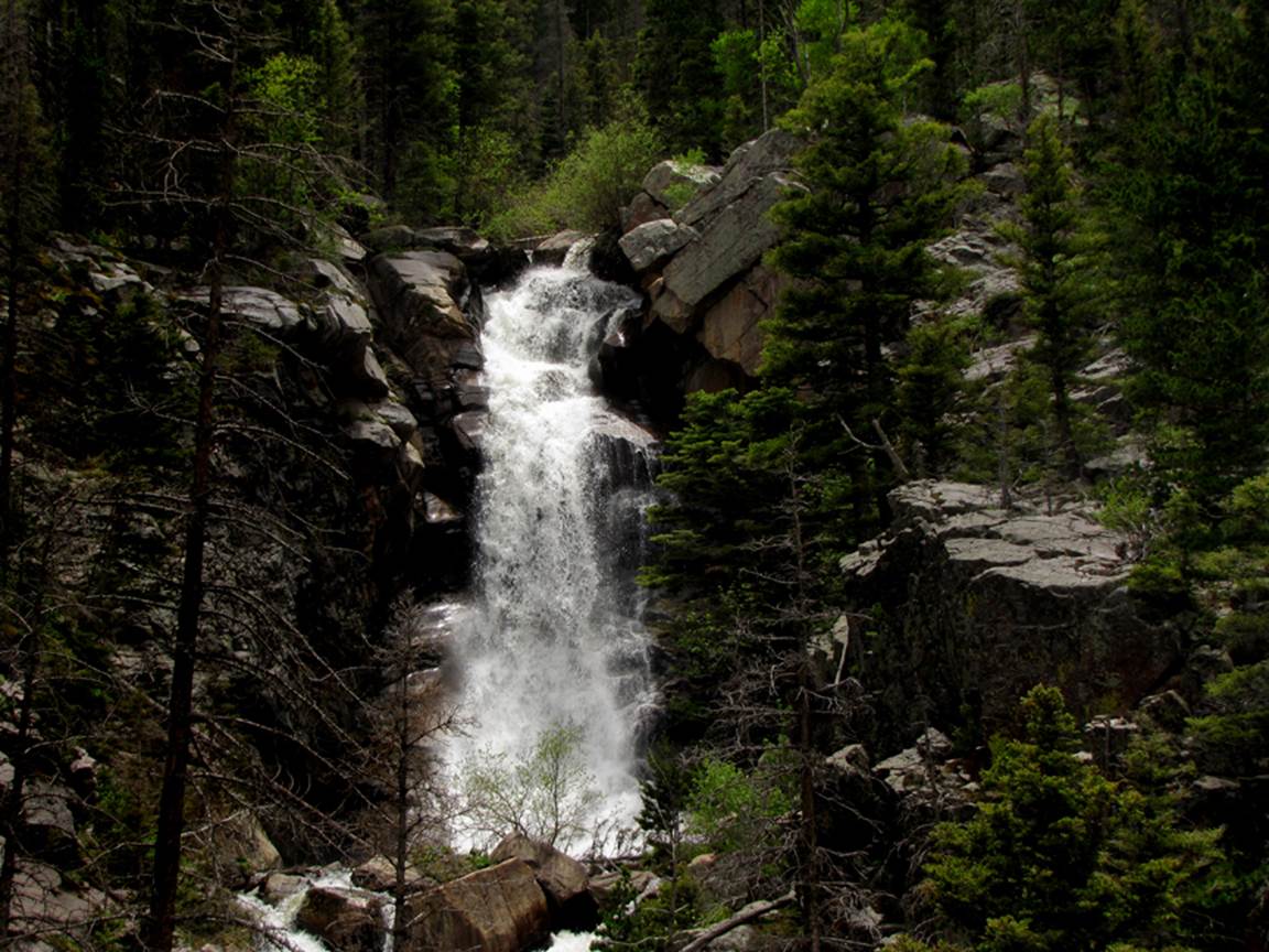
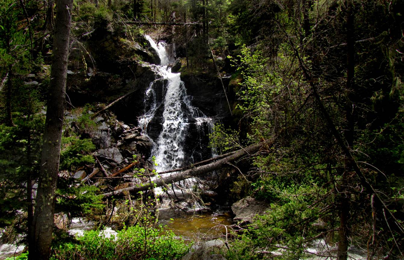
Wonderful… beautiful… 95’ high South Casa Falls
…and this is how gorgeous she is from the side view…
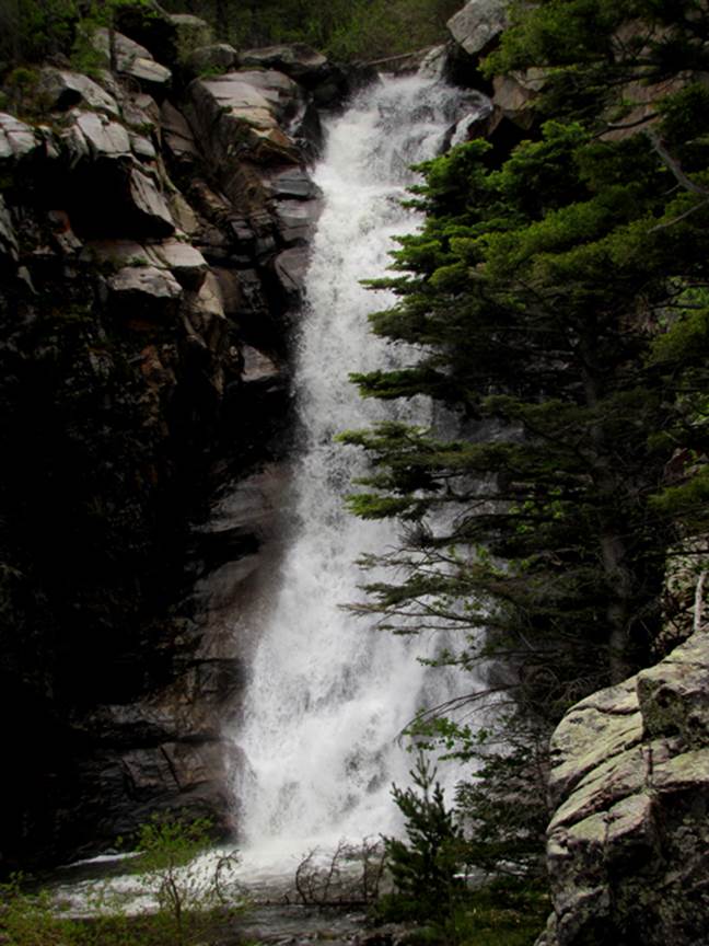
There is easily another hundred-plus feet elevation drop in
the cascades below her
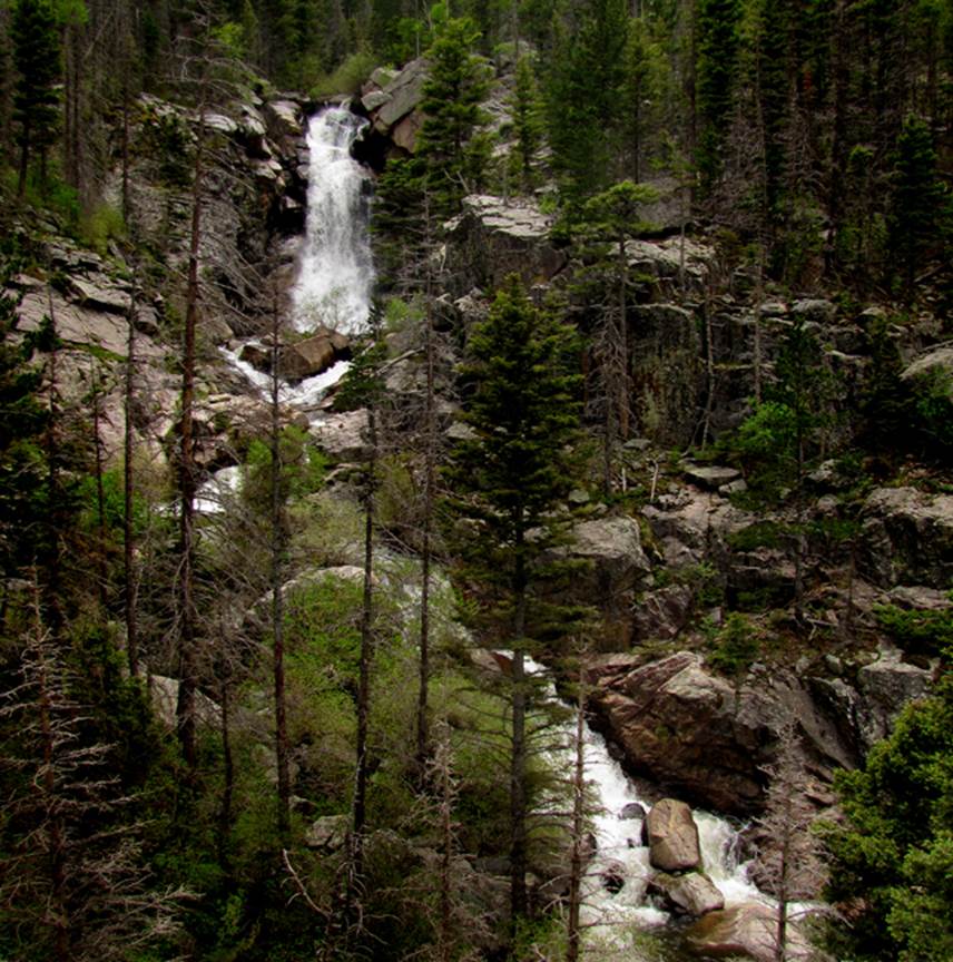
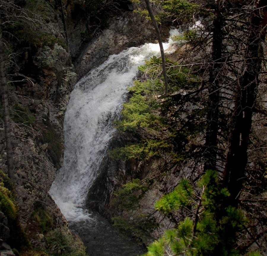
…and another half-mile above her, is her lovely sister… 60’
high Upper South Casa Falls
And… half way between these two waterfalls, is Hideaway Falls
Hideaway Creek Canyon is 45 feet higher South Fork Casa
Canyon, so here where these two canyons meet we have a sweet 45’ high
waterfall. I feel that this is the most
beautiful confluence of any two streams in New Mexico. South Fork Rio de la Casa (English for House
Creek) flows from right to left across the bottom of this photo… and Hideaway
Creek does a splash-landing into it, as it passes by…
Hideaway Falls has its own webpage. See: http://www.dougscottart.com/hobbies/waterfalls/Hideaway.htm
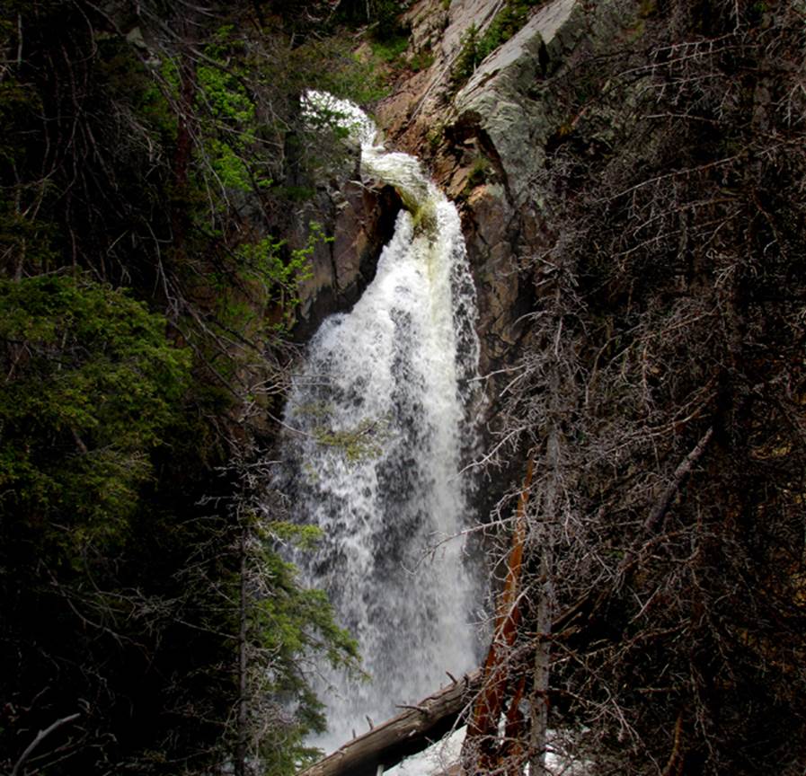
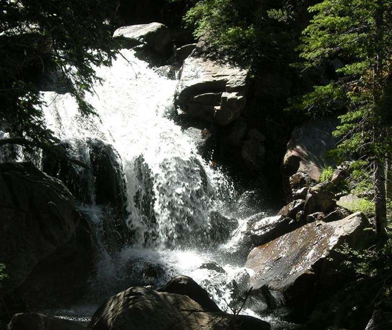
…immediately below Upper South Casa Falls is this 30 to 40
foot waterfall… it is a bit strenuous navigating up this steep rugged canyon
that has no trail…!!!
We lose count trying to keep track of all the 20 to 30 foot
high waterfalls
See a couple more South Casa Waterfalls
with an awesome rock formation… at the bottom of this page
beta facts:
name- South Casa Falls - AKA - South Fork Casa Falls
height- 95 feet high
elevation- 9500 feet
GPS coordinates- ±35°58.896’N 105°29.034’W
flow- a fine perennial trout stream
season- May thru Oct… earlier is the best flow,
but you may have snow
accommodations- none – Pecos Wilderness
ownership- public – Santa Fe National Forest
access- I’m still working this out, but as of now
it is a four mile arduous bushwhack in from near Walker Flats
nearest town- Mora is about 14 miles east of here
fun fact- Ah… er…
not very many road signs in this area… I’m told the locals use Forest Service
signs for firewood
There is a
very special Cutthroat Trout living in these waters
essay bro:
Four miles north of Mora on NM hwy 518 you will find the little town of Cleveland,
NM. Turn west here on county road B-028
for 5 miles and follow forest road # 113 to Walker Flats. This is where the going will get sketchy as
I’m told that the locals in this area use forest road signs for firewood… so, you will likely have to go by feel from here. But the good thing is that you are
close. Walker Flats is on this topo map
below and some difficult dirt/mud road lead southwest from there… ah… you must
have superb topo reading skills… Try
mixing a little luck with a little Español, also a
National Forest Map as well as a copy of my map below…AND… Google Maps…, to
find a place to park and begin your hike.
NO TRAIL HAS EVER ENTERED THIS CANYON.
It is the most wild canyon I have visited.
Or… you can hike the
WAY-LONG-WAY-AROUND… your hike into South Fork Casa Falls on Trail #269 will start at about 10400’ elevation if you have
a high clearance vehicle that can navigate the roughness of the primitive road
above Walker Flats. After you pass North
fork Lake and Middle Fork Lake and climb the ridge
beyond there... you’ll turn east without a trail and head down the canyon. Follow South Fork Casa
Creek to the falls.
Right
click-and-save to print yourself a copy of my map below. It is not complete
yet, as I am still investigating this Walker Flats access area. I will update more info soon…
Enhanced USGS topo map NORTH IS UP
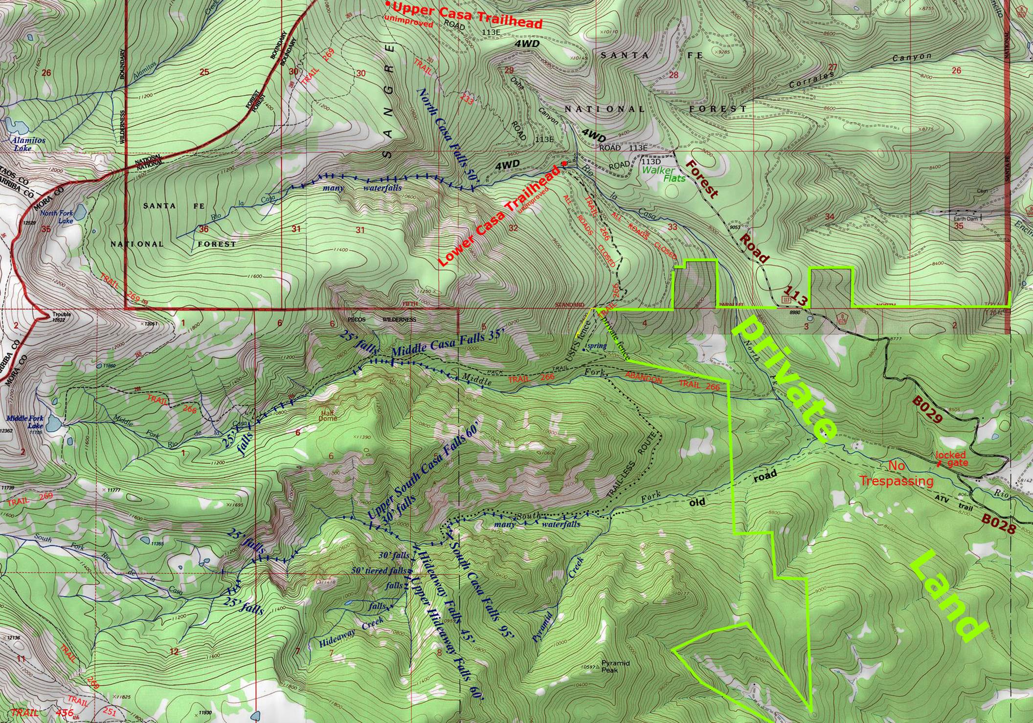
these waterfalls appear in the far upper portion
of South Fork Casa Creek...
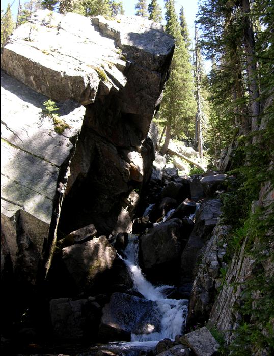
A 15’ falls runs
under this huge angular boulder near the upper end of the steep canyon.
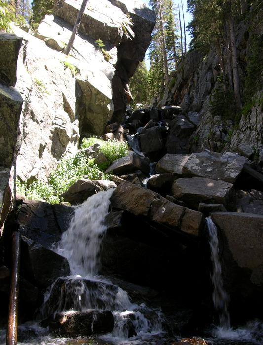
This 15-footer is just below the previous
one. The angular boulder above is
awesome!
Send questions and comments to dscott@themarblesculptor.com