Laguna Canyon Falls
The
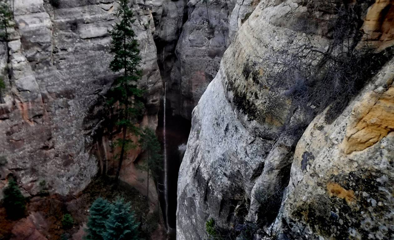
200 foot high lower tier of Laguna Canyon Falls is
shown in the photo below
...a closer look...
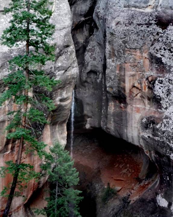
This un-named 20 foot
waterfall in the photo below, is the beginning of The Laguna Slot Canyon
There is a 100 foot high
upper tier of Laguna Falls between the two falls photographed above, which we
do not have a photo of…
beta facts:
name- Laguna Canyon Falls
height- 300 feet total – the upper tier is
100 feet high and the lower tier is 200 feet high
elevation- + 7300’
GPS coordinates- ±36°21.210’N 106°43.206’W
flow- only April and May and during
drought, it remains dry most of the time, except for thunderstorm induced
flashfloods
season- April and May
accommodations-
NONE –Chama Canyon Wilderness Area
ownership- Santa Fe
National Forest
access- is from
above on Forest Road #8 and/or #11… see the map below
nearest town- Gallina is about 12 miles south of here
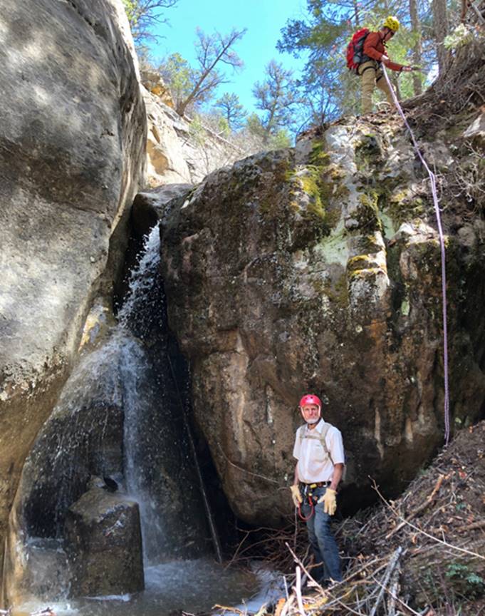
fun fact- These are amazing waterfalls that
are extremely difficult to visit
essay bro
These are amazing waterfalls that are
extremely difficult to visit. Laguna
Creek is shown by a red line on the map below.
Laguna Falls is shown by a short, thick hash mark on that red line… in the
center of our map.
Right-click-save-as
on our map below, to print your own “hand-held” copy for your hike
Click this link to see a larger map of this entire area: http://www.dougscottart.com/hobbies/SlotCanyons/Gallina.htm
Enhanced USGS topo map by Doug Scott
The thin Red Lines depict
sections of “slot canyons” or “box canyons” and the thicker Red Lines show the boundries of Chama River Canyon Wilderness Area
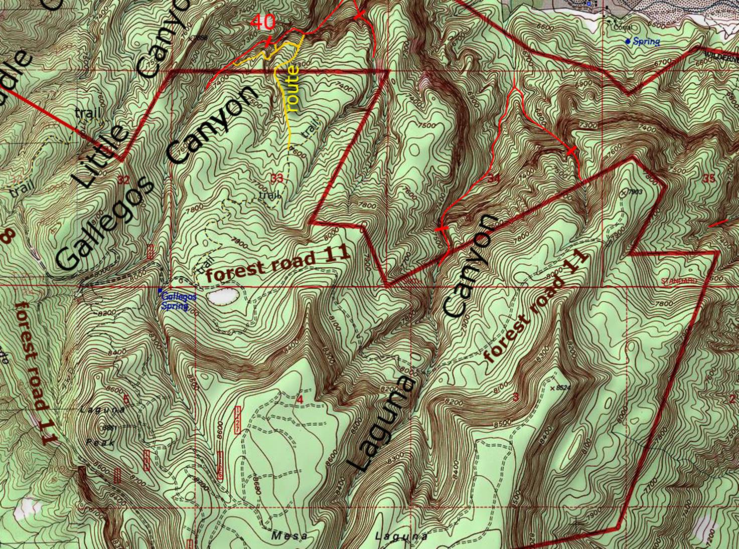
_____________one mile____________
Send questions and comments to dscott@themarblesculptor.com