Gallina Canyon see photos at bottom of page
ACA Canyon
Rating: 1B III
…is the mother canyon to 11
slot canyons shown there on the map below plus many unnamed small slots...!!!
NEVER ENTER ANY SLOT CANYON WHEN HEAVY RAIN IS
IN THE FORECAST
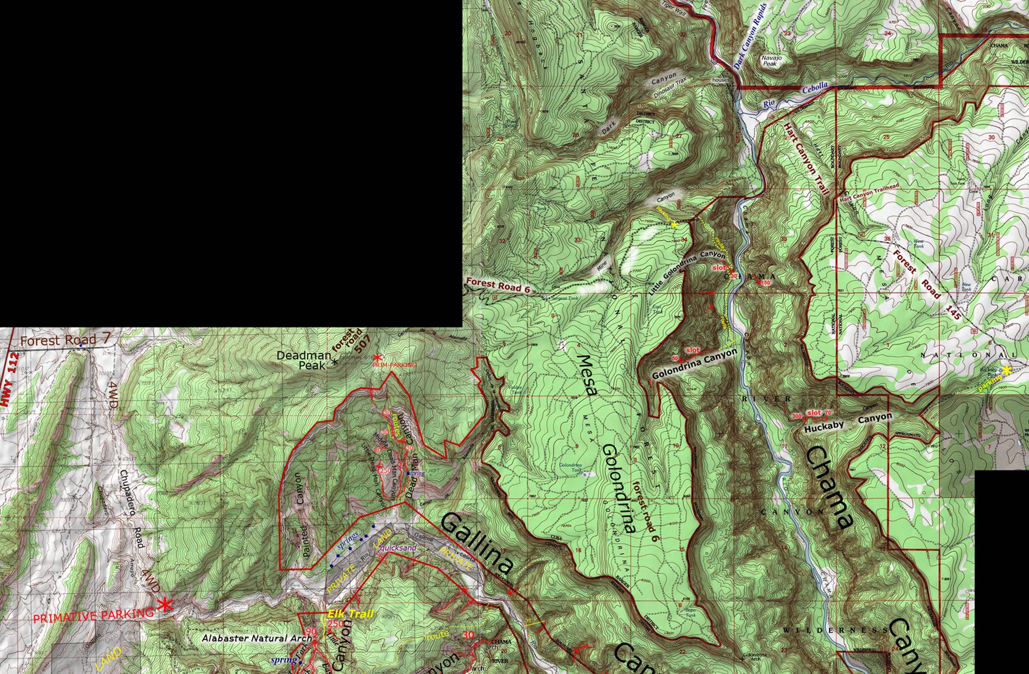
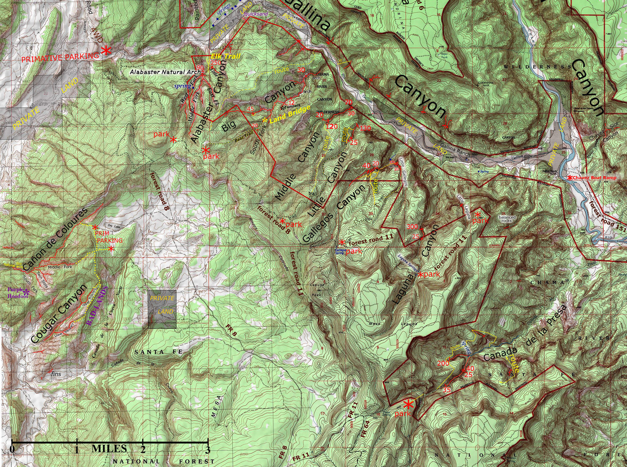
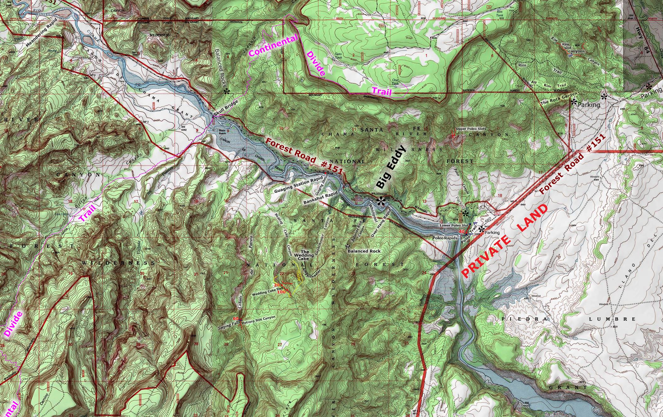
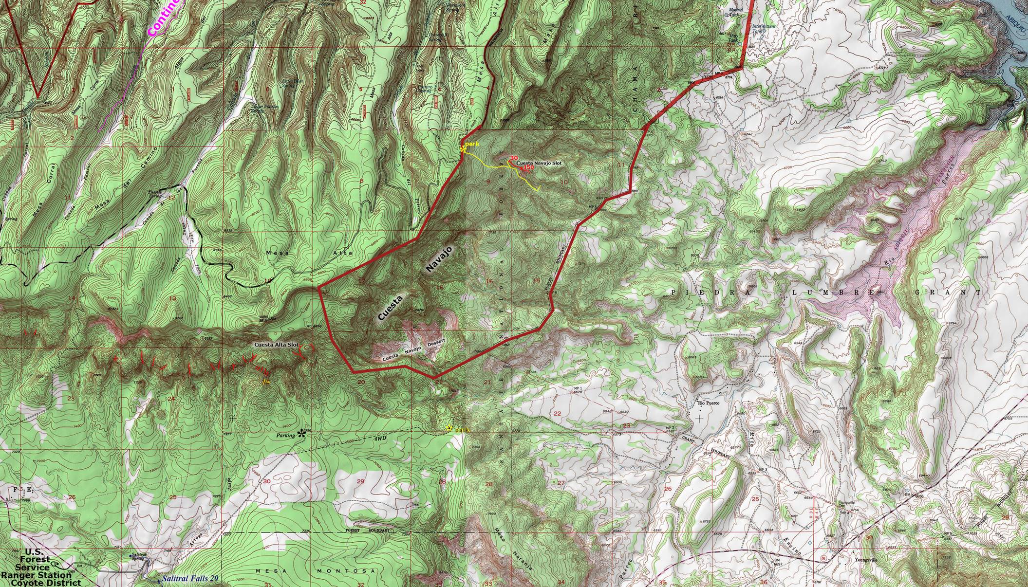
Enhanced USGS topo map by Doug Scott
The Red Lines depict
sections of slot canyons
We have divided this map
of Chama Canyon Wilderness Area into four maps: North, West, East and South -
trying to achieve a more clean & clear image on line. Please use this map in conjunction with our
smaller maps that appear on each canyons individual page. Gallina Canyon appears mostly on the West
map, but some of it is on the North map.
Slot canyons are shown as narrow red lines.
North Map Chama Canyon Wilderness
West Map Chama Canyon Wilderness
East Map of Chama Canyon Wilderness
South Map of Chama Canyon Wilderness
Gallina Canyon is an amazing canyon hike and it
can be hiked from end to end without trespassing. However
you MUST stay off of the private land… There is more private land in Gallina Canyon than there is public land. It is about 40% public lands and 60% private
lands. The private lands are fenced and
posted. To stay off of the four separate
pieces of private land you must do as follows:
Walk around the upper piece of private land to the west of it. Walk around ALL of the other private land
pieces on the south side.
Please DO NOT
TRESPASS…!!!
However
A very pleasant way to maximize enjoying Gallina
Canyon is to plan a vacation at:
Gallina Canyon Ranch
it is
Amazing…!!!
Click this
link: http://gallinacanyonranch.com/
Forest Road 474, Abiquiu, NM 87510
(505) 490-3333
Gallina Canyon Ranch is the best way to visit and
enjoy these amazing “slot canyons” of the Chama Canyon Wilderness. All the slot canyons can be visited with
normal hiking from here. In fact,
vacationing at Gallina Canyon Ranch is the only way
to see the grand portions of Big Canyon Slot and the other slot canyons of this
area… without technical rock climbing and repelling equipment and
experience. Gallina Canyon Ranch is truly
amazing and is the only reasonable hiking access to this western portion of the
Chama Canyon Wilderness.
beta facts:
name- Gallina
Canyon
canyon depth- 1500 feet
elevation- ±6800’
riverbed at the upper end down to ±6400’
riverbed at the mouthof the canyon
GPS coordinates- ±36°23.464’N 106°48.647’W riverbed at the top down to ±106°22.266’N 106°40.788’W riverbed at the mouth
flow- perennial stream
season to visit- anytime… but December thru
March will be icy and snowy AND JULY AND AUGUST WILL HAVE
OCCASIONAL FLASHFLOODS…!!!
accommodations- NONE –Chama Canyon
Wilderness Area
ownership- Santa Fe National Forest and
private land
access- see the map above
fun fact- this is a wonderful place
Gallina Canyon Photos
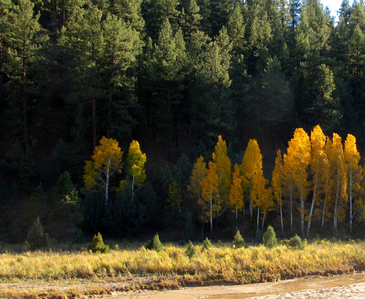
The
west end or the upstream end of Gallina Canyon at the
primitive parking, is a beautiful grove of aspens
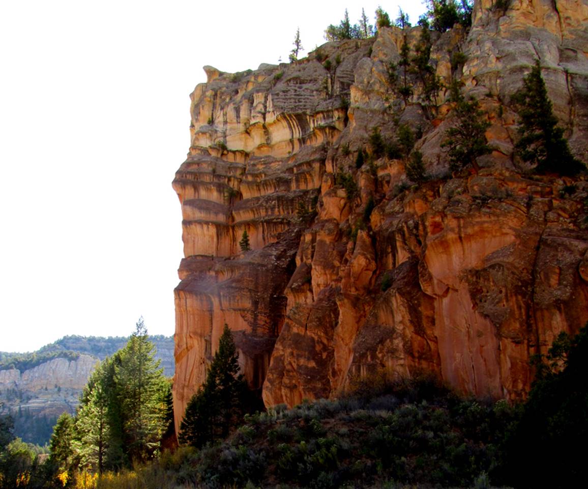
…around
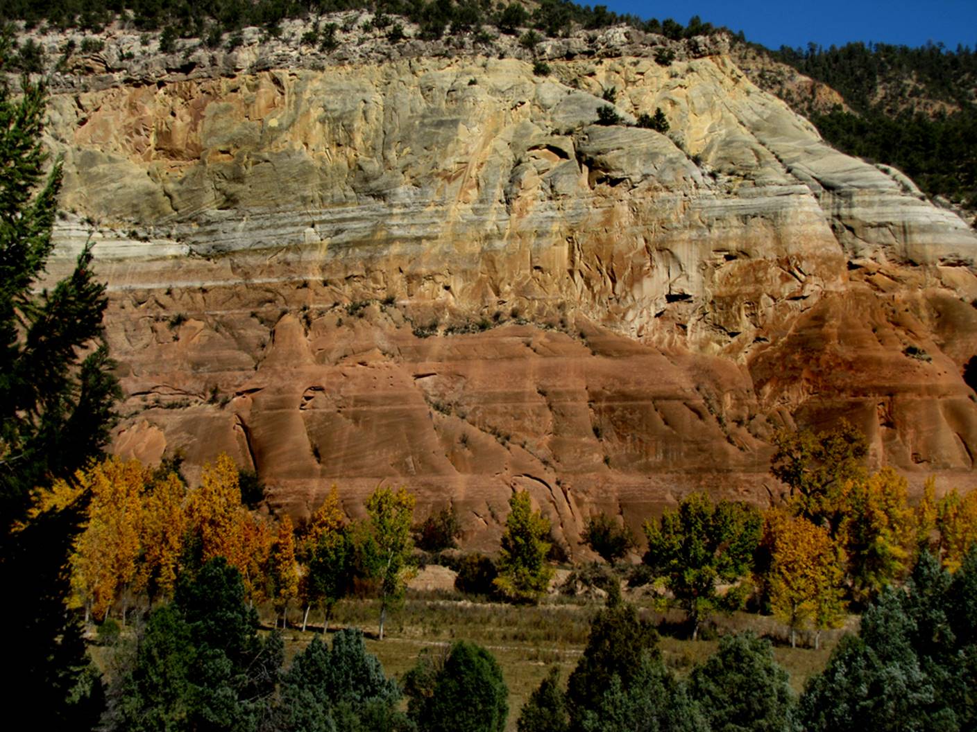
the first bend, the beautiful cliffs begin… and climb quickly to hundreds of
feet high…
Back to New Mexico
Slot Canyons
Send questions and comments to dscott@themarblesculptor.com