Geronimo Falls
See on Youtube: https://www.youtube.com/watch?v=uhnHc4kzHps&sns=fb
The Famous American historical figure “Geronimo”
was born in this Mogollon Creek area.
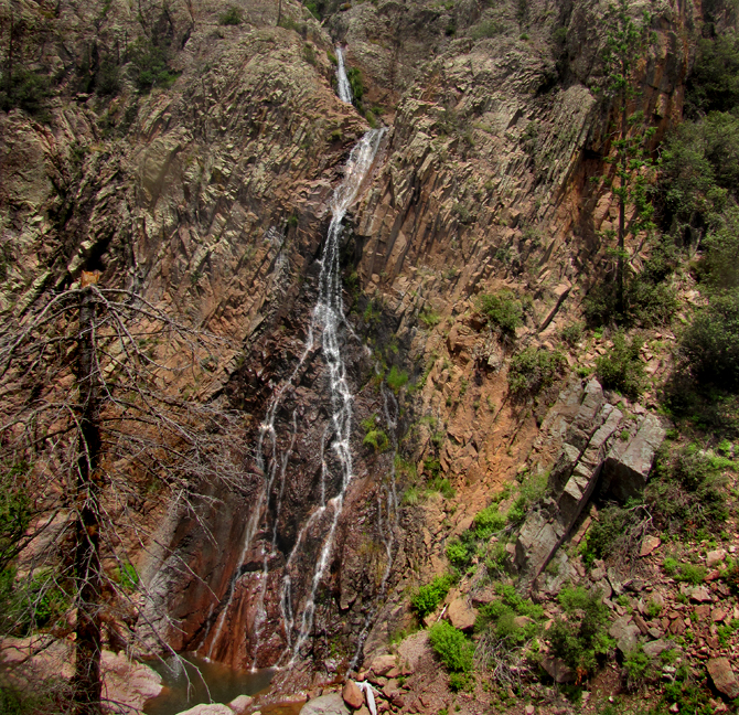
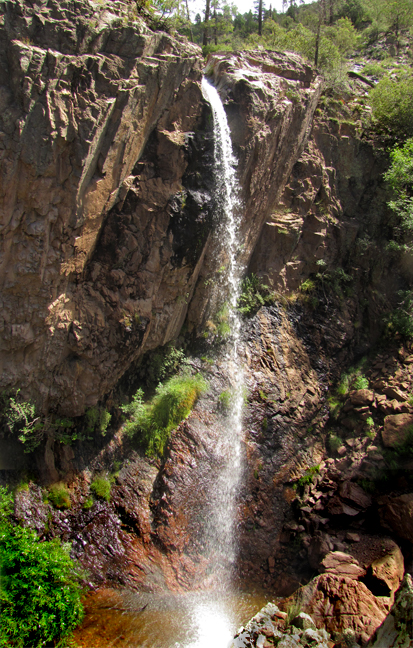
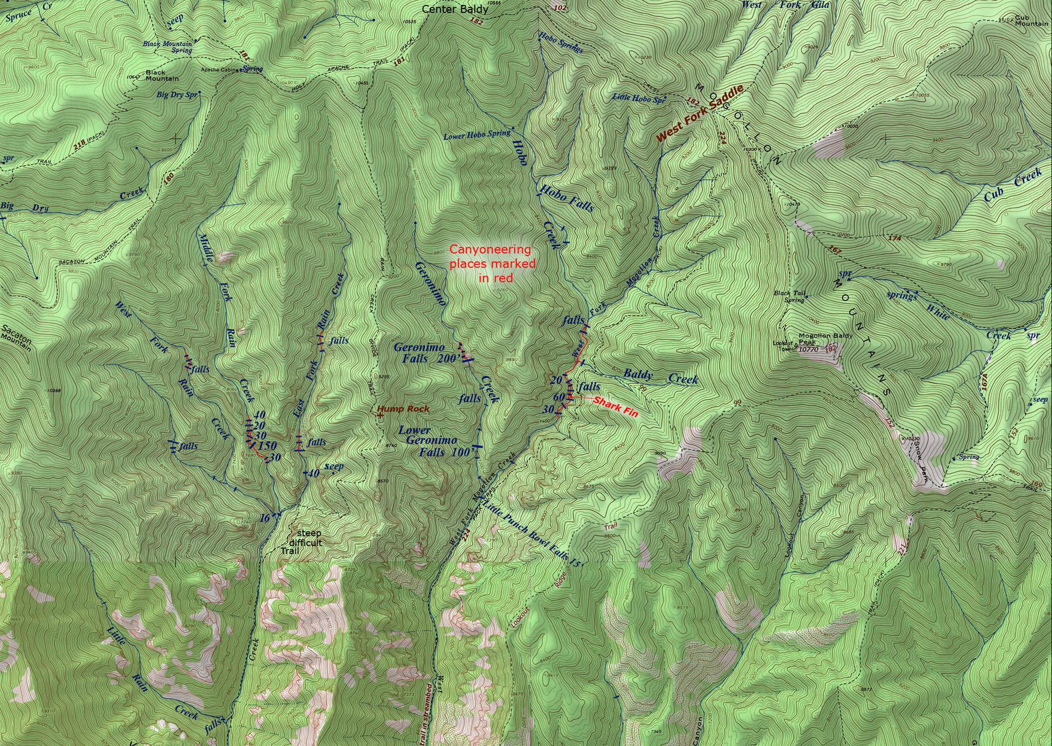
200’ high Geronimo
Falls is at 7900’ elevation in upper Geronimo Creek and.... ...100’ high Lower Geronimo Falls is a
half-mile downstream
Geronimo
Creek is a tributary of the West Fork Mogollon.
beta facts:
name- Geronimo Falls & Lower Geronimo Falls
height- 200’ & 100’ approx..
elevation- 7900’
GPS coordinates- ±33°15.665’N 108°39.169’W and ±33°15.670’N 108°37.917’W
flow- perennial
season- April/May and July/August ...but anytime
the trails are open is okay... just don’t go to all of this effort during a
drought
accommodations- none - Gila Wilderness Area
ownership- Gila National Forest
access- Rain Creek Trailhead – Trail 189 – Trail
224 – bushwhack and scramble after that...
nearest town- Silver City is about 40 miles
northwest of here
fun fact- This seemed like paradise to
us......
essay bro
We just made it in to
document these wonderful waterfalls on July 28th 2017..... The Mogollon Range holds the Gila Mountain’s
highest elevations and gives birth to the larger upper Gila River
tributaries. West Fork Mogollon Creek is
a fine trout stream draining the south slopes of the Mogollon Range. The upper West Fork divides into three forks:
Geronimo Creek, Hobo Creek and West Fork Mogollon Creek. West Fork Mogollon Creek is a fine perennial
trout stream. This south-flowing system
is easily accessible via Forest Road 147 at the Rain Creek Trailhead (see map
below). While the Mogollon Trailhead at
the end of Forest Road 916, has a sometimes impassable ford (a bridge-less
river crossing.)
We packed 5.5 miles in... and camped near the junction of Trail 189 & 224... on the west bank of West Fork Mogollon Creek. The next day we did the 5 miles trek upstream
to both the 200’ Geronimo Falls and 100’ Lower Geronimo Falls. Trail 224 only lasts for about a mile heading
north from here. Above this point Trail
224 has been mostly, washed away by floods.
Therefore hiking near or within the stream is mandatory from that point
on to Little Punch Bowl Falls: ±33°15.420’N
108°37.866’W (see map below).
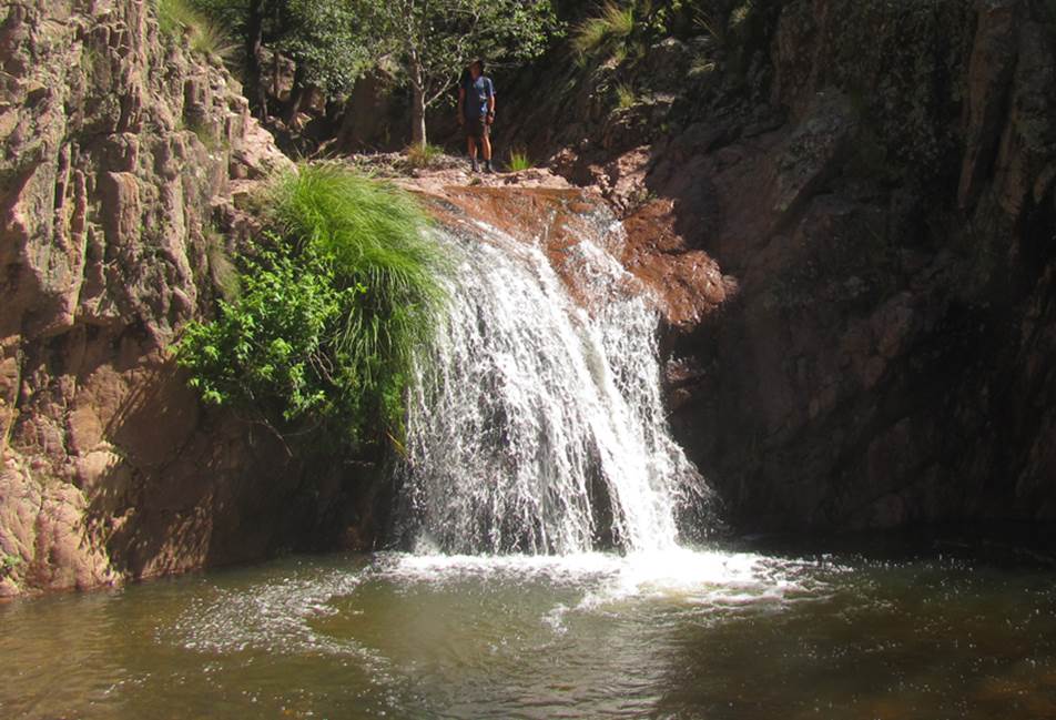
Little Punch Bowl Falls is
where the upper West Fork Mogollon Water-show
begins. Geronimo Creek confluence is 100
feet upstream from Little Punchbowl Falls.
Lower Geronimo Falls is a short half-mile on up Geronimo Creek above...
but traversing Geronimo either direction is very tough going. Hiking Geronimo is not only trail-less, but it
is often an “all-fours” hands & Feet
scramble/climb. We did not use or need
ropes, but it is difficult to achieve a speed of one-mile-per-hour. Difficult route finding is quite time
consuming as well. Therefore the
seemingly short 5 miles up and 5 miles back..... took
us all day and wore us down... even tho we carried
only a small day pack.
200’ high Geronimo Falls,
at almost 8000’ elevation, is another half-mile upstream above the lower
falls. Perhaps the young and strong
would be able to visit all of the waterfalls up both the West Fork Mogollon and
Geronimo Creek in one day...... but we could not. At nearly 70 years now, I ain’t
what I used to be. The
scrambling/climbing up Geronimo Canyon is equally demanding all the way –
one-mile - up to the upper 200’ waterfall.
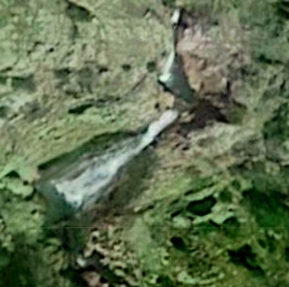
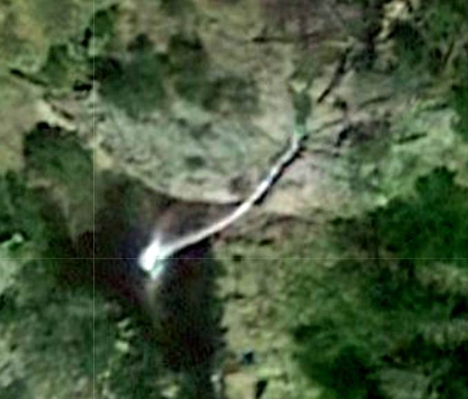
We originally found these splendid waterfalls on Google Satellite
along with USGS Topo Maps
Look at these google satellite images below
Isn’t it amazing how recognizable the google images are to the
real photos above…???
Little
Punch Bowl Falls ±33°15.420’N 108°37.866’W -shown in the photo below, is
where Trail 224 climbs up and away from the stream ... as shown on the map
below.
Right-click-save-as on
our map below to print yourself a hard copy for your hike...
Or click
this link to see a new updated & enlarged map: http://www.dougscottart.com/hobbies/waterfalls/WestFkMogo.htm
To see the
Trailhead click on this enlarged map: http://www.dougscottart.com/hobbies/waterfalls/WestFkMogo.htm
Send questions and comments to dscott@themarblesculptor.com