East Fork Rain Creek Falls
Rain Creek
is one of New Mexico’s best waterfall streams
Upper Rain
Creek likely has 30 or more waterfalls of 20’ high or more... and several
close to 100’ high ...as well as 2 possibly near 200’
high...!!!
Devon Fletcher and I made
it in the visit East Fork Rain Creek Falls on June 6, 2018. We knew that severe drought conditions were
extreme, but we went anyway... Rain Creek was flowing small down below the high
waterfalls, but the high waterfalls were not flowing enough to show
whitewater. The surface
of the cliff-faces were wet and dripping, but not really flowing. We shall try to visit them again during
wetter times, so we can get some photos.
Hundreds of native trout were huddled together in pools... waiting and
hoping for precipitation.
The Mogollon Range holds
the Gila Mountain’s highest elevations and gives birth to the largest upper
Gila River tributaries. Rain Creek is a
fine trout stream draining the south slopes of the Mogollon Range. Upper Rain Creek divides into three
forks. We refer to these three forks as
East Fork Rain Creek, Middle Fork Rain Creek and West Fork Rain Creek. Rain Creek is a fine perennial trout
stream. This south-flowing system is
easily accessible via Forest Road 147 at the Rain Creek Trailhead (see map
below). Government maps and our map show
that Rain Creek used to have a trail up it.
The feds discontinued maintaining this trail years
ago. Today it is totally void of any
maintained trails except for one trail-crossing. Trail 189 descends from the Rain Creek
Trailhead only to cross Rain Creek while continuing on east and immediately
climbing up and out of Rain Creek Canyon.
see the map below-
HOWEVER...!!! The “Phantom” Gila Wilderness Trail Repairman
has saved this trail. He has been
faithful. He is a blessing to
humanity…!!! See: http://www.dougscottart.com/hobbies/waterfalls/WestFkMogo.htm
Some of the trails, shown
by dotted lines on our map below, no longer exist. Forest fires and the massive floods that have
happen because of the fires, coupled with discontinued maintenance,
have allowed these old obsolete trails to desist. Faint remnants of these appear for short
stretches... then vanish with no warning.
Good Luck and Happy
Exploring…!!!
All of these photos are Google Earth Images
We have yet
to explore this area...!!!
This first image has
some snow
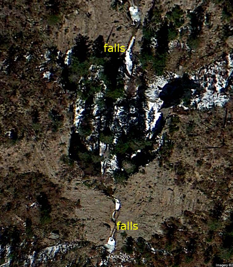
Comparing Google Earth Images with USGS
Topo maps we feel that the waterfall you see at the top of the photo above,
will be some less than 100 feet high.
While… we feel the sculpted waterfall near the bottom of the above
photo, will be more than 100 feet high and possibly as high as 200’...
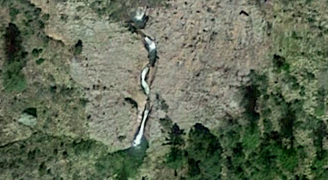
below is a Google Image of the sculpted
waterfall, without snow and ice
GPS coordinates- ±33°15.665’N 108°39.169’W
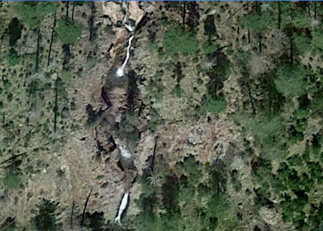
...and below is a snow-less Google Image of
the waterfall shown at the top of the first photo... with more waterfalls above
it...!!!!
GPS coordinates- ±33°15.705’N 108°39.164’W
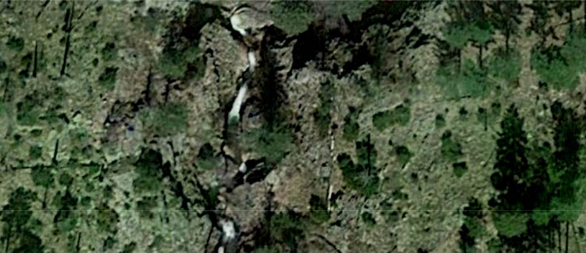
This bottom photo is of some 20 & 30
foot falls about mile farther upstream...
GPS coordinates- ±33°15.966’N 108°39.112’W
HAPPY EXPLORING...!!!
Most of the
printed numbers (waterfall heights) on the map below,
are estimates... that have not been verified in the field
Right-click-save-as on
our map below to print yourself a hard copy for your hike...
Or for a new
updated & enlarged map click this link: http://www.dougscottart.com/hobbies/waterfalls/WestFkMogo.htm
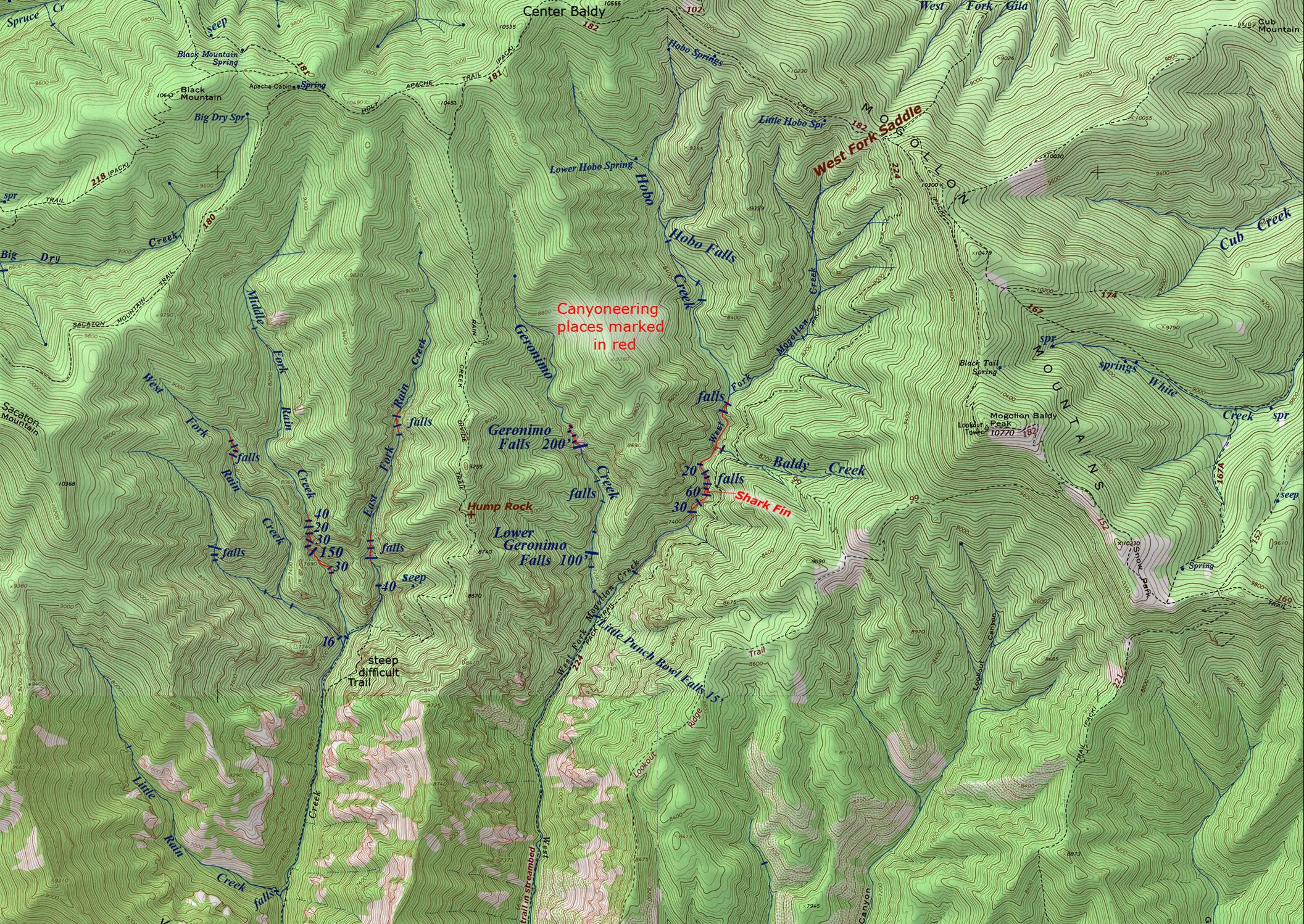
To see the
Trailhead click on this enlarged map: http://www.dougscottart.com/hobbies/waterfalls/WestFkMogo.htm
Send questions and comments to dscott@themarblesculptor.com