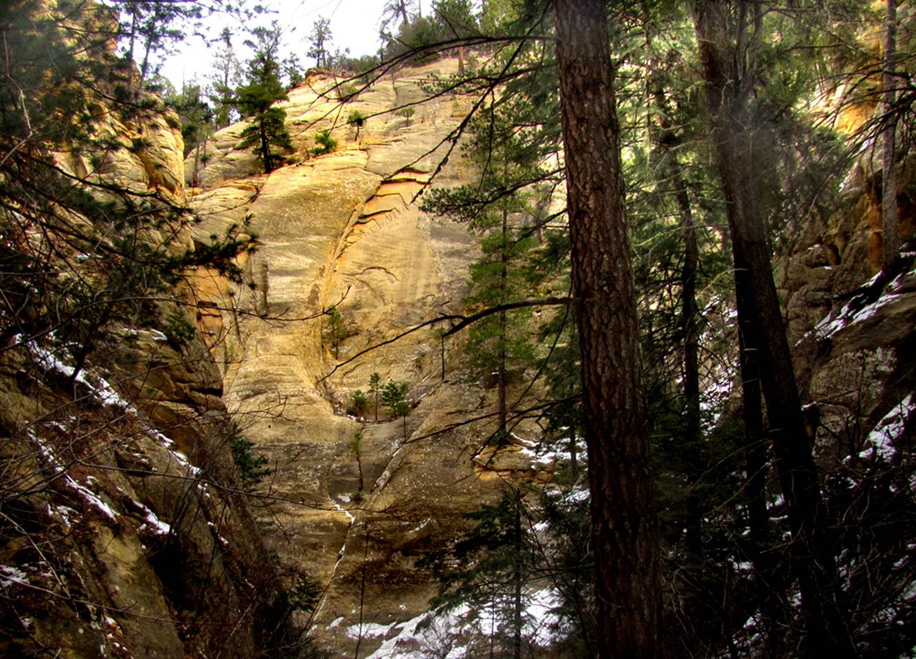
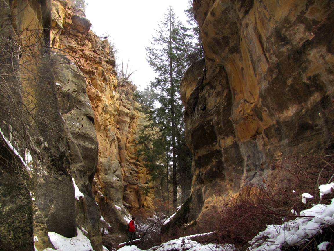
Cañada de Presa
ACA Canyon
Rating – 3A III
Experienced Canyoneers Only
requires a
full range of technical rock climbing equipment as well as multiple ropes…!!!
NEVER ENTER ANY
SLOT CANYON WHEN HEAVY RAIN IS IN THE FORCAST…!!!
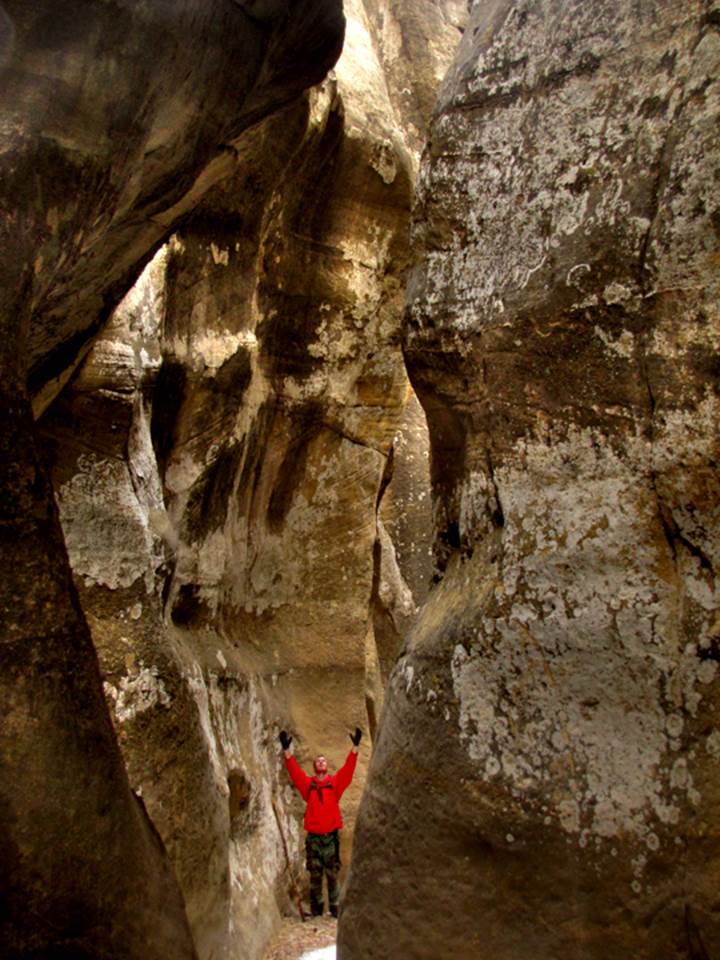
We finally got in here Dec 2, 2014 and had
to deal with up to a half a foot of snow… but isn’t this a fine slot canyon… we
shall return.
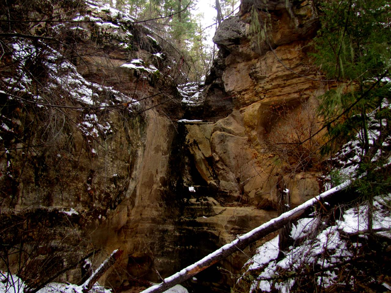
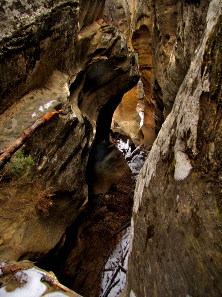
Above is the first dry falls to be
encountered while descending Presa Slot Canyon.
it is about 35’ high and can be scrambled around without ropes on your
left-hand side of this photo
beta facts:
name- Cañada de Presa
depth of slot portion-up to 300 feet
length of slot canyon-
elevation- 7700’ at the top down to 7300’ at the bottom
GPS coordinates- ±36°19.167’N 106°42.756’W at the top
flow- intermittent
season to visit- drier months of the year,
like May, June, September, October and November… NEVER ENTER ANY SLOT CANYON WHEN HEAVY RAIN IS IN
THE FORCAST…!!!
accommodations- NONE –Chama Canyon
Wilderness Area
ownership- Santa Fe National Forest
access- is from above off Forest Road #11…
see the map below
nearest town- Gallina is about 10 miles
south of here
fun fact- …in English,
Canada de Presa means: Large Canyon of Capture or Quarry or Dam …I have no idea
which applies, all three of these words could fit
essay bro
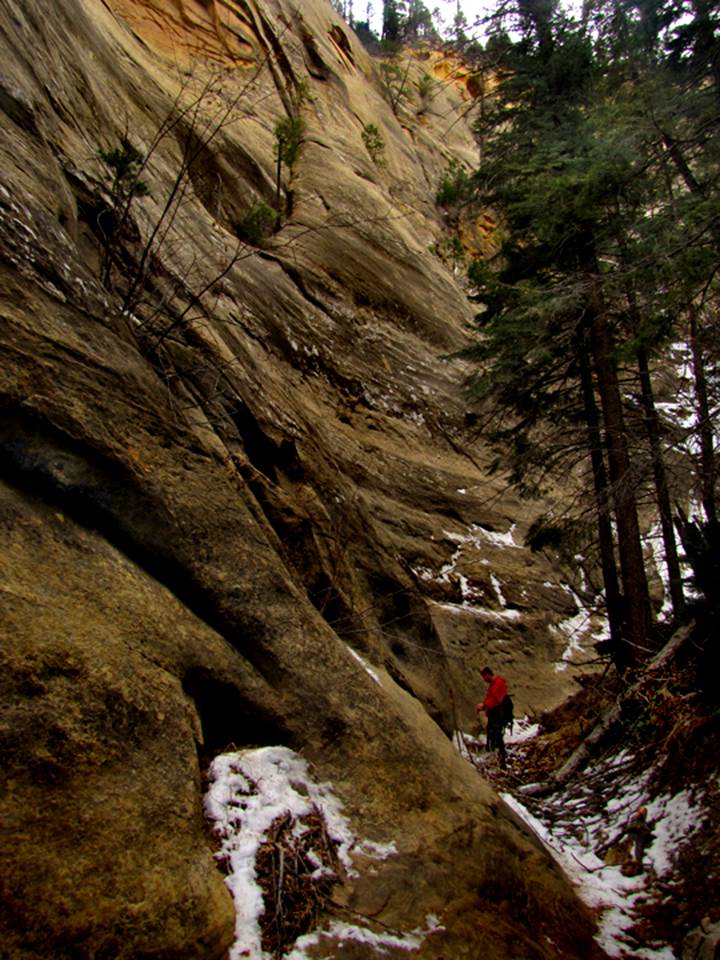
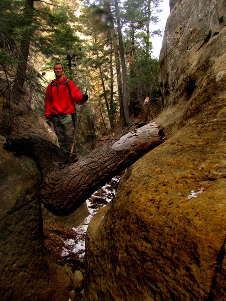
There are many dry falls within Presa Slot
Canyon between the 35’ and 25’ falls shown on the map below. Some are up to 20’ high and some need the
assistance of a rope. For these smaller
falls we often use a rope ladder so we can easily go both up and down… to
return the same way we came. The north
fork of this slot canyon ends with 200 feet or more of smooth sheer walls. This north fork is easy to hike without ropes
above the spring… which FYI - this spring is a strong flowing, trust-worthy
spring. You can count on it even during
dry years.
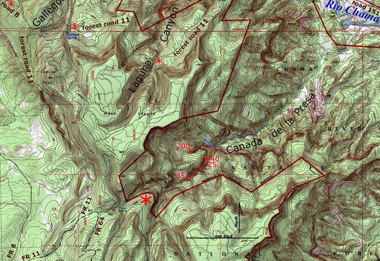
Click this link to open a
large detailed topo map of the entire slot canyon area near and within the western
Chama Canyon Wilderness: http://www.dougscottart.com/hobbies/SlotCanyons/Gallina.htm
Enhanced USGS topo map
The Red Lines depict
sections of “slot canyons”
Back to New Mexico
Slot Canyons
Send questions and comments to dscott@themarblesculptor.com