Little Canyon
ACA Canyon
Rating – 3A III
NEVER ENTER ANY
SLOT CANYON WHEN HEAVY RAIN IS IN THE FORECAST…!!!
DO NOT LET
THE NAME: Little Canyon fool you. Little
Canyon Slot is quite substantial when descended from end to end with ropes and
gear…!!!!
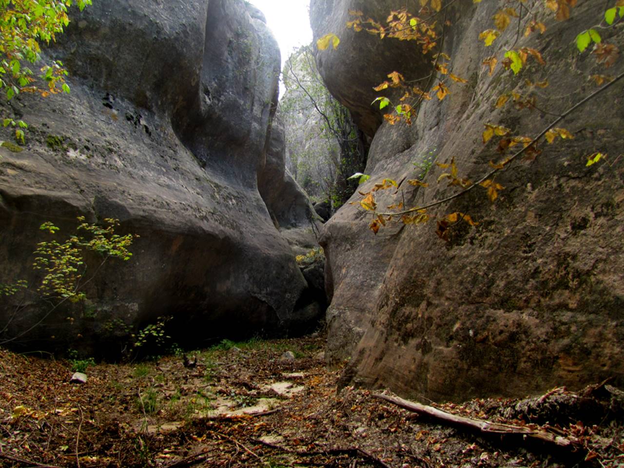
the map below shows a very difficult but non-technical route that drops you into the middle
of the slot canyon section without ropes to only visit part of this slot canyon
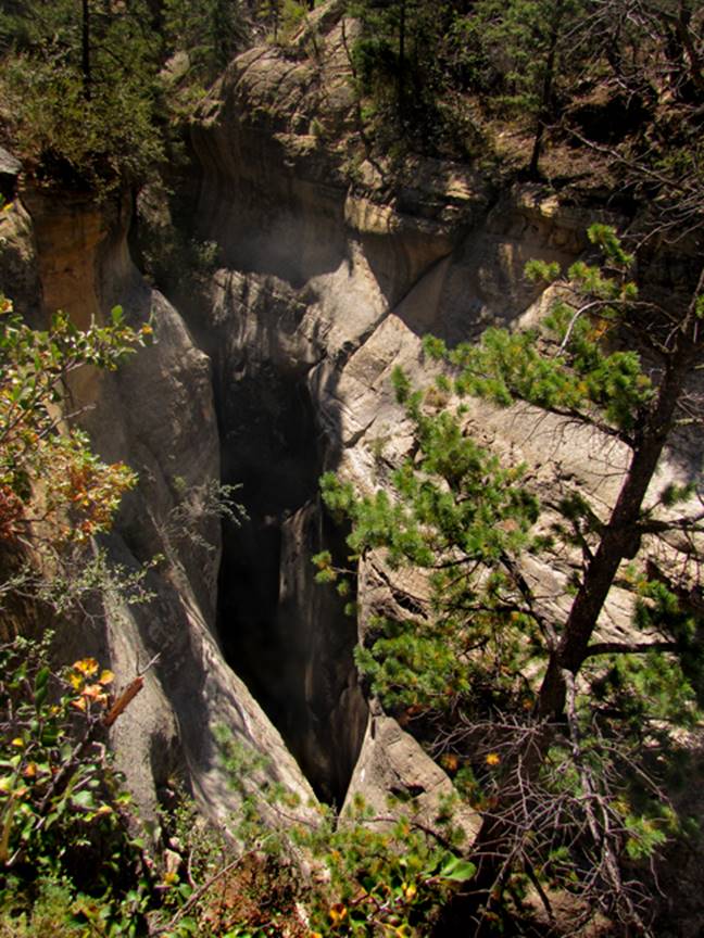
Down in the heart of Little Canyon
beta facts:
name- Little Canyon
depth of slot portion- 100 feet
length of slot canyon portion- a quarter
mile
elevation- 7200’ at the top down to 6700’
at the bottom
GPS coordinates- ±36°22.490’N 106°44.337’W
Parking GPS coordinates- - ±36°21.343’N 106°45.516’W
flow- intermittent
best season to visit- drier months of the
year, like May, June, September, October and November… NEVER ENTER ANY SLOT CANYON WHEN
HEAVY RAIN IS IN THE FORCAST…!!!
accommodations- NONE –Chama Canyon
Wilderness Area
ownership- Santa Fe National Forest
access- is from above on Forest Road #8 and
#11… see the map below
nearest town- Gallina
is about 12 miles south of here
fun fact- You can visit a small portion of
the middle section without ropes but enjoy it all with ropes
essay bro
to traverse all of Little Canyon you will
need to do several rappels, the final rappel will be 130 to 150 feet… The return to your wheels is best done up
Gallegos Canyon.
Click this link to see a
larger map of this entire area: http://www.dougscottart.com/hobbies/SlotCanyons/Gallina.htm
Enhanced USGS topo map by Doug Scott
The thin Red Lines depict
sections of “slot canyons” and the thicker Red Lines show the boundries of Chama River Canyon Wilderness Area
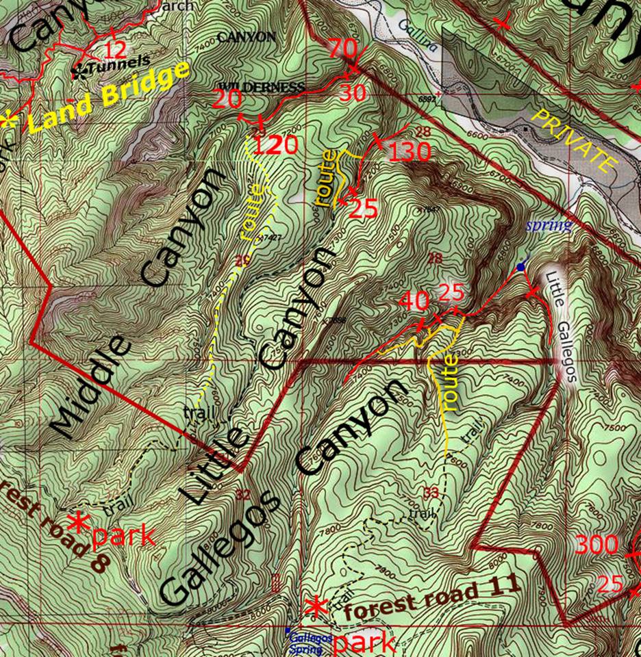
_________one mile__________
Back to New Mexico
Slot Canyons
Send questions and comments to dscott@themarblesculptor.com