Huckaby Canyon or Huckbay Canyon
Before old
man Carl Cooper of El Vado Ranch died, he explained
to me that Huckbay Canyon is really Huckaby Canyon. The
old homesteader’s family who lived there, had the last
name of Huckaby.
The Huckaby family homesteaded the upper end
of this canyon. Carl Cooper knew them
well... they were friends and next-door-neighbors, just 17 miles away. Huckaby Canyon is
the true and correct name, because the canyon was named after them. The name Huckbay is
a surveyor’s miss-print, that still appears on most government maps today.
However… MyTopo.com has it correct on their maps…! ! ! …Huckaby…!
! !
ACA Canyon
Rating – 3A III
Experienced
Canyoneers Only
NEVER ENTER ANY
SLOT CANYON WHEN HEAVY RAIN IS IN THE FORECAST…!!!
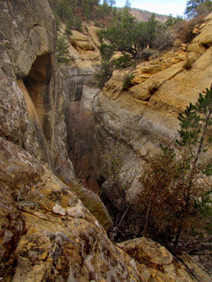
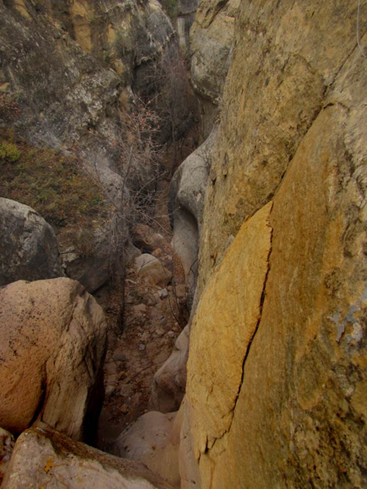
Huckaby Slot Canyon starts off with a two-tiered
drop 70’ high, shown clearly below
beta facts:
name- Huckaby Canyon
depth of slot portion- 200 feet
length of slot canyon portion- ¼ mile
elevation- 7000’ at the top down to 6600’ at the
bottom
GPS coordinates- ±36°25.135’N 106°41.424’W
flow- intermittent
season to visit- drier months of the year, like
May, June, September, October and November… NEVER ENTER ANY SLOT CANYON WHEN HEAVY RAIN IS IN
THE FORCAST…!!!
accommodations- NONE –Chama Canyon Wilderness Area
ownership- Santa Fe National Forest
access- is from above on Forest Road #145… see the
map below
nearest town- there’s not one
fun fact- I hope to descend into this beauty
next time
essay bro
Downstream from Huckaby
Tank where you can park your wheels along FR 145, there is an old cow trail
continuing on down that canyon... and it is kinda
brushy... but beautiful AND it leads to the slot canyon. It would be fun to do the 300’ rappel… but
GREAT just getting down to the top of it and return back out of there…
Click this link to access a detailed topo map that shows this entire area: http://www.dougscottart.com/hobbies/SlotCanyons/Gallina.htm
Enhanced USGS topo map by Doug Scott
The thin Red Lines depict
sections of “slot canyons” and the thicker Red Lines show the boundries of Chama River Canyon Wilderness Area
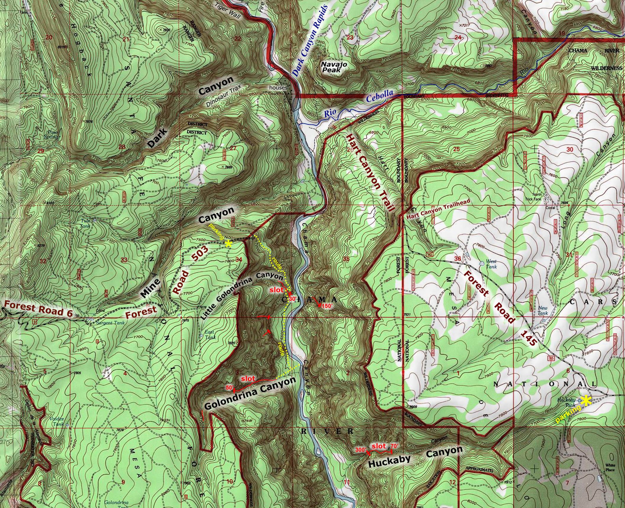
__________one mile__________
Back to New Mexico
Slot Canyons
Send questions and comments to dscott@themarblesculptor.com