Golondrina Canyon
English = Cliff Swallow
ACA Canyon
Rating – 2A II
NEVER ENTER ANY SLOT CANYON WHEN HEAVY
RAIN IS IN THE FORECAST…!!!
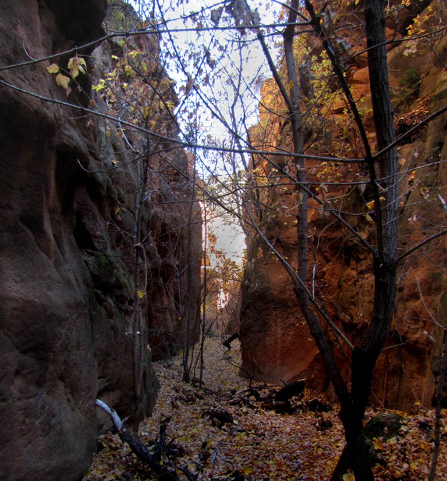
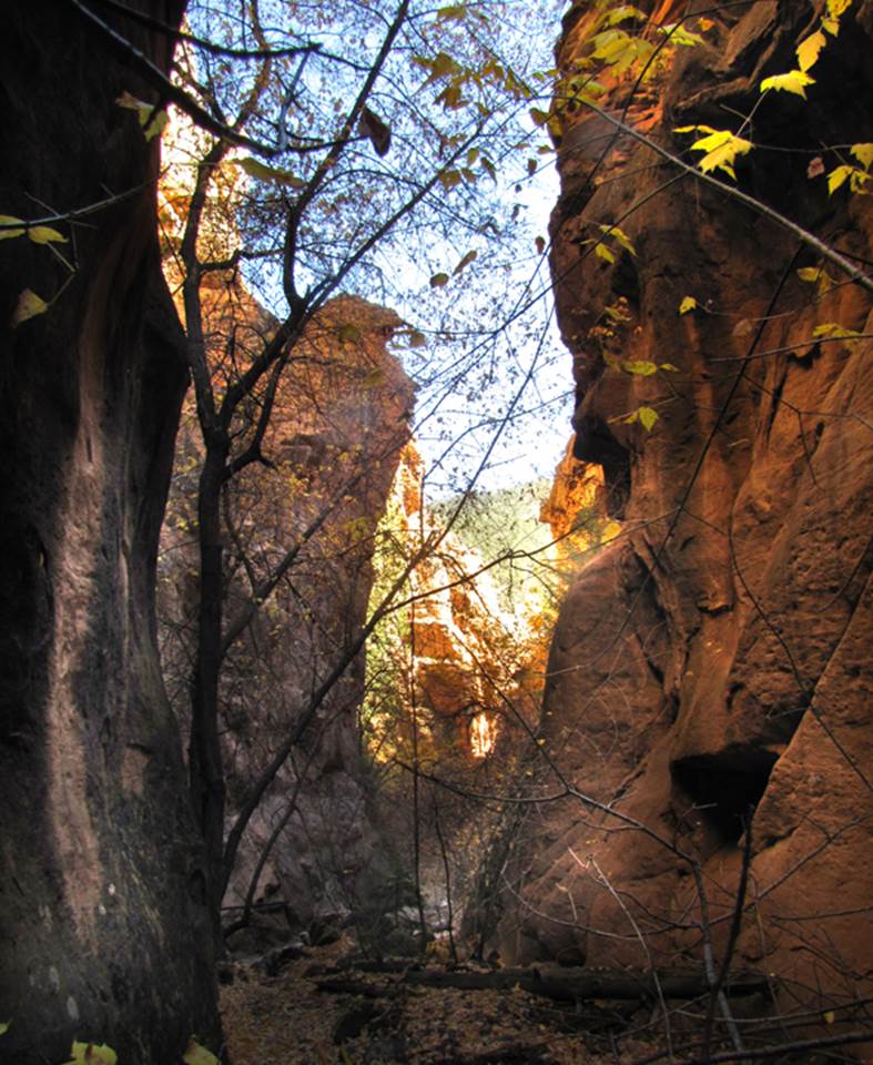
Golondrina Canyon is a Non-technical hike/scramble up
from the Chama River… this is a beauty… one of my favorites…!!!
beta facts:
name- Golondrina
Canyon
depth of slot portion- 100 to 200 feet
length of slot canyon portion- half-mile
elevation- 6900’ at the top down to 6500’ at the
bottom
GPS coordinates- ±36°25.642’N 106°42.833’W
flow- intermittent
season to visit- drier months of the year, like
May, June, September, October and November… NEVER ENTER ANY SLOT CANYON WHEN HEAVY RAIN IS IN
THE FORCAST…!!!
accommodations- NONE –Chama Canyon Wilderness Area
ownership- Santa Fe National Forest
access- is from the Wild River section of Chama
River Canyon… see the map below
nearest town- there isn’t one
fun fact- Golondrina
Canyon is a Non-technical hike/scramble up from the Chama River… it is a
beauty… one of my favorites…!!!
essay bro
Golondrina Canyon is a Non-technical hike/scramble up
from the Chama River… it is a beauty… one of my favorites…!!!
HOWEVER… if you hike here instead of
float here, you must ford the river…and if the
Chama River is flowing more than 300 CFS… necessary fording the river becomes a
swim…!!!
Click this link to access a detailed
topo map that shows this entire area: http://www.dougscottart.com/hobbies/SlotCanyons/Gallina.htm
Enhanced USGS topo map by Doug Scott
The thin Red Lines depict
sections of “slot canyons” and the thicker Red Lines show the boundries of Chama River Canyon Wilderness Area
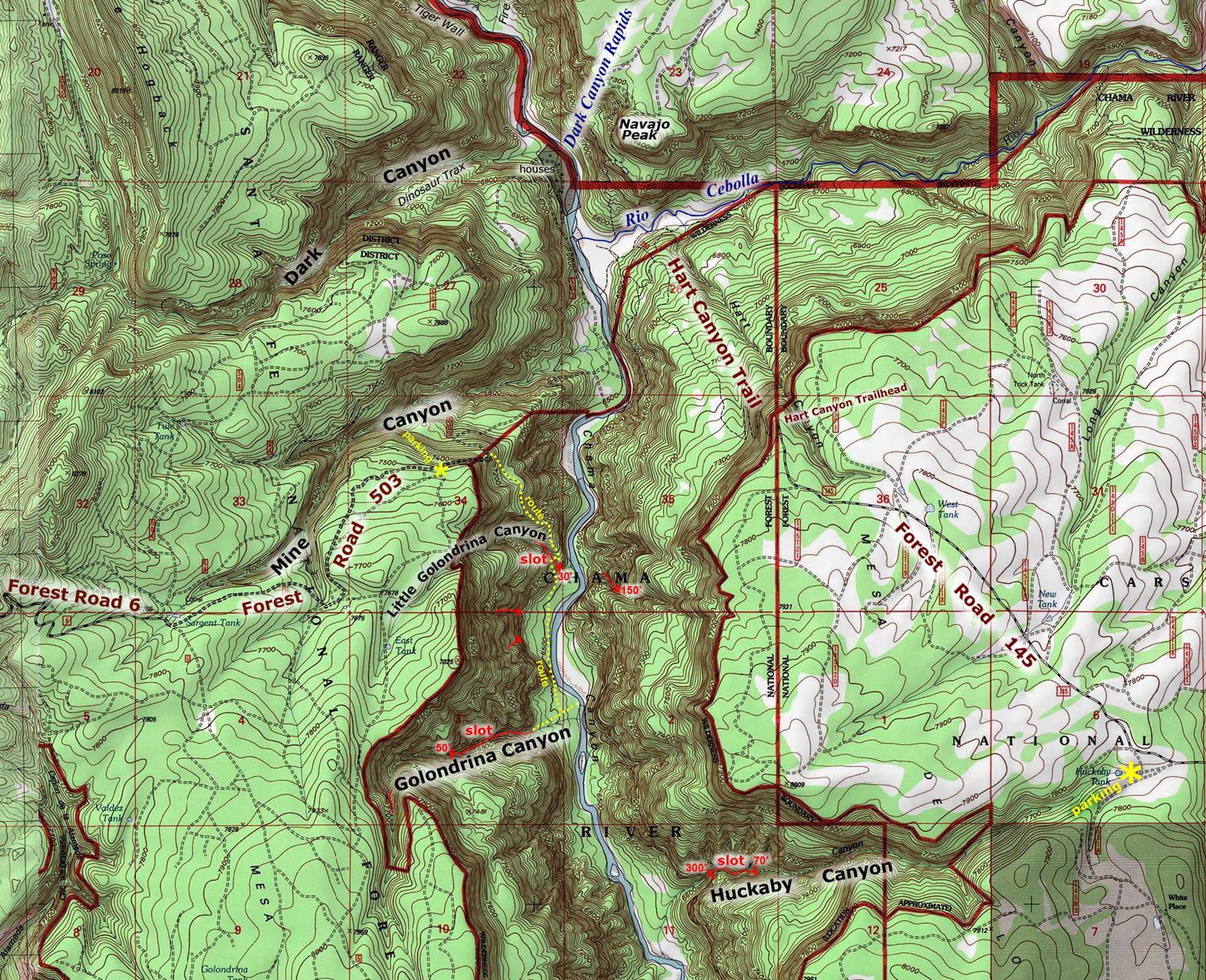
_________one mile_________
Back to New Mexico
Slot Canyons
Send questions and comments to dscott@themarblesculptor.com