Deadman Canyon
https://www.youtube.com/watch?v=MVj3XP2vsOg
ACA Canyon
Rating – 3A III
NEVER ENTER ANY
SLOT CANYON WHEN HEAVY RAIN IS IN THE FORECAST…!!!
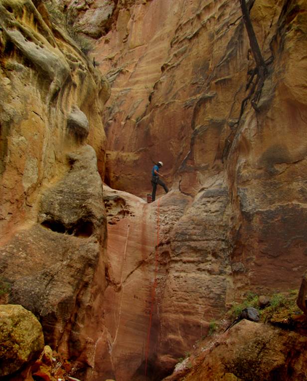
Kelton sets a “ghost” leave-no-trace
anchor for the final rappel in the middle “crux” section of Deadman Canyon
Slot. Ghosting allows those who follow
us to feel as tho no one has ever been here
before.....
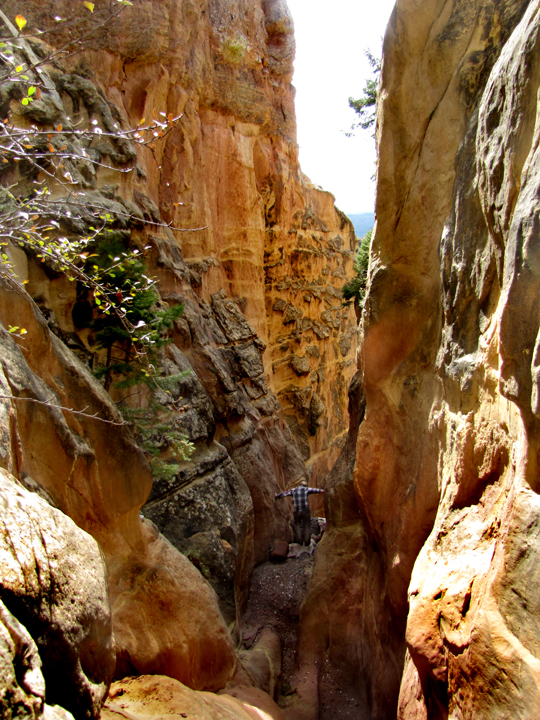
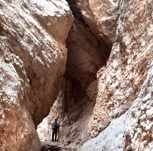
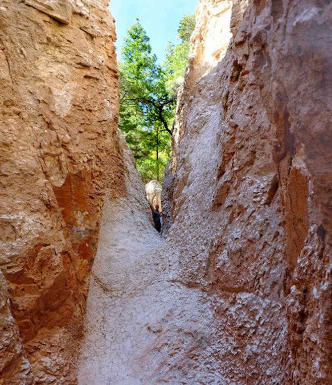
hands on the walls... Nicoli Carr stares down into the
narrow crux of Deadman Slot
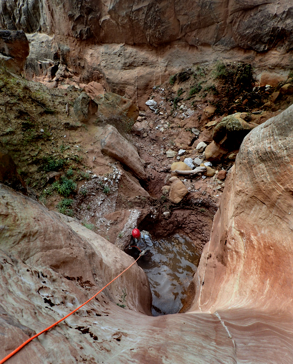
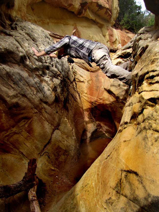
Below
is a Kelton Manzanares photo of me trying to keep my
64 year old bones out of the cold, muddy water
Our
footprints are in the mud in this photo below... after a partially controlled
butt-slide down the first 20’ drop
I
don’t how far Kelton had to lean out over the edge to capture me getting
“off-rope” crotch-deep in a cold water pothole
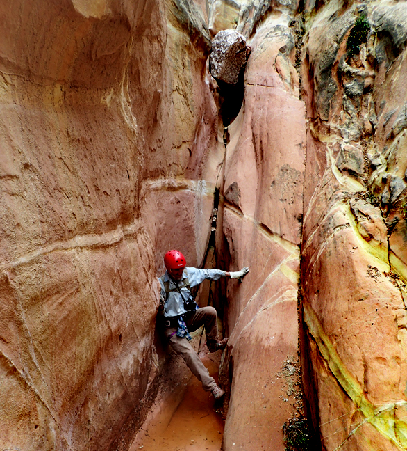
The
two photos below are Kelton Manzanares’ shots of me
in the alabaster tunnel of Deadman Slot Canyon
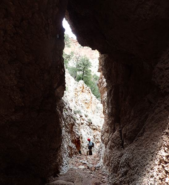
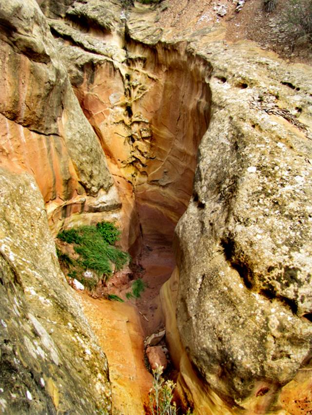
The
photo below shows the view looking back up at the 500’ high, rope-less descent
thru upper Deadman Canyon
...Nicoli, stemming the potholes...
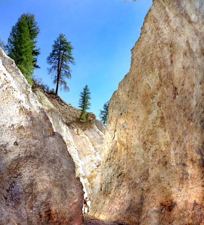
the lower half of Deadman Canyon Slot is
shining white alabaster… very beautiful
A Nate Bartnick
Photo above
Nate above in a tributary, this 25’ drop
had just enough slope and texture for us to both ascend and descend it without
technical protection
beta facts:
name- Deadman Canyon
length of slot canyon portion- just over a
mile...
elevation- 8100’ at the top down to 6800’ at the
bottom
GPS coordinates at midway- ±36°25.045’N 106°45.713’W
flow- intermittent
season to visit- drier months of the year, like
May, June, September, October and November… NEVER ENTER ANY SLOT CANYON WHEN HEAVY RAIN IS IN
THE FORECAST…!!!
accommodations- NONE –Chama Canyon Wilderness Area
ownership- Santa Fe National Forest
access- is from either Deadman Peak or the Chupadero Area - see the map and text below
nearest town- Gallina is
about 15 miles south of here
fun fact- this is mountain lion country
essay bro
All three of these Deadman Canyons (Little Deadman, Middle Deadman and Deadman Canyons) are reserved for the hardy... and not for the faint of heart. They are VERY REMOTE and have many dry falls as down-climbs and rappels. These canyons can be partially visited without ropes but the climb-out and around these drops are extremely steep, strenuous and dangerous. There are NO TRAILS in or around these canyons.
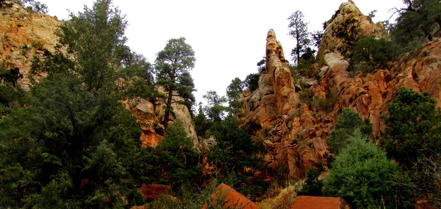
Most
of Deadman Canyon is slot that widens occasionally. The lower half is all alabaster. The upper half is steeper and predominately
Entrada Sandstone. Perhaps because it
faces south, Deadman Canyon seems quite desert-like for its high elevation.
Descending Deadman Slot goes like this: Parking
shown on the map below is near GPS: 36°25.646’N 106°46.095’W ele- 8337’. Hike
south-southwest about ¼ mile, down thru a meadow and
into a small canyon at GPS: 36°25.294’N 106°46.213’W ele-8006’. Even tho this upper
end of Deadman Slot Canyon drops more than 500 feet extremely steep, we found
that descending it is a very safe, rope-less down-climb. This narrow steep canyon is about ¼ mile
long. After another ¼ mile of steep
hiking the main Slot canyon will begin slowly, getting deeper and narrower as
you descend. Both the far upper portion
and the upper half of this main portion of Deadman Slot are mostly composed of Endrada Sandstone...very beautiful.
At
GPS: 36°25.064’N 106°45.974’W ele-7565’ is a 20’ drop followed closely by a
40’er. A butt-slide and a down-climb
worked here for us. These dry falls mark the beginning of a series of a
half-dozen or so 20 to 40 foot rappels and/or down-climbs thru the deepest and
most narrow portion of the Deadman Slot.
Anchors will be hard-to-find here.
The slot canyon walls rise to 100 or more feet overhead and close-in
quite narrow.
This
entire “crux” of the canyon may be circumvented by back tracking upstream 50
yards to a major tributary entering from the west. Walk up this trib a
short ways and scramble 30 feet up a steep dirt slope. Holding this same elevation, you are soon
hiking the rim of Deadman Canyon.
Continue south about ¼ mile and drop down back
into Deadman Canyon at GPS: 36°24.990’N 106°45.981’W ele-
7433’. Once in the streambed, hike back
upstream to see the exit of this wonderful slot. This section is marked in yellow
with the word “route” on
the map below.
From
this point on downstream, Deadman Slot will be alabaster instead of
sandstone. Within the next couple
hundred yards is the “Tunnel” in the midst of a half dozen or so 15 to 30’
rappels and/or down-climbs in a narrow and curving alabaster slot canyon. Anchors are abundant and easy here. This technical slot can be circumvented on
the opposite side of the canyon via a steep and crumbling route to a major
east-side tributary which has two rope-less
down-climbs. Please note that both of
these climb-around routes are shown with a yellow line on the map below. This alabaster climb-around is labeled only
with a yellow,
small-case letter “r” on the map while the
one above it is labeled “route”.
One
last difficult drop will meet you another ¼ mile downstream. This 20 foot drop can be done with a line rope
instead of a rappel, or...if you are up for a challenge, it has been both
up-climbed and down-climbed “ropeless”. From here downstream is an easy,
scramble/hike all the way to the Rio Gallina at 6700’
elevation.
We like to do Deadman Canyon Slot from the
top, parking near Deadman Peak lookout Tower.
See map below. After the descent,
Deadman Canyon can be hiked back up using the climb-arounds mentioned above and
shown on the map below with yellow lines.
Also, you will likely have time to look into or traverse one or both of
the other two Deadman Canyons - Middle Deadman Canyon and little Deadman
Canyon.
Kelton Manzanares
and I did what we believe to be the first descent of Deadman Canyon Slot on Oct
29, 2015.... after earlier scouting trips with Nicoli Carr and Nate Bartnick.
Driving
Access
The Deadman
Lookout Road (Forest Road 507) is accessed from Hwy 112 about 4 miles north of Llaves, NM
to Forest Road 7 one mile to Forest Road 6 followed by about 4 miles to Forest
Road 507. This is where you
have to be careful. Do not
take Forest Road 507. Instead,
drive a few feet past it to a small 2-track “un-named” road and turn right on
this road. In less than a
mile this small 2-track road will reach a flat open area 400’ directly below the
Deadman Lookout Tower. A
gentle, quarter mile hike to the south-southeast will quickly drop into the
beginnings of the upper Deadman Slot (@ 36°25.405’N 106°46.187’W). Use
this same route to reach any one or all of these three wonderful Deadman Slot
Canyons. We wish you the
best...
Another way to
reach these canyons is from the bottom... walking along the Rio Gallina. Chupadero Road access is three and a half miles
up the Rio Gallina from its Deadman Canyon Confluence. A map showing Cupadero Road can be found by clicking this
link: http://www.dougscottart.com/hobbies/SlotCanyons/Gallina.htm
- Gallina Canyon is a beautiful creek-side
stroll that will please and amaze you.
Please be careful of the private land
here. It is marked as shaded gray on our
map below and it is easy to walk around their fences to stay on public land.
DO NOT
TRESPASS…!!!
However…
A very pleasant way to maximize enjoying Gallina
Canyon is to plan a vacation at:
Gallina Canyon Ranch
…it is
Amazing…!!!
They have
campgrounds and wonderful cabins “just for you” right in the middle of a dozen
slot canyons...! ! !
Click this
link: http://gallinacanyonranch.com/
Forest Road 474, Abiquiu,
NM 87510
(505) 490-3333
Gallina Canyon Ranch a great way to visit and
enjoy these amazing “slot canyons” of the Chama Canyon Wilderness. Several amazing slot canyons are easy to
visit with normal hiking from here. In
fact, vacationing at Gallina Canyon Ranch will put
you in the heart of New Mexico’s best slot canyon country...!!! Gallina Canyon Ranch is truly
amazing and is a great access to this western portion of the Chama Canyon
Wilderness.
Click this link to
access a detailed topo map that shows this entire area: http://www.dougscottart.com/hobbies/SlotCanyons/Gallina.htm
Enhanced USGS topo map by Doug Scott
The thin Red Lines depict
sections of “slot canyons” and/or “box canyons” …… the thicker Red Lines show the boundries of Chama River Canyon
Wilderness Area 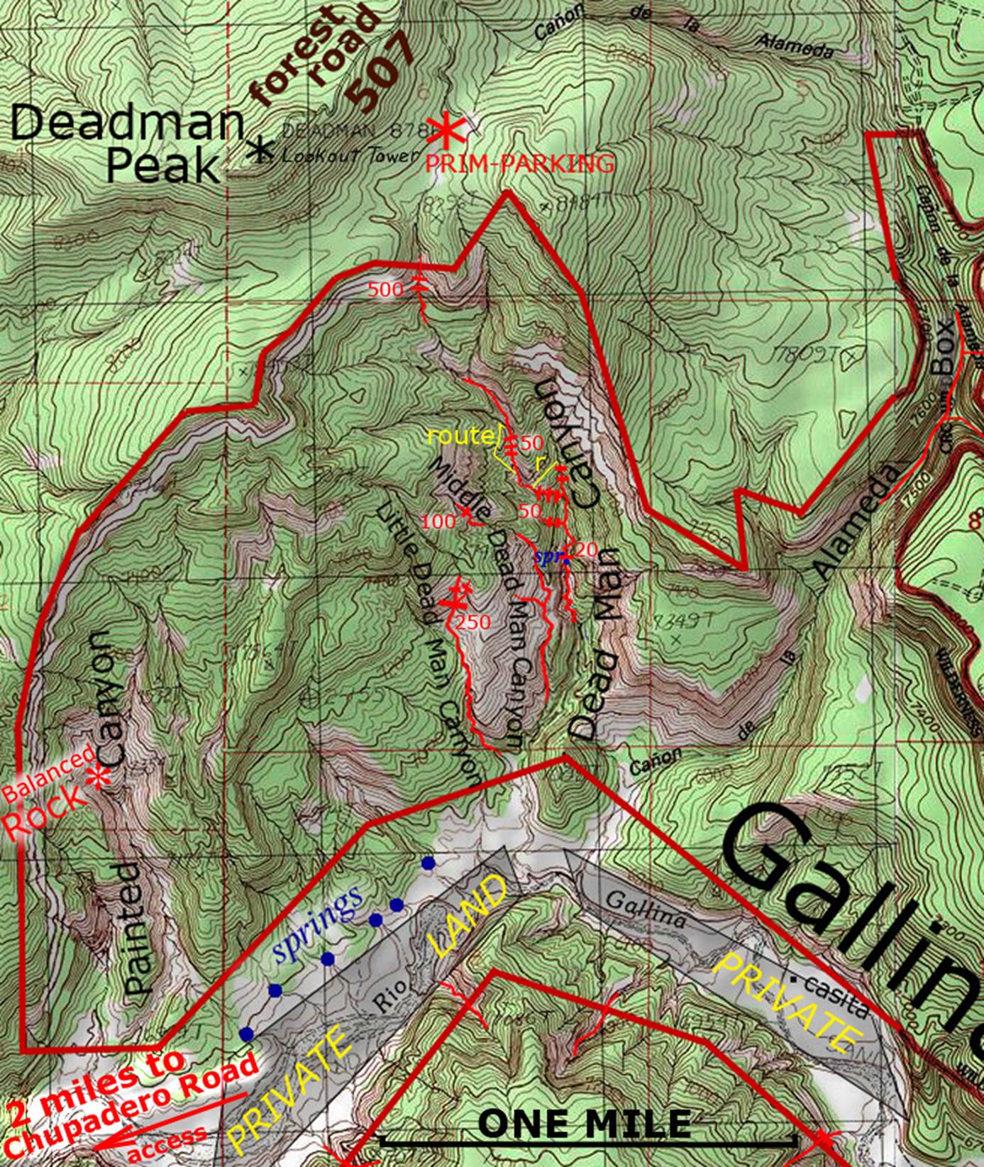
Back to New Mexico
Slot Canyons
Send questions and comments to dscott@themarblesculptor.com