Cañon de
ColouresSpanish
Canyon of ColorsEnglish
ACA Canyon
Rating – 2B III
This entire
canyon can be hiked without ropes but it is difficult and should only be
attempted by experienced canyoneers
This is an “extreme” hikers dream canyon...
rope-less...!!!
NEVER ENTER ANY
SLOT CANYON WHEN HEAVY RAIN IS IN THE FORCAST…!!!
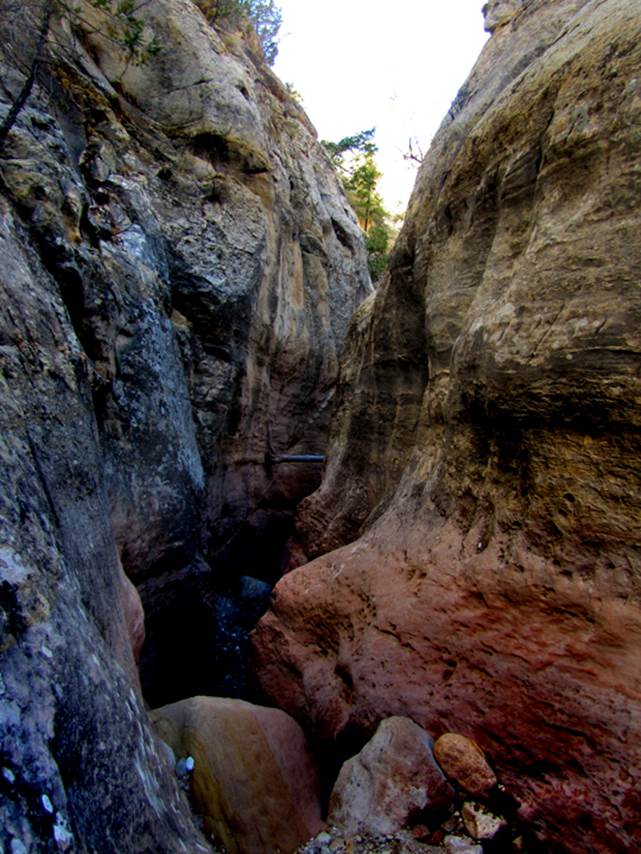
Cañon de Colores means
Canyon of Colors... yellows, reds, blues & purples... a narrow slot 100’
deep
…and beautifully sculpted…
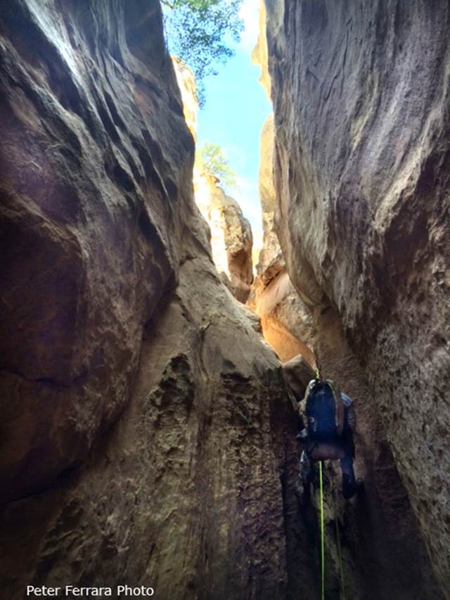
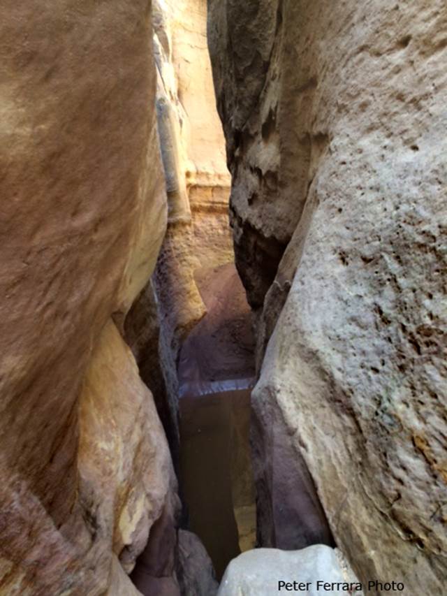
...once committed in
the deep narrow slot portion there is no escape or turning back...
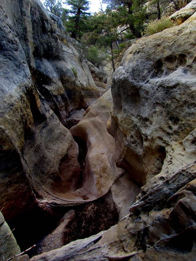
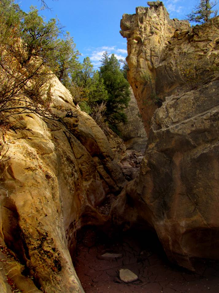
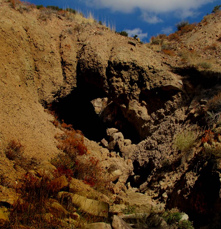
We called this rock outcropping in the
upper canyon… “Dog Rock” –and notice the rocks we threw into the mud to give us
“stepping-stones” –sometimes there is no mud or water.
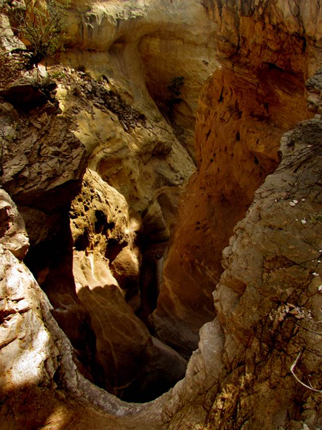
This photo above shows the confluence of Cañon de Coloures’ largest
tributary, called the “Middle Fork” …see the map below
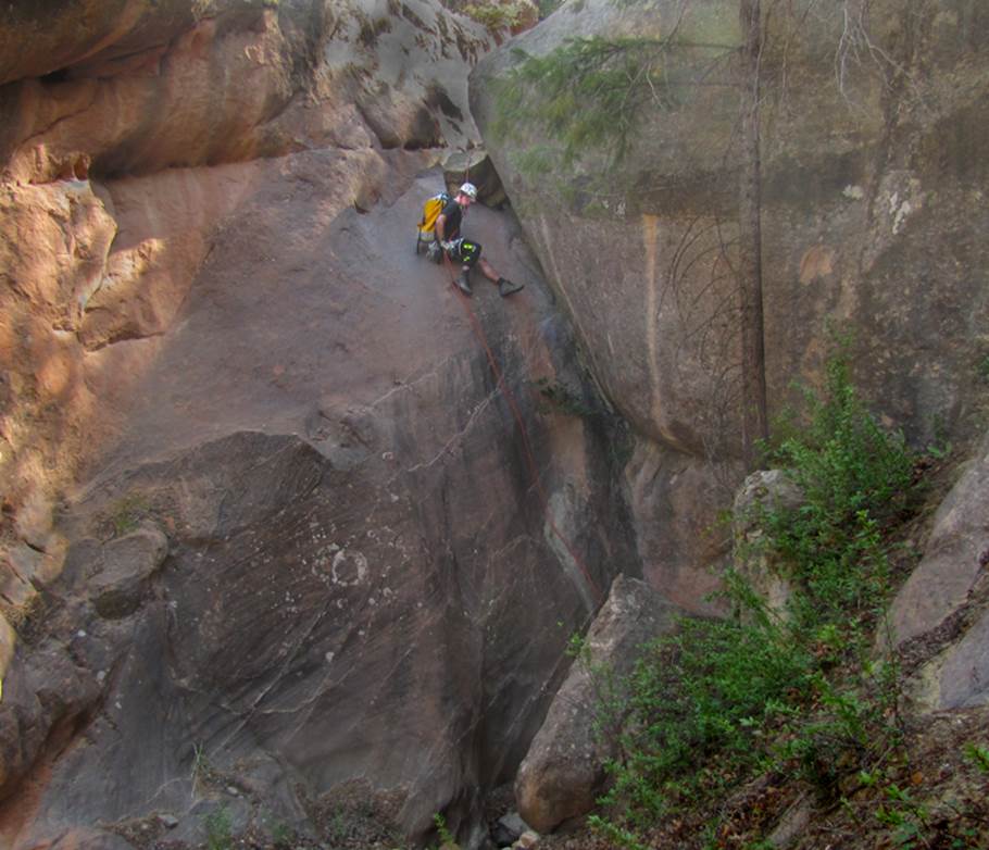
In the photo below, Chris Erwin descends a
steep hand-line, 25’ high, within the crux of Cañon
de Coloures “Middle Fork”. We believe that the agile canyoneer can
ascend this Middle Fork as an optional, return to your parked wheels… but it will take extreme effort,
knowledge, endurance as well as a full bag of tricks...! ! ! -at least bring a 40’ hand-line.
In fact it may be best to descend this Middle Fork slot first …and
return via the main canyon...!!!
The photo below shows a ten foot wide
natural bridge made of dirt …in the lower canyon
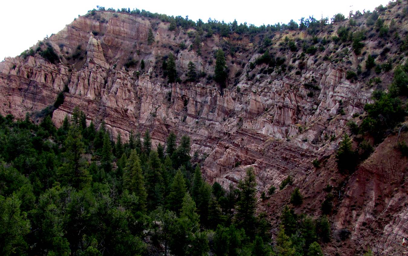
And this last photo is a 400’ high cliff of
“Purple Hoodoos”
beta facts:
name- Cañon de Coloures or in English= Canyon of Colors
depth of slot - 100 feet
=elevation- 7900’at the top down to 6900’at the bottom
GPS coordinates- ±36°21.391’N 106°48.387’W at the top and ±36°20.652’N 106°49.721’W at the lower end
flow- intermittent
season to visit- drier months of the year, like
May, June, September, October and November… NEVER ENTER ANY SLOT CANYON WHEN HEAVY RAIN IS IN
THE FORCAST…!!!
accommodations- NONE
ownership- Santa Fe National Forest
access- is from Dry Lake 4WD Road off of Forest
Road #8… see the map below
nearest town- Gallina is
about 15 miles southeast of here
fun fact- this is a wonderful desert
canyon
essay bro
The first known descent of Cañon de Coloures Slot was done
by Peter Ferrara and J Martin on Saturday, May 21, 2016
Peter’s notes are below:
The drive out there takes
a while. From the car, we crossed through the small saddle and followed the
terrain down to the drainage and just kept walking down the drainage. At one
point we started to question if we were in the proper canyon at all, because it
just seemed to be a drainage. But once we found
"Dog Rock," we knew we were in the correct place.
A short distance down
from Dog Rock we came to the first obstacle which we decided to rappel. This
first rappel is only about 15 feet. We used a large boulder at the top to build
a ghosting anchor. Once down, we tried to pull the anchor, but last rap ring
got stuck. So we climbed up as high as we could and cut as much of the webbing
as we could, but did end up leaving a short bit behind.
Continuing
down for about another 15-20 mins before entering the narrows and deepest part
of canyon. This required a few down
climbs into water that was not more than knee deep. Then
coming to the next (2nd) rappel. Which is maybe 20
feet, but requires a rappel. There are many escape routes in this canyon
and ways we felt we would be able to scramble out if we had to. Which was a big comfort and allowed us to continue moving forward,
because we never felt as if we were going to be trapped. The 2nd rap required that we build a chock
stone anchor. We used a small rock from the previous down climb and wedged it
between the canyon wall and large boulder at top of rap. Both of these first 2 raps had a way to step
down into the slot and get on the rope comfortably before starting to rappel.
This rap descended into the deepest water we encountered which was waist deep
and absolutely freezing cold. The mud in the canyon is also very soft and deep.
In some places our foot sank almost a foot deep into pure almost quick sand
like mud.
Upon coming to the 3rd
and final rappel, which is also the highest at maybe 30 feet, we choose to sit
and have our lunch. This obstacle can be climbed around, but what fun is that.
So we used a Pinon tree to build an anchor. There exists a small ledge to enter
the rappel, but this required a small step out and swing into the rappel - a
bit unnerving, but completely exhilarating at the same time. After this the
canyon opens up and flattens out. One is heading toward the purple hoodoos, we
choose to end here and start our climb back up and out. It took us 2 hours and
45 mins to complete the canyon. Although, now having done it and knowing what
to expect, I feel it could be done much quicker.
The climb out is steep. We kept climbing up and to
our right, choosing to pass through the saddle that is visible from both the
front side (car park side) and back side (canyon side). Climbing down
the
crumble and hiking back to our cars. The whole trip for us was just under 4 miles and took just under 5 hours.
Editor’s notes: We have found
that the easiest return to our parked wheels, is to
back-track right up the same canyon we came down...Cañon
de Coloures ...only scrambling up – out – and around
all of the un-climbable places on the northwest side of each narrow impasse... Some of these escape routes are quite
difficult, but this allows another slightly different view of Cañon de Coloures on your way
out. It also means that Cañon de Coloures can be visited
end to end – both directions – without ropes and gear... just hiking and
scrambling. You will miss traversing the
1/3 of a mile of a true “slot canyon” section, while not really missing it at
all. Because you non-technical canyoneers – can actually walk from either end (top and/or
bottom of this slot...) all the way to it’s one rappel
...so you actually miss nothing.
The 30’ rappel that is the
farther-most downstream, has a very steep and dangerous
climb-around to your right-hand side...
rocks here are crumbly and loose...
Today- July 4, 2017 Chris
Erwin and Doug Scott just did a first descent of Cañon
de Coloures Middle Fork. See map & photos... This is Canon de Coloures’
largest tributary. We believe this
Middle Fork can be traversed both directions... down-climbing and up-climbing,
which is just like the main Cañon de Coloures below.
However, it will take a full bag-of-tricks and at the very least, a 40’
hand-line rope.
The Twin Slots shown on the
map below are canyons consisting of solid alabaster. Neither of these have been traversed that
anyone knows of. We suspect them to be
steep and dangerous. Alabaster is
brittle and does not hold anchors or hardware of any kind.
Click this link to open a
large detailed topo map of the entire slot canyon area near and within the
western Chama Canyon Wilderness: http://www.dougscottart.com/hobbies/SlotCanyons/Gallina.htm
Enhanced
USGS topo map by Doug Scott
The Red Lines depict sections of “slot canyons”
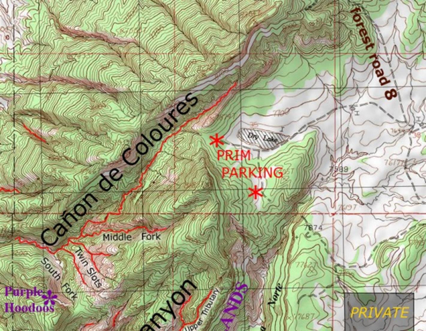
___________one mile__________
Click this link to open a
large detailed topo map of the entire slot canyon area near and within the
western Chama Canyon Wilderness: http://www.dougscottart.com/hobbies/SlotCanyons/CCWslotsMap.htm
Back to New Mexico
Slot Canyons
Send questions and comments to dscott@themarblesculptor.com