Palociento
Falls
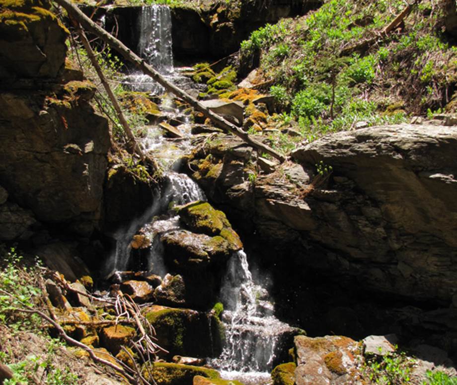
Palociento Falls drops about 20’ with two
tiers
Photos of more waterfalls also nearby on Palociento
Creek appear below the map
beta facts:
name- Palociento Falls
height-20’
elevation-6900’
GPS coordinates- ±36°14.828’N 105°25.734’W
flow-perennial
season- late May has the most water flow
but anytime is okay
accommodations- none
ownership- public – Carson National Forest
access-
3½-mile hike from the upper Pot Creek Trailhead and just over 4-miles
from the lower Pot Creek Trailhead
nearest town- Taos is about 16-miles
northwest of here
fun fact- The Pot Creek Road has been
closed now for maybe 15 years and beaver dams are now 6-feet high and full of
big trout…!!!
essay bro
I do not know why it has taken so long for me to finally hike up Palociento Creek… ah… er… my radar has told me for years now that there were waterfalls up there. I just visited there for my first time in mid-November 2012 …and it is wonderful country. I returned June, 2013
Enhanced
United States Geological Survey 7.5’ topo map
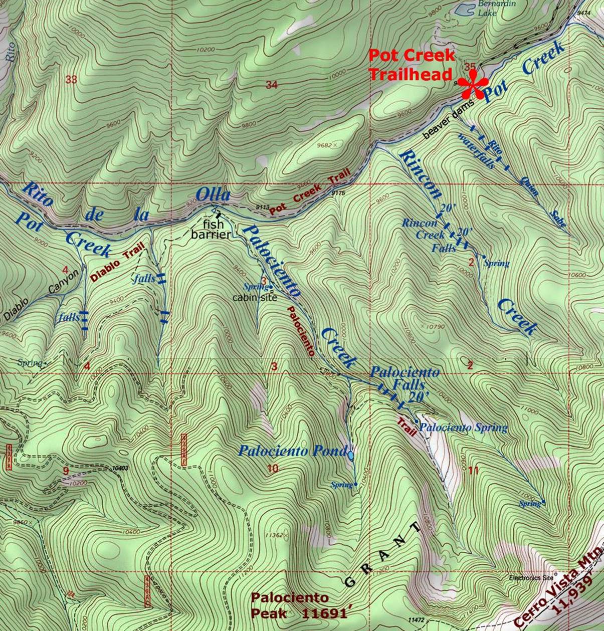
_______________ONE_MILE_______________
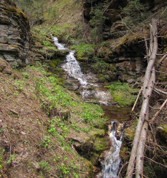
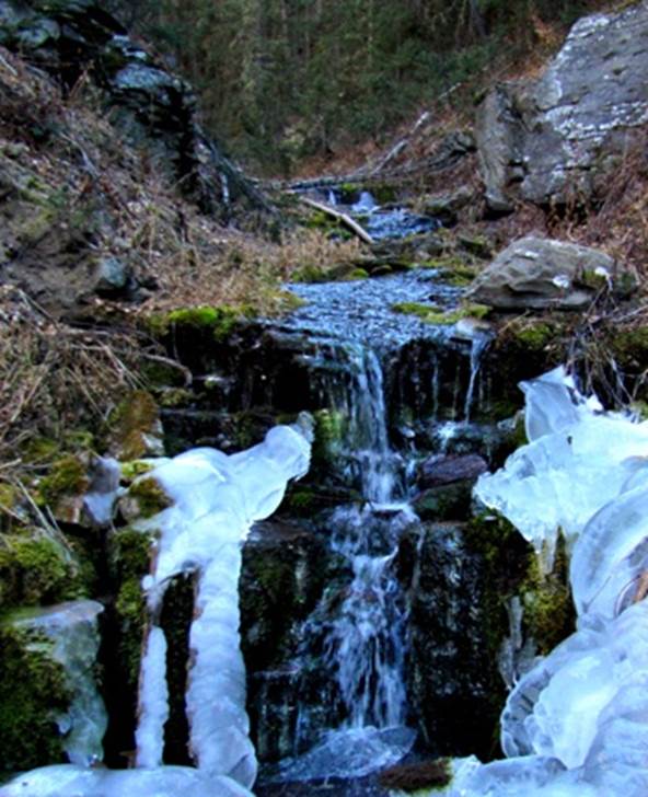
Photos of more waterfalls also on Palociento
Creek
This beautiful, two-tiered, 15’
high cascade is on Palociento Creek, downstream but close to the other
waterfalls
This 7-footer is upstream a short ways from the other waterfalls, shown here with Nov ice
Send questions and comments to dscott@TheMarbleSculptor.com