Waterfall
Creek Falls
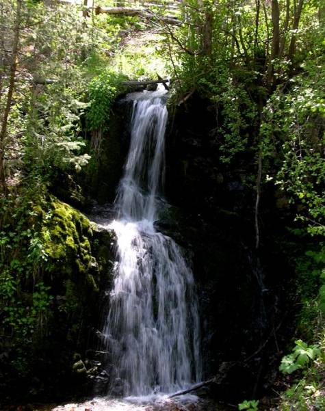
Waterfall
Creek Falls is a 25’ high two-tiered beauty
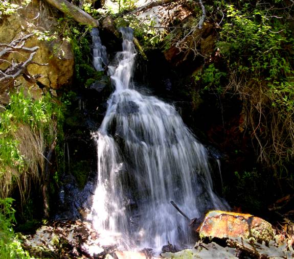
Upper
Waterfall Creek Falls is 20’ high and also has two tiers.
Scroll down to see more
photos below the map at the bottom of the page.
beta facts:
name- Waterfall Creek Falls and
Upper Waterfall Creek Falls
height- 25’ and the upper falls is
20’
elevation- 9600’ and the upper falls
is 10,000’
GPS coordinates- ±36°45.468’N
105°26.510’W and the upper falls are ±36°45.600’N 105°26.776’W
flow- perennial spring fed
season- June thru Oct… the early-bird will fight snow drifts but
will see the most powerful water-show
accommodations- Latir Peak Wilderness
ownership- Carson National Forest
access- is a short ½-mile bushwhack and a
harder ½-mile bushwhack to the upper falls
nearest town- Red River is about 10 miles
south of here and Questa is about 10 west of here
fun fact- people who only hike trails...
will never see these waterfalls...!!!
essay
bro
Waterfall Creek Falls are wonderful however
they involve a fairly difficult and slow going “bushwhack” type of hike... but
it is only about a third-of-a-mile from where you park your car...!!! Continuing on up stream another
third-of-a-mile will bring you to Upper Waterfall Creek Falls... and this is a
steep difficult bushwhack...!!!
Milepost 10 seems to be missing on the
Cabresto Creek forest road #134 and about one-tenth-of-a-mile past where it
should be is the best place to park.
Waterfall Creek is hard to see here.
It cascades down a steep tiny gully hidden with thick trees and bushes
very close to the road. You can easily
whiz past it without realizing it. Turn
up the small two-track road on the north side of the road to park your
wheels. Please make yourself a copy of
my map... Waterfall Creek Falls appear near the bottom.
Enhanced
National Geographic 7.5’ topo map
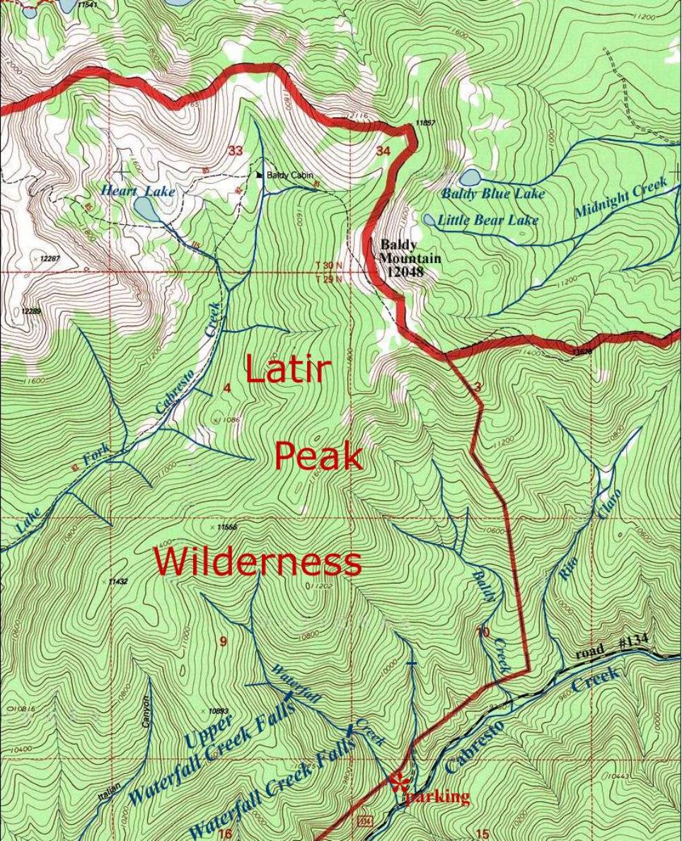
_____________ONE-MILE_____________
I climbed Baldy Mountain while I was there.
These photos are some of the nice views I saw from up
on top of Baldy.
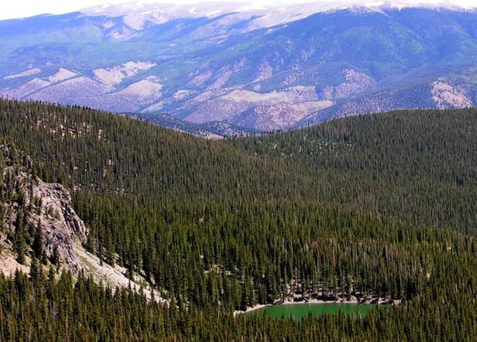
Baldy Blue lake looks more green than blue... New
Mexico’s 13000’ Big Costilla Peak is in the background.
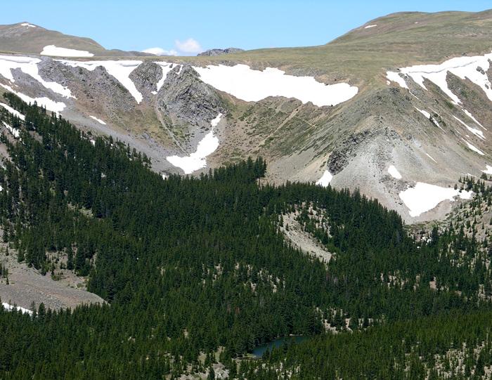
Mid-June snowfields linger on Latir Mesa above Heart
Lake as seen from Baldy Mountain.
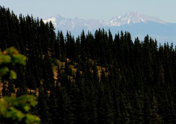
Little Costilla Peak 12,585’ is to the east, in the
beautiful Valle Vidal Area.
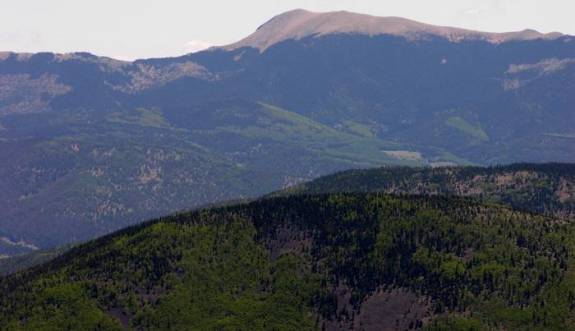
Colorado’s 14345’ Blanca Peak looms to the north
Send questions and comments to dscott@TheMarbleSculptor.com