Upper Cow Creek
Falls
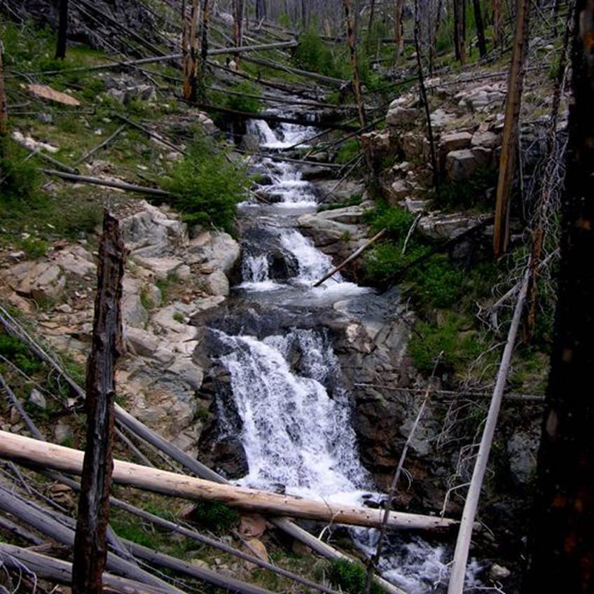
20’ high Upper Cow
Creek Falls ….after the fire. The falls above the main lower falls are 10
high and less…
beta facts:
name- Cow Creek Falls
height- 20’
elevation- 9300’
GPS coordinates- ± 35°43.470’N 105°35.440’W
flow- nice trout stream
season- summer and fall… earlier is better
accommodations- lots and lots of charred
logs
ownership- Santa Fe National Forest
access- 3-mile hike mostly down an old
closed logging road
nearest town- hmmm…. That is a good
question…??? …maybe Pecos some 20 miles
SW of here
interesting fact- this must have been a
way-good, beautiful place before the huge forest fire
essay bro:
The Santa Fe National Forest map lists the road into upper Cow Creek as #639… but up on the mountain the sign calls it #92… Good Luck…!!! Downed trees make for extremely difficult hiking off trail the last quarter mile to the falls…!!!
Enhanced
USGS 7.5’ topo map
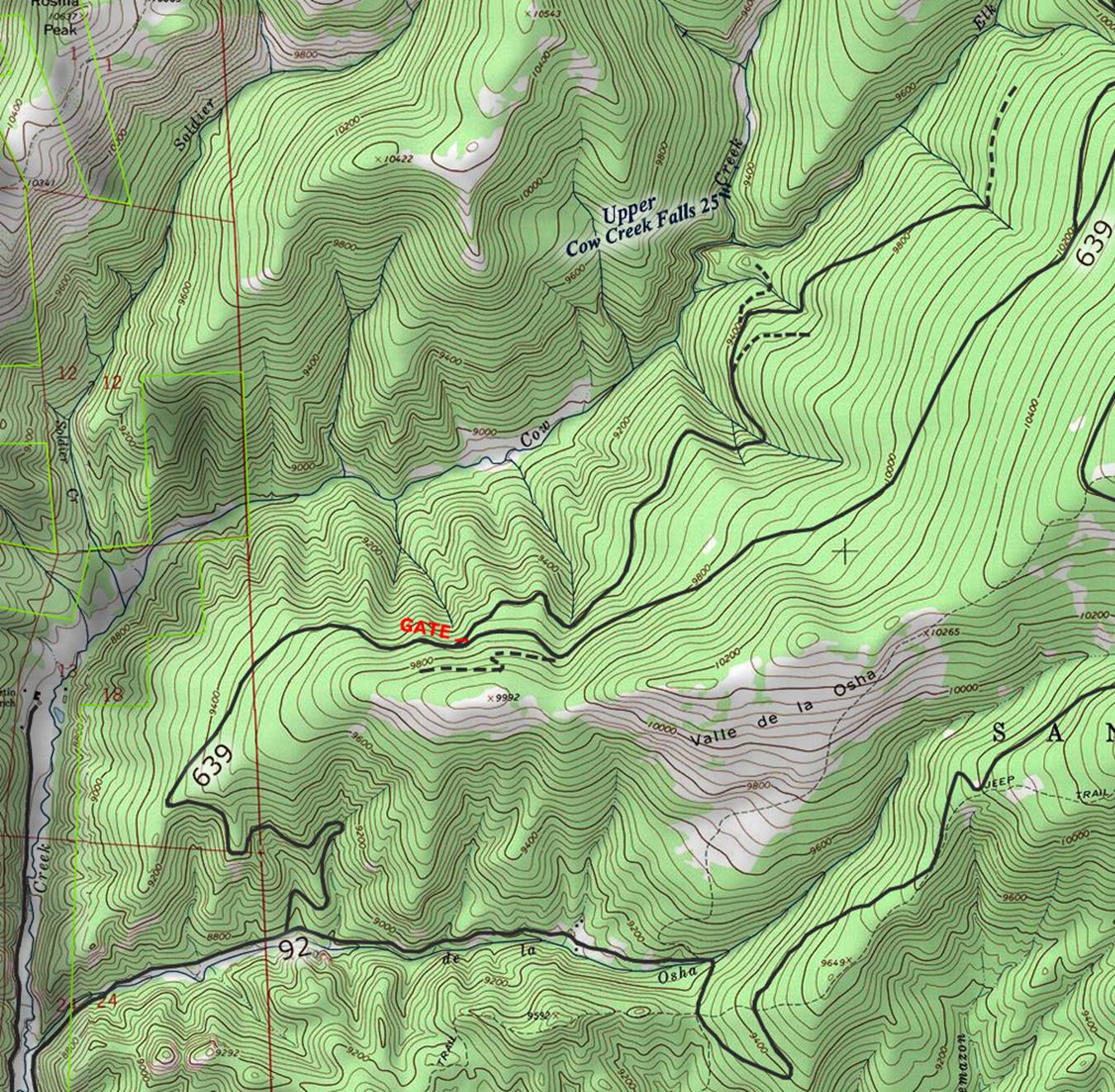
__________one
mile___________
Send questions and comments to doug.vivian@yahoo.com