Upper Beaver Creek Falls
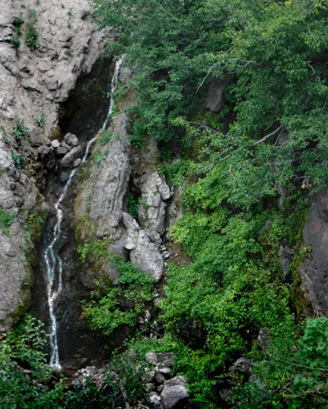
Upper Beaver Creek Falls is roughly 35’
high and very difficult to photograph without a sky-hook…!!!
I had to climb out onto the face a sheer cliffs to get this photo that doesn’t quite show the
entire waterfall… but most of it.
beta facts:
name- Upper Beaver Creek Falls
height- 35 feet
elevation- 9950’
GPS coordinates- ±36°55.041’N 106°20.081’W
flow- perennial
season- summer and fall
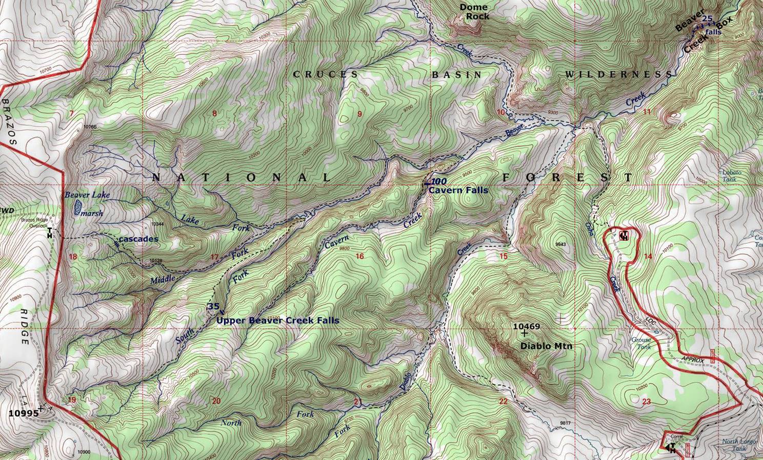
accommodations- none - Cruses Basin
Wilderness Area
ownership- Carson National Forest
access- see the map below
nearest town- Chama is about 15 miles west
of here
fun fact- nobody visits this waterfall
essay bro
I
accessed this waterfall from the west, parking at the Brazos Ridge Overlook
Trailhead. But
the Cruses Basin Wilderness Area is fairly small and any trailhead will get you
there. Cruses Basin W A has no official
trails. However, trails are abundant
there and always seem to go wherever you desire. Cruses Basin is likely the least visited
wilderness area in New Mexico. I love
it….!!!!
Upper Beaver Creek Falls is on the
South Fork of Beaver Creek. The trails
shown on our map below are fairly descent trails,
made and maintained by wildlife and cattle. No human made trails exist within the
wilderness area itself.
There is also a 25
foot high, quite steep, bedrock cascade downstream from Upper Beaver
Creek Falls… maybe 50 yards or so… as well as another (30 foot high or more)
cascade up near the Brazos Ridge Overlook parking…. On the Middle Fork Beaver
Creek.
Right-click-save-as
on our map below, to print your own “hand-held” copy for your hike
Enhanced USGS topo map
Send questions and comments to dscott@themarblesculptor.com