Taos
Cone Creek Cascades
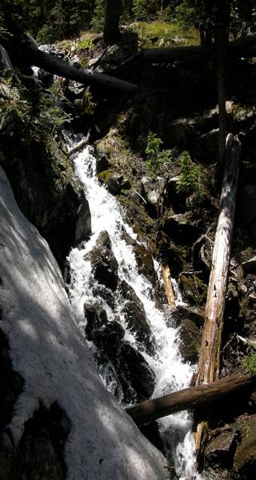
This
is the top 30 feet of 300’ high Taos Cone Creek Cascades
beta facts:
name- Taos Cone Creek Cascades
height- 300’ cascades
elevation- 11,200’
GPS coordinates- ±36°33.604’N 105°23.012’W
flow- perennial
season- June thru Oct… the early bird will fight snowdrifts but will
see the most powerful water-show
accommodations- Wheeler Peak Wilderness
ownership- Carson National Forest
access- 2¾ miles on East Fork Trail #56
then upstream bushwhack for about a mile see map below
nearest town- Red River is about 11 miles
North of here
fun fact- people who never leave the trail,
never see these cascades
essay bro
This is a very high and beautiful cascade…
but really only the top 30’ falls over bedrock… the rest cascades over alluvial
fill. The World Waterfall Data Base
standards state that an alluvial base does not make a waterfall, but rather a
waterfall must flow over exposed bedrock.
Right-click-save-as
to make yourself a copy of our map below
To see a larger, updated and
more detailed map of this entire Wheeler Peak Area, click here: http://www.dougscottart.com/hobbies/waterfalls/TaosMtnsSEquad.htm
and here: http://www.dougscottart.com/hobbies/waterfalls/TaosMtnsMap.htm
Enhanced USGS 7.5’ topo map
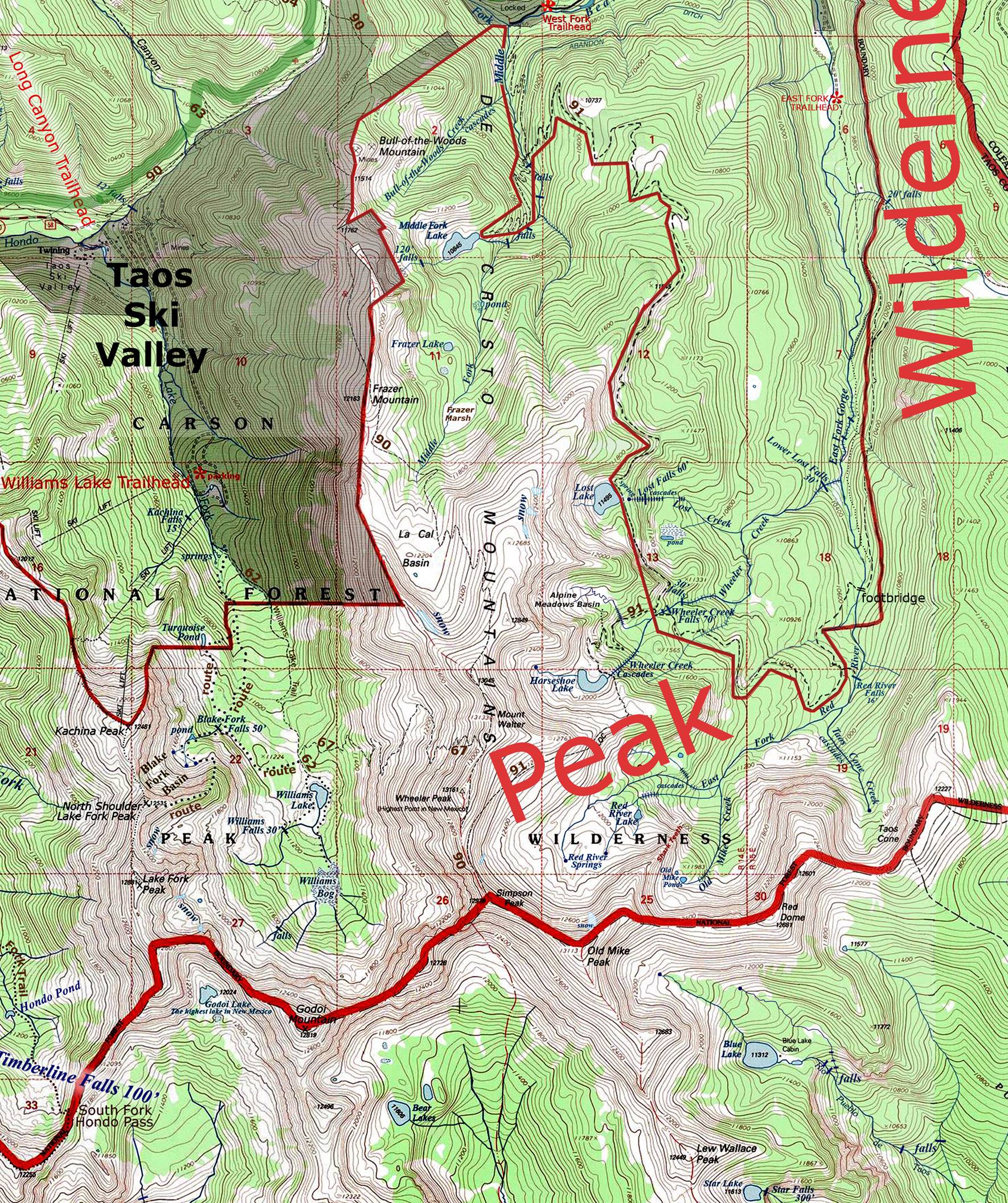
__________ONE-MILE__________
Send questions and comments to dscott@TheMarbleSculptor.com