Spruce
Creek Cascades
The
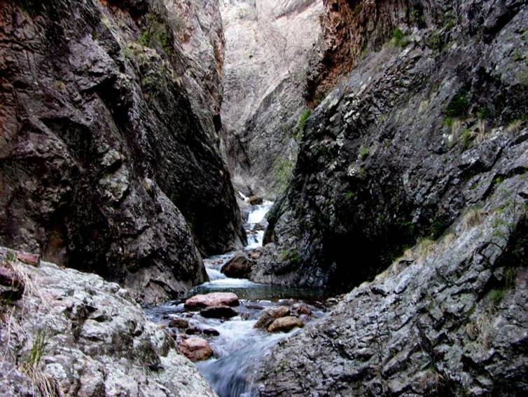
Spruce Creek “Box” is a canyon lovers delite...!!!
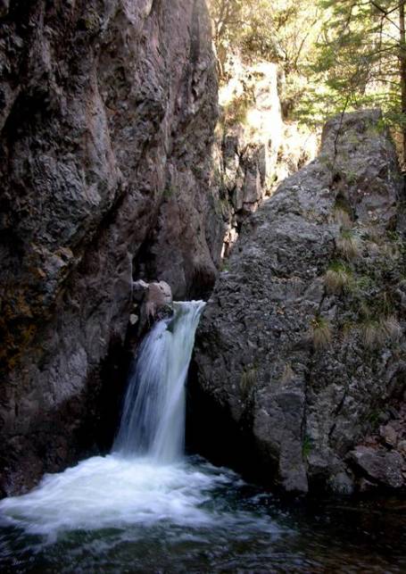 ...a
sweet little 15 footer
...a
sweet little 15 footer
Spruce
Creek Box 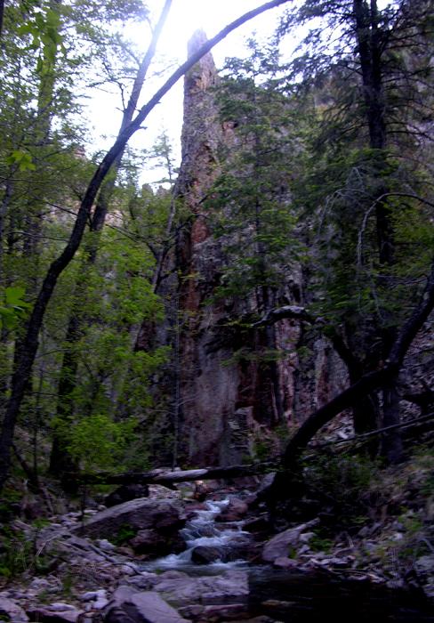 at
sunrise...
at
sunrise...
beta facts:
name- Spruce Creek Cascades
height- 15 to 20 feet are the highest
waterfalls here but the entire cascade drops about 150’ in a few 100 yards
elevation- 6950’
GPS coordinates- ±33°17.594’N 108°43.319’W
flow- perennial trout stream
best season- wet times like Memorial Day of a
wet year or July and August rainy season
accommodations- Gila Wilderness
ownership- Gila National Forest
access- 7 miles on trail
with some bushwhacking and game trails
nearest town- Glenwood is about 10 miles west of
here
fun fact- Gila high country’s BEST…!!!!! …but
hard to get to…!!!!!
essay bro
Spruce Creek Cascades cut thru the Spruce
Creek Box Canyon. We found no waterfalls
on Spruce Creek more than about 15 to 20 high.
However they are extra beautiful within the “Box” because the canyon
walls are sculpted and sheer for hundreds of feet overhead. This is a delightful place.
We did not have time to explore the “slot
canyon” farther up stream, but it likely holds
beautiful waterfalls of it own. In fact every tributary is highly likely
waterfall canidates because this whole area is
waterfall prone. Especially
the two upper creeks that parallel Crevice Creek flowing off the north slopes
of 10,643’ Black Mountain. 400’
high Crevice Falls here are great significance and splendid eye candy. It is best to view Crevice Falls from the
opposite side canyon outcroppings.
Hanging Rock Trail and Silver Drip Trail
are the two most direct routes into the upper Big Dry Creek drainage. Both have been abandon
by the National Forest Service. We will
soon loose these “two most spectacular trails of the Gila Wilderness”. They are both marked on the map below as
“unmaintained trail”. If we
outdoor-people use these trails and care for them each
time we hike them... they will be preserved... otherwise they will be lost.
Click this link
to open a new updated & enlarged map: http://www.dougscottart.com/hobbies/waterfalls/BigDryMapN.htm
Spruce Creek Cascades are
found in the middle of the map below.
Enhanced
USGS 7.5’ topo map
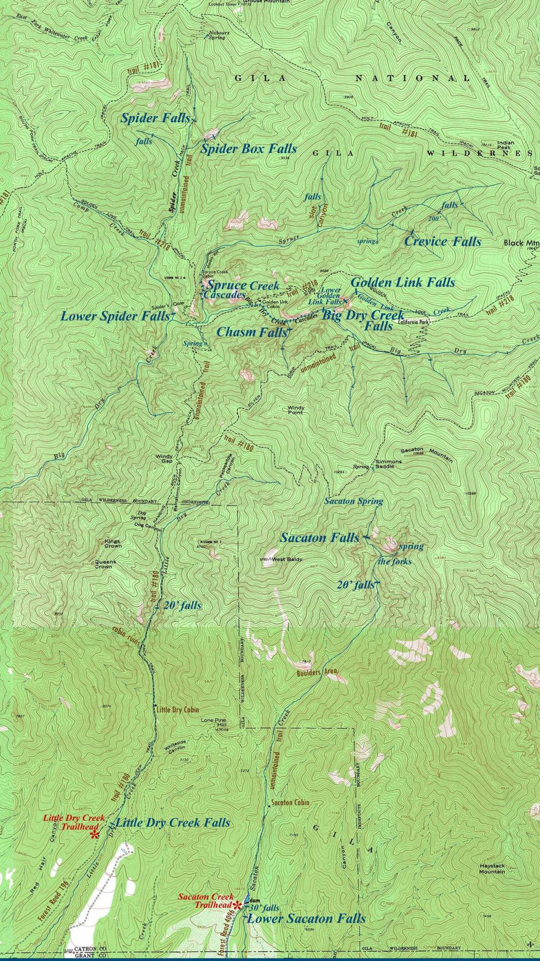
______ONE MILE______
This upper Big Dry Creek area this some of New Mexico’s best
waterfalls...!!!
Send questions and comments to dscott@TheMarbleSculptor.com