B-9Slide
Falls
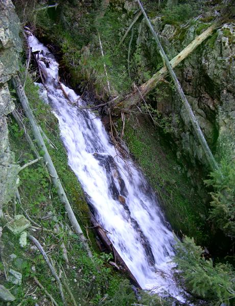
30’
Slide Falls is a tributary to South Fork Rio Hondo
beta facts:
name- Slide Falls
height-30’
elevation- 9900’
GPS coordinates- ±36°33.589’N 105°27.985’W
flow- perennial
season- Late May & June are best and it
freezes up in November
accommodations- none – Wheeler Peak Wilderness
ownership- Carson National Forest
access- 3½–mile hike on very poor hard-to-follow
game trails up South Fork Rio Hondo
nearest town- Taos Ski Valley is about 3 miles
north of here
fun fact- This is the least visited portion of
Wheeler Peak Wilderness
essay bro
To avoid trespass, the private land of Taos
East must be circumvented. This is a
very difficult task, but the north side is easier than the south side. Hopefully a trail will be pushed into this
area in the near future.
The two creeks called Rescue Creek, on the
map below, are where the Taos Ski Valley Ski patrol find
those who ski too far
out-of-bounds and end up on the wrong side of the
mountain. Broken Waters Creek flows down
from the Tummy of the
Pregnant Lady Mountain.
Please see the photo at the bottom of this page and you will understand
why this mountain received the name “The Pregnant Lady”.
Enhanced
National Geographic 7.5’ topo map
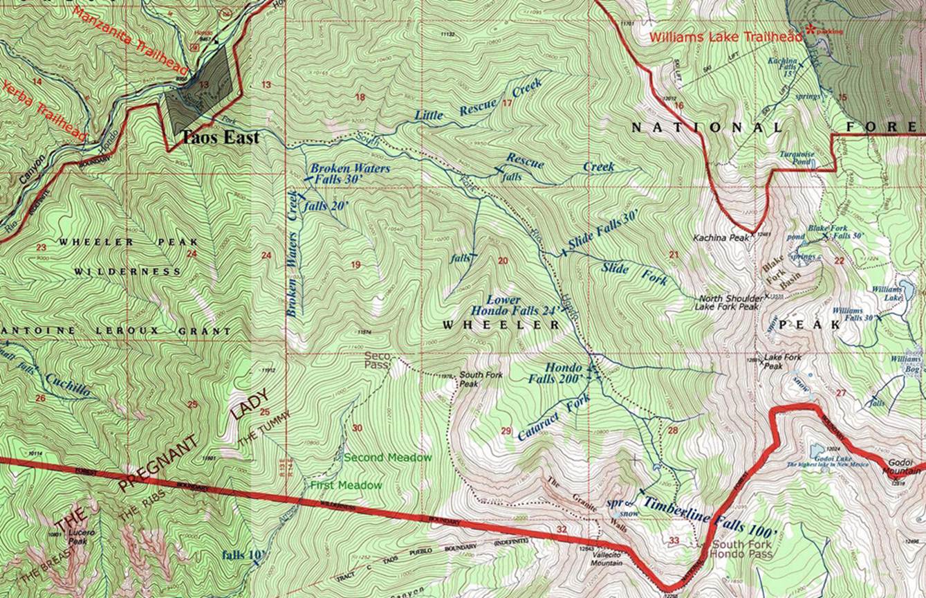
_____ONE_MILE______
The Pregnant Lady Mountain as seen from Taos. She is lying on her back here beyond Cid’s Food Market. You can see her breast, ribs and tummy very well in this photo.

Send questions and comments to dscott@TheMarbleSculptor.com