Slate
Creek Falls
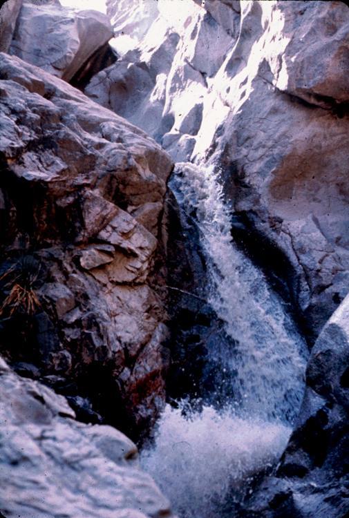
Slate Creek tumbles down a 75’ high falls that lands in the
Gila River.
This is a wonderfully sculpted falls that twists, twirls and
leaps wildly about.
Chuck
Henderson photo
beta facts:
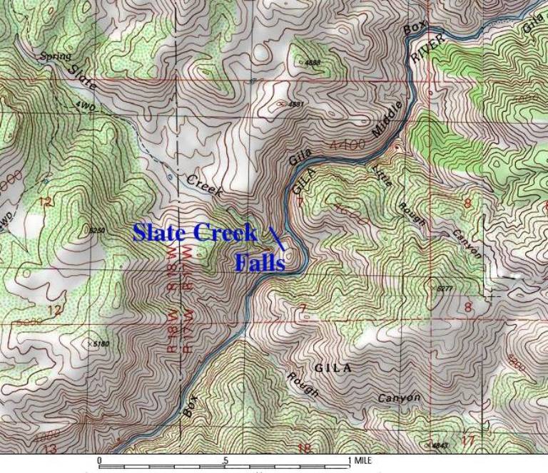
name- Slate Creek Falls
height- 75’
elevation- 4200’
GPS coordinates- ±32°45.205’N 108°38.388’W unverified in the
field
flow- perennial spring fed
season- anytime
accommodations- nothing but mountain lions
ownership- Gila National Forest
access- This waterfall would be a total
nightmare to find by any method other than a float trip
down the Middle Box of the Gila River
nearest town- Red Rocks is maybe 15 miles
east of here
fun fact- this is as far back into nowhere
than anywhere is
This is a beautiful waterfall
Enhanced
National Geographic 7.5’ topo map
Send questions and comments to doug.vivian@yahoo.com