Sawmill
Creek Falls
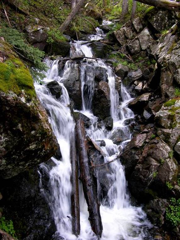
20’ high Sawmill Creek Falls
beta facts:
name- Sawmill Creek Falls
height- 20’
elevation- 10,100’
GPS coordinates- ±36°35.906’N 105°22.771’W
flow- perennial
season- May thru Oct but earlier is more
water
accommodations- Wheeler Peak Wilderness
ownership- Carson National Forest
access- ¾ mile trail and game trails
nearest town- Red River is about 8 miles
north of here
fun fact- sawmill…??? Where…??? This is wilderness. Hey our forefathers worked really hard.
essay bro
This is a rarely visited pleasant little
waterfall… enjoy my map below. Sawmill
Falls is on the far right-hand side of the map below… and this upper Red River
area has many beautiful waterfalls…!!!
Right-click-save-as
to make yourself a copy of our map below
To see a larger, updated and
more detailed map of this entire Wheeler Peak Area, click here: http://www.dougscottart.com/hobbies/waterfalls/TaosMtnsSEquad.htm
and here: http://www.dougscottart.com/hobbies/waterfalls/TaosMtnsMap.htm
Enhanced USGS 7.5’ topo map
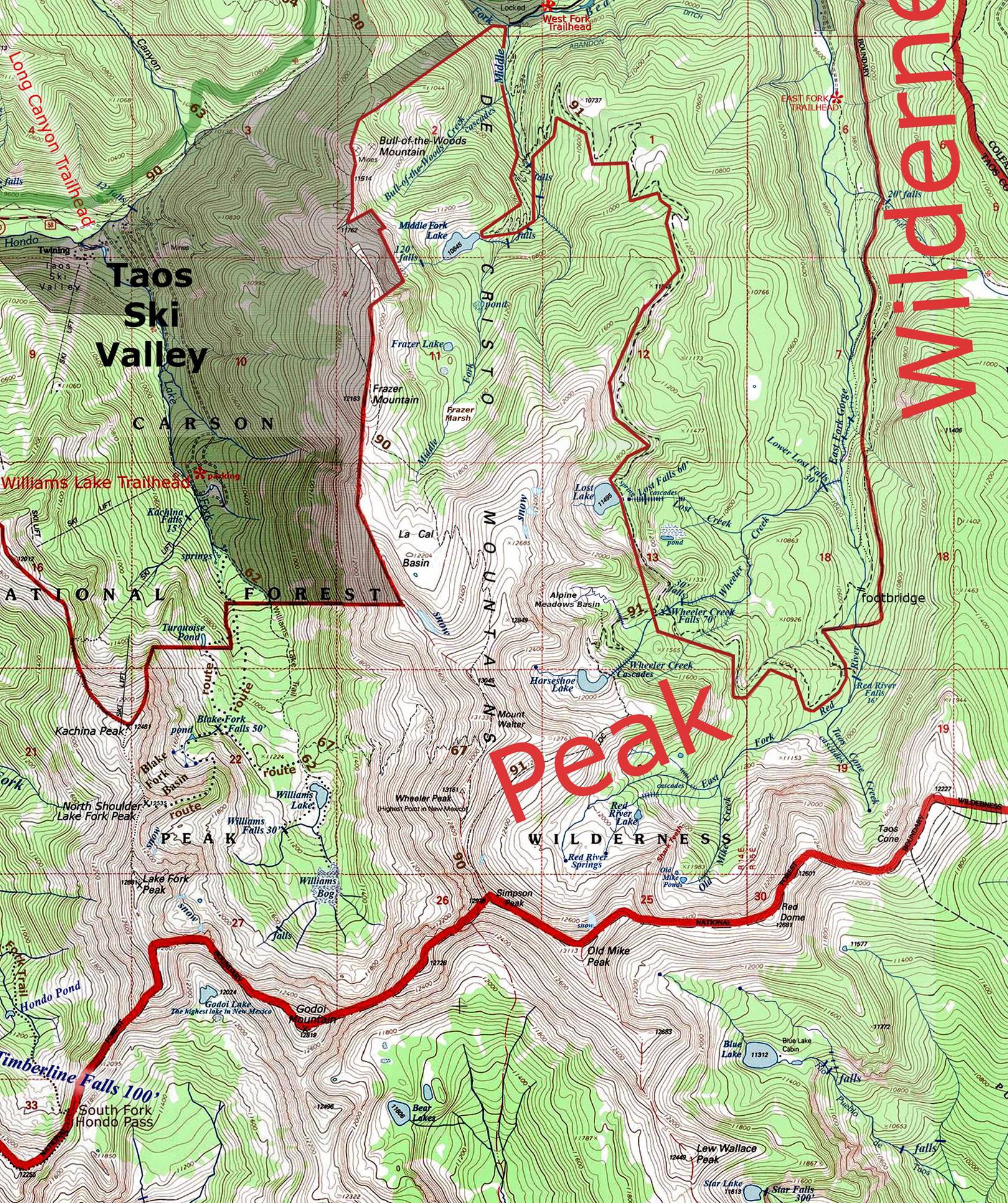
_____________ONE-MILE_____________
Send questions and comments to dscott@TheMarbleSculptor.com