Sanchez
Falls
beta facts:
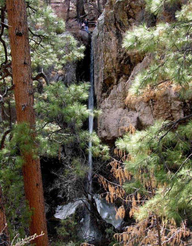
name- Sanchez Falls
height- 100’
elevation- 6400’
GPS coordinates- ±35°43.500’N 106°22.900’W
flow- perennial
season- spring, summer and fall
accommodations- none
ownership- public – Santa Fe National
Forest
access- a 1.2-mile hike from forest road
289
nearest town- Cochiti Lake is 7.5 miles
southeast of here
fun fact- this is a good one…!!!!
essay bro:
Between
Santa Fe and Albuquerque on I-25, take exit 264 into Cochiti. Follow Cochiti
Highway (Hwy 22) north past Cochiti Lake. After 2.8 miles, turn right onto
Forest Rd 289 (the gate is not always open.) A high clearance vehicle is needed
to drive 289. Follow the Forest road (3.5 miles) to a small parking space on
the right side of the road next to a Dome Wilderness sign. This is the
beginning of the Canada-Capulin Trail, #118.
Follow
the Canada Capulin Trail past the abandoned Eagle Pumice Mine. You almost
immediately drop into Eagle Canyon. After climbing out of Eagle Canyon, you enter
Bandelier National Monument. You pass a pumice pit soon. Soon after this the
trail descends into Sanchez Canyon. A permanent streams flows at the bottom on
the canyon. You reach it 1.2 miles into the hike. The 100 foot high waterfall
topples down a rock face to the right of where the trail meets the stream.
Cross the stream and follow the trail out of Sanchez Canyon. The waterfall is
visible on the trail out of the canyon, and is at its best during the spring
runoff.
description by: Rob Weiner
Enhanced
National Geographic 7.5’ topo map
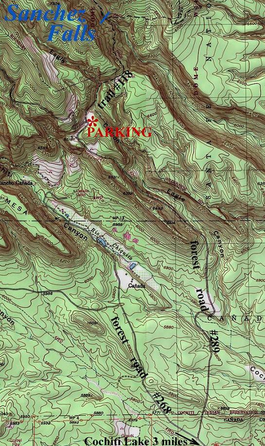
one
mile = approximately2.5 inches
Send questions and comments to doug.vivian@yahoo.com