Sacramento
Creek Falls
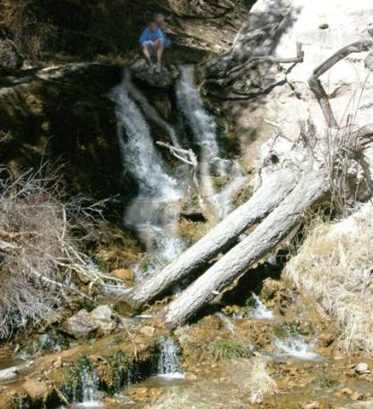
Brandy and Echo contemplating a leap over the falls
beta facts:
name- Sacramento Creek Falls
height- 13’
elevation- 7800’
GPS coordinates- ±32°42.860’N 105°45.300W
flow- perennial
season- anytime
accommodations- paved parking and restrooms
ownership- Lincoln National Forest
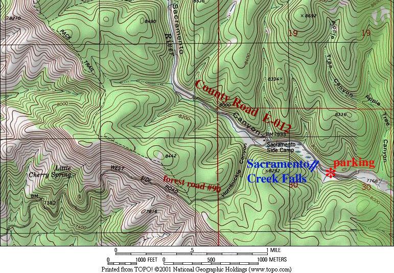
access- ¼ mile hike up stream
nearest town- Sunspot is 7 miles north of
here on county road E-012
fun fact- we were just driving down the
road minding our own business… and a sign
said the word waterfall
Enhanced
National Geographic 7.5’ topo map
Send questions and comments to doug.vivian@yahoo.com