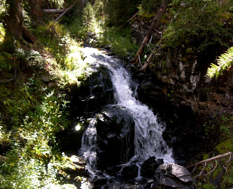
Red
River Falls
Red River Falls is only
about 20 feet high but its beauty and seclusion are exceptional.
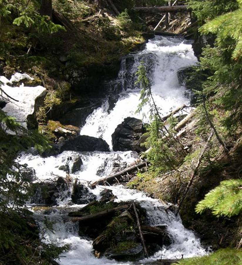
Red River Falls above is during high water
(June) and below is a low water photo (September).
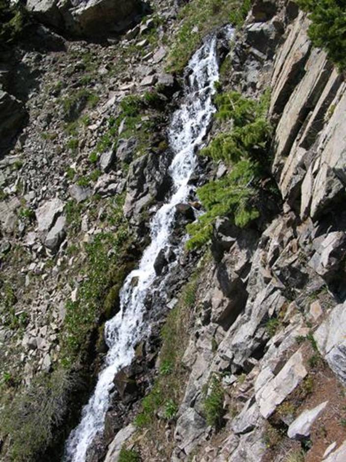
Upstream about a mile and a half above Red
River Falls you’ll find these 200’ high and steep Red River Cascades.
See the topo map below.
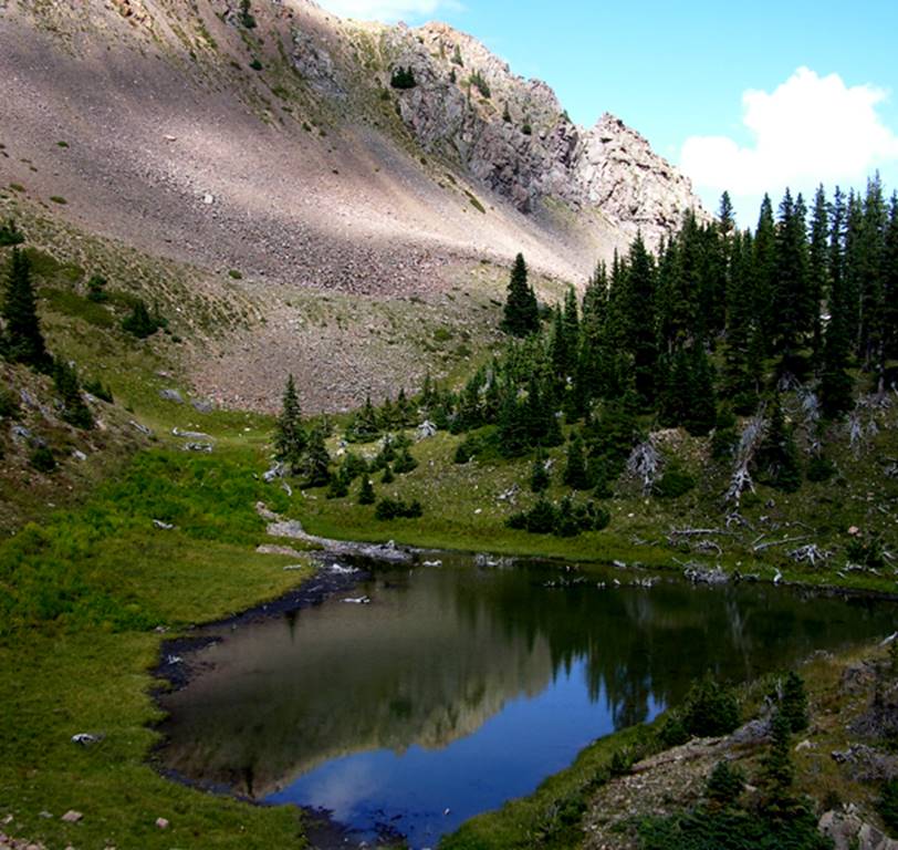
...and above the cascades are a couple
small but beautiful timberline lakes...
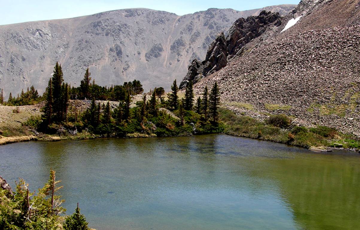
Above is Red River Lake & below is Old
Mike Pond... the “Sharkteeth” rocks between the
lakes, show in both photos.
beta facts:
name- Red River Falls
height- 20’
elevation- 10,700’
GPS coordinates- ±36°33.914’N 105°22.925’W
flow- a healthy perennial trout stream
season- June thru Oct… the early bird will fight snowdrifts but will
see the most powerful water-show
accommodations- Wheeler Peak Wilderness
ownership- Carson National Forest
access- 3 miles on East Fork Trail #56 then
bushwhack for about ¼ mile see map below
nearest town- Red River is about 11 miles
North of here
fun fact- people who never leave the trail,
never see this waterfall
essay bro
This is a nice waterfall
Make yourself a copy of my map and please
enjoy all of the many waterfalls of the upper Red River. They’re some of New Mexico’s best…!!!
Red River Falls is in the far right-hand
side of the map below.
Right-click-save-as
to make yourself a copy of our map below
To see a larger, updated and
more detailed map of this entire Wheeler Peak Area, click here: http://www.dougscottart.com/hobbies/waterfalls/TaosMtnsSEquad.htm
and here: http://www.dougscottart.com/hobbies/waterfalls/TaosMtnsMap.htm
Enhanced USGS 7.5’ topo map
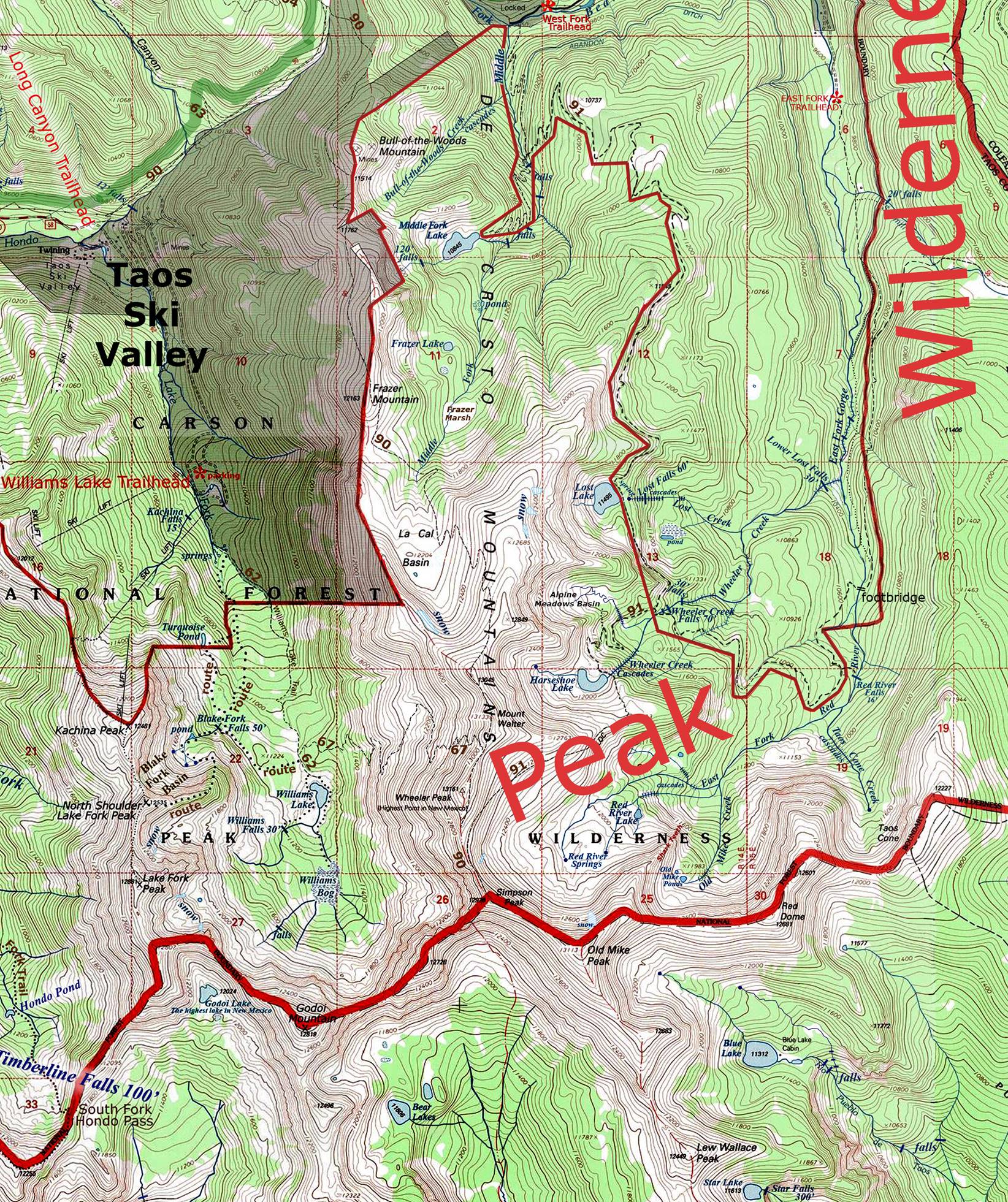
__________ONE-MILE_________
Send questions and comments to dscott@TheMarbleSculptor.com