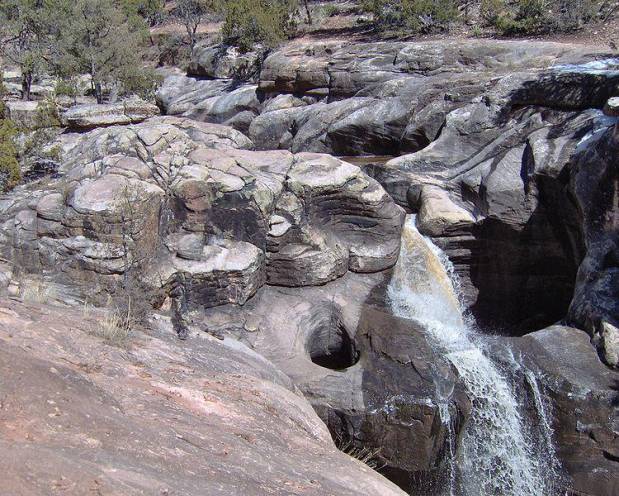
Ramah
Falls AKA-
“The Falls”… as well as Cebolla Creek Falls
beta facts:
name- Ramah Falls …AKA- “The Falls” …AKA-
Cebolla Creek Falls
height- many waterfalls here up to 25’ high
elevation- 7300’
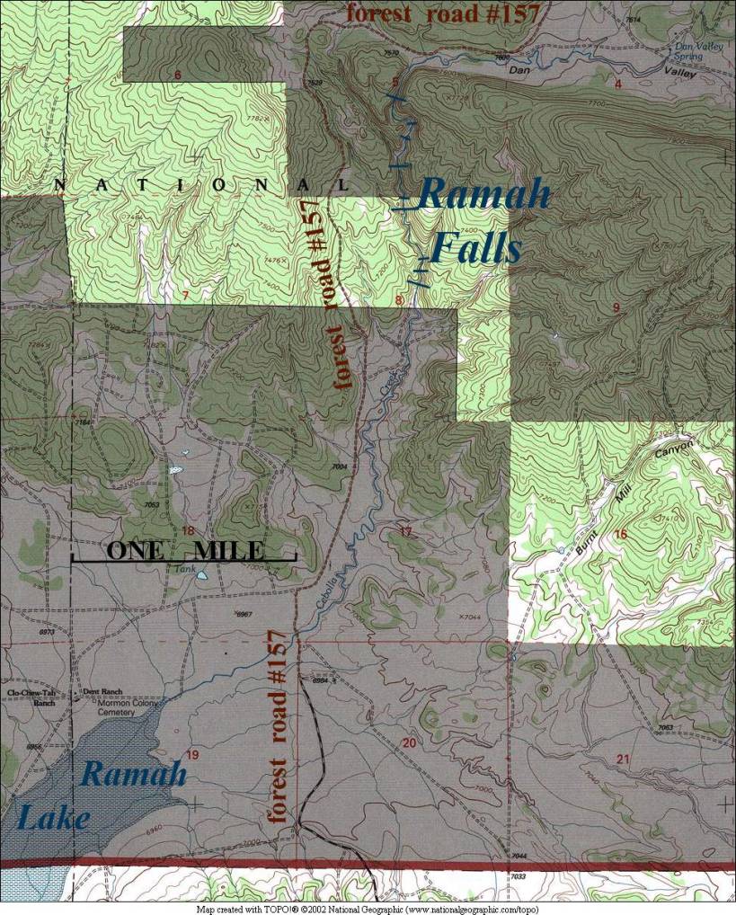
GPS coordinates- 35°12.467’N 108°26.581’W
flow- good during wet years and good during
wet seasons of other years
season- spring is best and late summer
rainy season is often good… April and August are best
accommodations- not much around… better
bring your own
ownership- Cibola National Forest
access- easy no-trail hike near forest road
157
nearest town- Ramah is about 6 miles SW of
here
fun fact- …a very beautifully sculpted
bedrock creek bed
essay bro
Wikimedia desribes and lists this place as
“Ramah Falls”. These waterfalls
are wonderful …when they have water.
They are sculpted with curves, circles and deep potholes. This is a one-mile stretch of continuous waterfalls. It is largely private land. Please respect ALL PRIVATE LAND whether
it is posted or not...!!!
Some of these land owners have contacted me with legitament concerns of litter. Please respect the earth and DO NOT TRASH IT...!!!!!
Enhanced
National Geographic 7.5’ topo map
Send questions and comments to dscott@TheMarbleSculptor.com