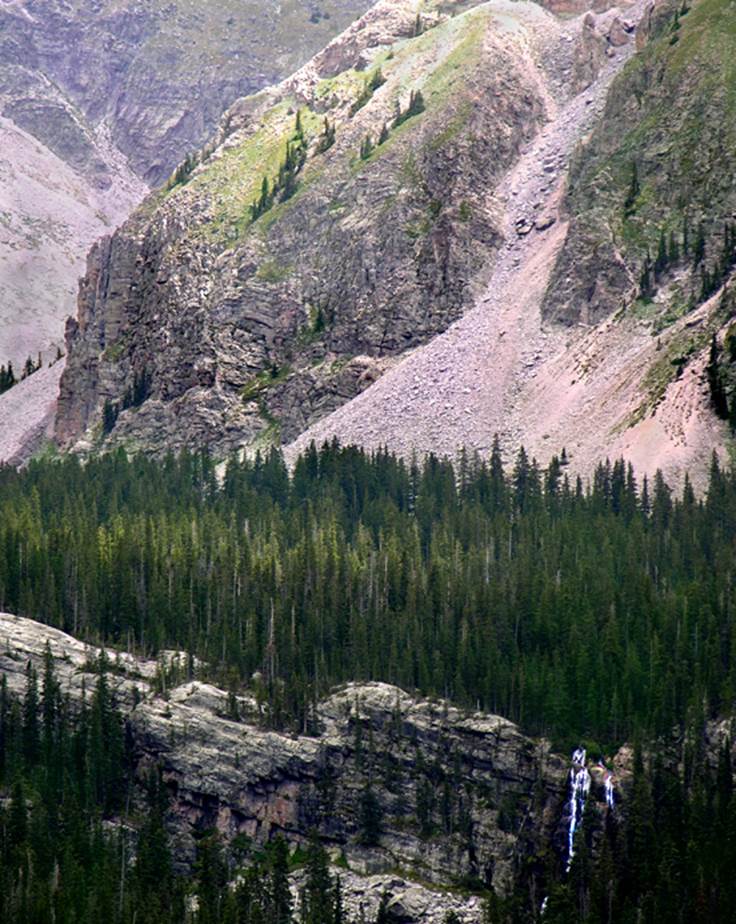
Quemado Falls
Many consider this to be New Mexico’s BEST waterfall…!!!
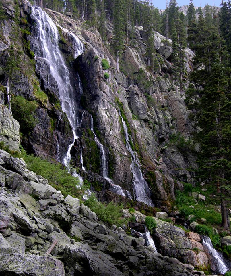
Quemado Falls dances down the west slopes of the
Pecos Wilderness under the 13,000’ Truchas Peaks. We have gps’d Quemado Falls to be 132’ high.
See Hunky Dory Lake & Falls photos at
the bottom of this page... as well as some of the other lakes in this area-
beta facts:
name- Quemado
Falls
height- 132’
elevation- 11,100’
GPS coordinates- ±35°59.030’N 105°39.130’W
flow- strong perennial flow
season- summer and fall
accommodations- none – within the Pecos Wilderness
ownership- public – Santa Fe National Forest
access- 8½-mile hike after 8 miles of narrow dirt
road
nearest town- Truchas is 12½ miles west of here
fun fact- you have to work for this one
essay bro:
Quemado Falls is among New Mexico’s Best
waterfalls. It puts on a spectacular
show in its own peculiar style. It has a
special beauty. We have gps’d Quemado Falls to be 132’
high… while the water is still white and cascading a hundred or more feet
elevation below here... a waterfall is “bedrock” and not alluvial fill with
boulders. The cascades below only
magnify Quemado’s majesty. The Truchas Peaks above Quemado
Falls are New Mexico’s answer to awesome Rocky Mountain Grandeur ....and...
Deep snow here, is difficult to deal with until late
June.
There is no
longer any easy way to hike into Quemado Falls. Forest road # 667 turns into a privately
owned road when it climbs up away from the stream above the town of
Truchas. From this point on ALL of the
roads are on a Spanish Land Grant, thus... private land.
A large steel gate displays a NO TRESSPASSING sign
here. Obey
this sign.
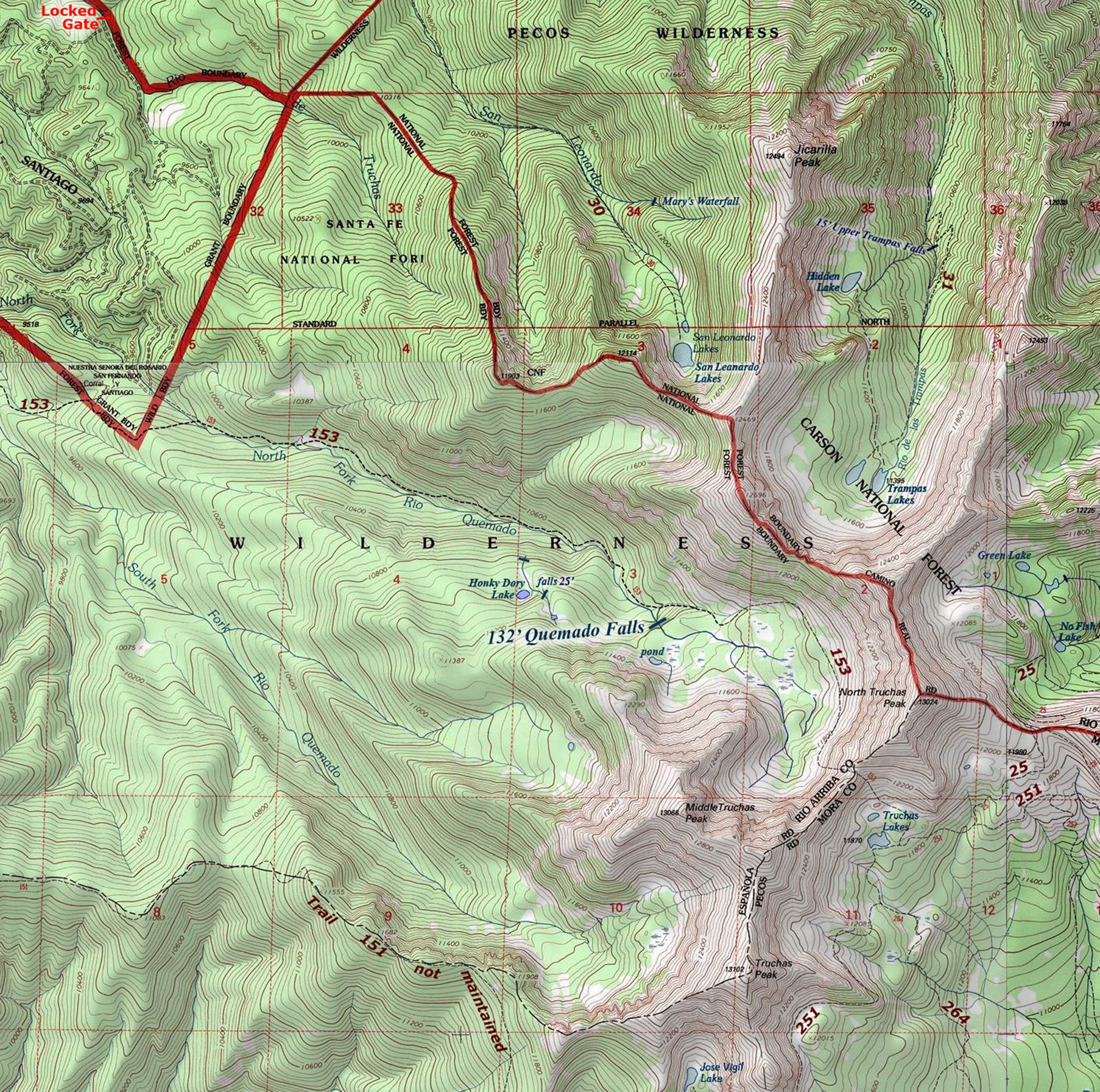
The
Forest Service suggested way to visit Quemado Falls,
is via Trail 153 from Quemado Trailhead - See the map
below. This totals about 8.5 miles
one-way in to Quemado Falls. This 8.5 miles
involves a lot of vertical...to the tune of about 3500’ ascent along with
almost 2000’ descent between your wheels and Quemado
Falls.
This is a
lot of vertical...!!!
Right-click-save-as on our map to have and
print your own hard copy
Enhanced
National Geographic 7.5’ topo map
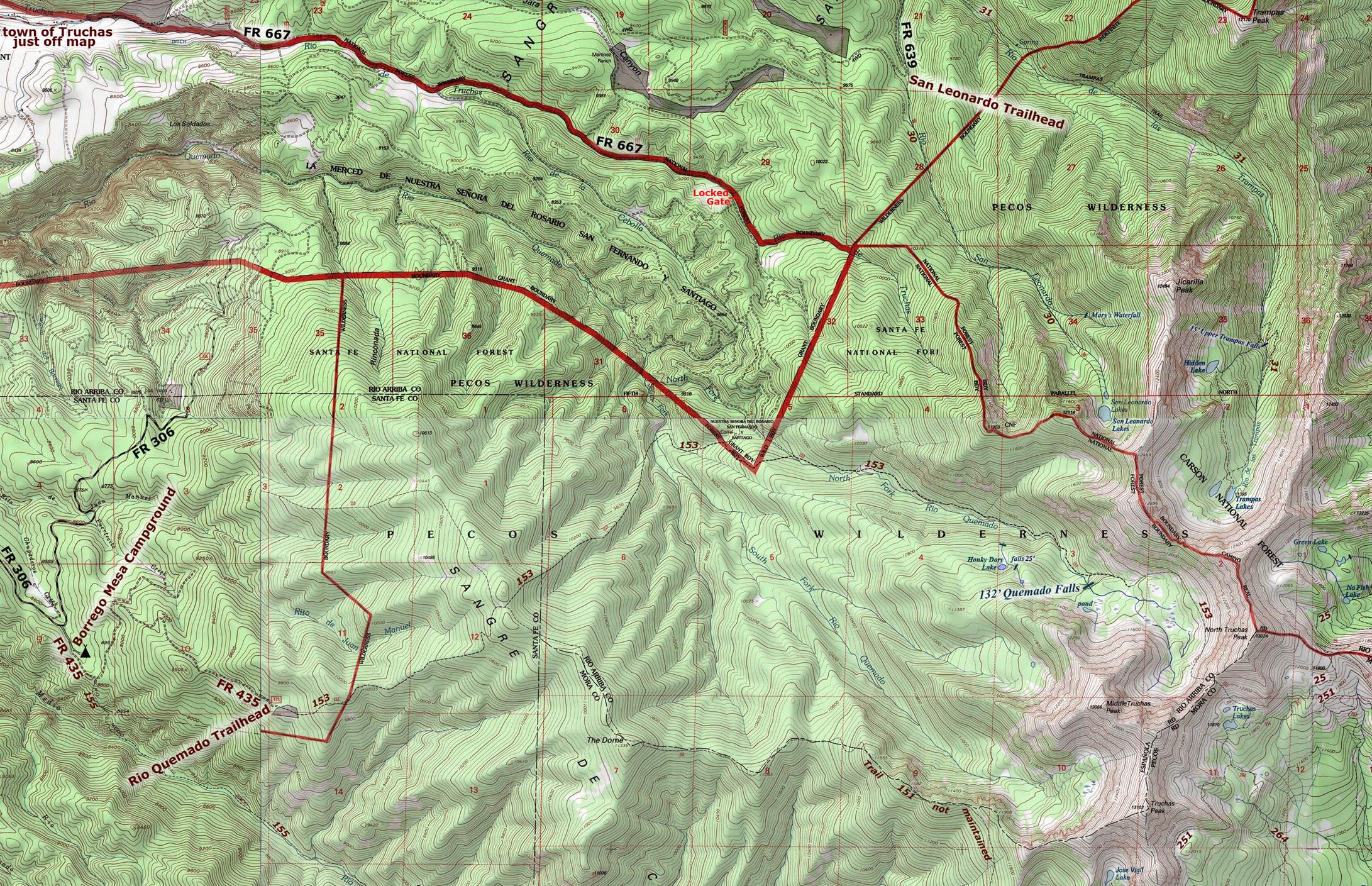
The
thin red lines shown above are section lines and represent one
mile.
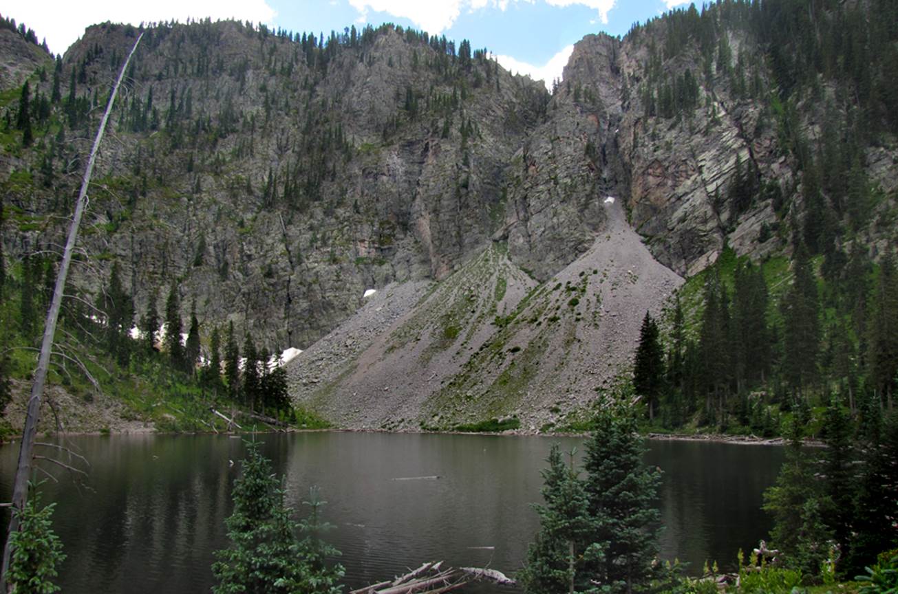
Hunky Dory Falls 25’ high
Hunky Dory Lake –
see map above
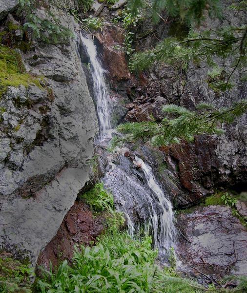
Hunky Dory Lake
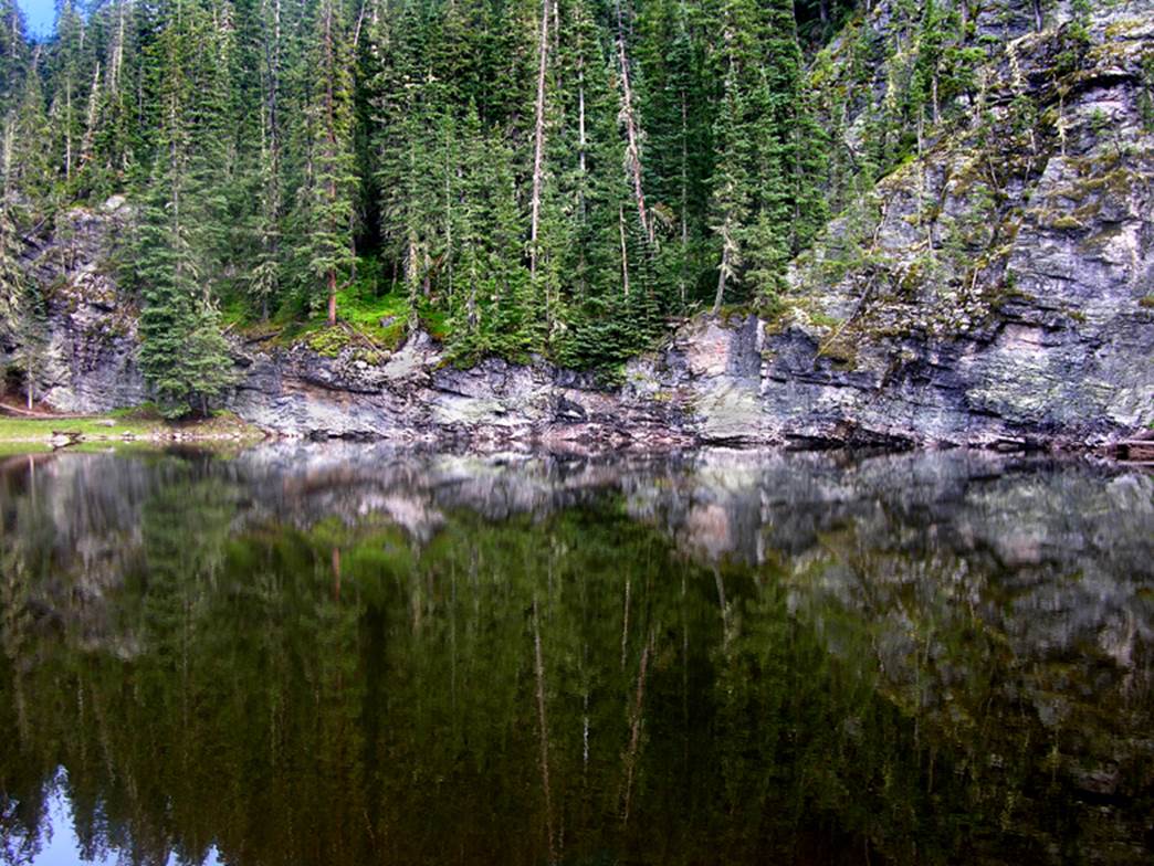
See why we call this “Green Lake” ...she’s a beauty
to behold...!!!
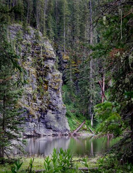
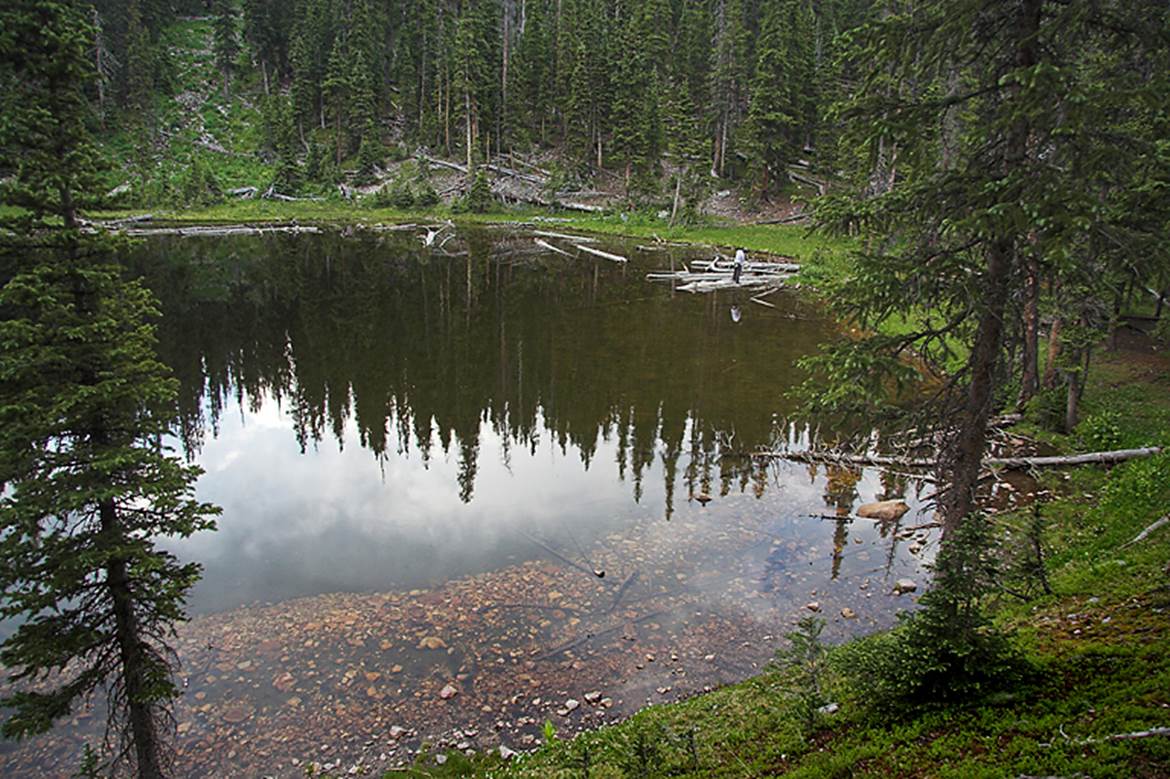
Below is the
“pond” at Quemado Falls
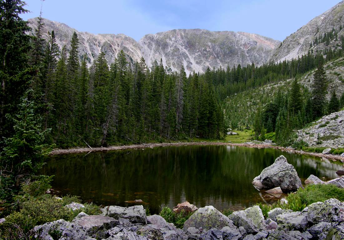
...and San
Leonardo Lake is a cathedral at timberline...!!! ...and has the largest
perennial snow-fields in New Mexico -photo: August 2016
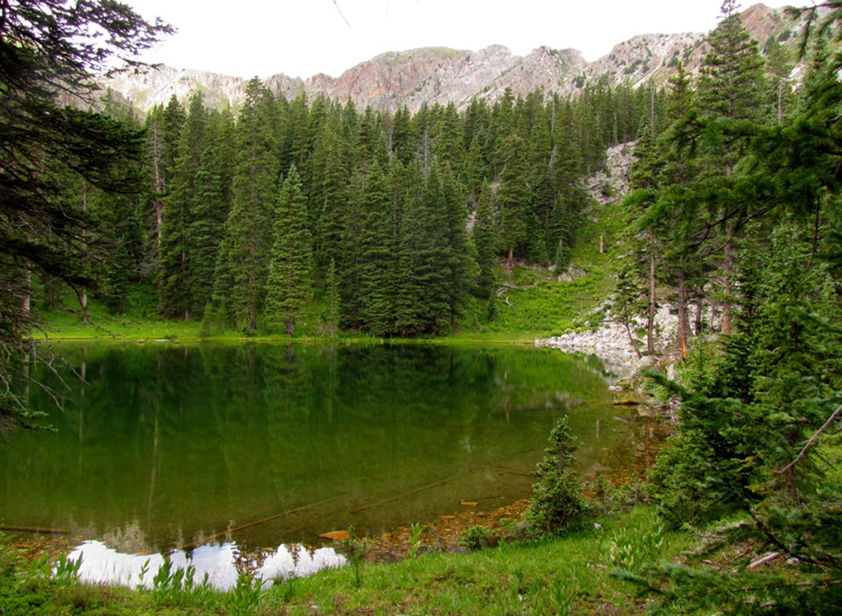
-the upper end of No Fish Lake...
Enlarged map of Truchas
Peaks area
Right-click-save-as on our map to have and
print your own hard copy
Send questions and comments to dscott@themarblesculptor.com