Ortega
Falls
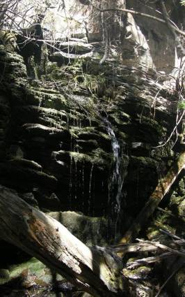
Left-hand side of Ortega Canyon Falls
15’
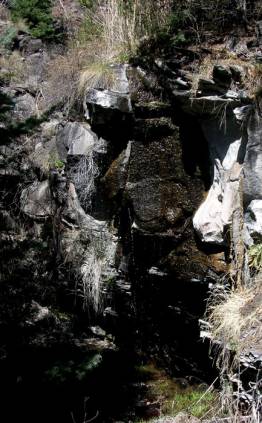
Right-hand side of Ortega Canyon Falls 25’
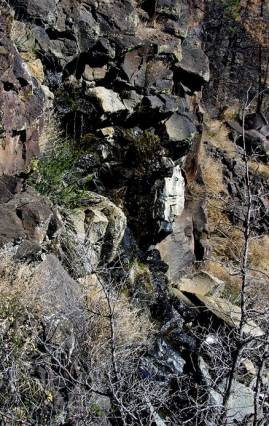
Ortega Mesa Falls 60’ high
May
of 2009 was kinda dry around these parts… so these beautiful waterfalls were
only trickling
beta facts:
name- Ortega Falls
height- Ortega Canyon Falls right side 15’
high, left side 25’ high… Ortega Mesa Falls 60’ high
elevation- 7400’
GPS coordinates- Ortega Canyon Falls -
±36°18.506’N 104°57.648’W
Ortega Mesa Falls - ±36°17.528’N
104°56.405’W
flow- minimal
season- spring, summer & fall
accommodations- none
ownership- New Mexico State Land
access- 4WD road then trail-less hiking
…see map below
nearest town- Rayado is about 5 miles north
of here
fun fact- very, very few people ever visit
this place
essay bro
I hiked here in early May of 2009…
some-what of a dry year. Ortega
Mesa was covered with Wild Iris that was not yet in bloom and a herd of 30 elk
grazed 50 yards east of me. What a
deliteful place this is. A special
use permit for recreation is required to legally enter these beautiful state
owned lands. This permit can be
purchased for $25 a year from the New Mexico State Land Office at 310 Old Santa Fe
Trail PO BOX
1148 Santa
Fe, NM 87504.
Enhanced
National Geographic 7.5’ topo map
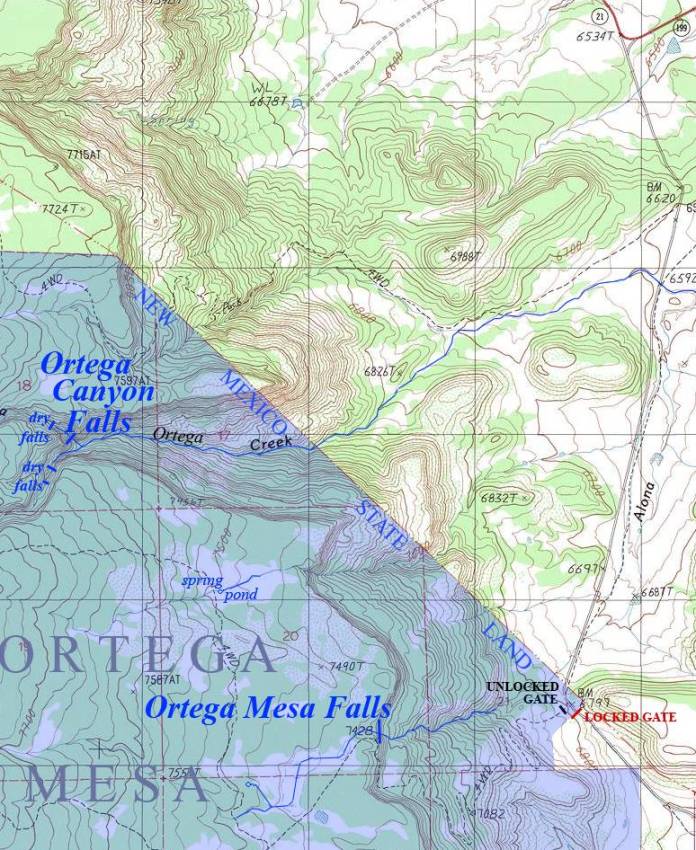
______________one
mile______________
Send questions and comments to dscott@TheMarbleSculptor.com