Mineral
Creek Falls
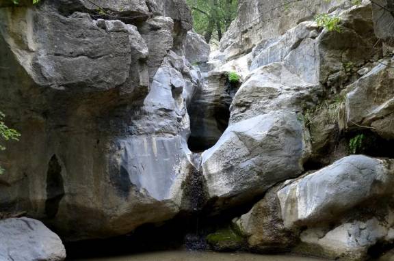
10
feet high Mineral Creek Falls dwindles to a small spring-fed flow during dry
years. photo by:
John Scott
beta facts:
name- Mineral Creek Falls
height- 10 feet high with two tiers
elevation- 6800’
GPS coordinates- ±33°21.580’N 107°45.150’W
flow- perennial
season- spring, summer and fall
accommodations- none
ownership- Gila National Forest
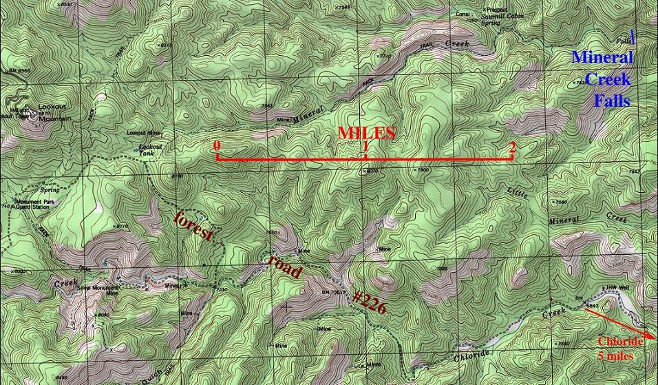
access- 4-mile hike from forest road #226
nearest town- Chloride is 5 air miles SW of
here
fun fact- I think John has been the only
person to visit this waterfall within the last 30 years.
essay bro:
About 11 miles east of Chloride on forest
road #226 is the trailhead for the Mineral Creek Trail. You will know you are there when you
drive up a long steep hill and have a beautiful view of Lookout Mountain
straight ahead of you. There has
been a lot of mining activity in this area, and it likely will kind of
show. Thanx John for hiking in
here... I hope to some day...
Enhanced
National Geographic 7.5’ topo map
Send questions and comments to doug.vivian@yahoo.com