Long
Canyon Falls AKA East Fork Hondo Falls
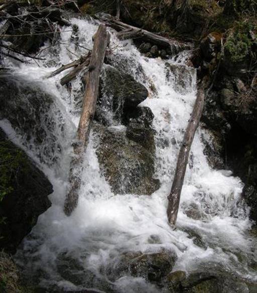
Long
Canyon Falls
beta facts:
name- Long Canyon Falls
height- 13’
elevation- 9760’
GPS coordinates- ±36°35.926’N 105°26.700’W
flow- perennial
season- May thru Oct but earlier is more
water
ownership- Carson National Forest
access- ¼ mile trail and game trails
nearest town- Taos Ski Valley is about ¼
mile southwest of here
fun fact- ...short ...fun ...refreshing
hike at Taos Ski Valley
essay bro
This small waterfall is amongst a large
group of noisy and steep cascades, about ¼ of-a-mile up Long Canyon Trail from
Taos Ski Valley parking area... on your right.
Right-click-save-as
to make yourself a copy of our map below
To see a larger, updated and
more detailed map of this entire Wheeler Peak Area, click here: http://www.dougscottart.com/hobbies/waterfalls/TaosMtnsSEquad.htm
and here: http://www.dougscottart.com/hobbies/waterfalls/TaosMtnsMap.htm
Enhanced USGS 7.5’ topo map
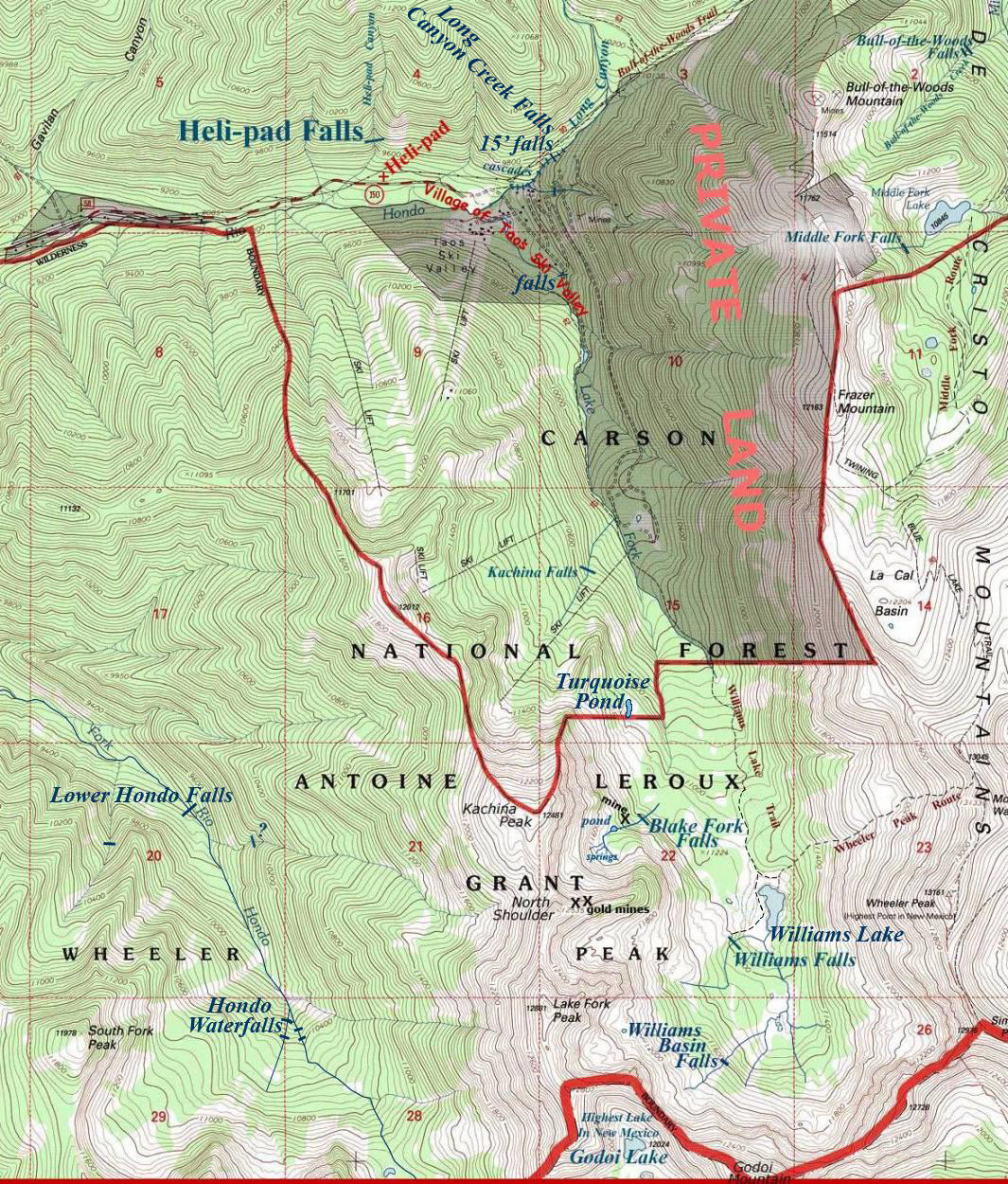
___________ONE-MILE___________
Send questions and comments to dscott@TheMarbleSculptor.com