Little
Creek Falls
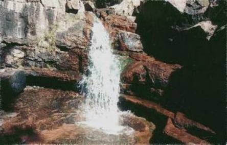
beta facts:
name- Little Creek Falls
height- 16’
elevation- 5900’
GPS coordinates- ±33°11.019’N 108°15.281’W
flow- perennial
season- any
accommodations- nearby cabins and
campgrounds
ownership- Gila National Forest
access- Approximately 4 miles of
backcountry hiking with no maintained trail
nearest town- Gila Hot Springs is about 5
miles east of here
fun fact- beautiful little semi-arid creek canyon
essay bro:
Little Creek is about 35 miles north of Silver City on State Highway 15. It shows blatant evidence of occasional severe flooding… so be ready for a flashflood while you are up in this small “box canyon”.
Enhanced
National Geographic 7.5’ topo map
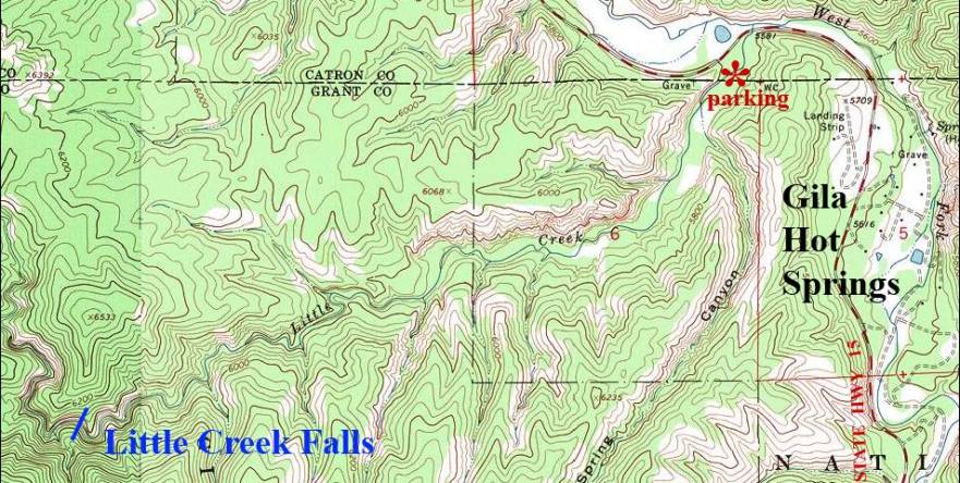
______________one mile_____________
Send questions and comments to doug.vivian@yahoo.com