Largo
Canyon Falls
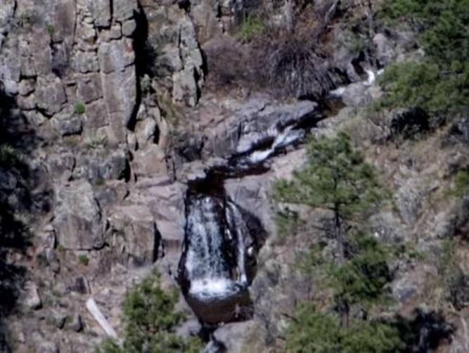
...sorry
for the blurry photo... ah... er... I can dance better than I can shoot
photographs.
beta facts:
name- Largo Canyon Cascades
height- 20’
elevation- 6900’
GPS coordinates- ±33°50.245’N 108°43.209’W
flow- perennial
best flows- March/April snowmelt and
July/August rainy season
accommodations- none
ownership- Apache National Forest
access- ½ mile hike to the canyon rim to
view the falls and another ¼ mile to the creek... straight down…!!!!
nearest town- Reserve is about 10 miles
south of here
fun fact- This is an extra beautiful place
with more than the one waterfall... high beautiful cliffs...!!! The hike is easy to the canyon rim but
harder down to the waterfalls.
Enhanced
National Geographic 7.5’ topo map
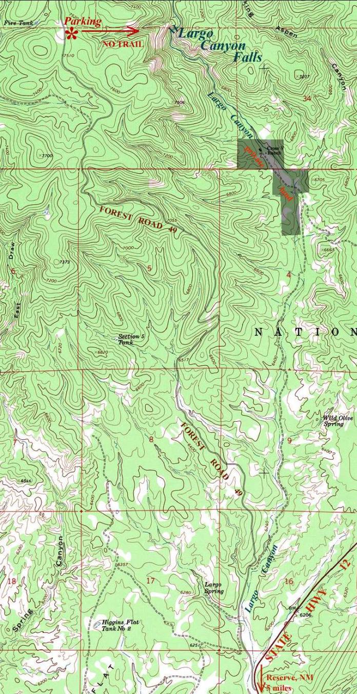
___________ONE
MILE____________
Send questions and comments to dscott@TheMarbleSculptor.com