La
Cueva Falls
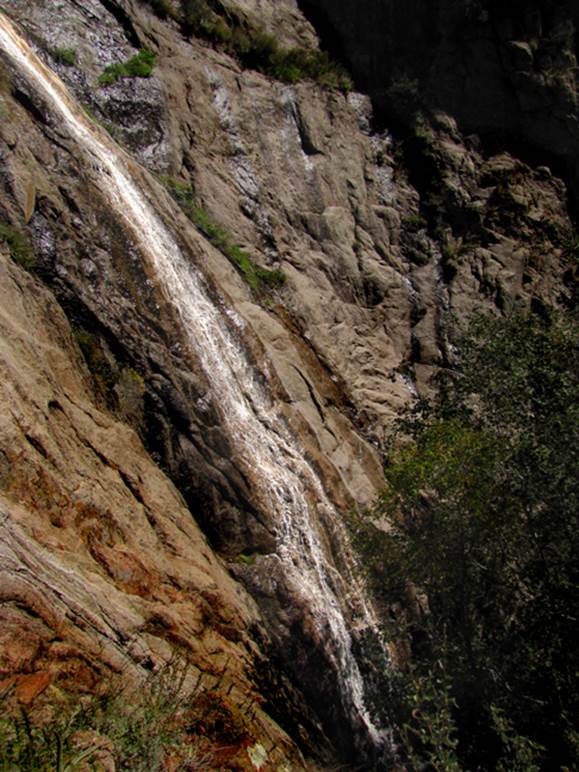
80’ high La Cueva Falls can be seen from a 100 yards south of La Luz
Trail near gps 35°12.529’N 106°27.778’W
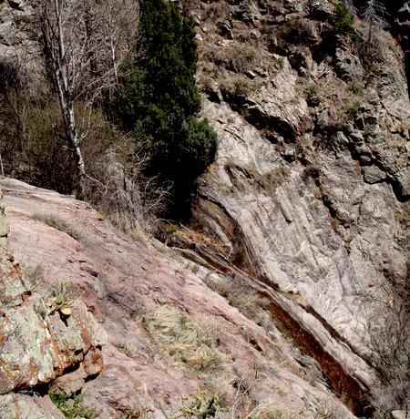
La
Cueva Falls during dry times - Photo by: Doug
Flynn
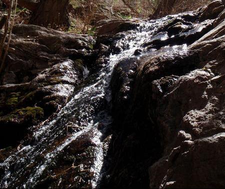
this 10’ falls slides
La Cueva Creek down into “the narrows” - Photo by:
Doug Flynn
beta facts:
name- La Cueva Falls
height- 80’
elevation-8300’
GPS coordinates- ±35°12.510’N 106°27.750’W
flow- small but perennial
season- any …but winter doesn’t fit my taste
anymore…
accommodations- none - wilderness
ownership- Cibola National Forest
access- 3 or 4 miles depending on the route you
take
nearest town- Albuquerque is your western view
from the top of the waterfall
fun fact- La Cueva
Canyon has Sandia’s highest waterfalls
essay bro
I like parking at La Cueva
Picnic Area and taking the Tram Trail angling up to La Luz Trail. Then hiking up La Luz Trail
to 8900’. At this point drop down
just below the trail to La Cueva Creek and follow it
back to my wheels. Some
“rock-scrambling” is inevitable. See map
below.
See
also: Chimney Falls
Enhanced
National Geographic 7.5’ topo map
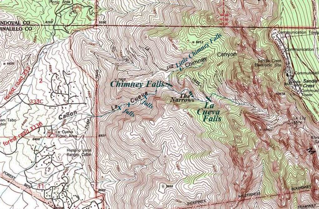
____________ONE
MILE____________
Send questions and comments to dscott@TheMarbleSculptor.com