Heli-pad Cascade
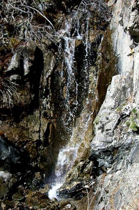
Heli-pad Cascade is a
couple hundred yards up above the helicopter landing pad at Taos Ski Valley.
The
above photo shows it’s upper 15’ high tier.
beta facts:
name- Heli-pad Cascade
height- 3 tiers 15 to 20’ high each w/ steep
cascades between – total fall about 70 feet
elevation- 9740’
GPS coordinates- ±36°35.977’N 105°27.458’W
flow- perennial spring fed
season- May to November
ownership- Carson National Forest
access- a couple hundred yard steep hike with
no trail… but quite easy
nearest town- Taos Ski Valley is right there
fun fact- …a great hike next time you are
there ...and with a wonderful view of West Basin…!!!
essay bro
While hiking up to visit Heli-pad Falls
DO NOT PARK YOUR
VIHICLE ON OR EVEN NEAR THE HELI-PAD... it may need to be
used...
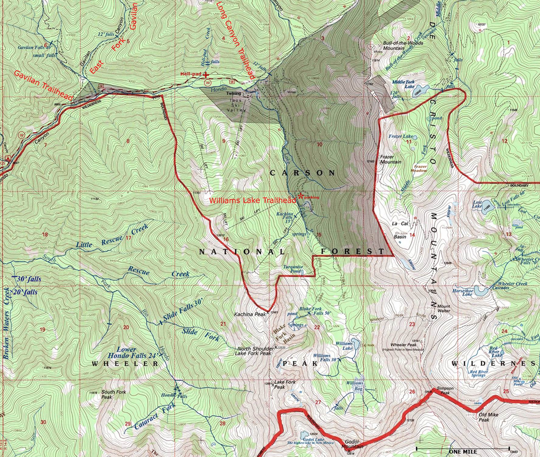
Heli-pad Falls appears in the upper
left-hand portion of the map below.
Please right-click-save-as to print your own personal hard-copy of our
map, and take it on your hike with you...!!!
See also nearby: Kachina Falls, Williams Falls, Bull-of-the-Woods-Falls, Blake Fork Falls, Gavilan Falls and more
Enhanced
USGS 7.5’ topo map
Send questions and comments to dscott@TheMarbleSculptor.com