Hardcastle
Falls
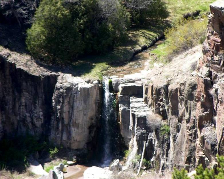
...a
nice view of 25’ high Hardcastle Falls can be enjoyed by taking a short walk
from State Highway 32
beta facts:
name- Hardcastle Falls
height- 25’
elevation- 7000’
GPS coordinates- ±33°57.330’N 108°41.249’W
flow- perennial
season- March/April snowmelt and
July/August rainy season
accommodations- none
ownership- the waterfall is on private land
but the hike is Apache National Forest land
access- roadside attraction... you maybe
walk ½-mile on public land to view it...
nearest town- Apache Creek is about 9 miles
south of here
fun fact- these people own a beautiful
waterfall, so stay away from their house while you enjoy seeing it from the
canyon rim…!!!
essay bro
Hardcastle Falls is a beauty but it is on
private land... and even tho the land is not posted with no trespassing
signs... please do not venture down to the actual waterfall. Their private residence is easily seen
alittle north of the falls… please stay out of sight (south) of their home so
as to respect their personal privacy.
The view of Hardcastle Falls from the canyon rim is very nice and is on
Apache National Forest land.
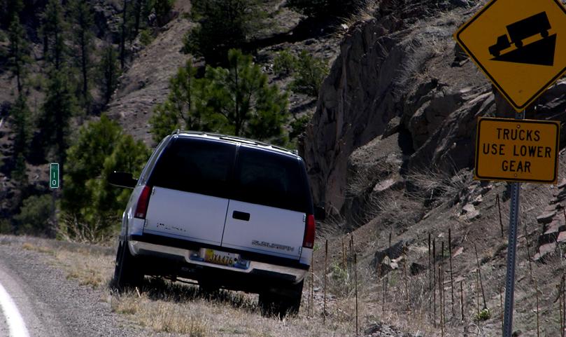
This photo below shows where we park beside
Highway 32 at milepost 10 while hiking to see Hardcastle Falls.
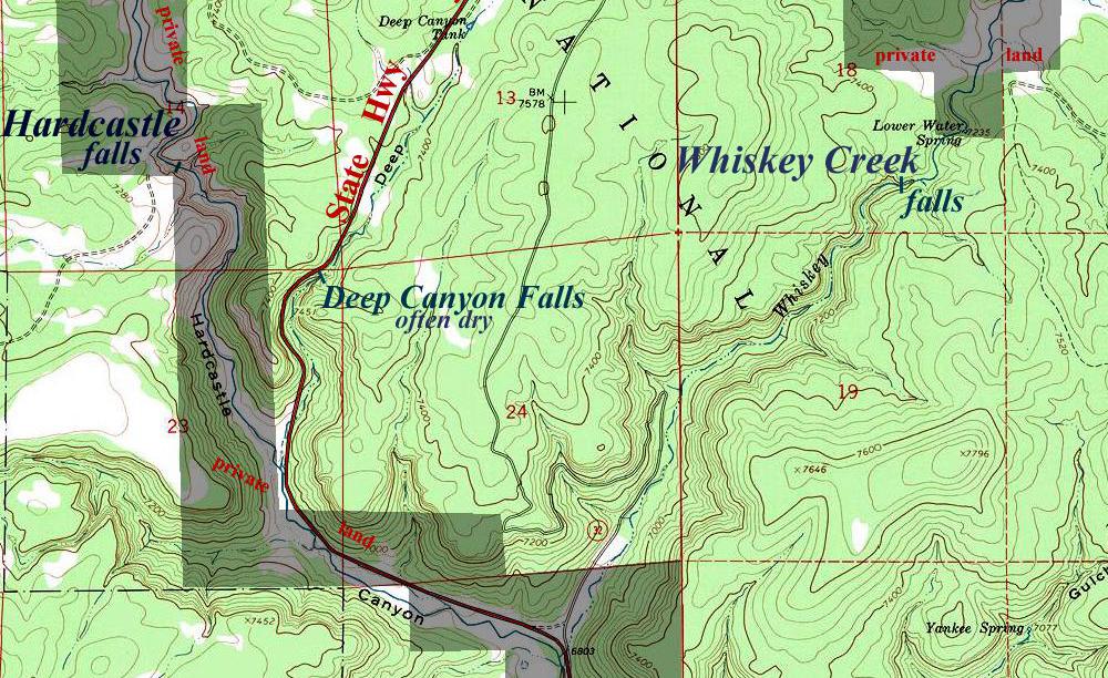
...just down the highway past mile post 10
and on the east side, near the road is 30’ high Deep Canyon Falls which is
often dry... but beautiful during wet times…!!!
See also nearby: Whiskey Creek Falls
Enhanced
National Geographic 7.5’ topo map
______________ONE_MILE________________
Send questions and comments to dscott@TheMarbleSculptor.com