Gila Falls
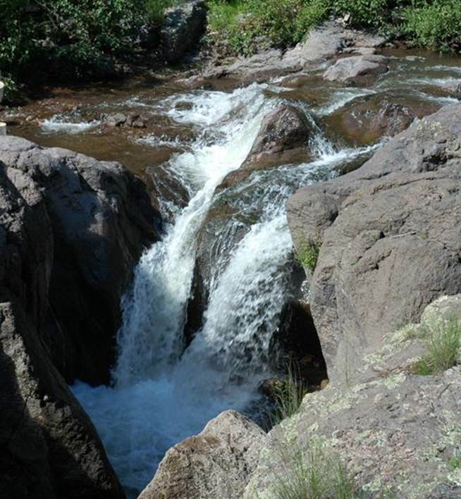
New Mexico State Game and
Fish photo of 20’ high Gila Falls
beta facts:
name- West Fork Gila Falls aka Gila Falls
height- 20’
elevation- ±7200’
GPS coordinates- ±33°16.150’N 108°27.134’W
flow- strong year round trout stream
season- Spring, Summer and fall
accommodations- none – Gila Wilderness
ownership- Gila National Forest
access- 22 miles of wilderness trail… wheeew…!!!!!
nearest town- Silver City is 60 some miles south
of here
fun fact- remoteness... and this waterfall
acts as a natural fish barrier protecting Gila Trout the native species here,
from intrusion of non-native species...
essay bro:
This falls and White Creek Falls are close to where White Creek conflues with the West Fork… in fact we believe several of
the nearby creeks also display nice waterfalls.
It is interesting that the falls is off-trail, out of sight and ear-shot
from the trail. This is why hardly
anyone knows that it is here.
Gila Falls appears near the center of the map below. Please “right-click-save-as” on our map below
to print your own hard copy to have in-hand during your hike.
(see
also White
Creek Falls)
Enhanced USGS 7.5’ topo map
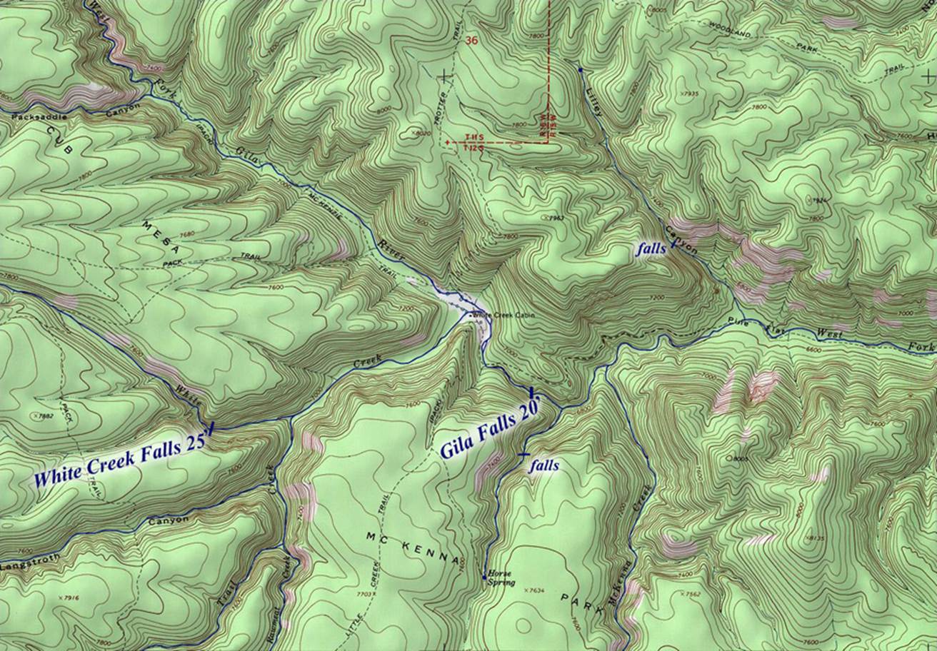
one mile = approximately 2 inches
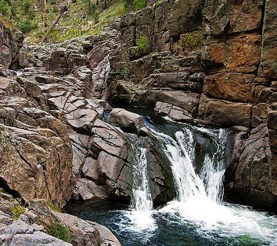
another one of several nice West Fork falls nearby
Send questions and
comments to dscott@themarblesculptor.com