Gavilan
Falls
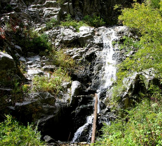
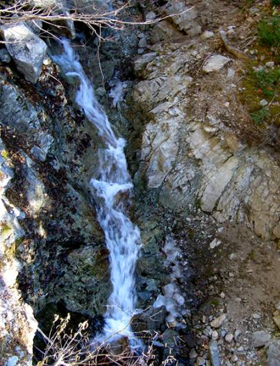
This is the view of Gavilan Falls from the
Gavilan Falls Trail that is discussed below. Gavilan Creek is near Taos Ski Valley.
It turns out that there are two more tiers above
this that I cannot be see from here.
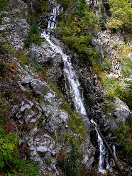
The photo below shows all four tiers of
50-foot high Gavilan Falls.
These photos were taken
during low water in late September ...so late spring should be quite grand…!!!
beta facts:
name- Gavilan Falls
height- 50 feet in 4 tiers
elevation- 9775’
GPS coordinates- ±36°36.200’N 105°29.316’W
flow- perennial spring fed
season- May to November
ownership- Carson National Forest
access- a one and a half mile hike up
Gavilan Trail #60 then a one-quarter-mile side trail marked “Gavilan Falls ¼
mile”
nearest town- this falls is a mile and a
quarter north of Taos Ski Valley
fun fact- ...a short hike ...to a fine
waterfall...!!!
essay bro
Gavilan Falls is a fairly easy waterfall to
visit and a beautiful waterfall to see... please “right-click-save-as” and make
yourself a copy of my map below... as this map shows more detail and has more
correct information than other maps.
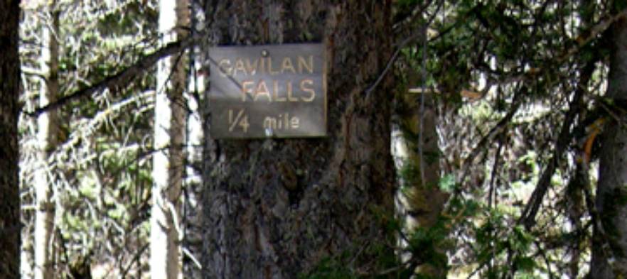
About 1½-miles up Gavilan Trail #60 look
for a trail forking off to the west.
There will be a small wooden sign on a Douglas Fir tree about head high
that will read “Gavilan Falls ¼ mile”...
Here’s a
photo of it:
East Fork Gavilan
The trail ascending the near-by East Fork
Gavilan Canyon is not shown on any map that I could find. I believe it is an old trail that the
Forest Service has discontinued.
However it is in quite good condition and is obviously maintained by
somebody...???
I enjoy a loop hike going up the West Fork
and descending the East Fork... but on my way down the East Fork I prefer to
hike down the creek instead of following the trail. There are an abundance of falls and cascades here. It is a nice water show even tho none
of the individual falls are too spectacular alone.
There are many small falls and cascades up
East Fork of Gavilan Creek but only three are of worthy mention. These Three are about 15’ high
each. They are marked on the map
below and two of them are shown in the photos below. These falls are not very sheer but they flow over solid clean
bedrock.
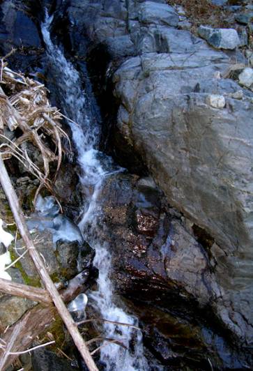
15’ high Upper East Fork Gavilan Falls
15’ high Lower East Fork Gavilan Falls
See also nearby: Heli-pad Falls, Williams Falls, Italianos Falls, Blake Fork Falls and more
Enhanced
National Geographic 7.5’ topo map
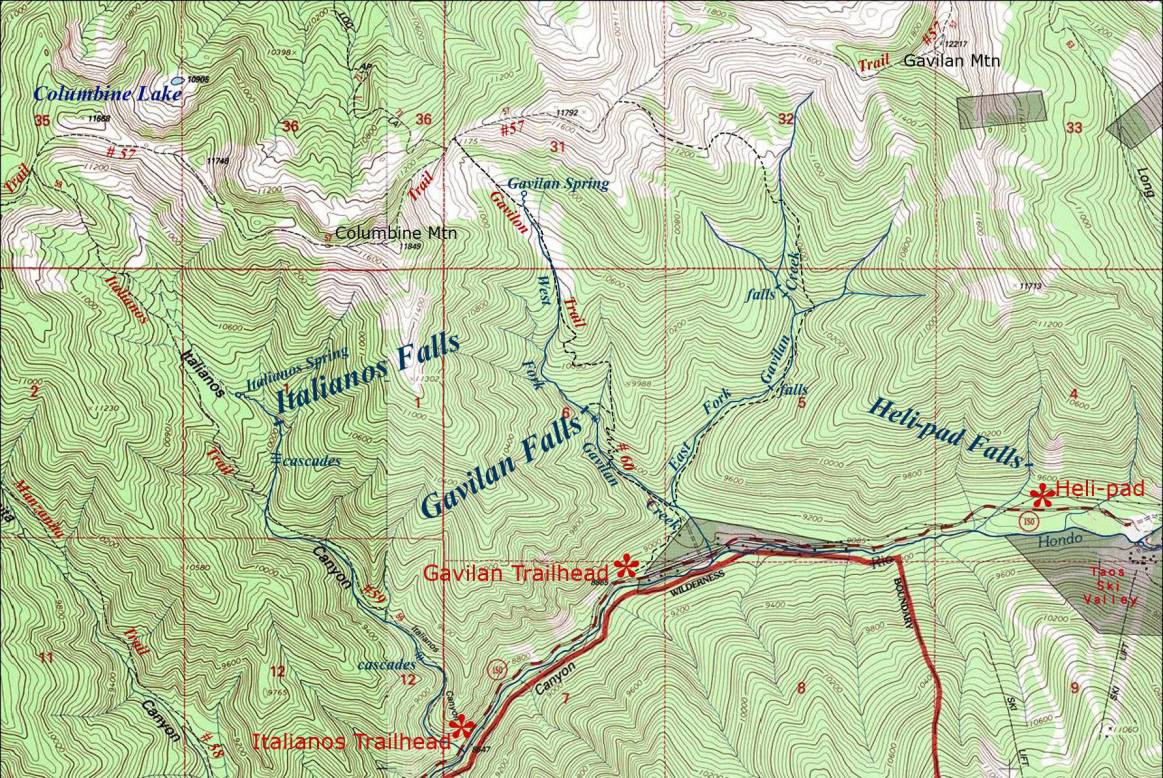
________ONE MILE_________
Send questions and comments to dscott@TheMarbleSculptor.com