Frijoles Falls
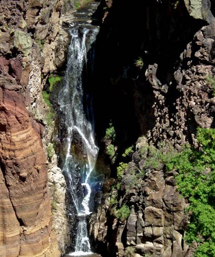
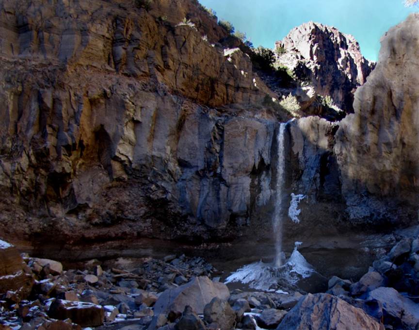
50 foot high Upper Frijoles Falls
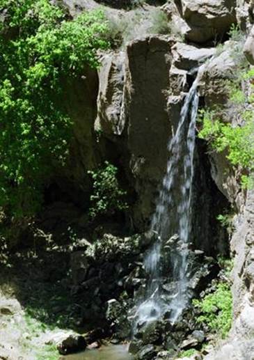
This photo of 20 foot high Lower Frijoles Falls is now
obsolete
Due to enormous forest fires in resent years, “epic floods” have re-designed Lower
Frijoles Canyon. These floods reached a
volume of 9000 cfs…while average flow is 1 cfs. The cliffs on
both sides of the falls are now totally sheer and unstable, eliminating any
possibility of rebuilding the trail any time soon. Lower Frijoles is currently very difficult to visit.
The photo above
is obsolete… and the
de-forestation will be causing major flooding for many years to come. It will take many decades to re-grow a
“forest” healthy enough to suppress this flooding. The amount of earth and boulders that have been
removed is incomprehensible. A person
wonders…. by the time this natural cycle
completes itself …Hmmmmm…
…how high will this waterfall be…???
and… what will it look like….???
Will I still be alive to see the ‘new’
Lower Frijoles Falls…????
I’m hoping it will become a plunge pool.
Isn’t nature wonderful…!!!
Scroll down below the map to
see a new photo and new information.
beta facts:
name- Upper and Lower Frijoles Falls
height- 50’ and 60’
elevation-
±5400’
GPS coordinates- ±#35°45.750’N 106°15.575’W
flow- nice healthy perennial trout stream but now all aquatic life is dead
because of flowing ash.
season- anytime
accommodations- Bandelier National Park
campgrounds and headquarters
ownership- public – Bandelier National Park
access- a mile and a half hike on a
well-kept and well-marked trail
nearest town- 9 miles NE to Whiterock and 12 miles NW to Los Alamos
fun fact- wonderful things are
happening…!!!
Enhanced USGS 7.5’ topo map
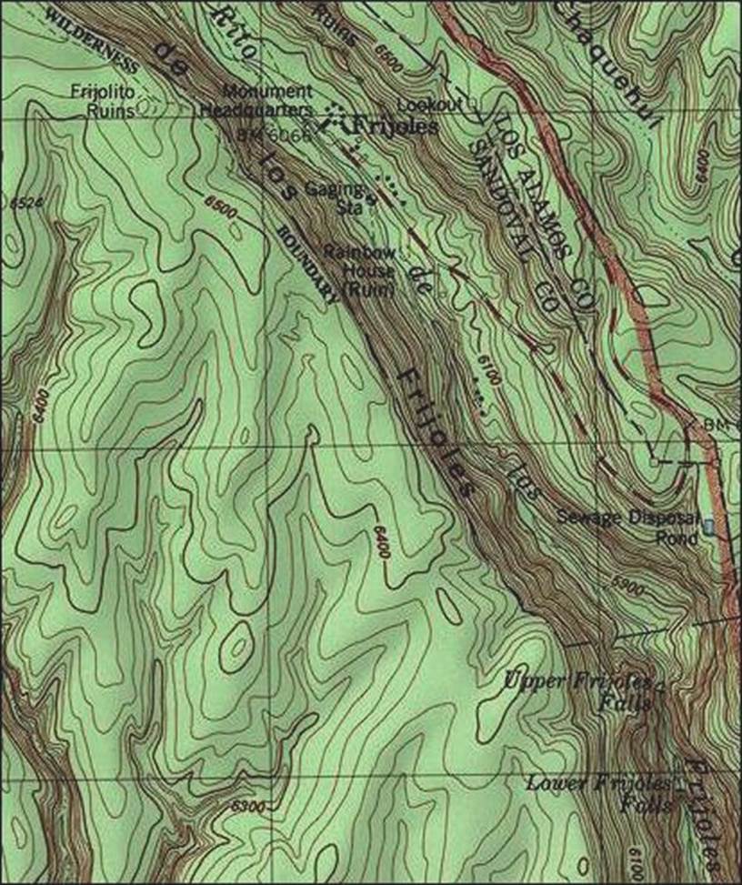
I have been hiking 9 miles
one-way to visit the bottom of Lower Frijoles Falls to document its
transformation. I park at Ancho Springs
Trailhead 3 or 4 miles southwest of Whiterock,
NM. I walk Ancho Springs Trail down to
the old River Trail along the Rio Grande.
Then follow the remnants of the “hard to follow” River Trail 3 miles
down to the mouth of Frijoles Canyon.
Frijoles Canyon is a totally re-arranged “moonscape” because of the
extreme flooding. A half mile scramble
up Frijoles Canyon is Lower Frijoles Falls, shown in this photo below:
This is Lower Frijoles Falls
current “look”. I estimate its height to
be about 60 feet… THREE-TIMES higher as it was before the 2013 fire-induced
flooding began. Bus-sized boulders along
with 60 feet of earth…
is GONE…!!!!!!!!
The flooding here is FAR FROM
OVER…!!!! Who knows how high this
waterfall will be ten years from now… 20 years from now… 30 years…
Send questions and comments to dscott@themarblesculptor.com