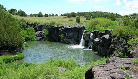
Folsom
Falls & Corrumpa Falls (bottom of page)


Folsom Falls as seen in the photos above is
the “public” Folsom Falls. There
are three Folsom Falls. See the
map below. However two of them downstream
from here are on private land.
This Folsom falls is about 15 feet high and is 3.2 miles northeast of
Folsom, NM on State Highway 325.
Parking and picnic area are between the road and the falls. A sign here claims that swimming is not
safe because of DANGEROUS
UNDERTOWS….!!!!! At the Dry
Cimmaron River’s normal flow, about 10 cubic feet per second, the only
undertows I can think of would be the swimmers toes… under the surface of the
water.
A second fall is 2.8 miles downstream. A third is another 9.7 road miles
farther on. Topo maps indicate
that each fall get higher on down the creek. The Lower Folsom Falls seems to be about 30 to 40 feet high. If we stopped at the ranchers house and
ask real nice…. Maybe he’d let us
walk 200 yards on his land to see them.
Enhanced
National Geographic 7.5’ topo map

one
mile = approximately2.5 inches
photo
not available
Corrumpa Falls
is far from any pavement. It’s way
out in the middle of a private ranch about 18 miles north of Clayton, NM. Its coordinates are: 36 degrees
42.813’N 103 degrees 08.950’W. It
appears on the topo to have a fall of about 30 to 40 feet and is shown to be
perennial.
Enhanced
National Geographic 7.5’ topo map

Send questions and comments to doug.vivian@yahoo.com