Falls
Canyon Falls
Photo by: Jim and Jackie
Blurton KOA Kampground Silvercity, NM
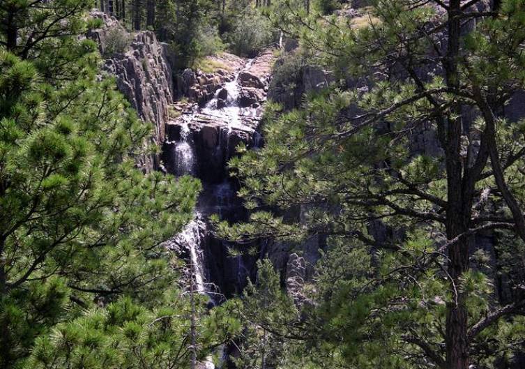
This
photo only shows the top portion of this 200’ high beauty as it falls into a
deep sheer crevasse.
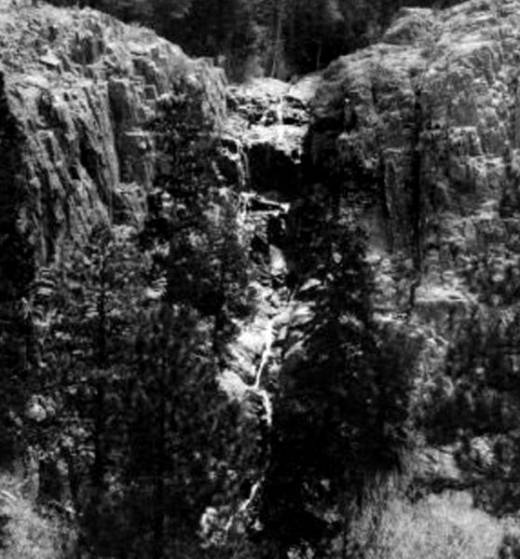
This
antique photo is from USDA-Gila National Forest archives. It shows the full 200’ height of the
multi-tiered, Falls Canyon Falls.
beta facts:
name- Falls Canyon Falls
height- 200’
elevation- 8800’
GPS coordinates- ±33°09.727’N 107°52.010’W
flow- is reliable during spring snow melt
and late summer rainy season but has dry spells in dry years
season- spring, summer and fall
accommodations- none – Aldo Leopold
Wilderness
ownership- Gila National Forest
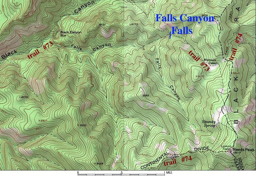
access- 11 miles up forest trail #73 from
trailhead near Black Canyon Campground
nearest town- Mimbres is 30 miles south of
here
fun fact- a beautiful high waterfall deep
into the wilderness
essay bro:
Right near where State Highway 35 crosses
the Continental Divide between Mimbres and Lake Roberts, take forest road 150,
which is also called State Highway 61, north about 23 miles to Black Canyon
Campground. The trailhead for
forest trail #73 is across the highway from this campground, about one mile to
the east. 11 miles of trail leads
to this wonderful waterfall… however the last few miles are “killer” with
massive down timber from a resent devastating burn. It might be better to access the falls by hiking off-trail
right up the bottom of Falls Canyon.
It can also be accessed via the Black Range Crest Trail #74.
Enhanced
National Geographic 7.5’ topo map
Send questions and comments to doug.vivian@yahoo.com