Encarnacion
Falls Spanish/English = Incarnation
Encarnacion
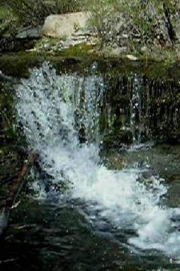
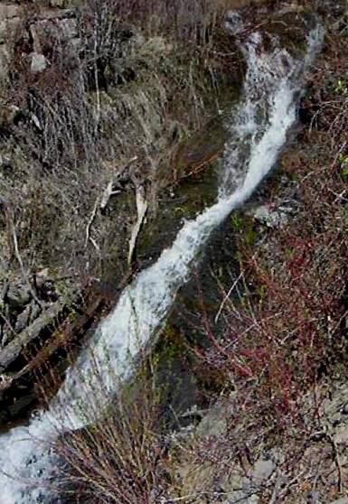
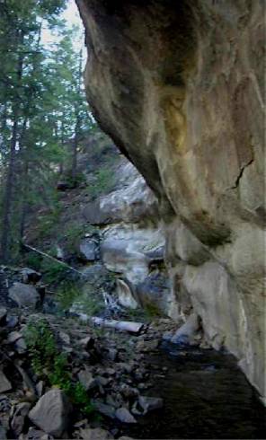
Canyon has many waterfalls. Above
is a 5 footer and a 25 footer.
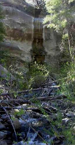
A high sheer sandstone wall
runs along Encarnacion Creek’s west side about a mile above its confluence with
Navajo River. This “spring-flow”
side canyon pictured above, joins Encarnacion Creek from the west and pours over this 50’ high waterfall.
beta facts:
name- Encarnation Falls …Spanish/English
translation is Incarnation
height- numerous waterfalls along this
creek. I have seen some up to 50’
high
elevation- 7300’
GPS coordinates- ±36°59.205’N 107°00.332’W
…this is the approximate location of the 25 footer
flow- is strong in the spring during
snow-melt and fairly reliable most anytime
season- May is best
accommodations- nearby Dulse has everything
you need
ownership- Jicarilla Apache Nation
access- a 2 mile bushwhack
nearest town- Dulse is about 5 miles south
of here
fun fact- very, very few people ever visit
this place
essay bro
The upper reaches of Encarnacion Canyon are
on public land, BLM. Notice in the
far upper right-hand corner of the map below, a piece of a BLM road that is
open to the public. This is a good
access from Montezuma Canyon in Colorado to upper Encarnacion Canyon and
Archuleta Mesa Lookout tower.
However most of the waterfalls are on Jicarilla Apache Land.
I find the Jicarilla Apache Nation to be
very hospitable and kind. Check in
at their office in Dulse and purchase a permit to picnic or even campout. I find their backcountry extremely
enjoyable.
Enhanced
National Geographic 7.5’ topo map
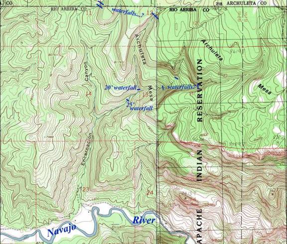
____________ONE MILE_____________
Send questions and comments to dscott@TheMarbleSculptor.com