East
Fork Gorge
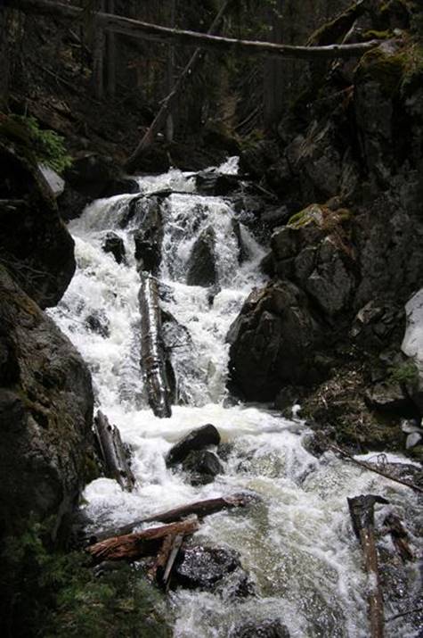
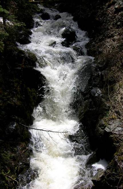
This
falls above is about 20 feet high Red River’s East
Fork Gorge is Watershow city…!!!
beta facts:
name- East Fork Gorge
height- the highest single drop is maybe
20’, but falls and cascades are continuous and solid white
elevation- 10,200’
GPS coordinates- ±36°34.811’N 105°22.021’W
flow- a large mountain stream
season- mid-May thru October
accommodations- none
ownership- Carson National Forest
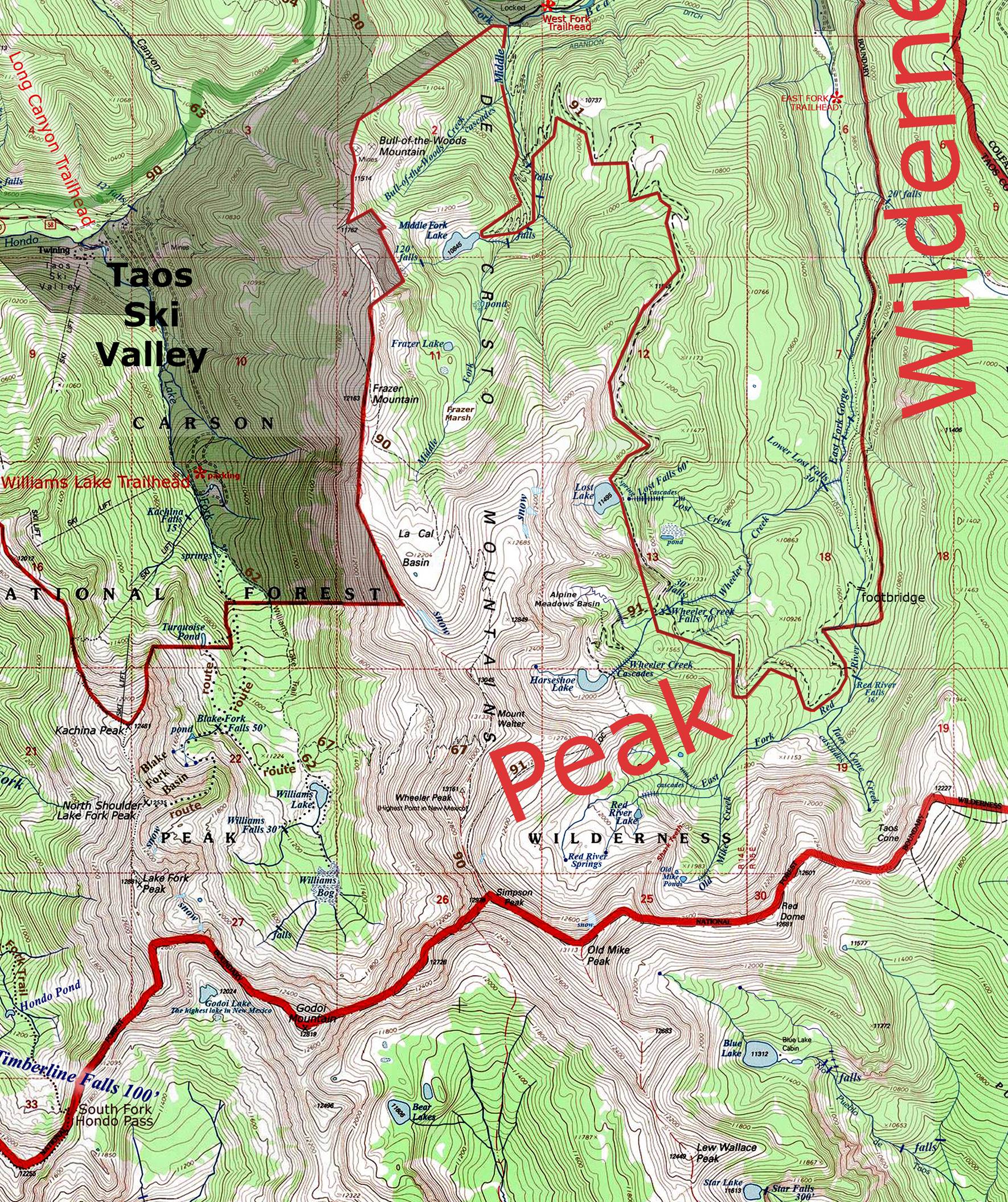
access- 1 mile on trail 56 and ½ mile south
on the abandon ditch, then ½ mile of mild bushwhacking
nearest town- Red River is about 10 miles
north of here
fun fact- powerful whitewater
essay bro
After a strong mile up East Fork Trail #56
you will need to veer to the right and follow the old abandon ditch south for a
half-mile. When the ditch reaches the
East Fork Red River hike up stream another half-mile to the roaring whitewater
of the “East Fork Gorge.”
Right-click-save-as
to make yourself a copy of our map below
To see a larger, updated and
more detailed map of this entire Wheeler Peak Area, click here: http://www.dougscottart.com/hobbies/waterfalls/TaosMtnsSEquad.htm
and here: http://www.dougscottart.com/hobbies/waterfalls/TaosMtnsMap.htm
Enhanced USGS 7.5’ topo map
_______________one mile________________
Send questions and comments to dscott@TheMarbleSculptor.com