Cumbres Falls
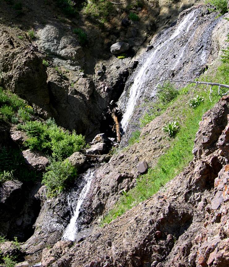
Cumbres Falls is a tiered-cascade type waterfall
that descends about 100 feet elevation over conglomerate bedrock.
This photo was taken October first 2010... a dry autumn. I have
seen this waterfall gush all white and foamy during late May.
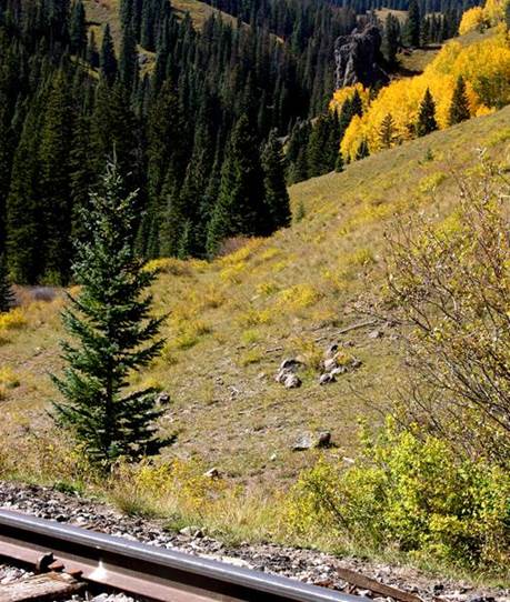
Up stream about a third of a mile above the train
tracks is a 100’ high monolith out cropping of conglomerate rock. This marks the Wolf Creek Cascades. The bright yellow aspen grove marks the
canyon that holds Cumbres Falls.
beta facts:
name- Cumbres Falls
height- 100’
type of waterfall- a tiered-cascade
elevation- 10,000’
GPS coordinates- ±37°01.527’N 106°28.227’W
flow- perennial
season-May thru Oct …earlier is better
accommodations- none
ownership- Rio Grande National Forest
access- 1¾ mile hike... half trail... half old
hard –to-follow old trail or “route”
nearest town- Chama NM is about 10 miles southwest
of here
fun fact- this is my favorite country
essay bro
There are two ways to hike into this
waterfall. Either walk
the RR Tracks and continue up the canyon on game trails …or hike the Colorado
Continental Divide Trail and drop into the falls from above. Please feel free to right-click-save-as my
map below and print yourself a hard copy to carry with you.
Enhanced
USGS 7.5’ topo map
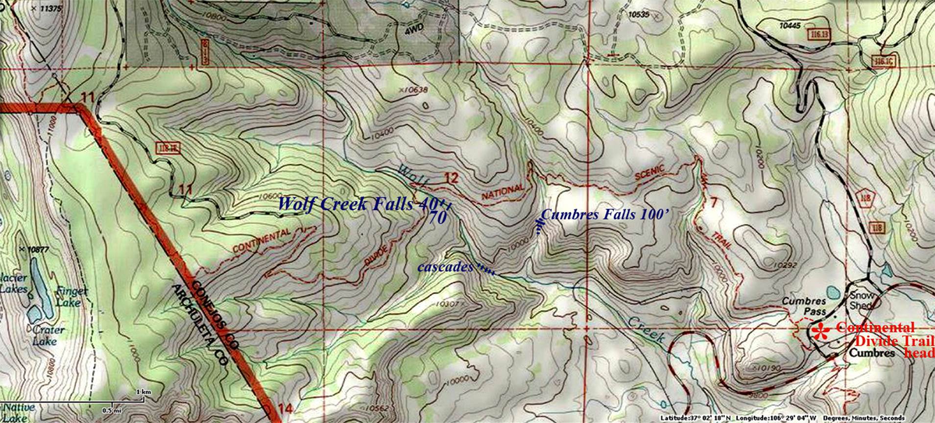
Thin
red lines above are one-mile squares
Send questions and comments to dscott@TheMarbleSculptor.com